$5,000 / Month
139 Nottinghill Rd
Boston, MA 02135
3 Days Ago
Favorites
617-405-3410
-
Bedrooms
5
-
Bathrooms
2
-
Square Feet
9,999 sq ft
-
Available
Available Sep 1
Highlights
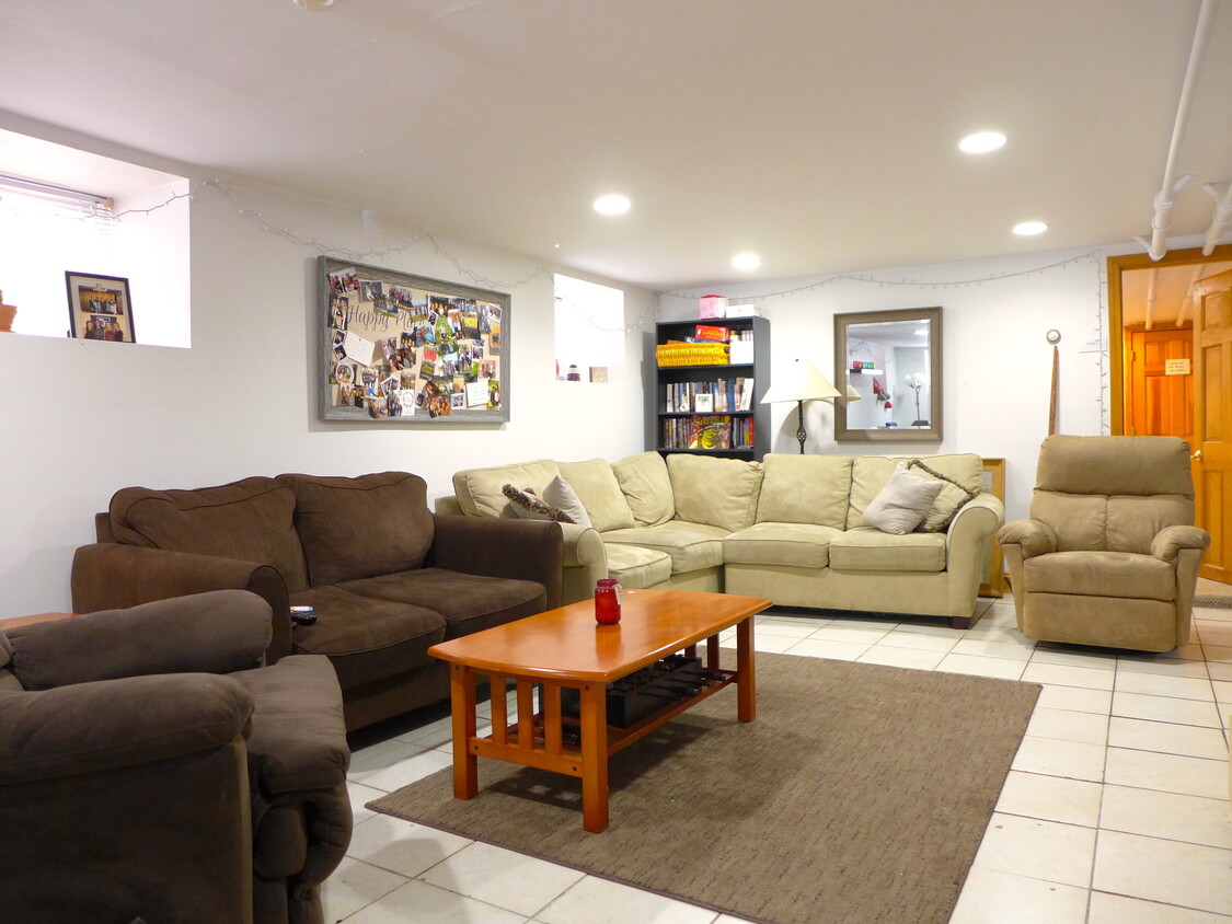
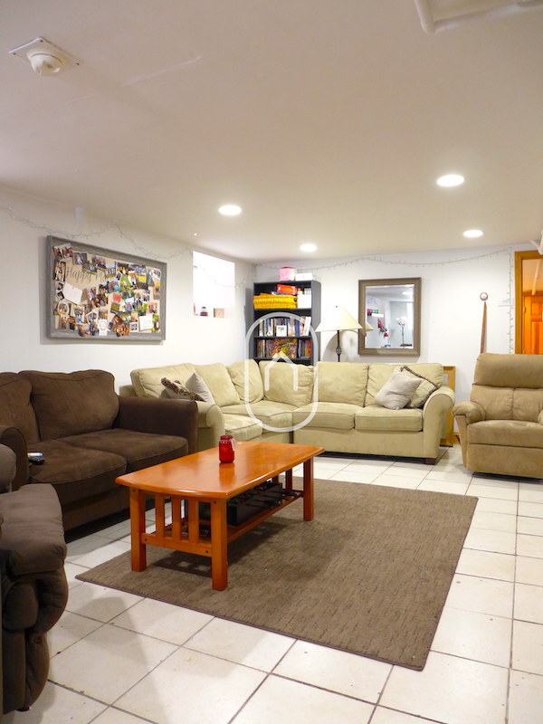
- Hardwood Floors
- Yard
139 Nottinghill Rd

Favorites
About This Home
12 Month Lease,
$2,700 deposit,
Available Sep 1
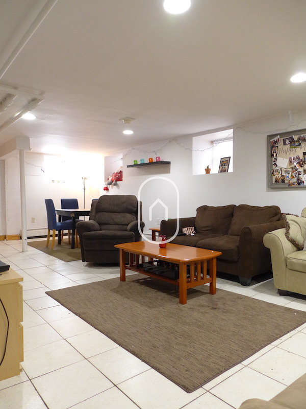
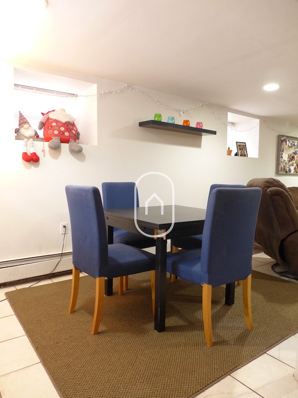
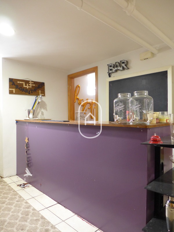
Massive Brighton Single Family with Tons of Parking & Charm • Parking: Driveway and garage included — space for up to five cars • Location: Gorgeous tree-lined street, steps from Brighton Center • Transit: Easy access to B Line, 65, 503, and 57 bus routes • Living Space: Huge first-floor living room, charming foyer with oversized closet • Bathrooms: Two fully renovated tile bathrooms • Bedrooms: Large bedrooms with ample closet space • Kitchen: Spacious eat-in kitchen with gas stove, fridge, dishwasher & extra counters • Extras: Dedicated bar/hosting nook, private back porch and yard • Laundry: Free in-unit laundry • Management: Friendly mom & pop-style owner • Move-In: No last month’s rent, only half security deposit
139 Nottinghill Rd is an apartment community located in Suffolk County and the 02135 ZIP Code. This area is served by the Boston Public Schools attendance zone.
* Price shown is base rent and may not include non-optional fees and utilities.
Price, availability, fees, and any applicable rent special are subject to change without notice.
* Square footage definitions vary. Displayed square footage is approximate.
Apartment Features
Washer/Dryer
Dishwasher
Hardwood Floors
Refrigerator
- Washer/Dryer
- Heating
- Dishwasher
- Disposal
- Eat-in Kitchen
- Kitchen
- Oven
- Range
- Refrigerator
- Hardwood Floors
- High Ceilings
- Large Bedrooms
- Porch
- Yard
Fees and Policies
The fees below are based on community-supplied data and may exclude additional fees and utilities.
- Parking
-
Surface Lot--
Details
Utilities Included
-
Trash Removal
Contact
- Phone Number
- Contact
Location
Get Directions
Saint Elizabeth’s is a Brighton neighborhood situated about 10 miles away from Boston. Thanks to Saint Elizabeth’s top border sitting on Highway 20, commuting in and out of Brighton is easy. Some residents travel by car, but buses and railways make commuting via public transportation a breeze.
The neighborhood’s best amenities are two world-renowned hospitals, Saint Elizabeth’s Medical Center and Franciscan Children’s, that sit on the edge of town. Other great amenities of Saint Elizabeth’s include many local parks like Ringer Playground and Chestnut Hill Reservoir, which has great trails and greenspace. This neighborhood is also equipped with cozy coffee shops, restaurants serving international and American classics, and shopping plazas with grocers and convenience stores.
Saint Elizabeth’s has several rental options ranging from apartments to single-family homes.
Learn more about living in St Elizabeth's
Education
| Colleges & Universities | Distance | ||
|---|---|---|---|
| Colleges & Universities | Distance | ||
| Drive: | 4 min | 1.5 mi | |
| Drive: | 3 min | 1.6 mi | |
| Drive: | 6 min | 2.6 mi | |
| Drive: | 8 min | 3.2 mi |
139 Nottinghill Rd is within 4 minutes or 1.5 miles from Boston College, Brighton. It is also near Boston College and Boston University.
Schools


Public Elementary School
Grades PK-6
338 Students
Attendance Zone
Public Elementary School
Grades PK-1
172 Students
Attendance Zone
Charter Middle & High School
Grades 6-12
476 Students
Attendance Zone
Public Middle & High School
Grades 7-12
2,423 Students
Attendance Zone
Public Middle & High School
Grades 7-12
532 Students
Attendance Zone
Public High School
Grades 9-12
116 Students
Attendance Zone
Private Elementary School
Grades PK-6
103 Students
Nearby
Private Middle & High School
Grades 7-12
9 Students
Nearby
School data provided by
 The GreatSchools Rating helps parents compare schools within a state based on a variety of school quality indicators and provides a helpful picture of how effectively each school serves all of its students. Ratings are on a scale of 1 (below average) to 10 (above average) and can include test scores, college readiness, academic progress, advanced courses, equity, discipline and attendance data. We also advise parents to visit schools, consider other information on school performance and programs, and consider family needs as part of the school selection process.
View GreatSchools Rating Methodology
View GreatSchools Rating Methodology
Transportation options available in Boston include Sutherland Street Station, located 0.3 mile from 139 Nottinghill Rd. 139 Nottinghill Rd is near General Edward Lawrence Logan International, located 9.8 miles or 18 minutes away.
| Transit / Subway | Distance | ||
|---|---|---|---|
| Transit / Subway | Distance | ||
|
|
Walk: | 6 min | 0.3 mi |
|
|
Walk: | 8 min | 0.4 mi |
|
|
Walk: | 9 min | 0.5 mi |
|
|
Walk: | 11 min | 0.6 mi |
|
|
Walk: | 15 min | 0.8 mi |
| Commuter Rail | Distance | ||
|---|---|---|---|
| Commuter Rail | Distance | ||
|
|
Drive: | 8 min | 3.5 mi |
|
|
Drive: | 8 min | 3.9 mi |
|
|
Drive: | 9 min | 4.0 mi |
|
|
Drive: | 10 min | 4.3 mi |
| Drive: | 9 min | 4.3 mi |
| Airports | Distance | ||
|---|---|---|---|
| Airports | Distance | ||
|
General Edward Lawrence Logan International
|
Drive: | 18 min | 9.8 mi |
Time and distance from 139 Nottinghill Rd.
| Shopping Centers | Distance | ||
|---|---|---|---|
| Shopping Centers | Distance | ||
| Walk: | 12 min | 0.6 mi | |
| Walk: | 19 min | 1.0 mi | |
| Drive: | 5 min | 1.5 mi |
139 Nottinghill Rd has 3 shopping centers within 1.5 miles, which is about a 5-minute walk. The miles and minutes will be for the farthest away property.
| Parks and Recreation | Distance | ||
|---|---|---|---|
| Parks and Recreation | Distance | ||
|
Chestnut Hill Reservation
|
Walk: | 16 min | 0.8 mi |
|
John Fitzgerald Kennedy National Historic Site
|
Drive: | 4 min | 2.1 mi |
|
Frederick Law Olmsted National Historic Site
|
Drive: | 5 min | 2.4 mi |
|
Hammond Pond Reservation
|
Drive: | 6 min | 2.6 mi |
|
Coit Observatory
|
Drive: | 7 min | 3.1 mi |
139 Nottinghill Rd has 5 parks within 3.1 miles, including Chestnut Hill Reservation, John Fitzgerald Kennedy National Historic Site, and Frederick Law Olmsted National Historic Site.
| Hospitals | Distance | ||
|---|---|---|---|
| Hospitals | Distance | ||
| Walk: | 13 min | 0.7 mi | |
| Walk: | 14 min | 0.7 mi | |
| Drive: | 4 min | 2.1 mi |
139 Nottinghill Rd has 3 hospitals within 2.1 miles, the nearest is St. Elizabeth's Medical Center which is 0.7 mile away and a 13 minute walk.
| Military Bases | Distance | ||
|---|---|---|---|
| Military Bases | Distance | ||
| Drive: | 27 min | 12.6 mi | |
| Drive: | 23 min | 13.4 mi |
139 Nottinghill Rd is 12.6 miles from Hanscom Air Force Base, and is convenient to other military bases, including US Military Reservation.
Amenities
- Washer/Dryer
- Heating
- Dishwasher
- Disposal
- Eat-in Kitchen
- Kitchen
- Oven
- Range
- Refrigerator
- Hardwood Floors
- High Ceilings
- Large Bedrooms
- Porch
- Yard
139 Nottinghill Rd Photos
What Are Walk Score®, Transit Score®, and Bike Score® Ratings?
Walk Score® measures the walkability of any address. Transit Score® measures access to public transit. Bike Score® measures the bikeability of any address.
What is a Sound Score Rating?
A Sound Score Rating aggregates noise caused by vehicle traffic, airplane traffic and local sources

139 Nottinghill Rd
Boston, MA 02135