$3,250
3 Beds, 2 Baths, 2,100 sq ft
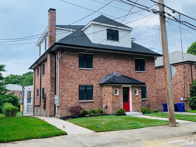
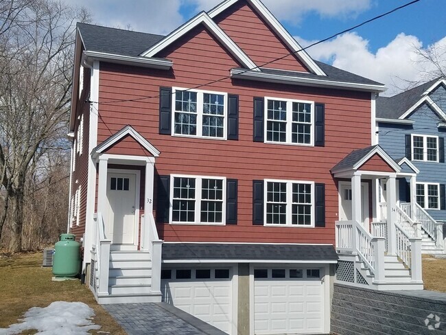
Townhome for Rent

| Beds | Baths | Average SF |
|---|---|---|
| 3 Bedrooms 3 Bedrooms 3 Br | 1.5 Baths 1.5 Baths 1.5 Ba | 1,100 SF |
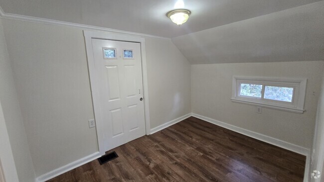
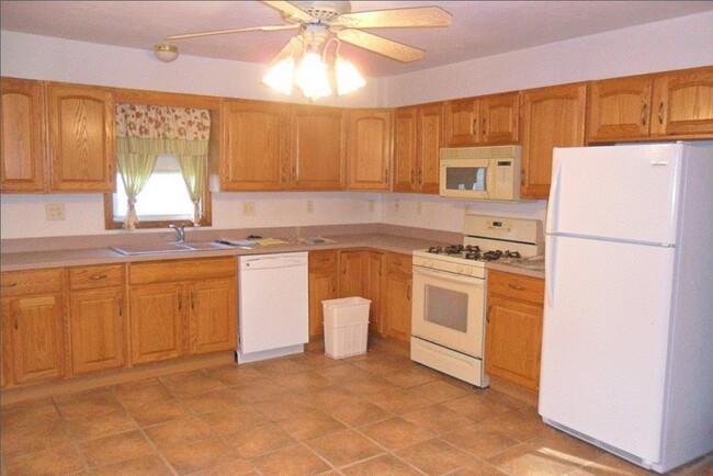
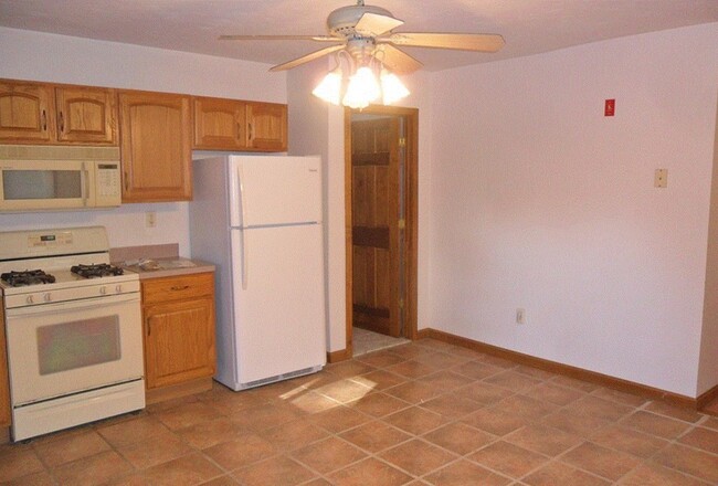
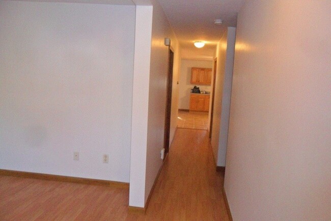
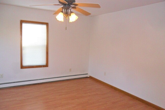
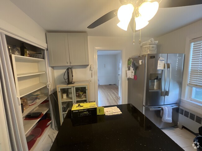
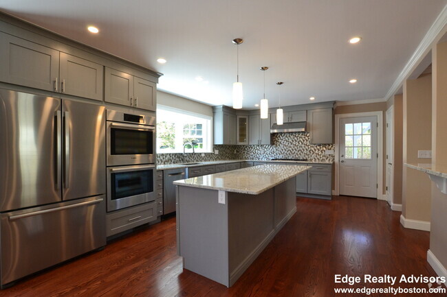
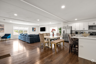
This home is immaculate. All hardwood or ceramic tile floors with large bedrooms and kitchen. Parking for 3 cars to left of building off street and a short walk to downtown. Includes a washer & dryer,disposal,gas range,microwave and vent hood over stove,dishwasher and refrigerator. Large common 80 ft X 60 ft grass back yard
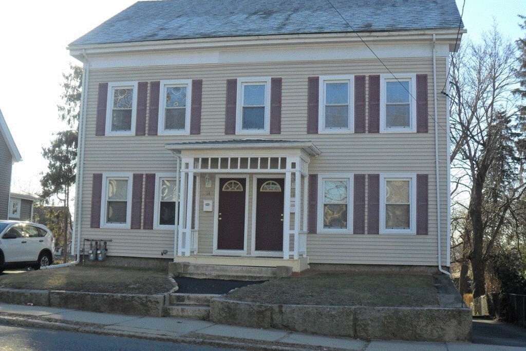
14 West St is a townhome located in Worcester County and the 01757 ZIP Code. This area is served by the Milford attendance zone.
 This Property
 Available Property
Forty miles southwest of Boston, Milford is a thriving town nestled amid the lush forests and rocky hills of Worcester County. Most of the community is made up of residential neighborhoods, with a broad variety of apartments and condos making up the majority of the local rental market. Main Street connects the timeless Downtown district’s vintage storefronts on the southwest side to the more modern shopping centers on the east side, forming the town’s main commercial corridor. Milford Pond serves as the centerpiece of the community, with Plains Park and Clark Island providing great venues for outdoor recreation including baseball diamonds and access to the Charles River Bike Trails.
Learn more about living in Milford| Colleges & Universities | Distance | ||
|---|---|---|---|
| Colleges & Universities | Distance | ||
| Drive: | 31 min | 15.2 mi | |
| Drive: | 36 min | 17.1 mi | |
| Drive: | 27 min | 18.1 mi | |
| Drive: | 33 min | 21.2 mi |
Transportation options available in Milford include Riverside Station, located 29.2 miles from 14 West St. 14 West St is near Worcester Regional, located 27.1 miles or 46 minutes away, and Rhode Island Tf Green International, located 34.2 miles or 53 minutes away.
| Transit / Subway | Distance | ||
|---|---|---|---|
| Transit / Subway | Distance | ||
|
|
Drive: | 40 min | 29.2 mi |
|
|
Drive: | 40 min | 29.5 mi |
|
|
Drive: | 41 min | 30.2 mi |
|
|
Drive: | 43 min | 31.8 mi |
|
|
Drive: | 44 min | 32.0 mi |
| Commuter Rail | Distance | ||
|---|---|---|---|
| Commuter Rail | Distance | ||
|
|
Drive: | 13 min | 8.1 mi |
|
|
Drive: | 15 min | 9.4 mi |
|
|
Drive: | 18 min | 10.8 mi |
|
|
Drive: | 23 min | 12.1 mi |
|
|
Drive: | 24 min | 12.3 mi |
| Airports | Distance | ||
|---|---|---|---|
| Airports | Distance | ||
|
Worcester Regional
|
Drive: | 46 min | 27.1 mi |
|
Rhode Island Tf Green International
|
Drive: | 53 min | 34.2 mi |
Time and distance from 14 West St.
| Shopping Centers | Distance | ||
|---|---|---|---|
| Shopping Centers | Distance | ||
| Walk: | 13 min | 0.7 mi | |
| Drive: | 3 min | 1.4 mi | |
| Drive: | 3 min | 1.5 mi |
| Parks and Recreation | Distance | ||
|---|---|---|---|
| Parks and Recreation | Distance | ||
|
Upton State Forest
|
Drive: | 12 min | 6.7 mi |
|
Blackstone River and Canal Heritage State Park
|
Drive: | 13 min | 7.0 mi |
|
Mass Audubon's Waseeka Wildlife Sanctuary
|
Drive: | 20 min | 9.0 mi |
|
Whitehall State Park
|
Drive: | 23 min | 10.1 mi |
|
Ashland State Park
|
Drive: | 19 min | 11.1 mi |
| Hospitals | Distance | ||
|---|---|---|---|
| Hospitals | Distance | ||
| Walk: | 16 min | 0.8 mi | |
| Drive: | 20 min | 12.1 mi |
| Military Bases | Distance | ||
|---|---|---|---|
| Military Bases | Distance | ||
| Drive: | 32 min | 15.2 mi |
What Are Walk Score®, Transit Score®, and Bike Score® Ratings?
Walk Score® measures the walkability of any address. Transit Score® measures access to public transit. Bike Score® measures the bikeability of any address.
What is a Sound Score Rating?
A Sound Score Rating aggregates noise caused by vehicle traffic, airplane traffic and local sources

14 West St
Milford, MA 01757

