
$4,500 / Month
14 Worcester St Unit 2
Belmont, MA 02478
Today
Favorites
617-272-6779
-
Bedrooms
3
-
Bathrooms
1
-
Square Feet
1,600 sq ft
-
Available
Available Now
Highlights
- Property is near public transit
- Enclosed patio or porch
- Ductless Heating Or Cooling System
- Shops
- Hot Water Heating System
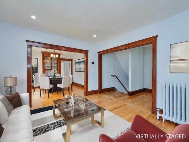
14 Worcester St Unit 2

Favorites
About This Home
$4,500 deposit,
Available Now
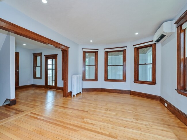
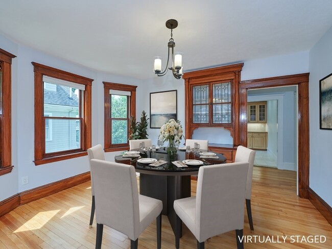
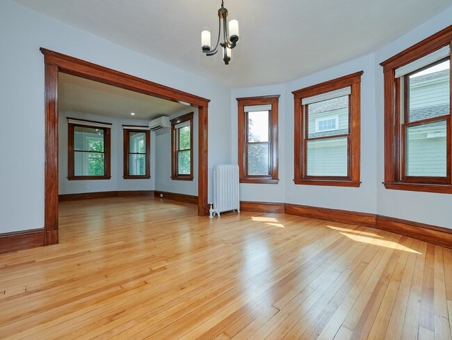
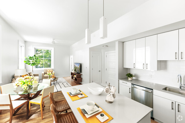
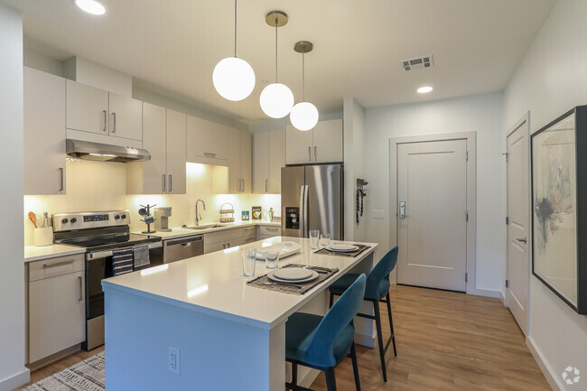
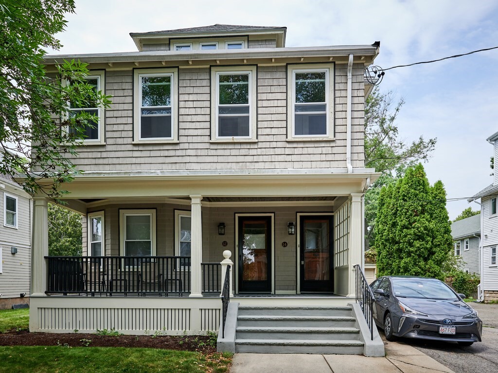
Tastefully remodeled three bedroom conveniently located in Harvard Lawn near the Cambridge line. Some features include gleaming hardwood floors,refinished period millwork,newer windows,stainless appliances,an oversized pantry,new light fixtures and a new primary bedroom on upper floor. Wonderful mix of classic period architecture with contemporary remodeling. Unit consists of three generous sized bedrooms,open floor plan living/dining area,extra large hall closet and exclusive use laundry and storage on the lower level. Front enclosed porch and rear patio space perfect for outside outings. Two-car tandem parking also included. Easy commuting to Cambridge,Boston or points west. Available for June!
14 Worcester St is an apartment community located in Middlesex County and the 02478 ZIP Code.
* Price shown is base rent and may not include non-optional fees and utilities.
Price, availability, fees, and any applicable rent special are subject to change without notice.
* Square footage definitions vary. Displayed square footage is approximate.
Home Details
Accessible Home Design
Entry on the 1st floor
Bedrooms and Bathrooms
1 Full Bathroom
3 Bedrooms
Home Design
Apartment
Interior Spaces
1,600 Sq Ft Home
Kitchen
Range
Microwave
Dishwasher
Laundry
Dryer
Laundry in unit
Washer
Listing and Financial Details
Security Deposit $4,500
Property Available on 6/1/25
12 Month Lease Term
Rent includes water, sewer, trash collection, recreational facilities, gardener, extra storage, laundry facilities, parking
Location
Property is near public transit
Lot Details
9,999 Sq Ft Lot
Outdoor Features
Enclosed patio or porch
Rain Gutters
Parking
2 Car Parking Spaces
Utilities
Ductless Heating Or Cooling System
Hot Water Heating System
Heating System Uses Natural Gas
Internet Available
Community Details
Amenities
Shops
Common Area
Overview
No Home Owners Association
Pet Policy
Call for details about the types of pets allowed
Contact
- Listed by Edward Kebadjian | Real Estate 109
- Phone Number
-
Source
 MLS Property Information Network
The property listing data and information set forth herein were provided to MLS Property Information Network, Inc. from third party sources, including sellers, lessors and public records, and were compiled by MLS Property Information Network, Inc. The property listing data and information are for the personal, non-commercial use of consumers having a good faith interest in purchasing or leasing listed properties of the type displayed to them and may not be used for any purpose other than to identify prospective properties which such consumers may have a good faith interest in purchasing or leasing. MLS Property Information Network, Inc. and its subscribers disclaim any and all representations and warranties as to the accuracy of the property listing data and information set forth herein. All properties are subject to prior sale, change or withdrawal. Copyright © 2025 MLS Property Information Network, Inc. All rights reserved.
Location
Get Directions
Amenities
- Dishwasher
- Microwave
- Range
- Refrigerator
- Patio
- Porch
Cushing Square is a cozy and historic neighborhood in the western Boston suburb of Belmont. With its large houses and dense canopy of trees shading the sidewalks, Cushing Square gives off a distinctly suburban vibe, amplified by the abundance of large parks and golf courses surrounding the community. A small cluster of storefront businesses at the intersection of Trapelo Road and Common Street provides residents with a one-stop shopping and dining destination close to home, featuring everything from a hardware store to a yoga studio to a Greek diner and everything in between.
Burbank Elementary School and WL Chenery Middle School are both within easy walking distance of anywhere in the neighborhood, giving local students the option of walking to class. The neighborhood’s location offers prime access to both Harvard and Tufts, with all of Boston just minutes away.
Learn more about living in Cushing Square
Education
| Colleges & Universities | Distance | ||
|---|---|---|---|
| Colleges & Universities | Distance | ||
| Drive: | 5 min | 2.4 mi | |
| Drive: | 7 min | 3.1 mi | |
| Drive: | 7 min | 3.3 mi | |
| Drive: | 9 min | 3.4 mi |
14 Worcester St Unit 2 is within 5 minutes or 2.4 miles from Harvard University. It is also near Lesley University and Lesley University, Porter.
Transportation options available in Belmont include Alewife Station, located 2.8 miles from 14 Worcester St Unit 2. 14 Worcester St Unit 2 is near General Edward Lawrence Logan International, located 10.7 miles or 19 minutes away.
| Transit / Subway | Distance | ||
|---|---|---|---|
| Transit / Subway | Distance | ||
|
|
Drive: | 6 min | 2.8 mi |
|
|
Drive: | 6 min | 3.0 mi |
|
|
Drive: | 7 min | 3.1 mi |
|
|
Drive: | 7 min | 3.2 mi |
|
|
Drive: | 7 min | 3.3 mi |
| Commuter Rail | Distance | ||
|---|---|---|---|
| Commuter Rail | Distance | ||
|
|
Drive: | 4 min | 1.8 mi |
|
|
Drive: | 3 min | 1.8 mi |
|
|
Drive: | 7 min | 3.4 mi |
|
|
Drive: | 6 min | 3.4 mi |
| Drive: | 9 min | 5.0 mi |
| Airports | Distance | ||
|---|---|---|---|
| Airports | Distance | ||
|
General Edward Lawrence Logan International
|
Drive: | 19 min | 10.7 mi |
Time and distance from 14 Worcester St Unit 2.
| Shopping Centers | Distance | ||
|---|---|---|---|
| Shopping Centers | Distance | ||
| Walk: | 16 min | 0.9 mi | |
| Walk: | 19 min | 1.0 mi | |
| Drive: | 3 min | 1.2 mi |
14 Worcester St Unit 2 has 3 shopping centers within 1.2 miles, which is about a 3-minute walk. The miles and minutes will be for the farthest away property.
| Parks and Recreation | Distance | ||
|---|---|---|---|
| Parks and Recreation | Distance | ||
|
Longfellow National Historic Site
|
Drive: | 4 min | 2.0 mi |
|
Harvard-Smithsonian Center for Astrophysics
|
Drive: | 5 min | 2.1 mi |
|
Beaver Brook Reservation
|
Drive: | 5 min | 2.5 mi |
|
Mass Audubon's Habitat Education Center and Wildlife Sanctuary
|
Drive: | 8 min | 2.9 mi |
|
Harvard Museum of Natural History
|
Drive: | 7 min | 3.1 mi |
14 Worcester St Unit 2 has 5 parks within 3.1 miles, including Longfellow National Historic Site, Harvard-Smithsonian Center for Astrophysics, and Beaver Brook Reservation.
| Hospitals | Distance | ||
|---|---|---|---|
| Hospitals | Distance | ||
| Drive: | 3 min | 1.5 mi | |
| Drive: | 4 min | 2.4 mi | |
| Drive: | 6 min | 2.7 mi |
14 Worcester St Unit 2 has 3 hospitals within 2.7 miles, the nearest is Mount Auburn Hospital which is 1.5 miles away and a 3 minute drive.
| Military Bases | Distance | ||
|---|---|---|---|
| Military Bases | Distance | ||
| Drive: | 20 min | 9.6 mi | |
| Drive: | 25 min | 14.2 mi |
14 Worcester St Unit 2 is 9.6 miles from Hanscom Air Force Base, and is convenient to other military bases, including US Military Reservation.
You May Also Like
Similar Rentals Nearby


What Are Walk Score®, Transit Score®, and Bike Score® Ratings?
Walk Score® measures the walkability of any address. Transit Score® measures access to public transit. Bike Score® measures the bikeability of any address.
What is a Sound Score Rating?
A Sound Score Rating aggregates noise caused by vehicle traffic, airplane traffic and local sources
14 Worcester St
Belmont, MA 02478