$3,500 / Month
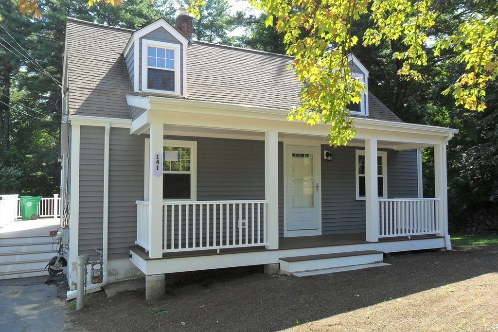
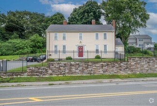
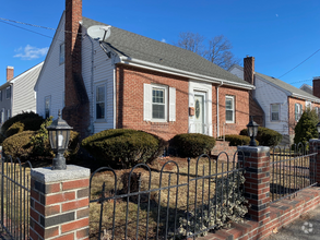
141 Myrtle St
Ashland, MA 01721
2 Weeks Ago
Favorites
141 Myrtle St

Favorites
Check Back Soon for Upcoming Availability
| Beds | Baths | Average SF |
|---|---|---|
| 3 Bedrooms 3 Bedrooms 3 Br | 2 Baths 2 Baths 2 Ba | 1,312 SF |
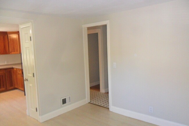
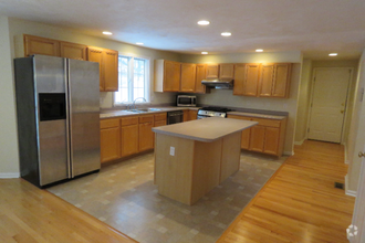
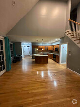
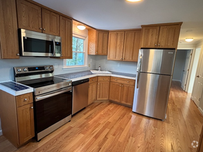
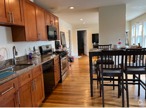
About This Property
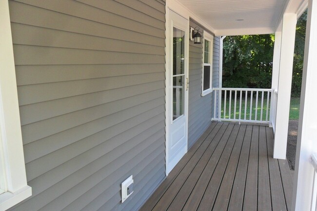
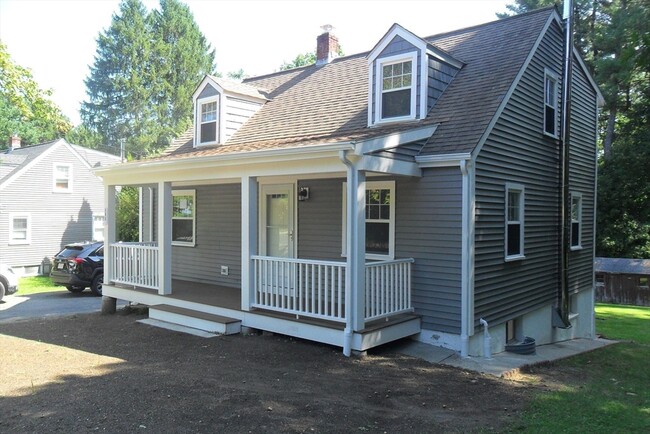
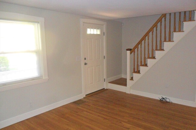
This pristine home is a sight to behold. Gleaming hardwood floors with freshly painted walls and well located. Brand new farmers porch. Newly paved driveway. This lease is designed to end on 5/31/25. The changes to update required so much work that it took the summer to correct. The landlords job ties her up in the fall so she has no time to get work done at that time. By having a lease end of 5/31,it would allow work to be done. That does not mean she would not renew on 6/1/25.
141 Myrtle St is a house located in Middlesex County and the 01721 ZIP Code. This area is served by the Ashland attendance zone.
Property Address:
141 Myrtle St,
Ashland,
MA
01721
495-South is a large area surrounding Interstate 495 about 20 miles south of Boston. This suburban town features peaceful neighborhoods nestled in forested areas paired with commercial developments. Renters have the choice of moderately priced to luxury apartments, condos, and single-family homes. An abundance of shopping and dining choices are scattered along the town’s major thoroughfares. Ponds, creeks, and large natural areas like Franklin State Forest and DelCarte Conservation Area provide relaxing outdoor activities. Residents have access to big-city amenities by driving a bit north into Boston, and the eclectic downtown districts of Worcester and Framingham are situated outside of the western and eastern corners of town.
Learn more about living in 495-South
Education
| Colleges & Universities | Distance | ||
|---|---|---|---|
| Colleges & Universities | Distance | ||
| Drive: | 7 min | 2.9 mi | |
| Drive: | 23 min | 9.2 mi | |
| Drive: | 23 min | 12.3 mi | |
| Drive: | 29 min | 15.1 mi |
141 Myrtle St is within 7 minutes or 2.9 miles from Framingham State College. It is also near Wellesley College and Babson College.
Schools
Public Elementary School
Grades PK-1
350 Students
Nearby
Public Elementary School
Grades K-2
643 Students
Attendance Zone
Public Elementary School
Grades 3-5
644 Students
Attendance Zone
5
Out of 10
Public Middle School
Grades 6-8
682 Students
Attendance Zone
7
Out of 10
Public High School
Grades 9-12
840 Students
Attendance Zone
7
Out of 10
Private Elementary & Middle School
Grades PK-8
174 Students
Nearby
Private Elementary School
Grades PK-5
93 Students
Nearby
Private Elementary, Middle & High School
97 Students
Nearby
Private High School
Grades 9-12
9 Students
Nearby
School data provided by
GreatSchools
The GreatSchools Rating helps parents compare schools within a state based on a variety of school quality indicators and provides a helpful picture of how effectively each school serves all of its students. Ratings are on a scale of 1 (below average) to 10 (above average) and can include test scores, college readiness, academic progress, advanced courses, equity, discipline and attendance data. We also advise parents to visit schools, consider other information on school performance and programs, and consider family needs as part of the school selection process.
Transportation options available in Ashland include Woodland Station, located 13.7 miles from 141 Myrtle St. 141 Myrtle St is near Worcester Regional, located 24.8 miles or 43 minutes away, and General Edward Lawrence Logan International, located 27.9 miles or 44 minutes away.
| Transit / Subway | Distance | ||
|---|---|---|---|
| Transit / Subway | Distance | ||
|
|
Drive: | 25 min | 13.7 mi |
|
|
Drive: | 26 min | 14.4 mi |
|
|
Drive: | 26 min | 14.8 mi |
|
|
Drive: | 27 min | 15.0 mi |
|
|
Drive: | 28 min | 15.2 mi |
| Commuter Rail | Distance | ||
|---|---|---|---|
| Commuter Rail | Distance | ||
|
|
Drive: | 9 min | 2.3 mi |
|
|
Drive: | 8 min | 2.7 mi |
|
|
Drive: | 7 min | 2.7 mi |
|
|
Drive: | 7 min | 3.9 mi |
|
|
Drive: | 12 min | 4.3 mi |
| Airports | Distance | ||
|---|---|---|---|
| Airports | Distance | ||
|
Worcester Regional
|
Drive: | 43 min | 24.8 mi |
|
General Edward Lawrence Logan International
|
Drive: | 44 min | 27.9 mi |
Time and distance from 141 Myrtle St.
| Shopping Centers | Distance | ||
|---|---|---|---|
| Shopping Centers | Distance | ||
| Drive: | 3 min | 1.3 mi | |
| Drive: | 3 min | 1.4 mi |
141 Myrtle St has 2 shopping centers within 1.4 miles, which is about a 3-minute drive. The miles and minutes will be for the farthest away property.
| Parks and Recreation | Distance | ||
|---|---|---|---|
| Parks and Recreation | Distance | ||
|
Cowassock Woods and Ashland Town Forest
|
Drive: | 5 min | 2.3 mi |
|
Ashland State Park
|
Drive: | 6 min | 2.4 mi |
|
Wilfred J. Turenne Wildlife Habitat
|
Drive: | 7 min | 4.0 mi |
|
Callahan State Park
|
Drive: | 10 min | 4.2 mi |
|
Hopkinton State Park
|
Drive: | 16 min | 5.6 mi |
141 Myrtle St has 5 parks within 5.6 miles, including Cowassock Woods and Ashland Town Forest, Ashland State Park, and Hopkinton State Park.
| Hospitals | Distance | ||
|---|---|---|---|
| Hospitals | Distance | ||
| Drive: | 10 min | 3.5 mi | |
| Drive: | 18 min | 9.5 mi |
141 Myrtle St is 3.5 miles from MetroWest Medical Center, and is convenient to other hospitals, including UMass Memorial Healthcare - Marlborough Hospital.
| Military Bases | Distance | ||
|---|---|---|---|
| Military Bases | Distance | ||
| Drive: | 15 min | 7.8 mi | |
| Drive: | 40 min | 20.4 mi |
141 Myrtle St is 7.8 miles from US Military Reservation, and is convenient to other military bases, including Hanscom Air Force Base.
You May Also Like
Similar Rentals Nearby
-
-
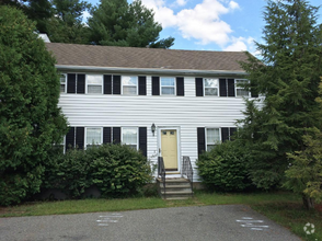
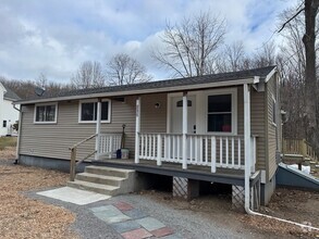 $3,0003 Beds, 2 Baths, 1,880 sq ftHouse for Rent
 -
 $3,5003 Beds, 2 Baths, 1,600 sq ftHouse for Rent
 -
 $3,3004 Beds, 2 Baths, 2,000 sq ftHouse for Rent
 -
-
-
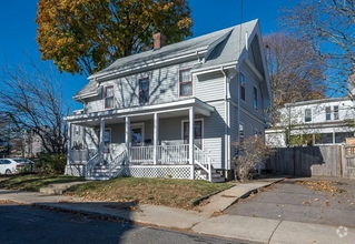
 $8,5004 Beds, 5 Baths, 4,439 sq ftHouse for Rent
 -
-
-
 $4,0003 Beds, 2 Baths, 1,300 sq ftHouse for Rent
What Are Walk Score®, Transit Score®, and Bike Score® Ratings?
Walk Score® measures the walkability of any address. Transit Score® measures access to public transit. Bike Score® measures the bikeability of any address.
What is a Sound Score Rating?
A Sound Score Rating aggregates noise caused by vehicle traffic, airplane traffic and local sources

141 Myrtle St
Ashland, MA 01721