$2,495 / Month
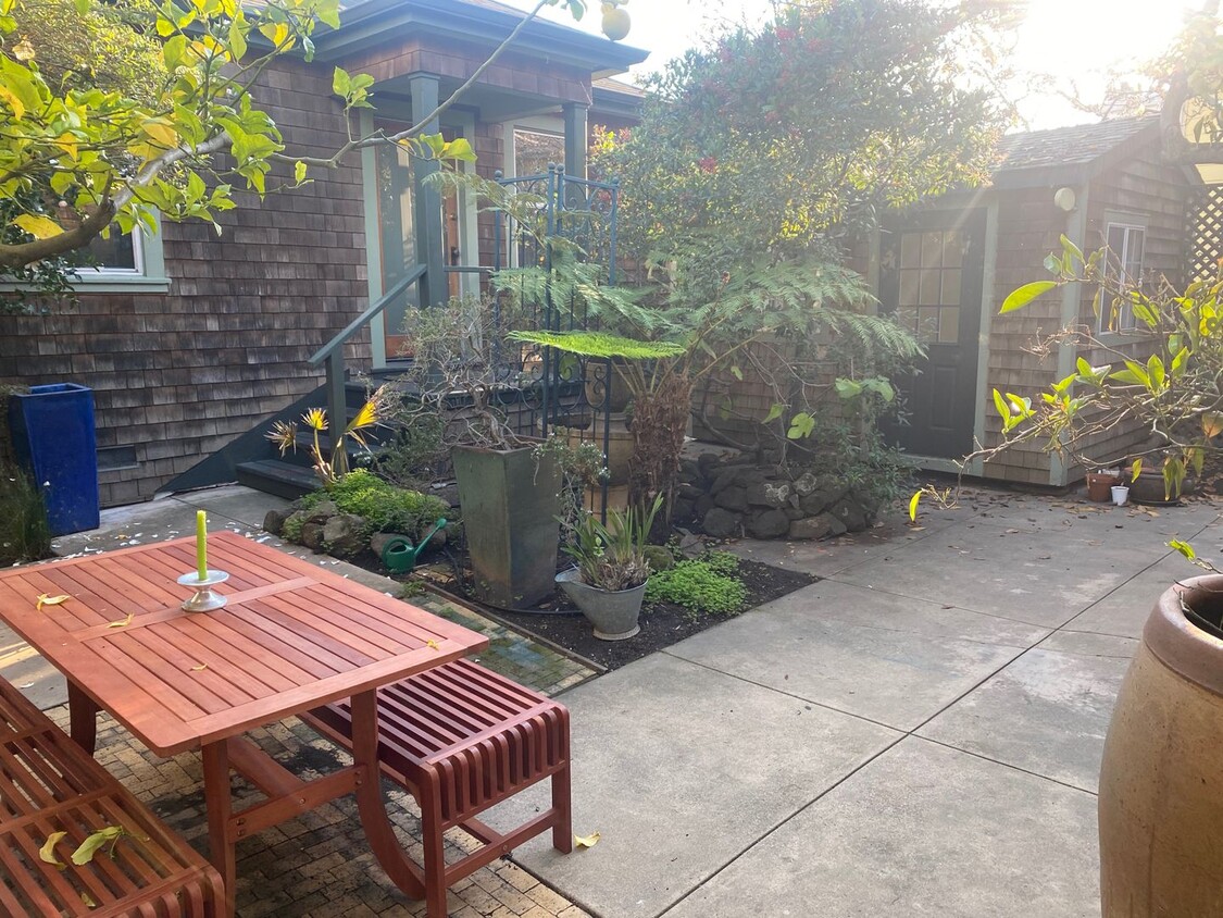
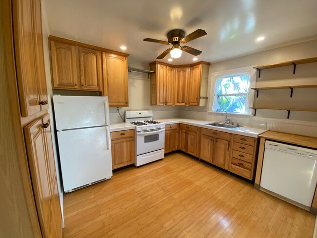
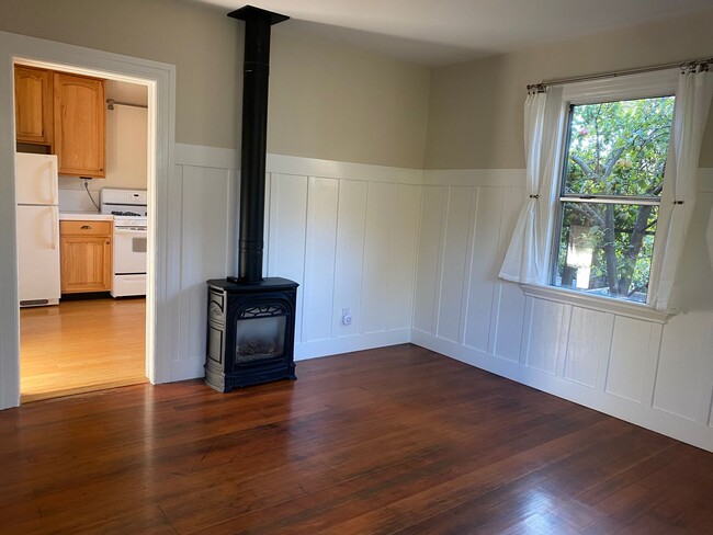
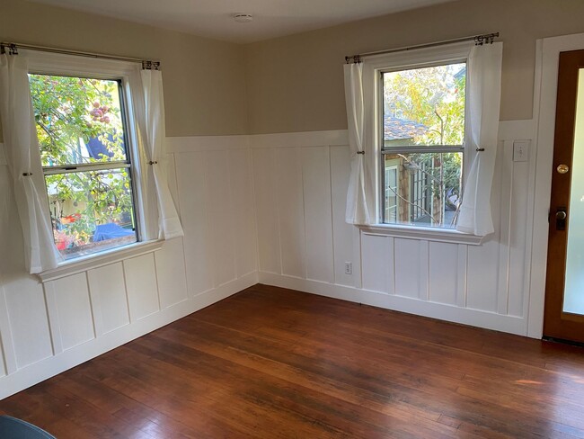
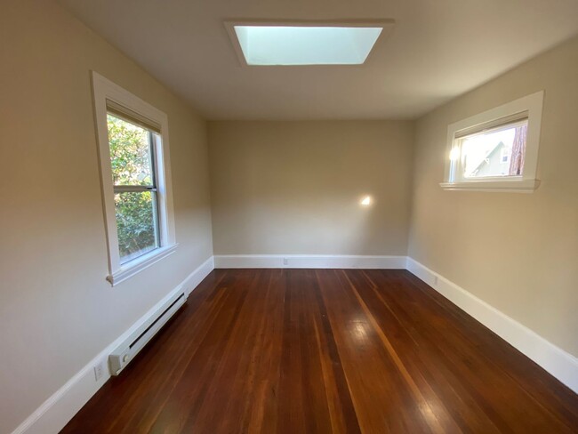
1412 66th St Unit 1412 1/2
Berkeley, CA 94702
Today
Favorites
510-715-0528
-
Bedrooms
1
-
Bathrooms
1
-
Square Feet
--
-
Available
Available Now
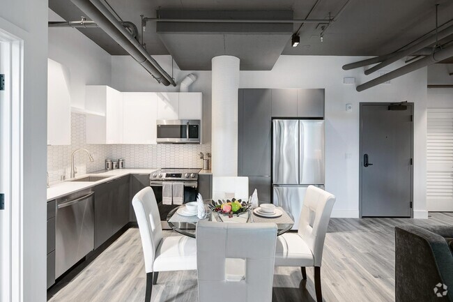
1412 66th St Unit 1412 1/2

Favorites
Southwest Berkeley is bounded by University Avenue to the north, Sacramento Street to the East, Alcatraz Avenue to the south and the San Francisco Bay to the west. Southwest Berkeley comprises a fascinating mix of the educational and the industrial. Less dense than the more inland parts of Berkeley, Southwest Berkeley has a diverse mix of apartment and home rentals that will delight students and families alike. Convenient access to the illustrious university make this a great option for students and staff, but any renter will love the restaurant and retail options that make this walkable locale so convenient.
Learn more about living in Southwest Berkeley
Education
| Colleges & Universities | Distance | ||
|---|---|---|---|
| Colleges & Universities | Distance | ||
| Drive: | 5 min | 2.0 mi | |
| Drive: | 7 min | 2.7 mi | |
| Drive: | 10 min | 3.3 mi | |
| Drive: | 8 min | 3.6 mi |
1412 66th St Unit 1412 1/2 is within 5 minutes or 2.0 miles from Berkeley City College. It is also near Samuel Merritt University and UC Berkeley.
Transportation options available in Berkeley include Ashby Station, located 0.7 mile from 1412 66th St Unit 1412 1/2. 1412 66th St Unit 1412 1/2 is near Metro Oakland International, located 13.2 miles or 21 minutes away, and San Francisco International, located 22.9 miles or 36 minutes away.
| Transit / Subway | Distance | ||
|---|---|---|---|
| Transit / Subway | Distance | ||
|
|
Walk: | 12 min | 0.7 mi |
|
|
Drive: | 5 min | 1.9 mi |
|
|
Drive: | 6 min | 2.1 mi |
|
|
Drive: | 8 min | 2.6 mi |
|
|
Drive: | 8 min | 3.7 mi |
| Commuter Rail | Distance | ||
|---|---|---|---|
| Commuter Rail | Distance | ||
|
|
Drive: | 4 min | 1.3 mi |
|
|
Drive: | 6 min | 2.3 mi |
|
|
Drive: | 10 min | 4.4 mi |
| Drive: | 18 min | 10.5 mi | |
| Drive: | 20 min | 11.7 mi |
| Airports | Distance | ||
|---|---|---|---|
| Airports | Distance | ||
|
Metro Oakland International
|
Drive: | 21 min | 13.2 mi |
|
San Francisco International
|
Drive: | 36 min | 22.9 mi |
Time and distance from 1412 66th St Unit 1412 1/2.
| Shopping Centers | Distance | ||
|---|---|---|---|
| Shopping Centers | Distance | ||
| Drive: | 4 min | 1.5 mi | |
| Drive: | 4 min | 1.5 mi | |
| Drive: | 5 min | 1.6 mi |
1412 66th St Unit 1412 1/2 has 3 shopping centers within 1.6 miles, which is about a 5-minute drive. The miles and minutes will be for the farthest away property.
| Parks and Recreation | Distance | ||
|---|---|---|---|
| Parks and Recreation | Distance | ||
|
San Francisco Bay Trail (at Emeryville)
|
Drive: | 4 min | 1.6 mi |
|
Strawberry Creek Park
|
Drive: | 4 min | 1.6 mi |
|
Willard Park
|
Drive: | 5 min | 1.8 mi |
|
Habitot Children's Museum
|
Drive: | 5 min | 1.9 mi |
|
People's Park
|
Drive: | 7 min | 2.2 mi |
1412 66th St Unit 1412 1/2 has 5 parks within 2.2 miles, including Strawberry Creek Park, San Francisco Bay Trail (at Emeryville), and Willard Park.
| Hospitals | Distance | ||
|---|---|---|---|
| Hospitals | Distance | ||
| Drive: | 3 min | 1.4 mi | |
| Drive: | 4 min | 1.5 mi | |
| Drive: | 6 min | 2.7 mi |
1412 66th St Unit 1412 1/2 has 3 hospitals within 2.7 miles, the nearest is Children's Hospital & Research Center Oakland which is 1.4 miles away and a 3 minute drive.
| Military Bases | Distance | ||
|---|---|---|---|
| Military Bases | Distance | ||
| Drive: | 15 min | 5.7 mi | |
| Drive: | 17 min | 7.2 mi |
1412 66th St Unit 1412 1/2 is 5.7 miles from Oakland Army Base, and is convenient to other military bases, including Alameda/US Naval Air Station Alameda.
You May Also Like
Similar Rentals Nearby


What Are Walk Score®, Transit Score®, and Bike Score® Ratings?
Walk Score® measures the walkability of any address. Transit Score® measures access to public transit. Bike Score® measures the bikeability of any address.
What is a Sound Score Rating?
A Sound Score Rating aggregates noise caused by vehicle traffic, airplane traffic and local sources

1412 66th St
Berkeley, CA 94702