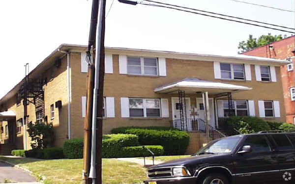
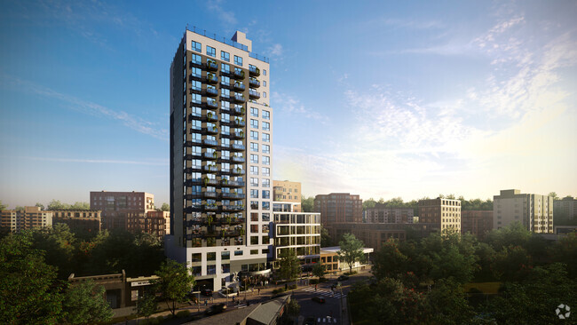
142 Chestnut St
142 Chestnut St,
Rutherford,
NJ
07070
2 Weeks Ago
Favorites
142 Chestnut St
Favorites
Check Back Soon for Upcoming Availability
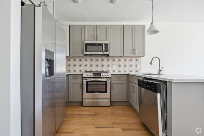
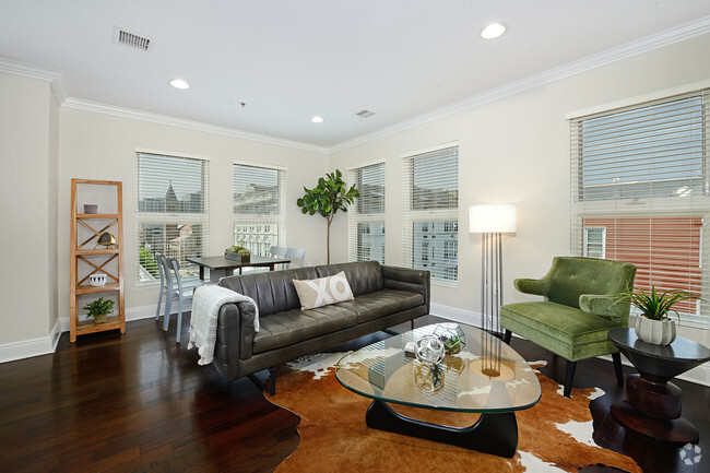
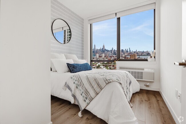
About 142 Chestnut St Rutherford, NJ 07070
Discover true Rutherford living at 142 Chestnut St. This community can be found on Chestnut St. in the 07070 area of Rutherford. Make sure you to check out the apartment floorplan options. Here at this community, the leasing staff is available to assist you in finding your perfect floorplan. Get moving on finding your next place. Contact or stop by the 142 Chestnut St leasing office to check the availability and schedule a tour today.
142 Chestnut St is an apartment community located in Bergen County and the 07070 ZIP Code. This area is served by the Rutherford Public attendance zone.
Fees and Policies
The fees below are based on community-supplied data and may exclude additional fees and utilities.
- Parking
-
Surface LotParking Available--
Details
Property Information
-
8 units/2 stories
Property Address:
142 Chestnut St,
Rutherford,
NJ
07070
Rutherford is a large suburban borough that stretches between the Passaic River and the Hackensack River about twelve miles west of Manhattan. The close proximity to New York and the relatively affordable rental market makes Rutherford a great option for commuters, while the terrific local schools and low crime rate boost the appeal for families.
The Downtown area along Park Avenue is a charming walkable district packed with locally-owned restaurants, coffeehouses, and specialty shops, creating a popular destination for locals and visitors alike. Drop into Erie Coffeeshop & Bakery for breakfast before catching the train, drop into the historic Center Cinemas to catch a flick, or unwind after hours at The New Park Tavern.
Living in Rutherford also puts you just a few blocks from MetLife Stadium and the Meadowlands Sports Complex, allowing you to walk to Giants and Jets games as well as the concerts and special events that are constantly rotating through the arena.
Learn more about living in Rutherford
Education
| Colleges & Universities | Distance | ||
|---|---|---|---|
| Colleges & Universities | Distance | ||
| Walk: | 10 min | 0.5 mi | |
| Drive: | 6 min | 2.2 mi | |
| Drive: | 5 min | 2.4 mi | |
| Drive: | 10 min | 4.2 mi |
142 Chestnut St is within 10 minutes or 0.5 mile from Felician College, Rutherford. It is also near Bergen C.C., Meadowlands and Passaic County C.C., Passaic.
Schools
Public Elementary & Middle School
Grades PK-8
520 Students
Nearby
5
Out of 10
Public Elementary School
Grades 4-6
561 Students
Nearby
9
Out of 10
Public Elementary School
Grades PK & 1-3
314 Students
Nearby
5
Out of 10
Public High School
Grades 9-12
753 Students
Attendance Zone
5
Out of 10
Private Elementary & Middle School
Grades PK-8
145 Students
Nearby
Private High School
Grades 9-12
209 Students
Nearby
School data provided by
GreatSchools
The GreatSchools Rating helps parents compare schools within a state based on a variety of school quality indicators and provides a helpful picture of how effectively each school serves all of its students. Ratings are on a scale of 1 (below average) to 10 (above average) and can include test scores, college readiness, academic progress, advanced courses, equity, discipline and attendance data. We also advise parents to visit schools, consider other information on school performance and programs, and consider family needs as part of the school selection process.
Transportation options available in Rutherford include Tonnelle Avenue, located 7.0 miles from 142 Chestnut St. 142 Chestnut St is near Newark Liberty International, located 12.8 miles or 16 minutes away, and Laguardia, located 22.2 miles or 35 minutes away.
| Transit / Subway | Distance | ||
|---|---|---|---|
| Transit / Subway | Distance | ||
|
|
Drive: | 10 min | 7.0 mi |
|
|
Drive: | 13 min | 7.1 mi |
|
|
Drive: | 14 min | 7.4 mi |
|
|
Drive: | 14 min | 7.5 mi |
|
|
Drive: | 15 min | 9.3 mi |
| Commuter Rail | Distance | ||
|---|---|---|---|
| Commuter Rail | Distance | ||
|
|
Walk: | 8 min | 0.4 mi |
|
|
Drive: | 3 min | 1.4 mi |
|
|
Drive: | 5 min | 1.6 mi |
|
|
Drive: | 4 min | 2.4 mi |
|
|
Drive: | 6 min | 3.0 mi |
| Airports | Distance | ||
|---|---|---|---|
| Airports | Distance | ||
|
Newark Liberty International
|
Drive: | 16 min | 12.8 mi |
|
Laguardia
|
Drive: | 35 min | 22.2 mi |
Time and distance from 142 Chestnut St.
| Shopping Centers | Distance | ||
|---|---|---|---|
| Shopping Centers | Distance | ||
| Walk: | 17 min | 0.9 mi | |
| Drive: | 3 min | 1.1 mi | |
| Drive: | 4 min | 1.3 mi |
142 Chestnut St has 3 shopping centers within 1.3 miles, which is about a 4-minute drive. The miles and minutes will be for the farthest away property.
| Parks and Recreation | Distance | ||
|---|---|---|---|
| Parks and Recreation | Distance | ||
|
Meadowlands Environment Center
|
Drive: | 13 min | 3.8 mi |
|
McDowell Observatory
|
Drive: | 13 min | 3.9 mi |
|
Richard W. DeKorte Park
|
Drive: | 13 min | 5.4 mi |
|
Kearny Marsh
|
Drive: | 11 min | 5.5 mi |
|
Laurel Hill Park
|
Drive: | 13 min | 7.4 mi |
142 Chestnut St has 5 parks within 7.4 miles, including Meadowlands Environment Center, McDowell Observatory, and Richard W. DeKorte Park.
| Hospitals | Distance | ||
|---|---|---|---|
| Hospitals | Distance | ||
| Drive: | 7 min | 3.5 mi | |
| Drive: | 9 min | 5.6 mi | |
| Drive: | 11 min | 6.7 mi |
142 Chestnut St has 3 hospitals within 6.7 miles, the nearest is St. Mary's General Hospital which is 3.5 miles away and a 7 minutes drive.
| Military Bases | Distance | ||
|---|---|---|---|
| Military Bases | Distance | ||
| Drive: | 25 min | 15.1 mi | |
| Drive: | 24 min | 17.3 mi |
142 Chestnut St is 15.1 miles from Governors Island Support Center, and is convenient to other military bases, including Military Ocean Terminal.
You May Also Like
How do I access Social Services in New Jersey?
Statewide service is free, confidential, multilingual and always open. Three easy ways to reach Social Services in NJ: Dial 2-1-1; text your zip code to 898-211; or chat at https://www.nj211.org
Similar Rentals Nearby


What Are Walk Score®, Transit Score®, and Bike Score® Ratings?
Walk Score® measures the walkability of any address. Transit Score® measures access to public transit. Bike Score® measures the bikeability of any address.
What is a Sound Score Rating?
A Sound Score Rating aggregates noise caused by vehicle traffic, airplane traffic and local sources
Responded To This Review