
$2,270 / Month
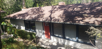
142 Denio St
Vallejo, CA 94590
2 Weeks Ago
Favorites
142 Denio St

Favorites
Check Back Soon for Upcoming Availability
| Beds | Baths | Average SF |
|---|---|---|
| 2 Bedrooms 2 Bedrooms 2 Br | 1.5 Baths 1.5 Baths 1.5 Ba | 1,005 SF |
About This Property
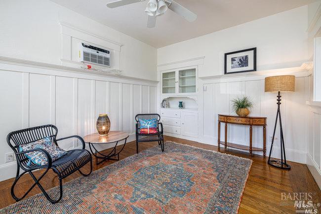
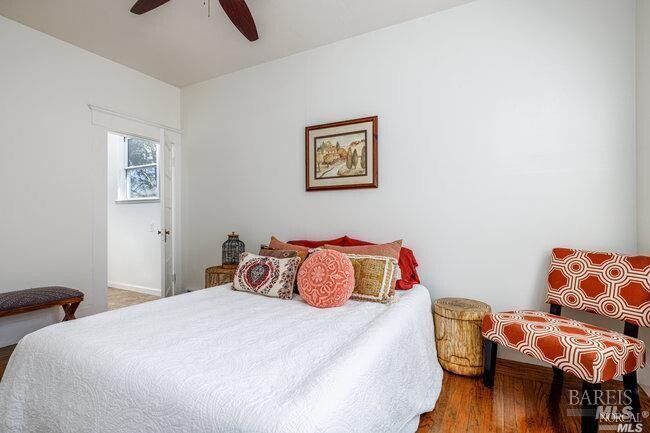
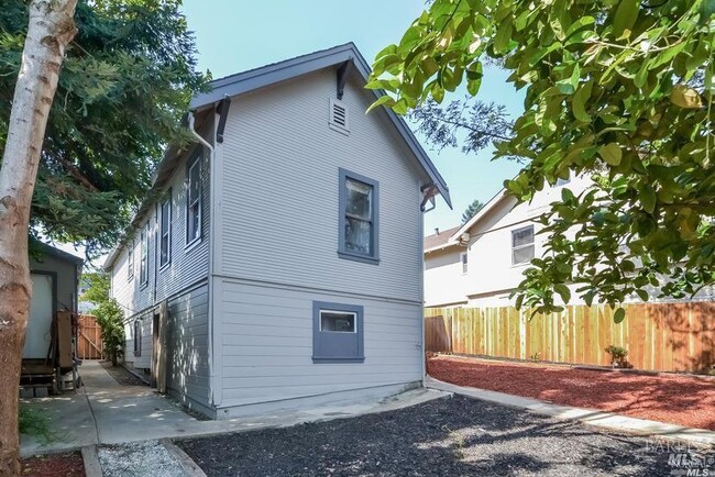
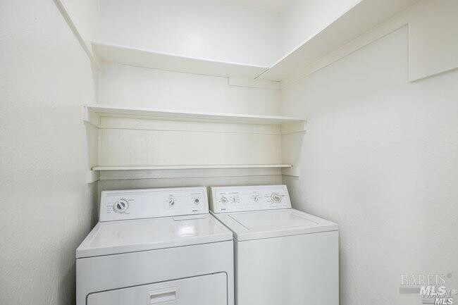
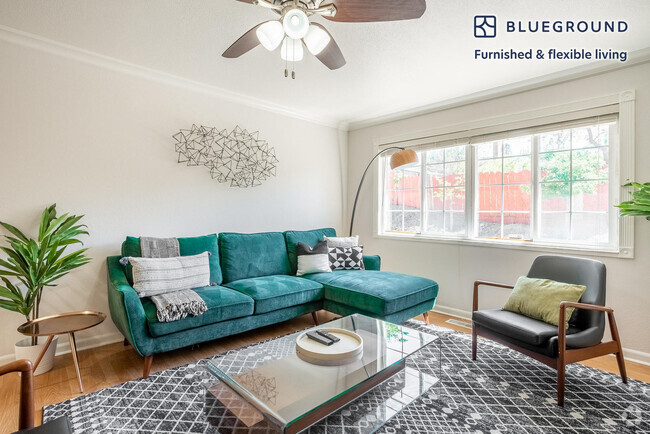
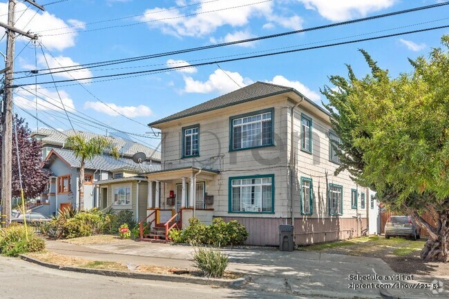
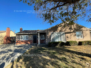
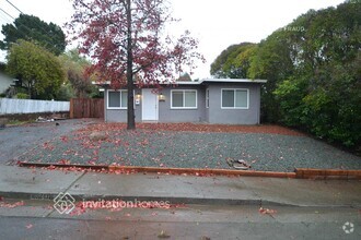
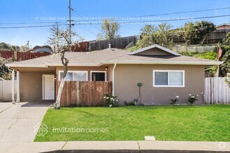
Esta encantadora casa de estilo artesanal de Vallejo Heights consta de 2 dormitorios, 1 baño completo y 1/4 de baño. Las habitaciones y el baño completo son de un tamaño suficiente para una casa de esta época. El lavadero independiente está convenientemente ubicado en la sala de estar de la planta superior. Se incluye una lavadora y secadora contiguas. Si bien la casa ha sido renovada con comodidades modernas como luces empotradas, aún conserva características originales, como pisos de madera y gabinetes empotrados. El patio trasero es de un tamaño generoso y está listo para un jardín, ¡entretenimiento o ambos! Hay muchas opciones de transporte debido a su proximidad a las terminales de transbordadores y autobuses, Park and Ride y las autopistas 29, 37, 80 y 780/680. ¡No te pierdas esta joya! MLS #324088176
142 Denio St is a house located in Solano County and the 94590 ZIP Code. This area is served by the Vallejo City Unified attendance zone.
House Features
- Cocina con isla
Fees and Policies
Property Address:
142 Denio St,
Vallejo,
CA
94590
Located about one mile northwest of the heart of Vallejo, Vallejo Heights is a tranquil neighborhood boasting rich diversity and sweeping views of the Napa River from its hilly landscape. Vallejo Heights is largely residential, offering an array of apartments and houses for rent in a beautiful locale.
Residents are typically drawn to the neighborhood’s natural beauty, scenic vistas, and overall peaceful atmosphere. Vallejo Heights contains numerous parks for the community to enjoy, including Terrace Park, Sheveland Park, and River Park. Vallejo Heights is also just a short drive from local attractions like Mare Island Naval Shipyard and Six Flags Discovery Kingdom, as well as Napa Wine Country and the San Francisco Bay Area.
Learn more about living in Vallejo HeightsBelow are rent ranges for similar nearby apartments
Amenities
- Cocina con isla
Education
| Colleges & Universities | Distance | ||
|---|---|---|---|
| Colleges & Universities | Distance | ||
| Drive: | 8 min | 3.8 mi | |
| Drive: | 17 min | 11.9 mi | |
| Drive: | 19 min | 13.4 mi | |
| Drive: | 21 min | 14.9 mi |
142 Denio St is within 8 minutes or 3.8 miles from Touro University California. It is also near Napa Valley College and Solano Community College.
Schools


Public Elementary School
Grades K-5
440 Students
Nearby
Public Elementary & Middle School
Grades K-8
427 Students
Attendance Zone
Public Middle School
Grades 6-8
548 Students
Attendance Zone
Public High School
Grades 9-12
1,335 Students
Attendance Zone
Private Elementary & Middle School
Grades PK-8
245 Students
Nearby
Private Elementary, Middle & High School
Grades 4-12
12 Students
Nearby
School data provided by
 The GreatSchools Rating helps parents compare schools within a state based on a variety of school quality indicators and provides a helpful picture of how effectively each school serves all of its students. Ratings are on a scale of 1 (below average) to 10 (above average) and can include test scores, college readiness, academic progress, advanced courses, equity, discipline and attendance data. We also advise parents to visit schools, consider other information on school performance and programs, and consider family needs as part of the school selection process.
View GreatSchools Rating Methodology
View GreatSchools Rating Methodology
Transportation options available in Vallejo include El Cerrito Del Norte Station, located 18.1 miles from 142 Denio St. 142 Denio St is near Metro Oakland International, located 37.0 miles or 48 minutes away, and San Francisco International, located 44.7 miles or 61 minutes away.
| Transit / Subway | Distance | ||
|---|---|---|---|
| Transit / Subway | Distance | ||
|
|
Drive: | 24 min | 18.1 mi |
|
|
Drive: | 25 min | 18.3 mi |
|
|
Drive: | 26 min | 18.4 mi |
|
|
Drive: | 27 min | 18.9 mi |
|
|
Drive: | 27 min | 19.9 mi |
| Commuter Rail | Distance | ||
|---|---|---|---|
| Commuter Rail | Distance | ||
|
|
Drive: | 19 min | 13.4 mi |
|
|
Drive: | 23 min | 17.4 mi |
| Drive: | 28 min | 20.1 mi | |
| Drive: | 29 min | 21.5 mi | |
| Drive: | 31 min | 21.8 mi |
| Airports | Distance | ||
|---|---|---|---|
| Airports | Distance | ||
|
Metro Oakland International
|
Drive: | 48 min | 37.0 mi |
|
San Francisco International
|
Drive: | 61 min | 44.7 mi |
Time and distance from 142 Denio St.
| Shopping Centers | Distance | ||
|---|---|---|---|
| Shopping Centers | Distance | ||
| Walk: | 12 min | 0.6 mi | |
| Walk: | 14 min | 0.8 mi | |
| Walk: | 15 min | 0.8 mi |
142 Denio St has 3 shopping centers within 0.8 mile, which is about a 15-minute walk. The miles and minutes will be for the farthest away property.
| Parks and Recreation | Distance | ||
|---|---|---|---|
| Parks and Recreation | Distance | ||
|
Dan Foley Park
|
Drive: | 6 min | 2.5 mi |
|
Six Flags Discovery Kingdom
|
Drive: | 6 min | 3.7 mi |
|
Benicia State Recreation Area
|
Drive: | 12 min | 6.2 mi |
|
Crockett Hills Regional Park
|
Drive: | 10 min | 6.7 mi |
|
Carquinez Strait Regional Shoreline
|
Drive: | 16 min | 8.9 mi |
142 Denio St has 5 parks within 8.9 miles, including Dan Foley Park, Six Flags Discovery Kingdom, and Benicia State Recreation Area.
| Hospitals | Distance | ||
|---|---|---|---|
| Hospitals | Distance | ||
| Walk: | 16 min | 0.9 mi | |
| Drive: | 4 min | 1.7 mi | |
| Drive: | 5 min | 2.5 mi |
142 Denio St has 3 hospitals within 2.5 miles, the nearest is Adventist Health Vallejo which is 0.9 mile away and a 16 minute walk.
| Military Bases | Distance | ||
|---|---|---|---|
| Military Bases | Distance | ||
| Drive: | 7 min | 3.2 mi | |
| Drive: | 16 min | 10.1 mi |
142 Denio St is 3.2 miles from Mare Island Naval Reserve, and is convenient to other military bases, including Armory Vallejo.
You May Also Like
Similar Rentals Nearby
What Are Walk Score®, Transit Score®, and Bike Score® Ratings?
Walk Score® measures the walkability of any address. Transit Score® measures access to public transit. Bike Score® measures the bikeability of any address.
What is a Sound Score Rating?
A Sound Score Rating aggregates noise caused by vehicle traffic, airplane traffic and local sources

142 Denio St
Vallejo, CA 94590