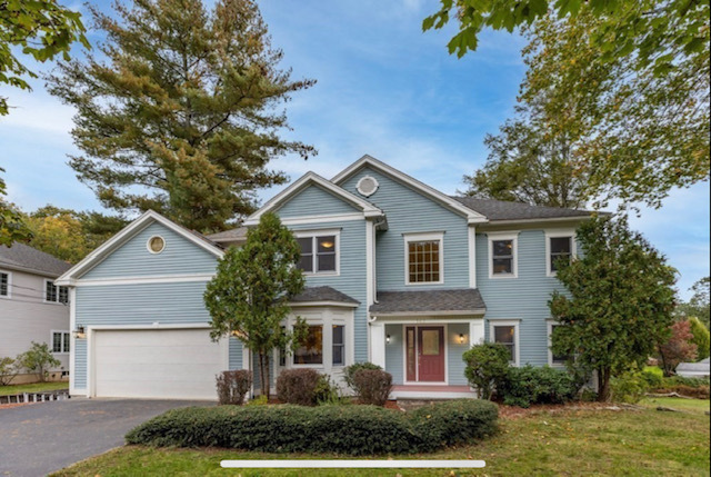
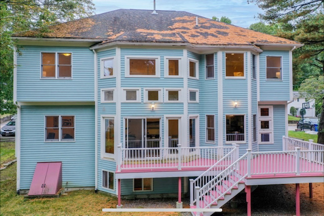
142 Hartman Rd
Newton, MA 02459
-
Bedrooms
5
-
Bathrooms
4.5
-
Square Feet
4,200 sq ft
-
Available
Available Now

Contact
- Listed by Julian Murtagh-Lux
- Phone Number (857) 403-3085
- Contact
Nestled against the Charles River 14 miles west of downtown Boston, Newton's Oak Hill neighborhood provides residents with a quiet residential community that has easy access to surrounding commercial centers. The area primarily contains single-family homes for rent amidst large swathes of green space for outdoor activities and relaxation.
Oak Hill residents indulge in local produce grown at the neighborhood's Newton Community Farm, the last working farm in the city. Pick up fresh vegetables at the farmer's market, or sign up for the farm's Community Supported Agriculture program for a regular box of seasonal goods. You can learn more about the food you eat by joining your neighbors as a volunteer at the farm. On sunny mornings, jog the trails at the 55-acre Nahanton Park, or rent a kayak and paddle down the Charles River and behold the surrounding scenery.
Learn more about living in Oak Hill| Colleges & Universities | Distance | ||
|---|---|---|---|
| Colleges & Universities | Distance | ||
| Drive: | 9 min | 4.7 mi | |
| Drive: | 10 min | 5.0 mi | |
| Drive: | 13 min | 6.1 mi | |
| Drive: | 14 min | 6.1 mi |
Transportation options available in Newton include Newton Highlands Station, located 2.3 miles from 142 Hartman Rd. 142 Hartman Rd is near General Edward Lawrence Logan International, located 12.6 miles or 26 minutes away.
| Transit / Subway | Distance | ||
|---|---|---|---|
| Transit / Subway | Distance | ||
|
|
Drive: | 4 min | 2.3 mi |
|
|
Drive: | 6 min | 2.7 mi |
|
|
Drive: | 6 min | 2.7 mi |
|
|
Drive: | 6 min | 2.8 mi |
|
|
Drive: | 8 min | 4.4 mi |
| Commuter Rail | Distance | ||
|---|---|---|---|
| Commuter Rail | Distance | ||
|
|
Drive: | 7 min | 2.5 mi |
|
|
Drive: | 7 min | 3.1 mi |
|
|
Drive: | 7 min | 3.5 mi |
|
|
Drive: | 8 min | 3.7 mi |
|
|
Drive: | 10 min | 4.6 mi |
| Airports | Distance | ||
|---|---|---|---|
| Airports | Distance | ||
|
General Edward Lawrence Logan International
|
Drive: | 26 min | 12.6 mi |
Time and distance from 142 Hartman Rd.
| Shopping Centers | Distance | ||
|---|---|---|---|
| Shopping Centers | Distance | ||
| Drive: | 5 min | 1.9 mi | |
| Drive: | 4 min | 2.2 mi | |
| Drive: | 6 min | 2.4 mi |
| Parks and Recreation | Distance | ||
|---|---|---|---|
| Parks and Recreation | Distance | ||
|
Cutler Park Reservation
|
Drive: | 4 min | 1.9 mi |
|
Brook Farm Historic Site
|
Drive: | 4 min | 2.3 mi |
|
Hammond Pond Reservation
|
Drive: | 6 min | 2.8 mi |
|
Hemlock Gorge Reservation
|
Drive: | 9 min | 4.0 mi |
|
Chestnut Hill Reservation
|
Drive: | 9 min | 4.9 mi |
| Hospitals | Distance | ||
|---|---|---|---|
| Hospitals | Distance | ||
| Drive: | 6 min | 2.6 mi | |
| Drive: | 8 min | 4.1 mi | |
| Drive: | 9 min | 4.5 mi |
| Military Bases | Distance | ||
|---|---|---|---|
| Military Bases | Distance | ||
| Drive: | 20 min | 11.3 mi | |
| Drive: | 27 min | 15.2 mi |
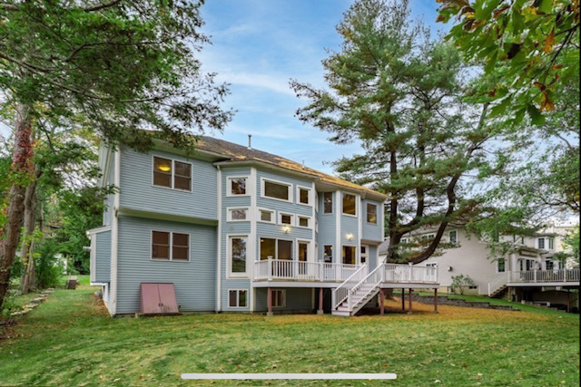
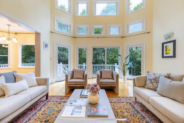
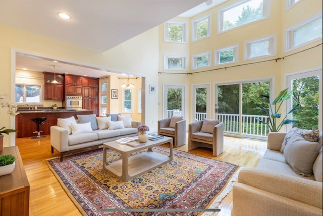
142 Hartman Rd Photos
What Are Walk Score®, Transit Score®, and Bike Score® Ratings?
Walk Score® measures the walkability of any address. Transit Score® measures access to public transit. Bike Score® measures the bikeability of any address.
What is a Sound Score Rating?
A Sound Score Rating aggregates noise caused by vehicle traffic, airplane traffic and local sources

142 Hartman Rd
Newton, MA 02459