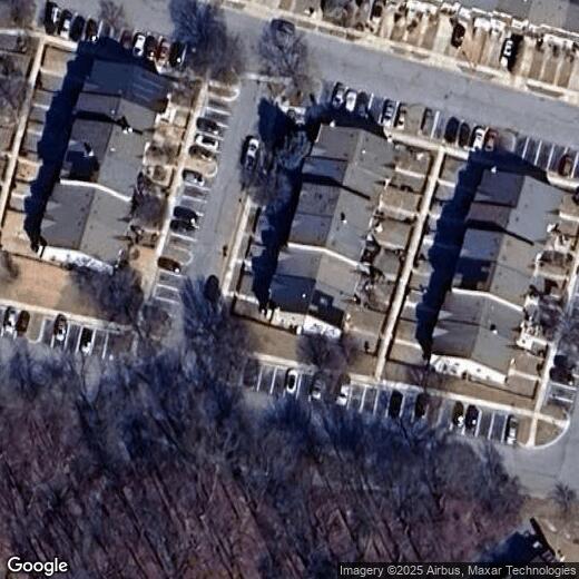
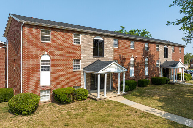
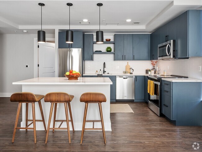
14303 S Shore Ct
14303 S Shore Ct
Laurel, MD 20707
2 Weeks Ago
Favorites
14303 S Shore Ct

Favorites
Check Back Soon for Upcoming Availability
Location
Get Directions
Laurel enjoys a unique position roughly halfway between DC and Baltimore, and its relative seclusion makes it an attractive option for commuters who work in either city but prefer a small-town home environment. The close proximity to Fort Mead also makes Laurel a popular option for Department of Defense employees and military personnel seeking off-base housing.
The cost of living is rather affordable, and apartments tend to rent for much more reasonable rates than closer to the major cities nearby. While almost exclusively residential, Laurel does feature a handful of large shopping centers along its major roadways as well as a quaint Main Street district, the perfect place to grab a cup of coffee in a friendly café before heading off to work.
Learn more about living in Laurel
Education
| Colleges & Universities | Distance | ||
|---|---|---|---|
| Colleges & Universities | Distance | ||
| Drive: | 18 min | 9.6 mi | |
| Drive: | 17 min | 9.8 mi | |
| Drive: | 23 min | 13.5 mi | |
| Drive: | 23 min | 14.2 mi |
14303 S Shore Ct is within 18 minutes or 9.6 miles from University of Maryland. It is also near Bowie State University and Howard Community College.
Transportation options available in Laurel include Dorsey, located 10.6 miles from 14303 S Shore Ct. 14303 S Shore Ct is near Baltimore/Washington International Thurgood Marshall, located 16.0 miles or 28 minutes away, and Ronald Reagan Washington Ntl, located 25.3 miles or 41 minutes away.
| Transit / Subway | Distance | ||
|---|---|---|---|
| Transit / Subway | Distance | ||
|
|
Drive: | 20 min | 10.6 mi |
|
|
Drive: | 21 min | 12.9 mi |
|
|
Drive: | 20 min | 13.0 mi |
|
|
Drive: | 20 min | 13.4 mi |
|
|
Drive: | 24 min | 14.5 mi |
| Commuter Rail | Distance | ||
|---|---|---|---|
| Commuter Rail | Distance | ||
|
|
Drive: | 5 min | 2.1 mi |
|
|
Drive: | 6 min | 3.0 mi |
|
|
Drive: | 9 min | 3.3 mi |
|
|
Drive: | 13 min | 5.5 mi |
|
|
Drive: | 14 min | 8.1 mi |
| Airports | Distance | ||
|---|---|---|---|
| Airports | Distance | ||
|
Baltimore/Washington International Thurgood Marshall
|
Drive: | 28 min | 16.0 mi |
|
Ronald Reagan Washington Ntl
|
Drive: | 41 min | 25.3 mi |
Time and distance from 14303 S Shore Ct.
| Shopping Centers | Distance | ||
|---|---|---|---|
| Shopping Centers | Distance | ||
| Walk: | 9 min | 0.5 mi | |
| Walk: | 14 min | 0.7 mi | |
| Walk: | 14 min | 0.8 mi |
14303 S Shore Ct has 3 shopping centers within 0.8 mile, which is about a 14-minute walk. The miles and minutes will be for the farthest away property.
| Parks and Recreation | Distance | ||
|---|---|---|---|
| Parks and Recreation | Distance | ||
|
Fairland Regional Park
|
Drive: | 9 min | 4.0 mi |
|
Patuxent Research Refuge - North Tract
|
Drive: | 16 min | 6.9 mi |
|
Patuxent Research Refuge - South Tract
|
Drive: | 15 min | 7.6 mi |
|
Maydale Conservation Park and Nature Center
|
Drive: | 16 min | 8.8 mi |
|
Browns Bridge Recreation Area
|
Drive: | 21 min | 10.3 mi |
14303 S Shore Ct has 5 parks within 10.3 miles, including Fairland Regional Park, Patuxent Research Refuge - North Tract, and Patuxent Research Refuge - South Tract.
| Hospitals | Distance | ||
|---|---|---|---|
| Hospitals | Distance | ||
| Drive: | 3 min | 1.4 mi | |
| Drive: | 14 min | 7.8 mi | |
| Drive: | 19 min | 10.7 mi |
14303 S Shore Ct has 3 hospitals within 10.7 miles, the nearest is Laurel Regional Medical Center which is 1.4 miles away and a 3 minute drive.
You May Also Like
Similar Rentals Nearby


What Are Walk Score®, Transit Score®, and Bike Score® Ratings?
Walk Score® measures the walkability of any address. Transit Score® measures access to public transit. Bike Score® measures the bikeability of any address.
What is a Sound Score Rating?
A Sound Score Rating aggregates noise caused by vehicle traffic, airplane traffic and local sources