
14605 Hawley Ln
Upper Marlboro, MD 20774
-
Bedrooms
3
-
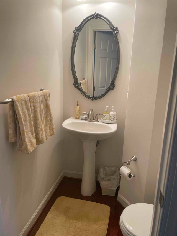
Bathrooms
4
-
Square Feet
--
-
Available
Available Jun 1
Highlights
- Pool
- Furnished
- Hardwood Floors
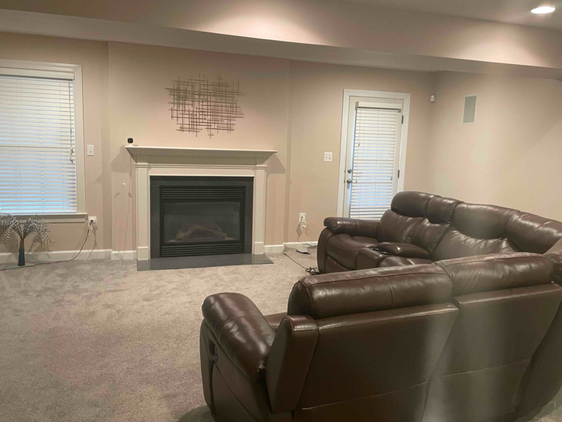
- Fireplace
- Fenced Lot
- Security System

About This Home
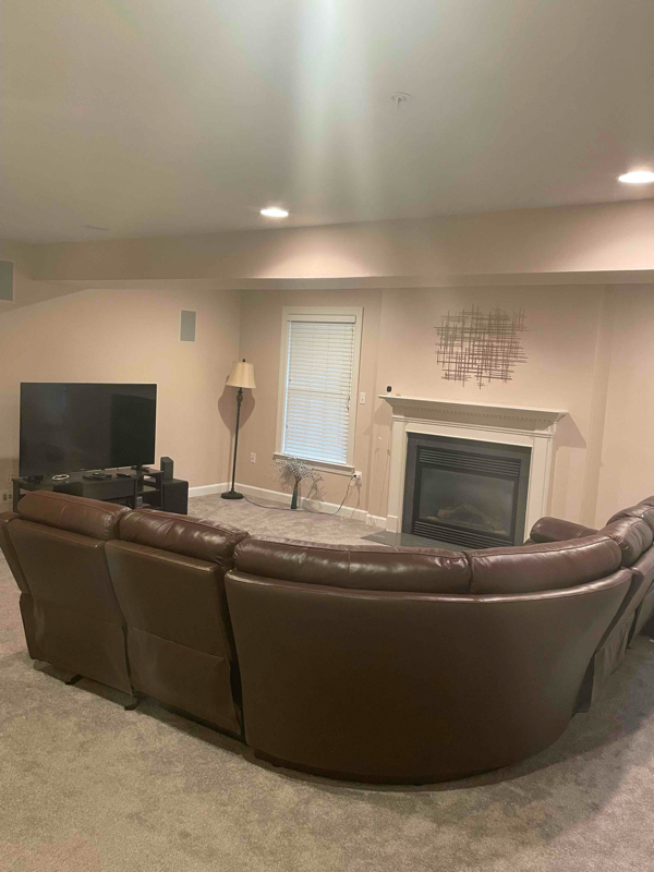
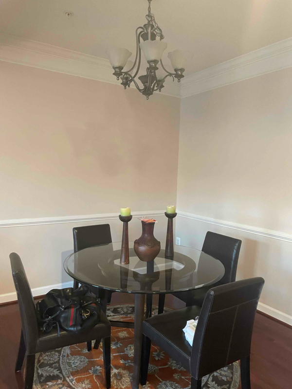
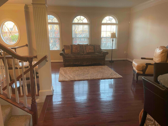
Property Id: 1818257 Luxury townhouse in gated community of Oak Creek. Community has a golf course, tennis court, swimming pool, exercise facility, and restaurant. Three levels with 3 bedrooms. Two full bathrooms and 2 half bathrooms. Master bedroom is large and spacious. Kitchen is large with large eating area with all appliances. Washer/dryer. Beautiful and large deck off of the second floor. Two car garage and driveway.
14605 Hawley Ln is a townhome located in Prince George's County and the 20774 ZIP Code. This area is served by the Prince George's County Public Schools attendance zone.
Townhome Features
Washer/Dryer
Dishwasher
Hardwood Floors
Microwave
- Washer/Dryer
- Cable Ready
- Security System
- Fireplace
- Dishwasher
- Disposal
- Microwave
- Oven
- Refrigerator
- Freezer
- Hardwood Floors
- Furnished
- Fitness Center
- Pool
- Bicycle Storage
- Fenced Lot
- Lawn
Fees and Policies
The fees below are based on community-supplied data and may exclude additional fees and utilities.
- Parking
-
Garage--
Details
Property Information
-
Furnished Units Available
Contact
- Phone Number
- Contact
-
Source

- Washer/Dryer
- Cable Ready
- Security System
- Fireplace
- Dishwasher
- Disposal
- Microwave
- Oven
- Refrigerator
- Freezer
- Hardwood Floors
- Furnished
- Fenced Lot
- Lawn
- Fitness Center
- Pool
- Bicycle Storage
Popularly known as a government district in Prince George’s County in the state of Maryland, Upper Marlboro offers residents a small-town vibe. Lined with an assortment of businesses, Main Street provides immediate access to the courthouse and county administrative building.
You'll find a combination of busy thoroughfares within the city and a quiet atmosphere in the residential suburbs. To the west of downtown are residential homes on quiet streets with mostly single-family homes, parks, and civic centers. Take a short walk from Main Street to access the Prince George’s County Public system. Aside from the few grocery stores and big-box retailers, the rural nature of the area is the biggest draw for residents. But it also means you might have to head to surrounding areas for more shopping and restaurant options.
Learn more about living in Greater Upper Marlboro| Colleges & Universities | Distance | ||
|---|---|---|---|
| Colleges & Universities | Distance | ||
| Drive: | 12 min | 6.1 mi | |
| Drive: | 13 min | 7.2 mi | |
| Drive: | 22 min | 10.9 mi | |
| Drive: | 30 min | 16.3 mi |


View GreatSchools Rating Methodology
Transportation options available in Upper Marlboro include Largo Town Center, located 8.0 miles from 14605 Hawley Ln. 14605 Hawley Ln is near Ronald Reagan Washington Ntl, located 21.5 miles or 37 minutes away, and Baltimore/Washington International Thurgood Marshall, located 29.0 miles or 45 minutes away.
| Transit / Subway | Distance | ||
|---|---|---|---|
| Transit / Subway | Distance | ||
|
|
Drive: | 14 min | 8.0 mi |
|
|
Drive: | 13 min | 8.1 mi |
|
|
Drive: | 14 min | 9.2 mi |
|
|
Drive: | 18 min | 10.2 mi |
|
|
Drive: | 20 min | 11.4 mi |
| Commuter Rail | Distance | ||
|---|---|---|---|
| Commuter Rail | Distance | ||
| Drive: | 22 min | 10.9 mi | |
|
|
Drive: | 20 min | 11.4 mi |
|
|
Drive: | 20 min | 11.7 mi |
|
|
Drive: | 25 min | 14.2 mi |
| Drive: | 28 min | 15.4 mi |
| Airports | Distance | ||
|---|---|---|---|
| Airports | Distance | ||
|
Ronald Reagan Washington Ntl
|
Drive: | 37 min | 21.5 mi |
|
Baltimore/Washington International Thurgood Marshall
|
Drive: | 45 min | 29.0 mi |
Time and distance from 14605 Hawley Ln.
| Shopping Centers | Distance | ||
|---|---|---|---|
| Shopping Centers | Distance | ||
| Drive: | 6 min | 2.5 mi | |
| Drive: | 5 min | 2.9 mi | |
| Drive: | 6 min | 3.2 mi |
| Parks and Recreation | Distance | ||
|---|---|---|---|
| Parks and Recreation | Distance | ||
|
Watkins Nature Center
|
Drive: | 8 min | 3.2 mi |
|
Old Maryland Farm
|
Drive: | 8 min | 3.3 mi |
|
Watkins Regional Park
|
Drive: | 12 min | 4.9 mi |
|
Queen Anne Natural Area
|
Drive: | 13 min | 6.7 mi |
|
School House Pond
|
Drive: | 14 min | 7.1 mi |
| Hospitals | Distance | ||
|---|---|---|---|
| Hospitals | Distance | ||
| Drive: | 20 min | 11.5 mi | |
| Drive: | 21 min | 12.2 mi |
| Military Bases | Distance | ||
|---|---|---|---|
| Military Bases | Distance | ||
| Drive: | 22 min | 13.4 mi |
You May Also Like
What Are Walk Score®, Transit Score®, and Bike Score® Ratings?
Walk Score® measures the walkability of any address. Transit Score® measures access to public transit. Bike Score® measures the bikeability of any address.
What is a Sound Score Rating?
A Sound Score Rating aggregates noise caused by vehicle traffic, airplane traffic and local sources
14605 Hawley Ln
Upper Marlboro, MD 20774