
$2,595 / Month
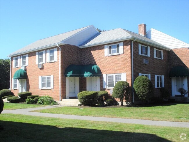
148 Lexington St Unit 22
Auburndale, MA 02466
2 Weeks Ago
Favorites
148 Lexington St Unit 22

Favorites
Check Back Soon for Upcoming Availability
| Beds | Baths | Average SF |
|---|---|---|
| 2 Bedrooms 2 Bedrooms 2 Br | 1 Bath 1 Bath 1 Ba | 9,999 SF |
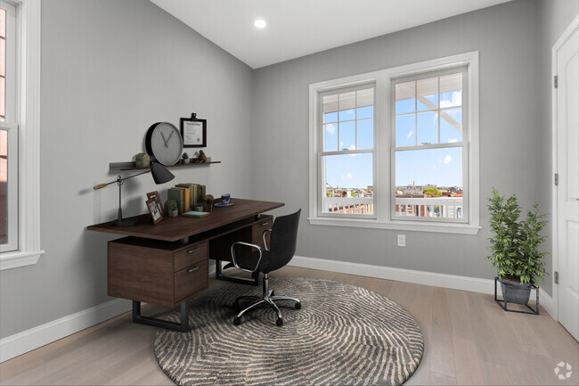
About This Property
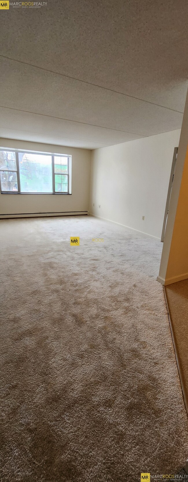
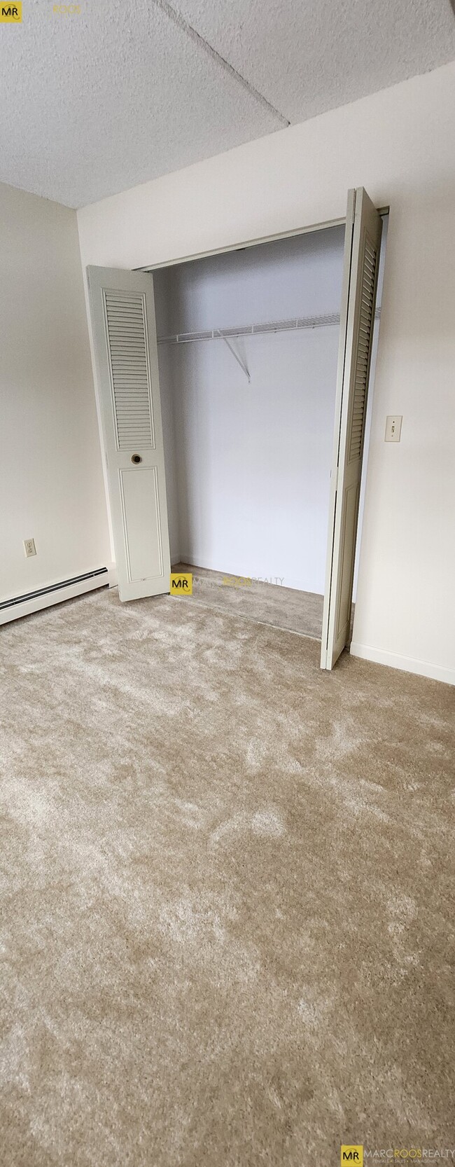
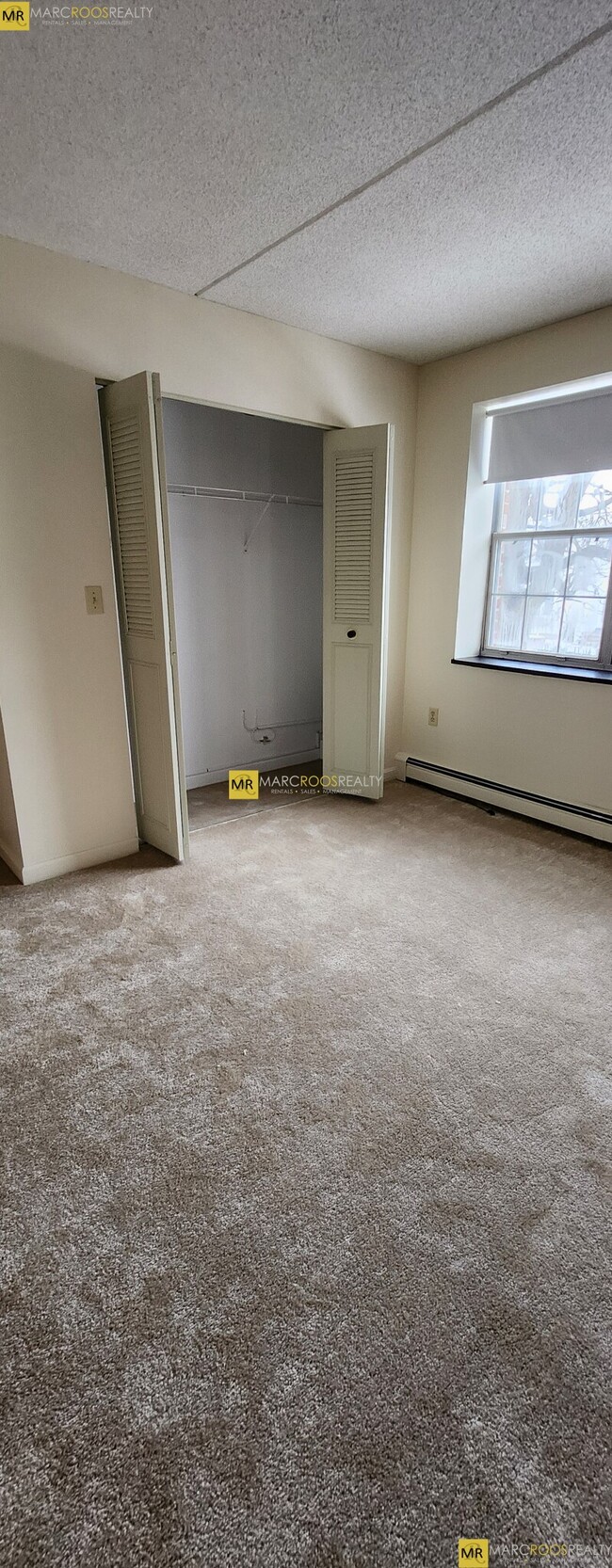
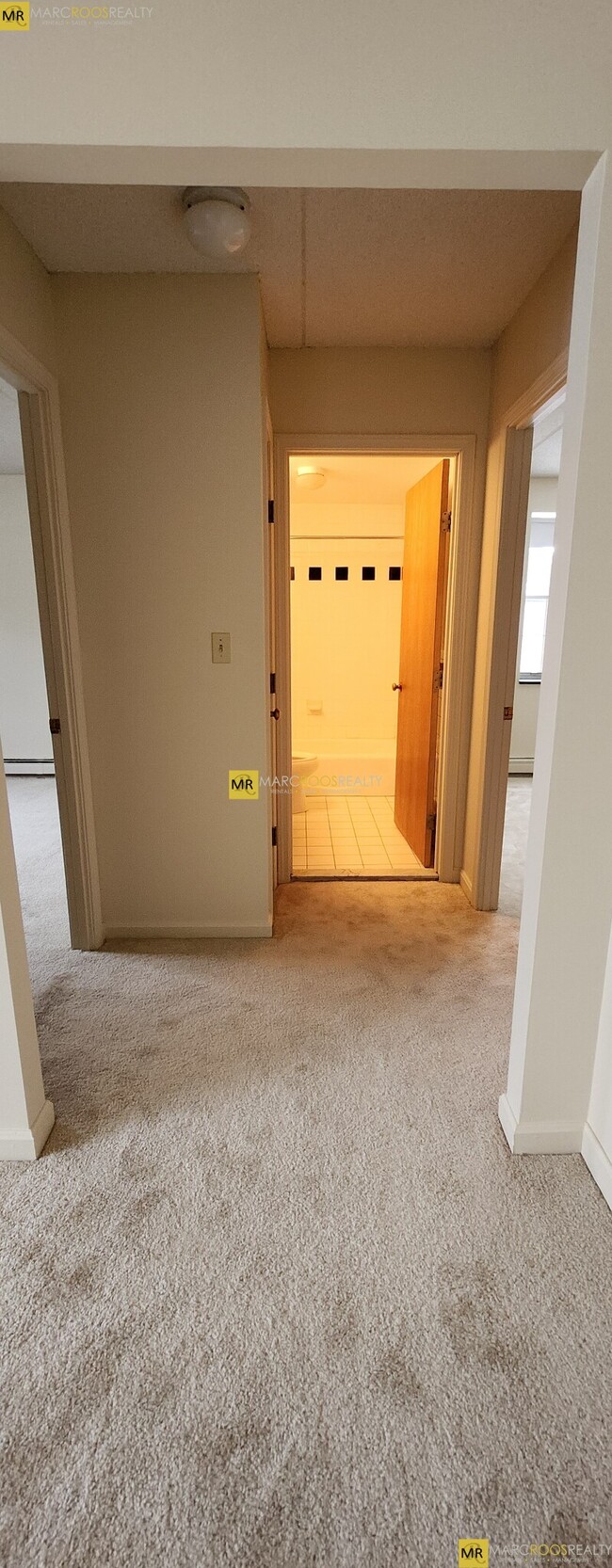
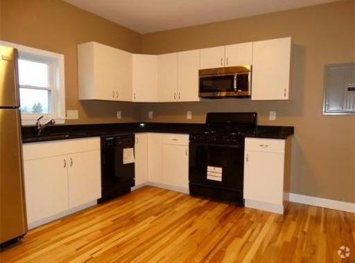
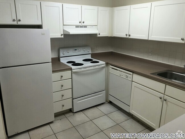
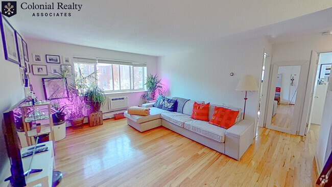
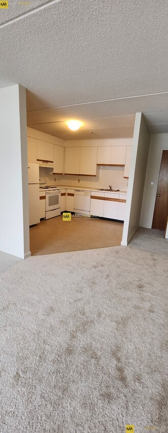
Prime location in Newton’s sought after Auburndale neighborhood! Next to desirable Lower Falls area on the border of Wellesley! Great commuting location with Green Line D train accessible at Riverside and MBTA bus routes nearby. Major state routes 16 and 9 close by and highways I-95 and I-90 (Mass Pike) just minutes away! Easy commute to Wellesley College, Babson College, Brandeis University, Regis College, and the new UMass developments at former Mount Ida College campus! A suburban oasis just minutes to the city and in close proximity to The Shops At Chestnut Hill, many parks along the Charles River, Woodland Golf Club, Leo J Martin Golf Course, Newton-Wellesley Hospital, country clubs, and much more! Up to date unit in a desirable & professionally managed Auburndale area apartment complex that features: - Modern kitchen w/ dishwasher! - Spacious & sunny living room! - 2 generously sized bedrooms! - Ample storage space & large closets! - Updated tiled full bathroom! - 1 parking space included! - Additional parking available! - Basement storage locker! - Central air conditioning!
148 Lexington St is a condo located in Middlesex County and the 02466 ZIP Code.
Condo Features
Air Conditioning
Dishwasher
Basement
Kitchen
- Air Conditioning
- Dishwasher
- Kitchen
- Basement
- Laundry Facilities
- Storage Space
Fees and Policies
The fees below are based on community-supplied data and may exclude additional fees and utilities.
- Cats Allowed
-
Fees not specified
-
Weight limit--
-
Pet Limit--
Details
Utilities Included
-
Water
-
Heat
Location
Get Directions
Auburndale, affectionately referred to as “The Dale” by locals, is one of 13 villages in the City of Newton. Situated near the intersection of Interstates 90 and 95, the Dale is surrounded by the City of Waltham and the Charles River as well as three other Newton villages including West Newton, Waban, and Newton Lower Falls. Getting around from the Dale is simple with access to the MBTA commuter rail.
The western end of Auburndale is well known for containing two historic parks, Norumbega Park and the Auburndale Cove Park and Playground, which offer plenty of options for outdoor recreation. The Auburndale Historic District is comprised of about 275 properties, many of which are on the National Register of Historic Places. Treasured resources like the Auburndale Community Library and Lasell College provide learning opportunities for the community.
Learn more about living in Auburndale
Amenities
- Air Conditioning
- Dishwasher
- Kitchen
- Basement
- Laundry Facilities
- Storage Space
Expenses
Utilities Included
Water, Heat
Included
Education
| Colleges & Universities | Distance | ||
|---|---|---|---|
| Colleges & Universities | Distance | ||
| Drive: | 7 min | 2.5 mi | |
| Drive: | 7 min | 3.1 mi | |
| Drive: | 10 min | 5.7 mi | |
| Drive: | 12 min | 6.1 mi |
148 Lexington St Unit 22 is within 7 minutes or 2.5 miles from Brandeis University. It is also near Bentley University and Boston College.
Transportation options available in Auburndale include Riverside Station, located 1.5 miles from 148 Lexington St Unit 22. 148 Lexington St Unit 22 is near General Edward Lawrence Logan International, located 14.2 miles or 23 minutes away, and Worcester Regional, located 39.3 miles or 56 minutes away.
| Transit / Subway | Distance | ||
|---|---|---|---|
| Transit / Subway | Distance | ||
|
|
Drive: | 3 min | 1.5 mi |
|
|
Drive: | 4 min | 2.1 mi |
|
|
Drive: | 6 min | 3.2 mi |
|
|
Drive: | 8 min | 4.0 mi |
|
|
Drive: | 8 min | 4.4 mi |
| Commuter Rail | Distance | ||
|---|---|---|---|
| Commuter Rail | Distance | ||
|
|
Drive: | 3 min | 1.4 mi |
| Drive: | 3 min | 1.5 mi | |
|
|
Drive: | 5 min | 2.4 mi |
|
|
Drive: | 11 min | 6.4 mi |
|
|
Drive: | 12 min | 7.2 mi |
| Airports | Distance | ||
|---|---|---|---|
| Airports | Distance | ||
|
General Edward Lawrence Logan International
|
Drive: | 23 min | 14.2 mi |
|
Worcester Regional
|
Drive: | 56 min | 39.3 mi |
Time and distance from 148 Lexington St Unit 22.
| Shopping Centers | Distance | ||
|---|---|---|---|
| Shopping Centers | Distance | ||
| Walk: | 15 min | 0.8 mi | |
| Drive: | 5 min | 2.1 mi | |
| Drive: | 5 min | 2.3 mi |
148 Lexington St Unit 22 has 3 shopping centers within 2.3 miles, which is about a 5-minute walk. The miles and minutes will be for the farthest away property.
| Parks and Recreation | Distance | ||
|---|---|---|---|
| Parks and Recreation | Distance | ||
|
Beaver Brook Reservation
|
Drive: | 7 min | 3.8 mi |
|
Land's Sake Farm
|
Drive: | 8 min | 4.0 mi |
|
Hemlock Gorge Reservation
|
Drive: | 10 min | 4.5 mi |
|
Hammond Pond Reservation
|
Drive: | 9 min | 5.1 mi |
|
Mass Audubon's Habitat Education Center and Wildlife Sanctuary
|
Drive: | 12 min | 5.6 mi |
148 Lexington St Unit 22 has 5 parks within 5.6 miles, including Hemlock Gorge Reservation, Beaver Brook Reservation, and Land's Sake Farm.
| Hospitals | Distance | ||
|---|---|---|---|
| Hospitals | Distance | ||
| Drive: | 4 min | 1.5 mi | |
| Drive: | 4 min | 2.1 mi | |
| Drive: | 8 min | 4.2 mi |
148 Lexington St Unit 22 has 3 hospitals within 4.2 miles, the nearest is Walden Behavioral Care which is 1.5 miles away and a 4 minute drive.
| Military Bases | Distance | ||
|---|---|---|---|
| Military Bases | Distance | ||
| Drive: | 19 min | 9.0 mi | |
| Drive: | 17 min | 9.8 mi |
148 Lexington St Unit 22 is 9.0 miles from Hanscom Air Force Base, and is convenient to other military bases, including US Military Reservation.
You May Also Like
Similar Rentals Nearby

What Are Walk Score®, Transit Score®, and Bike Score® Ratings?
Walk Score® measures the walkability of any address. Transit Score® measures access to public transit. Bike Score® measures the bikeability of any address.
What is a Sound Score Rating?
A Sound Score Rating aggregates noise caused by vehicle traffic, airplane traffic and local sources
148 Lexington St
Auburndale, MA 02466