
$2,900 / Month
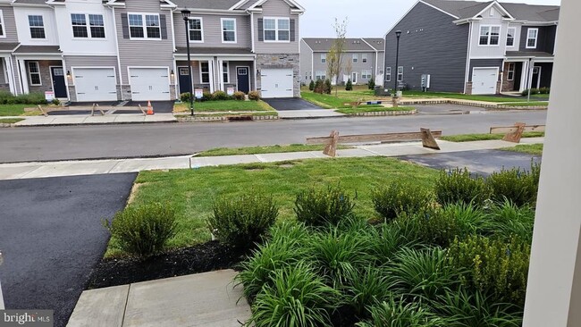
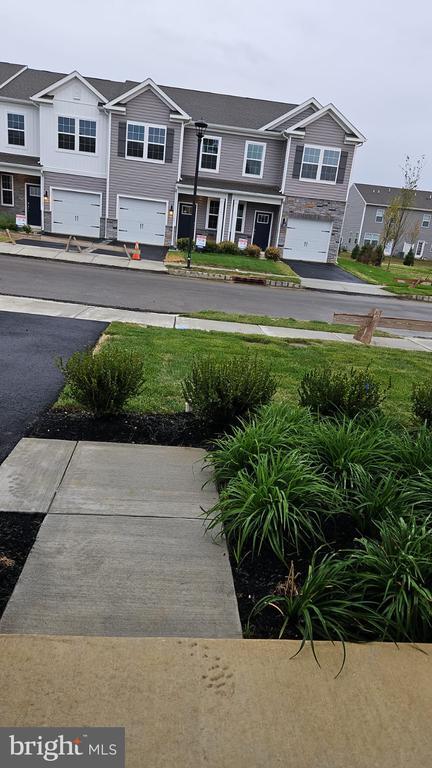
15 Elliot Ln
Westampton, NJ 08060
2 Weeks Ago
Favorites
15 Elliot Ln

Favorites
Check Back Soon for Upcoming Availability
| Beds | Baths | Average SF |
|---|---|---|
| 3 Bedrooms 3 Bedrooms 3 Br | 2.5 Baths 2.5 Baths 2.5 Ba | — |
About This Property
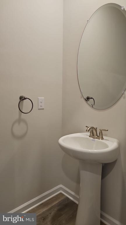
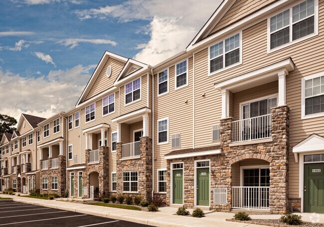
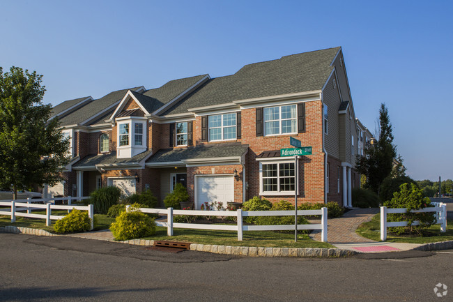
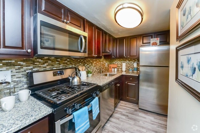
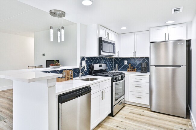
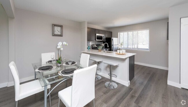
Brand New 2024 construction by top builder - 3 bed 2.5 bath townhomes in desirable Westampton . New community Laurel Run offers the best of everything, brand new , 2-story townhomes , minutes to both major commuting routes and local parks! Laurel Run is a commuters dream with its unbeatable location, being just about 0.9 miles from I-295, approximately 3.7 miles to the NJ Turnpike, 4.3 miles to Route 130, and various local shopping and dining venues! The convenience of townhome living meets the amenities of a single-family home with our stunning new construction 2 story plan featuring 1,500 square feet of living space including 3 bedrooms, 2.5 baths and a 1-car garage. Top of the line upgrades such as Quartz Countertops, Stainless Steel Appliances, Upgraded Flooring, Recessed Lighting and Upgraded Cabinetry! To top it all off, homes come complete with America's Smart Home Package, that keeps you close to the people and places you value most. Simplify your life with a home that features hands-free communication, remote keyless entry, Sky Bell video doorbell, and so much more .Some pictures are from model home. Available for occupancy Early October 2024
15 Elliot Ln is a townhome located in Burlington County and the 08060 ZIP Code. This area is served by the Westampton Township Public attendance zone.
Unique Features
- NewConstruction
Fees and Policies
Property Address:
15 Elliot Ln,
Westampton,
NJ
08060
Westampton is a small town in New Jersey that’s primarily made up of industrial centers, open land, and residential neighborhoods. Located about 25 miles northeast of Philadelphia, Pennsylvania, residents have quick and easy access into neighboring metropolitan communities. This short commute will take you past the Adventure Aquarium, across the Delaware River, and through Franklin Square.
This sparse suburb sits near the Columbus Farmers Market where local vendors sell their fresh goods, and the Moorestown Mall is just a few miles down Interstate 295. Rancocas State Park sits below Westampton, offering scenic hiking, jogging, and biking trails through densely forested lands. Though Westampton is mainly residential and industrial, there are a few local businesses around town and chain conveniences, along with high-ranking public schools like Rancocas Valley Regional High School.
Learn more about living in Westampton
Amenities
- NewConstruction
Education
| Colleges & Universities | Distance | ||
|---|---|---|---|
| Colleges & Universities | Distance | ||
| Drive: | 11 min | 5.2 mi | |
| Drive: | 25 min | 13.4 mi | |
| Drive: | 23 min | 14.4 mi | |
| Drive: | 28 min | 15.1 mi |
15 Elliot Ln is within 11 minutes or 5.2 miles from Burlington Co., Mount Laurel. It is also near Holy Family University and Burlington Co. Coll Pemberton.
Schools

Public Elementary School
Grades PK-3
394 Students
Attendance Zone
Public Elementary & Middle School
Grades 4-8
529 Students
Attendance Zone
Public Elementary School
Grades PK-5
321 Students
Nearby
Public High School
Grades 9-12
1,981 Students
Attendance Zone
Private Elementary School
Grades K-4
Nearby
Private Elementary & Middle School
Grades PK-8
111 Students
Nearby
Private Elementary, Middle & High School
Grades 4-12
Nearby
School data provided by
 The GreatSchools Rating helps parents compare schools within a state based on a variety of school quality indicators and provides a helpful picture of how effectively each school serves all of its students. Ratings are on a scale of 1 (below average) to 10 (above average) and can include test scores, college readiness, academic progress, advanced courses, equity, discipline and attendance data. We also advise parents to visit schools, consider other information on school performance and programs, and consider family needs as part of the school selection process.
View GreatSchools Rating Methodology
View GreatSchools Rating Methodology
Transportation options available in Westampton include Burlington Towne Center, located 4.4 miles from 15 Elliot Ln. 15 Elliot Ln is near Trenton Mercer, located 22.5 miles or 37 minutes away, and Philadelphia International, located 27.9 miles or 42 minutes away.
| Transit / Subway | Distance | ||
|---|---|---|---|
| Transit / Subway | Distance | ||
|
|
Drive: | 7 min | 4.4 mi |
|
|
Drive: | 9 min | 5.1 mi |
|
|
Drive: | 10 min | 6.4 mi |
|
|
Drive: | 11 min | 6.9 mi |
|
|
Drive: | 12 min | 7.4 mi |
| Commuter Rail | Distance | ||
|---|---|---|---|
| Commuter Rail | Distance | ||
|
|
Drive: | 15 min | 7.7 mi |
|
|
Drive: | 16 min | 8.2 mi |
|
|
Drive: | 19 min | 10.0 mi |
|
|
Drive: | 21 min | 11.1 mi |
|
|
Drive: | 25 min | 13.1 mi |
| Airports | Distance | ||
|---|---|---|---|
| Airports | Distance | ||
|
Trenton Mercer
|
Drive: | 37 min | 22.5 mi |
|
Philadelphia International
|
Drive: | 42 min | 27.9 mi |
Time and distance from 15 Elliot Ln.
| Shopping Centers | Distance | ||
|---|---|---|---|
| Shopping Centers | Distance | ||
| Drive: | 3 min | 1.5 mi | |
| Drive: | 4 min | 2.4 mi | |
| Drive: | 5 min | 2.7 mi |
15 Elliot Ln has 3 shopping centers within 2.7 miles, which is about a 5-minute drive. The miles and minutes will be for the farthest away property.
| Parks and Recreation | Distance | ||
|---|---|---|---|
| Parks and Recreation | Distance | ||
|
Rancocas Nature Center
|
Drive: | 4 min | 2.8 mi |
|
Paws Farm Nature Center
|
Drive: | 10 min | 6.0 mi |
|
Rancocas State Park
|
Drive: | 13 min | 6.7 mi |
|
Historic Smithville Park
|
Drive: | 13 min | 6.9 mi |
|
Neshaminy State Park
|
Drive: | 18 min | 9.1 mi |
15 Elliot Ln has 5 parks within 9.1 miles, including Rancocas Nature Center, Paws Farm Nature Center, and Historic Smithville Park.
| Hospitals | Distance | ||
|---|---|---|---|
| Hospitals | Distance | ||
| Drive: | 2 min | 1.4 mi | |
| Drive: | 8 min | 3.2 mi | |
| Drive: | 9 min | 5.8 mi |
15 Elliot Ln has 3 hospitals within 5.8 miles, the nearest is Hampton Behavioral Health System which is 1.4 miles away and a 2 minute drive.
| Military Bases | Distance | ||
|---|---|---|---|
| Military Bases | Distance | ||
| Drive: | 30 min | 16.3 mi | |
| Drive: | 39 min | 21.3 mi |
15 Elliot Ln is 16.3 miles from McGuire Air Force Base, and is convenient to other military bases, including Fort Dix Military Reservation New Hanover.
You May Also Like
Similar Rentals Nearby
-
-
-
-
1 / 19
-
-
-
-
-
-


What Are Walk Score®, Transit Score®, and Bike Score® Ratings?
Walk Score® measures the walkability of any address. Transit Score® measures access to public transit. Bike Score® measures the bikeability of any address.
What is a Sound Score Rating?
A Sound Score Rating aggregates noise caused by vehicle traffic, airplane traffic and local sources
15 Elliot Ln
Westampton, NJ 08060