
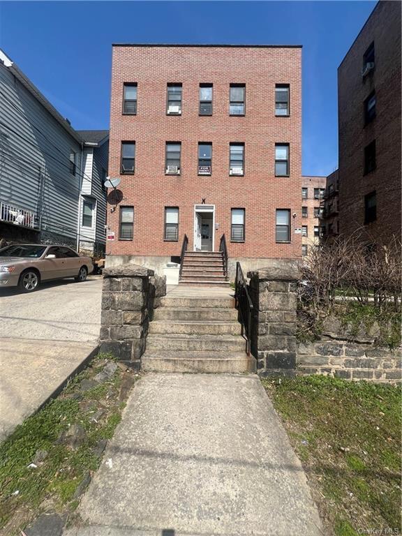
15 Sherwood Ave
Yonkers, NY 10704
Favorites

15 Sherwood Ave
Favorites
Check Back Soon for Upcoming Availability
| Beds | Baths | Average SF |
|---|---|---|
| 3 Bedrooms 3 Bedrooms 3 Br | 1 Bath 1 Bath 1 Ba | 1,000 SF |
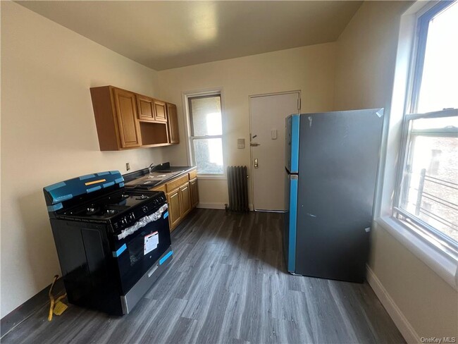
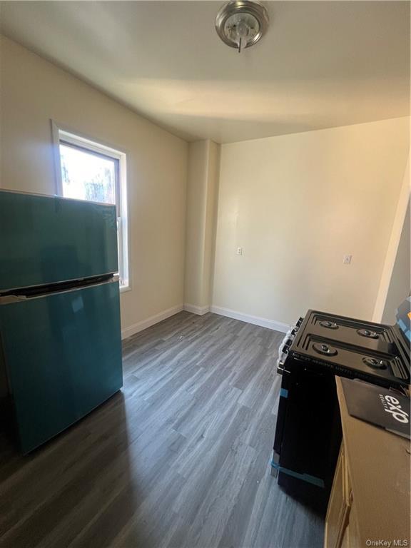
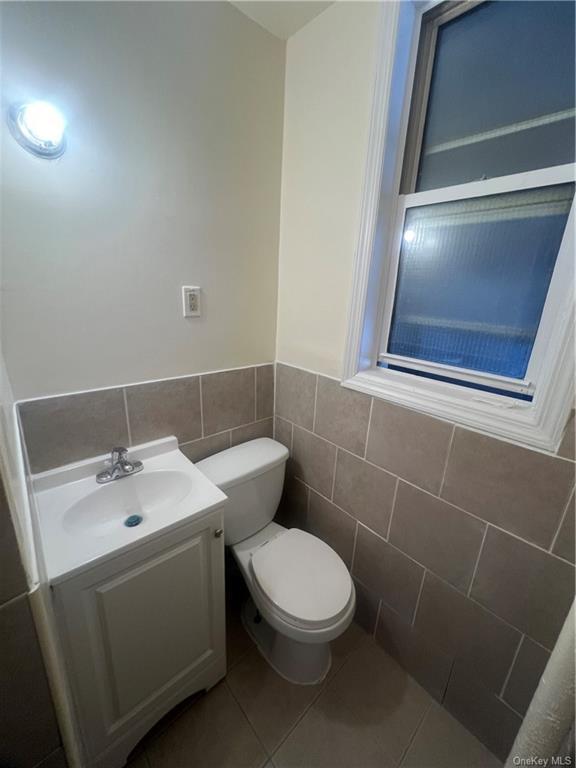
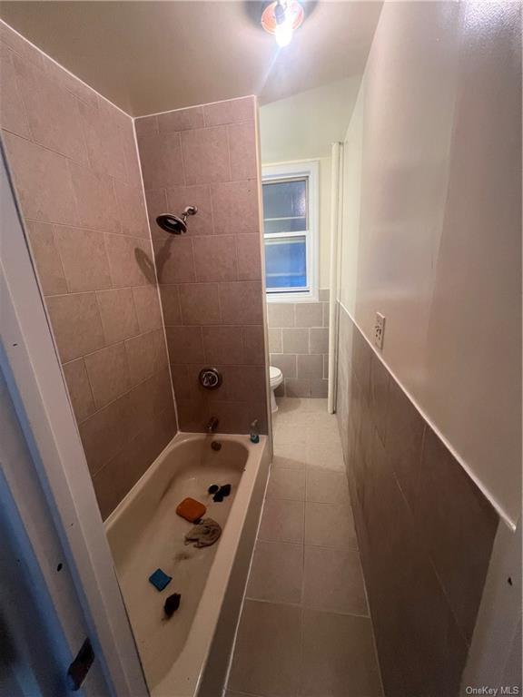
About This Property
3br apartment blocks away from Shopping,major highways and Mount Vernon train station. Based on information submitted to the MLS GRID as of [see last changed date above]. All data is obtained from various sources and may not have been verified by broker or MLS GRID. Supplied Open House Information is subject to change without notice. All information should be independently reviewed and verified for accuracy. Properties may or may not be listed by the office/agent presenting the information. Some IDX listings have been excluded from this website. Prices displayed on all Sold listings are the Last Known Listing Price and may not be the actual selling price.
15 Sherwood Ave is an apartment community located in Westchester County and the 10704 ZIP Code.
Property Address:
15 Sherwood Ave,
Yonkers,
NY
10704
 This Property
 Available Property
Southeast Yonkers is situated between Bronx River Parkway and New York State Thruway. This neighborhood is part of the city of Yonkers and is located about 15 miles north of Manhattan off the Hudson River. Because of its ideal location, Southeast Yonkers is just a few train stops away from some of the best entertainment, bars, restaurants, and retailers in the country, but residents can enjoy great amenities closer to home as well. In the northern corner of the neighborhood there’s a large shopping complex that’s home to a variety of stores, chain eateries, grocers, gyms, and more.
The rest of the neighborhood is made up of mostly residential areas with local stores and grocers scattered throughout. Renters will find that there are many options for trendy apartments and condos located throughout the city with average prices for the New York area.
Learn more about living in Southeast YonkersBelow are rent ranges for similar nearby apartments
Education
| Colleges & Universities | Distance | ||
|---|---|---|---|
| Colleges & Universities | Distance | ||
| Drive: | 5 min | 2.1 mi | |
| Drive: | 9 min | 4.8 mi | |
| Drive: | 8 min | 4.9 mi | |
| Drive: | 10 min | 5.4 mi |
15 Sherwood Ave is within 5 minutes or 2.1 miles from Sarah Lawrence College. It is also near Manhattan College and Iona College.
Transportation options available in Yonkers include Wakefield-241 Street, located 1.3 miles from 15 Sherwood Ave. 15 Sherwood Ave is near Laguardia, located 14.8 miles or 26 minutes away, and Westchester County, located 18.0 miles or 27 minutes away.
| Transit / Subway | Distance | ||
|---|---|---|---|
| Transit / Subway | Distance | ||
|
|
Drive: | 2 min | 1.3 mi |
|
|
Drive: | 3 min | 1.7 mi |
|
|
Drive: | 3 min | 2.0 mi |
|
|
Drive: | 4 min | 2.5 mi |
|
|
Drive: | 6 min | 3.4 mi |
| Commuter Rail | Distance | ||
|---|---|---|---|
| Commuter Rail | Distance | ||
|
|
Drive: | 3 min | 1.4 mi |
|
|
Drive: | 4 min | 1.4 mi |
|
|
Drive: | 4 min | 1.7 mi |
|
|
Drive: | 6 min | 3.4 mi |
|
|
Drive: | 7 min | 4.0 mi |
| Airports | Distance | ||
|---|---|---|---|
| Airports | Distance | ||
|
Laguardia
|
Drive: | 26 min | 14.8 mi |
|
Westchester County
|
Drive: | 27 min | 18.0 mi |
Time and distance from 15 Sherwood Ave.
| Shopping Centers | Distance | ||
|---|---|---|---|
| Shopping Centers | Distance | ||
| Drive: | 3 min | 1.2 mi | |
| Drive: | 3 min | 1.3 mi | |
| Drive: | 3 min | 1.6 mi |
15 Sherwood Ave has 3 shopping centers within 1.6 miles, which is about a 3-minute drive. The miles and minutes will be for the farthest away property.
| Parks and Recreation | Distance | ||
|---|---|---|---|
| Parks and Recreation | Distance | ||
|
Seton Falls Park
|
Drive: | 4 min | 2.6 mi |
|
Williamsbridge Oval
|
Drive: | 8 min | 3.6 mi |
|
Beczak Environmental Education Center
|
Drive: | 7 min | 4.0 mi |
|
Wave Hill
|
Drive: | 10 min | 5.2 mi |
|
Van Cortlandt Park
|
Drive: | 8 min | 5.5 mi |
15 Sherwood Ave has 5 parks within 5.5 miles, including Seton Falls Park, Van Cortlandt Park, and Williamsbridge Oval.
| Hospitals | Distance | ||
|---|---|---|---|
| Hospitals | Distance | ||
| Walk: | 13 min | 0.7 mi | |
| Drive: | 7 min | 3.6 mi | |
| Drive: | 6 min | 3.9 mi |
15 Sherwood Ave has 3 hospitals within 3.9 miles, the nearest is Montefiore Mount Vernon Hospital which is 0.7 mile away and a 13 minutes drive.
| Military Bases | Distance | ||
|---|---|---|---|
| Military Bases | Distance | ||
| Drive: | 22 min | 12.8 mi |
15 Sherwood Ave is 12.8 miles and a 22 minutes from Fort Totten US Govt Reservation.
You May Also Like
Similar Rentals Nearby


What Are Walk Score®, Transit Score®, and Bike Score® Ratings?
Walk Score® measures the walkability of any address. Transit Score® measures access to public transit. Bike Score® measures the bikeability of any address.
What is a Sound Score Rating?
A Sound Score Rating aggregates noise caused by vehicle traffic, airplane traffic and local sources
15 Sherwood Ave
Yonkers, NY 10704