
$2,950 / Month
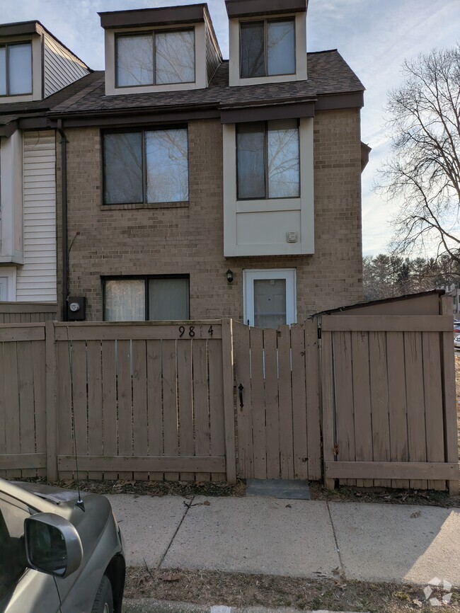
151 Sulgrave Ct
Sterling, VA 20165
Today
Favorites
703-585-0772
-
Bedrooms
3
-
Bathrooms
3
-
Square Feet
--
-
Available
Available Apr 27
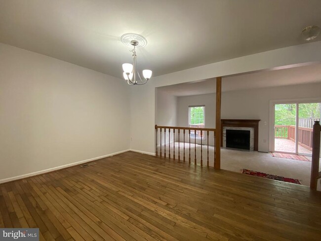
Highlights
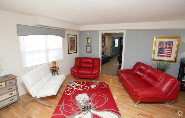
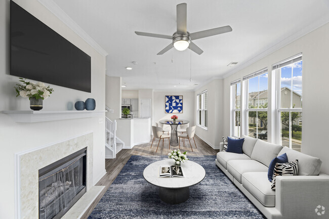
- Fireplace
- Basement
151 Sulgrave Ct

Favorites
151 Sulgrave Ct is a townhome located in Loudoun County and the 20165 ZIP Code. This area is served by the Loudoun County Public Schools attendance zone.
* Price shown is base rent and may not include non-optional fees and utilities.
Price, availability, fees, and any applicable rent special are subject to change without notice.
* Square footage definitions vary. Displayed square footage is approximate.
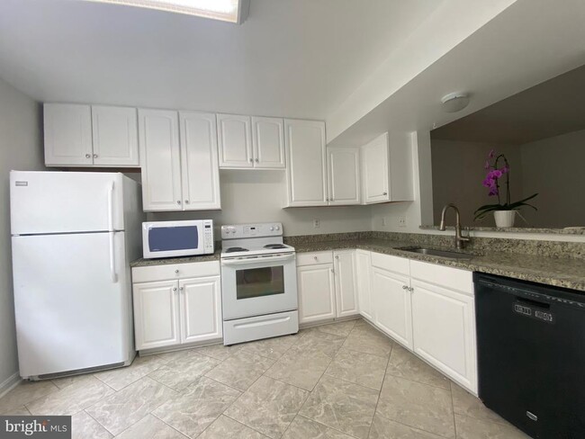
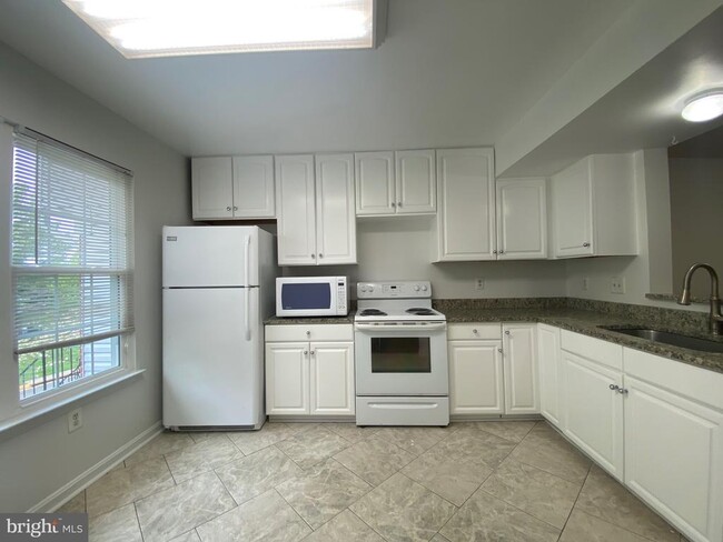
Townhome Features
- Fireplace
- Dishwasher
- Basement
Fees and Policies
Contact
- Listed by Michelle Gildea | Samson Properties
- Phone Number
- Contact
-
Source
 Bright MLS, Inc.
Copyright © 2025 Bright MLS, Inc.
Location
Get Directions
Amenities
- Fireplace
- Dishwasher
- Basement
While the name may inspire visions of rolling, green hills and cascading waterfalls, Countryside-Potomac Falls provides much more than a beautiful location for your Sterling apartment. It borders the Potomac River along the Virginia/Maryland line, then extends southward to Highway 7. The neighborhood is flanked by two popular parks: Bles Park and Algonkian Regional Park. Countryside-Potomac Falls is in northeastern Sterling, roughly 26 miles northwest of Washington, DC. With the nearby businesses of Sterling and the action of DC just minutes away, this fantastic area has grown rapidly since it was developed in the mid-1970s.
Taking full advantage of the area's natural beauty, Countryside-Potomac Falls offers several hiking trails, including the Countryside East River Trail, which connects to the Potomac Heritage Trail.
Learn more about living in Countryside-Potomac Falls
Education
| Colleges & Universities | Distance | ||
|---|---|---|---|
| Colleges & Universities | Distance | ||
| Drive: | 6 min | 2.8 mi | |
| Drive: | 6 min | 3.0 mi | |
| Drive: | 10 min | 5.2 mi | |
| Drive: | 47 min | 30.2 mi |
151 Sulgrave Ct is within 6 minutes or 3.0 miles from NOVA, Loudoun Campus. It is also near George Mason University and GWU, Virginia Sci. and Tech..
Schools


Public Elementary School
Grades PK-5
462 Students
Attendance Zone
Public Middle School
Grades 6-8
1,160 Students
Attendance Zone
Public High School
Grades 9-12
1,606 Students
Attendance Zone
Private Elementary & Middle School
Grades K-8
203 Students
Nearby
Private Elementary School
Grades PK-3
24 Students
Nearby
Private Elementary, Middle & High School
Grades PK-12
230 Students
Nearby
School data provided by
 The GreatSchools Rating helps parents compare schools within a state based on a variety of school quality indicators and provides a helpful picture of how effectively each school serves all of its students. Ratings are on a scale of 1 (below average) to 10 (above average) and can include test scores, college readiness, academic progress, advanced courses, equity, discipline and attendance data. We also advise parents to visit schools, consider other information on school performance and programs, and consider family needs as part of the school selection process.
View GreatSchools Rating Methodology
View GreatSchools Rating Methodology
Transportation options available in Sterling include Ashburn, Silver Line Center Platform, located 8.5 miles from 151 Sulgrave Ct. 151 Sulgrave Ct is near Washington Dulles International, located 10.6 miles or 20 minutes away, and Ronald Reagan Washington Ntl, located 29.9 miles or 47 minutes away.
| Transit / Subway | Distance | ||
|---|---|---|---|
| Transit / Subway | Distance | ||
| Drive: | 15 min | 8.5 mi | |
| Drive: | 16 min | 9.1 mi | |
| Drive: | 18 min | 11.4 mi | |
| Drive: | 22 min | 13.3 mi | |
| Drive: | 30 min | 19.3 mi |
| Commuter Rail | Distance | ||
|---|---|---|---|
| Commuter Rail | Distance | ||
| Drive: | 51 min | 31.0 mi | |
|
|
Drive: | 53 min | 34.0 mi |
|
|
Drive: | 60 min | 35.0 mi |
|
|
Drive: | 58 min | 38.1 mi |
|
|
Drive: | 61 min | 39.2 mi |
| Airports | Distance | ||
|---|---|---|---|
| Airports | Distance | ||
|
Washington Dulles International
|
Drive: | 20 min | 10.6 mi |
|
Ronald Reagan Washington Ntl
|
Drive: | 47 min | 29.9 mi |
Time and distance from 151 Sulgrave Ct.
| Shopping Centers | Distance | ||
|---|---|---|---|
| Shopping Centers | Distance | ||
| Drive: | 5 min | 1.8 mi | |
| Drive: | 5 min | 2.0 mi | |
| Drive: | 6 min | 2.8 mi |
151 Sulgrave Ct has 3 shopping centers within 2.8 miles, which is about a 6-minute drive. The miles and minutes will be for the farthest away property.
| Parks and Recreation | Distance | ||
|---|---|---|---|
| Parks and Recreation | Distance | ||
|
Algonkian Regional Park
|
Drive: | 9 min | 2.7 mi |
|
Claude Moore Park
|
Drive: | 7 min | 2.9 mi |
|
Washington & Old Dominion Railroad Trail
|
Drive: | 10 min | 5.3 mi |
|
Lake Newport
|
Drive: | 16 min | 8.7 mi |
|
Lake Anne
|
Drive: | 17 min | 8.9 mi |
151 Sulgrave Ct has 5 parks within 8.9 miles, including Claude Moore Park, Algonkian Regional Park, and Washington & Old Dominion Railroad Trail.
| Hospitals | Distance | ||
|---|---|---|---|
| Hospitals | Distance | ||
| Drive: | 11 min | 6.5 mi | |
| Drive: | 15 min | 8.6 mi |
151 Sulgrave Ct is 6.5 miles from Inova Loudoun Hospital, and is convenient to other hospitals, including Reston Hospital Center.
| Military Bases | Distance | ||
|---|---|---|---|
| Military Bases | Distance | ||
| Drive: | 44 min | 27.3 mi |
151 Sulgrave Ct is 27.3 miles and a 44 minute drive from Naval Observatory.
You May Also Like
Similar Rentals Nearby
-
-
-
-
-
1 / 34
-
-
-
-
-


What Are Walk Score®, Transit Score®, and Bike Score® Ratings?
Walk Score® measures the walkability of any address. Transit Score® measures access to public transit. Bike Score® measures the bikeability of any address.
What is a Sound Score Rating?
A Sound Score Rating aggregates noise caused by vehicle traffic, airplane traffic and local sources
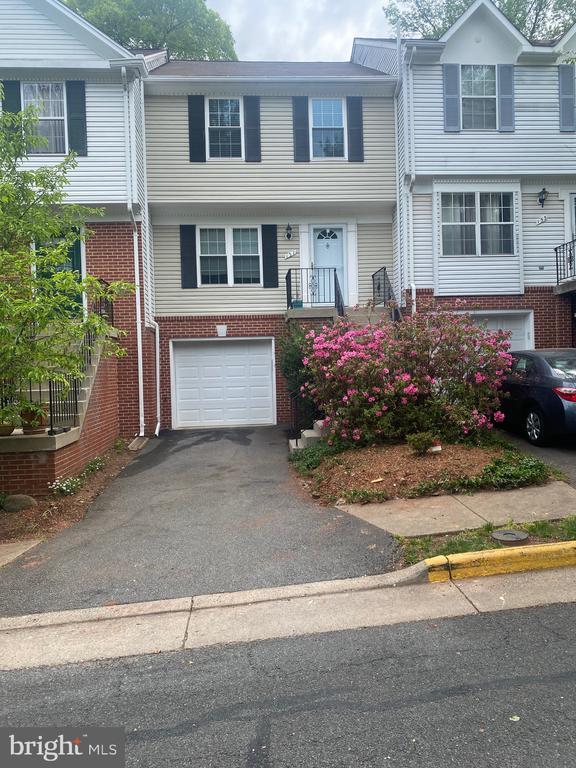
151 Sulgrave Ct
Sterling, VA 20165