
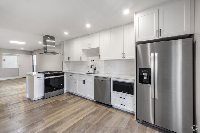
$3,500 / Month
15302 Bellflower Blvd Unit A
Bellflower, CA 90706
Today
Favorites
562-633-6313
-
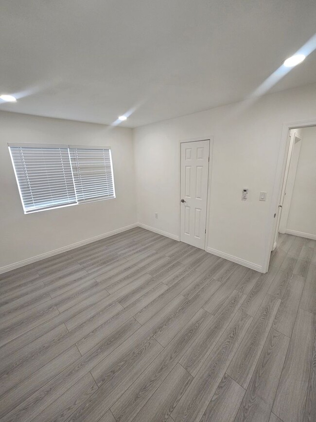
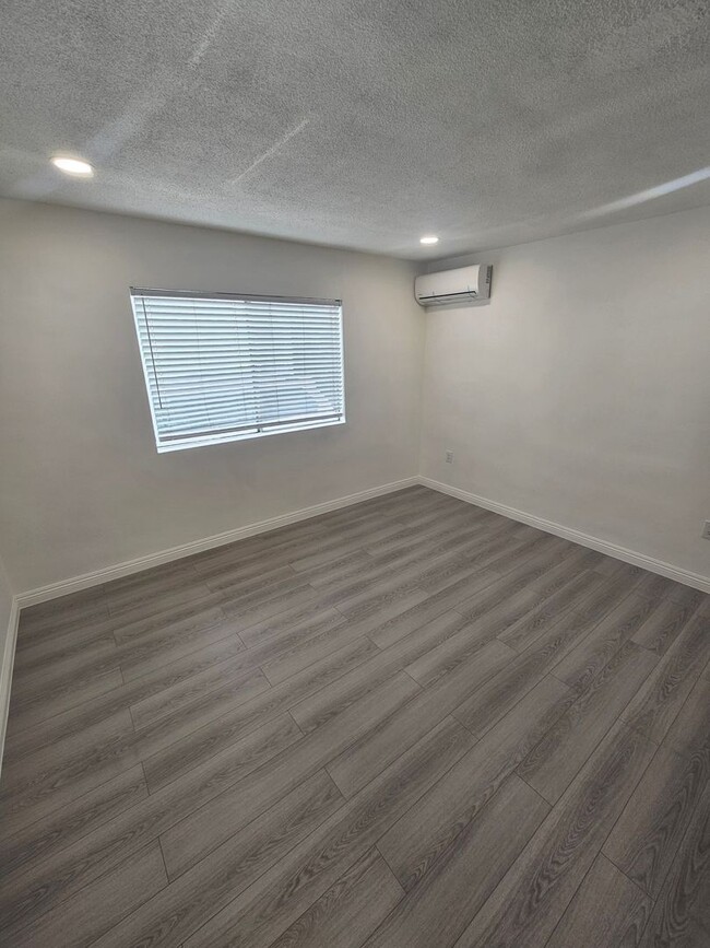
Bedrooms
3
-
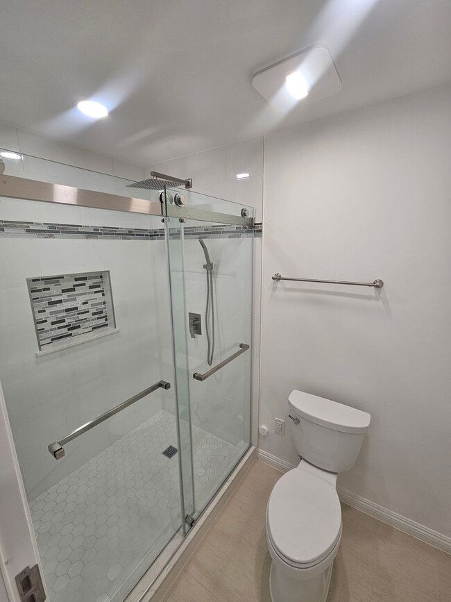
Bathrooms
1
-
Square Feet
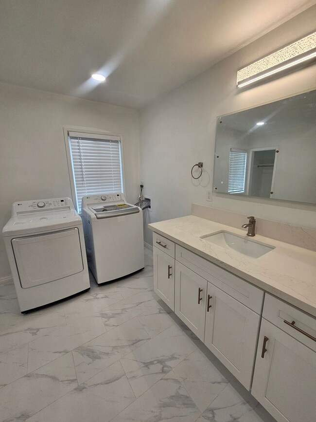
1,472 sq ft
-
Available
Available Now
15302 Bellflower Blvd Unit A

Favorites
Nestled just 20 miles southeast of Los Angeles, the small city of Bellflower first started outa s a farming town producing apples and milk. Now an up-and-coming community, residents can enjoy various amenities and activities like a leisurely bike ride along the Bellflower Bike Trail, dotted with vibrant bellflowers, and Pirate Park is a great place to let kids play outdoors. Bellflower is very small business-friendly, with abundant dining options along Bellflower Boulevard. Residents of this charming small town have easy access to Interstates 710, 605, 105, and 5, making commuting around the city simple.
Learn more about living in Bellflower
Education
| Colleges & Universities | Distance | ||
|---|---|---|---|
| Colleges & Universities | Distance | ||
| Drive: | 7 min | 2.5 mi | |
| Drive: | 12 min | 5.3 mi | |
| Drive: | 12 min | 6.9 mi | |
| Drive: | 14 min | 7.3 mi |
15302 Bellflower Blvd Unit A is within 7 minutes or 2.5 miles from Cerritos College. It is also near Long Beach City Coll. and El Camino College, Compton.
Transportation options available in Bellflower include Lakewood Station, located 2.3 miles from 15302 Bellflower Blvd Unit A. 15302 Bellflower Blvd Unit A is near Long Beach (Daugherty Field), located 8.4 miles or 15 minutes away, and Los Angeles International, located 19.3 miles or 26 minutes away.
| Transit / Subway | Distance | ||
|---|---|---|---|
| Transit / Subway | Distance | ||
|
|
Drive: | 4 min | 2.3 mi |
|
|
Drive: | 4 min | 2.5 mi |
|
|
Drive: | 10 min | 6.8 mi |
|
|
Drive: | 12 min | 6.9 mi |
|
|
Drive: | 13 min | 7.8 mi |
| Commuter Rail | Distance | ||
|---|---|---|---|
| Commuter Rail | Distance | ||
|
|
Drive: | 10 min | 5.1 mi |
|
|
Drive: | 14 min | 7.9 mi |
|
|
Drive: | 16 min | 9.2 mi |
|
|
Drive: | 16 min | 9.4 mi |
|
|
Drive: | 21 min | 14.8 mi |
| Airports | Distance | ||
|---|---|---|---|
| Airports | Distance | ||
|
Long Beach (Daugherty Field)
|
Drive: | 15 min | 8.4 mi |
|
Los Angeles International
|
Drive: | 26 min | 19.3 mi |
Time and distance from 15302 Bellflower Blvd Unit A.
| Shopping Centers | Distance | ||
|---|---|---|---|
| Shopping Centers | Distance | ||
| Walk: | 6 min | 0.3 mi | |
| Walk: | 7 min | 0.4 mi | |
| Walk: | 8 min | 0.4 mi |
15302 Bellflower Blvd Unit A has 3 shopping centers within 0.4 mile, which is about a 8-minute walk. The miles and minutes will be for the farthest away property.
| Parks and Recreation | Distance | ||
|---|---|---|---|
| Parks and Recreation | Distance | ||
|
Compton Creek Natural Park at George Washington Elementary
|
Drive: | 13 min | 7.3 mi |
|
El Dorado Nature Center
|
Drive: | 12 min | 8.2 mi |
|
Pio Pico State Historic Park
|
Drive: | 12 min | 8.7 mi |
|
El Dorado East Regional Park
|
Drive: | 15 min | 9.1 mi |
|
Watts Towers-Rodia State Park
|
Drive: | 14 min | 9.2 mi |
15302 Bellflower Blvd Unit A has 5 parks within 9.2 miles, including El Dorado Nature Center, Compton Creek Natural Park at George Washington Elementary, and El Dorado East Regional Park.
| Hospitals | Distance | ||
|---|---|---|---|
| Hospitals | Distance | ||
| Drive: | 4 min | 1.8 mi | |
| Drive: | 5 min | 2.2 mi | |
| Drive: | 5 min | 2.7 mi |
15302 Bellflower Blvd Unit A has 3 hospitals within 2.7 miles, the nearest is Kaiser Foundation Hospital - Downey which is 1.8 miles away and a 4 minute drive.
| Military Bases | Distance | ||
|---|---|---|---|
| Military Bases | Distance | ||
| Drive: | 20 min | 12.6 mi | |
| Drive: | 30 min | 18.2 mi |
15302 Bellflower Blvd Unit A is 12.6 miles from Los Alamitos Army Airfield, and is convenient to other military bases, including Long Beach Naval Station.
You May Also Like
Similar Rentals Nearby


What Are Walk Score®, Transit Score®, and Bike Score® Ratings?
Walk Score® measures the walkability of any address. Transit Score® measures access to public transit. Bike Score® measures the bikeability of any address.
What is a Sound Score Rating?
A Sound Score Rating aggregates noise caused by vehicle traffic, airplane traffic and local sources
15302 Bellflower Blvd
Bellflower, CA 90706