$1,800 / Month
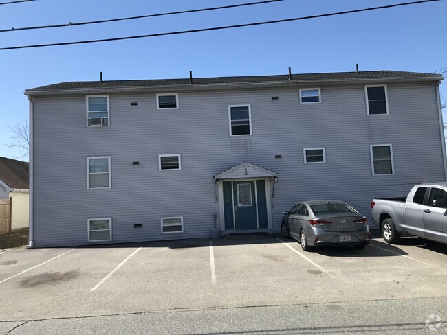
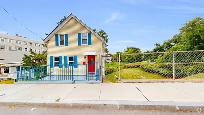
155 Milk St Unit 21
Westborough, MA 01581
2 Weeks Ago
Favorites
155 Milk St Unit 21

Favorites
Check Back Soon for Upcoming Availability
| Beds | Baths | Average SF |
|---|---|---|
| 2 Bedrooms 2 Bedrooms 2 Br | 1 Bath 1 Bath 1 Ba | 1,069 SF |
About This Property
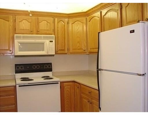
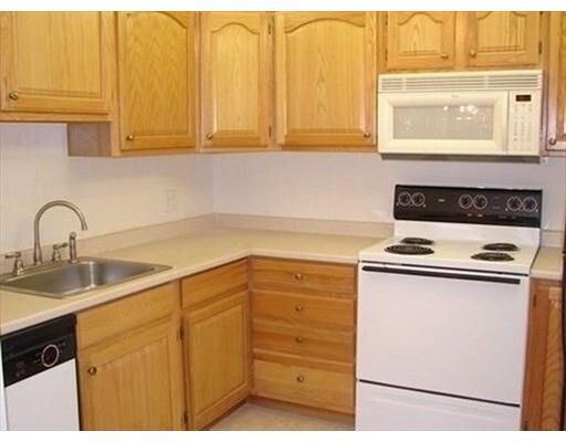
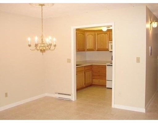
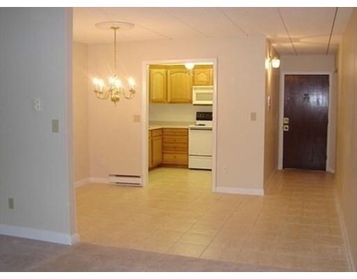
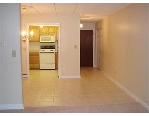
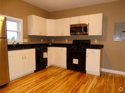
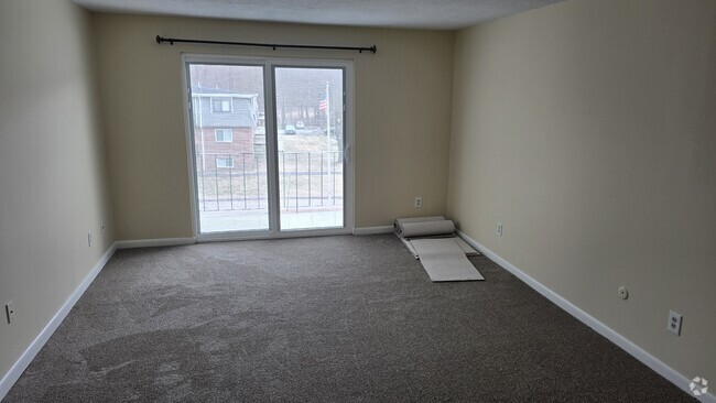
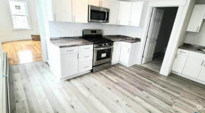
Second floor, Two bedroom apartment in desirable Carlton Garden~Two spacious bedrooms with good sized closets~Main bedroom features a balcony, Stainless appliances in kitchen~Rent includes water, trash removal, snow removal, grounds maintenance, swimming pool, tennis & basketball courts & 2 parking spaces~Freshly painted living room & replaced bathroom ceiling~Conveniently located to shopping & major highways~Must have a 650 Credit score or higher~Showings start on July 25th~ Available August 1st~
155 Milk St is a condo located in Worcester County and the 01581 ZIP Code. This area is served by the Westborough attendance zone.
Condo Features
Air Conditioning
Dishwasher
Microwave
Refrigerator
- Air Conditioning
- Cable Ready
- Intercom
- Dishwasher
- Microwave
- Range
- Refrigerator
- Pool
- Tennis Court
- Walking/Biking Trails
- Balcony
Fees and Policies
The fees below are based on community-supplied data and may exclude additional fees and utilities.
Pet policies are negotiable.
Details
Utilities Included
-
Water
-
Trash Removal
-
Sewer
Location
Get Directions
Situated just moments east of Worcester is the Route 9 Corridor, a large neighborhood compiled of several communities including Shrewsbury, Westborough, Northborough, and Southborough. Not only is Worcester at residents’ fingertips, but Downtown Boston is less than 40 miles east. The Route 9 Corridor is a commuter’s dream, offering easy city access and entry onto Interstates 290, 495, and 90.
The suburb is dotted with ponds, reservoirs, brooks, and rivers, providing ample outdoor recreation. Renters craving a beach day can bask on the sunny shores of Lake Chauncy Beach. Route 9 Corridor’s Prospect Park allows locals to take their dog for a stroll while Assabet Park gives children ample space to play on the playground. Those looking for winter recreation won’t want to miss the powdery slopes of Ski Ward Ski Area. No matter the season, renters settling in this diverse community can choose from gorgeous apartments ranging in price and amenities.
Learn more about living in Route 9 CorridorBelow are rent ranges for similar nearby apartments
| Beds | Average Size | Lowest | Typical | Premium |
|---|---|---|---|---|
| Studio Studio Studio | 506 Sq Ft | $1,857 | $2,464 | $4,110 |
| 1 Bed 1 Bed 1 Bed | 798-799 Sq Ft | $1,200 | $2,931 | $7,150 |
| 2 Beds 2 Beds 2 Beds | 1152-1153 Sq Ft | $1,975 | $3,656 | $6,805 |
| 3 Beds 3 Beds 3 Beds | 1461 Sq Ft | $2,200 | $4,755 | $10,802 |
| 4 Beds 4 Beds 4 Beds | 1973 Sq Ft | $3,075 | $4,269 | $5,000 |
Amenities
- Air Conditioning
- Cable Ready
- Intercom
- Dishwasher
- Microwave
- Range
- Refrigerator
- Balcony
- Pool
- Tennis Court
- Walking/Biking Trails
Expenses
Utilities Included
Water, Trash Removal, Sewer
Included
Education
| Colleges & Universities | Distance | ||
|---|---|---|---|
| Colleges & Universities | Distance | ||
| Drive: | 12 min | 6.4 mi | |
| Drive: | 13 min | 7.6 mi | |
| Drive: | 16 min | 9.4 mi | |
| Drive: | 22 min | 12.7 mi |
155 Milk St Unit 21 is within 12 minutes or 6.4 miles from Tufts University, Grafton. It is also near Stillman College and Worcester Polytechnic Inst..
Schools


Public Elementary School
Grades 4-6
865 Students
Nearby
Public Elementary School
Grades K-5
252 Students
Nearby
Public Elementary School
Grades PK-3
475 Students
Nearby
Public Elementary School
Grades K-3
391 Students
Nearby
Public Middle School
Grades 7-8
590 Students
Nearby
Public High School
Grades 9-12
1,178 Students
Attendance Zone
Private Elementary & Middle School
Grades 4-9
159 Students
Nearby
Private Elementary & Middle School
Grades PK-8
Nearby
Private Elementary School
Grades PK-K
95 Students
Nearby
Private High School
Grades 9-12
872 Students
Nearby
School data provided by
 The GreatSchools Rating helps parents compare schools within a state based on a variety of school quality indicators and provides a helpful picture of how effectively each school serves all of its students. Ratings are on a scale of 1 (below average) to 10 (above average) and can include test scores, college readiness, academic progress, advanced courses, equity, discipline and attendance data. We also advise parents to visit schools, consider other information on school performance and programs, and consider family needs as part of the school selection process.
View GreatSchools Rating Methodology
View GreatSchools Rating Methodology
Transportation options available in Westborough include Riverside Station, located 22.2 miles from 155 Milk St Unit 21. 155 Milk St Unit 21 is near Worcester Regional, located 14.4 miles or 26 minutes away, and General Edward Lawrence Logan International, located 35.3 miles or 50 minutes away.
| Transit / Subway | Distance | ||
|---|---|---|---|
| Transit / Subway | Distance | ||
|
|
Drive: | 32 min | 22.2 mi |
|
|
Drive: | 32 min | 22.6 mi |
|
|
Drive: | 34 min | 23.2 mi |
|
|
Drive: | 36 min | 24.8 mi |
|
|
Drive: | 36 min | 25.0 mi |
| Commuter Rail | Distance | ||
|---|---|---|---|
| Commuter Rail | Distance | ||
|
|
Drive: | 6 min | 2.8 mi |
|
|
Drive: | 10 min | 5.9 mi |
|
|
Drive: | 13 min | 7.2 mi |
|
|
Drive: | 16 min | 9.1 mi |
|
|
Drive: | 24 min | 11.8 mi |
| Airports | Distance | ||
|---|---|---|---|
| Airports | Distance | ||
|
Worcester Regional
|
Drive: | 26 min | 14.4 mi |
|
General Edward Lawrence Logan International
|
Drive: | 50 min | 35.3 mi |
Time and distance from 155 Milk St Unit 21.
| Shopping Centers | Distance | ||
|---|---|---|---|
| Shopping Centers | Distance | ||
| Walk: | 3 min | 0.2 mi | |
| Drive: | 3 min | 1.3 mi | |
| Drive: | 3 min | 1.3 mi |
155 Milk St Unit 21 has 3 shopping centers within 1.3 miles, which is about a 3-minute walk. The miles and minutes will be for the farthest away property.
| Parks and Recreation | Distance | ||
|---|---|---|---|
| Parks and Recreation | Distance | ||
|
Walkup And Robinson Memorial Reservation
|
Drive: | 6 min | 3.5 mi |
|
Cedar Hill and Sawink Farm Reservation
|
Drive: | 8 min | 3.5 mi |
|
Ward Hill Ski Area
|
Drive: | 9 min | 3.8 mi |
|
Whitehall State Park
|
Drive: | 18 min | 6.0 mi |
|
Felton Conservation Area
|
Drive: | 14 min | 6.0 mi |
155 Milk St Unit 21 has 5 parks within 6.0 miles, including Walkup And Robinson Memorial Reservation, Cedar Hill and Sawink Farm Reservation, and Ward Hill Ski Area.
| Hospitals | Distance | ||
|---|---|---|---|
| Hospitals | Distance | ||
| Drive: | 12 min | 7.2 mi | |
| Drive: | 12 min | 7.5 mi | |
| Drive: | 14 min | 9.5 mi |
155 Milk St Unit 21 has 3 hospitals within 9.5 miles, the nearest is Worcester Recovery Center and Hospital which is 7.2 miles away and a 12 minute drive.
| Military Bases | Distance | ||
|---|---|---|---|
| Military Bases | Distance | ||
| Drive: | 25 min | 15.2 mi |
155 Milk St Unit 21 is 15.2 miles and a 25 minute drive from US Military Reservation.
You May Also Like
Similar Rentals Nearby
What Are Walk Score®, Transit Score®, and Bike Score® Ratings?
Walk Score® measures the walkability of any address. Transit Score® measures access to public transit. Bike Score® measures the bikeability of any address.
What is a Sound Score Rating?
A Sound Score Rating aggregates noise caused by vehicle traffic, airplane traffic and local sources

155 Milk St
Westborough, MA 01581