1551 Unionport Rd
1551 Unionport Rd,
Bronx,
NY
10462
2 Weeks Ago
Favorites
1551 Unionport Rd

Favorites
Check Back Soon for Upcoming Availability
About 1551 Unionport Rd Bronx, NY 10462
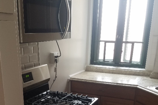
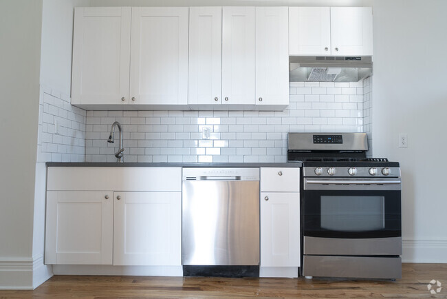
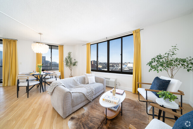
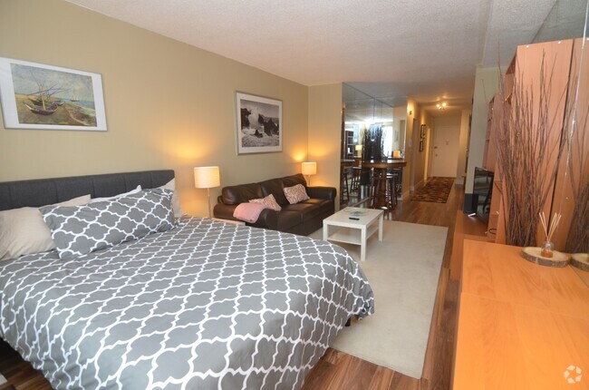
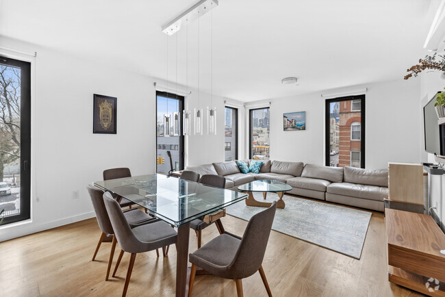
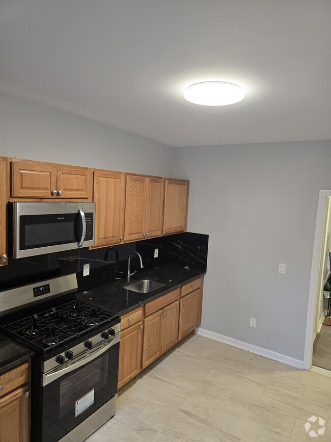
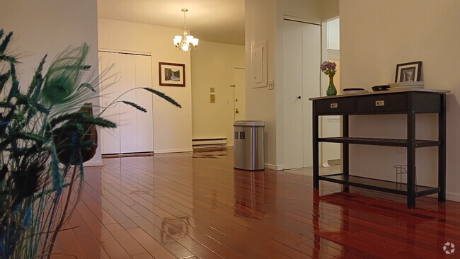
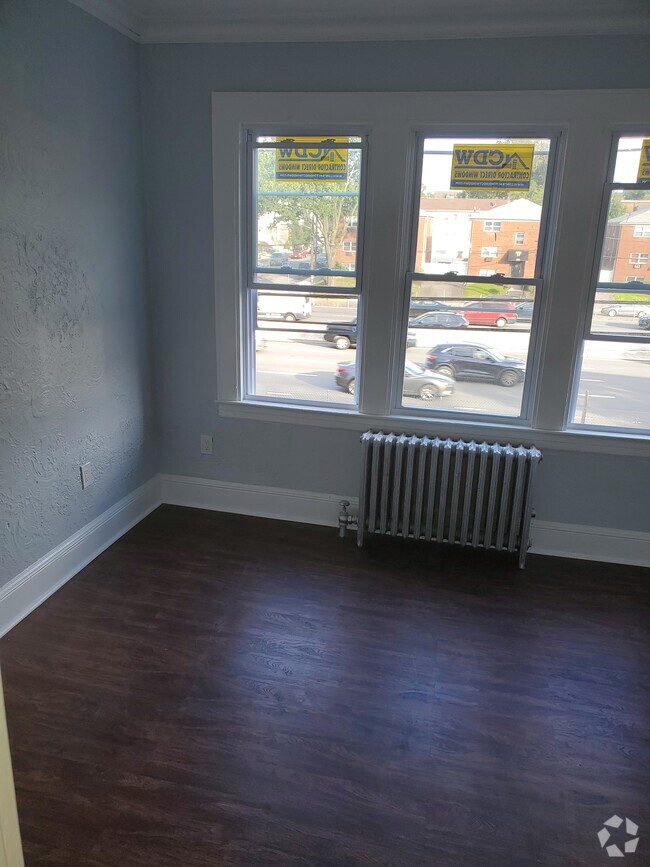
Renovated One Bedroom Apartment for RENT near the subway! Next to the corner of Starling Ave and McGraw. Close to grocery, Macy's, Marshalls and other shops. Looking for working tenants with good credit. Parkchester requires 45K yearly income. Subject to Parkchester board approval. Contact RC House Sales Realty 2415 E. Tremont Ave Bronx NY 10462
1551 Unionport Rd is a condo located in Bronx County and the 10462 ZIP Code. This area is served by the New York City Geographic District #11 attendance zone.
Location
Get Directions
A planned community in the heart of the Bronx, Parkchester offers affordable housing in a suburban environment. Residents have easy access to abundant shopping options, including big-box stores and various retailers like Macy’s and Marshalls. Casual dining options and local establishments are spread throughout the neighborhood. Locals appreciate easy access to subway stations and the interstate for simpler commutes. Parkchester sits about 10 miles north of Manhattan, so residents can easily commute into the city for work or leisure either by vehicle or public transit.
Learn more about living in ParkchesterBelow are rent ranges for similar nearby apartments
| Beds | Average Size | Lowest | Typical | Premium |
|---|---|---|---|---|
| Studio Studio Studio | 414-685 Sq Ft | $1,550 | $1,825 | $2,100 |
| 1 Bed 1 Bed 1 Bed | 679-729 Sq Ft | $1,850 | $2,190 | $2,788 |
| 2 Beds 2 Beds 2 Beds | 1137-1152 Sq Ft | $2,200 | $2,464 | $3,100 |
| 3 Beds 3 Beds 3 Beds | 1011-1026 Sq Ft | $2,700 | $3,562 | $4,000 |
| 4 Beds 4 Beds 4 Beds | 1300 Sq Ft | $4,070 | $4,375 | $4,680 |
Education
| Colleges & Universities | Distance | ||
|---|---|---|---|
| Colleges & Universities | Distance | ||
| Drive: | 5 min | 1.8 mi | |
| Drive: | 9 min | 3.0 mi | |
| Drive: | 10 min | 5.1 mi | |
| Drive: | 11 min | 5.9 mi |
1551 Unionport Rd is within 5 minutes or 1.8 miles from Yeshiva Univ., Resnick. It is also near Fordham University, Rose Hill and Monroe College, Bronx Campus.
Schools

Public Elementary School
Grades PK-5
889 Students
Attendance Zone
Public Middle & High School
Grades 6-12
287 Students
Nearby
Public Middle School
Grades 6-8
815 Students
Attendance Zone
Private Elementary & Middle School
Grades PK-8
300 Students
Nearby
Private High School
Grades 9-12
453 Students
Nearby
School data provided by
 The GreatSchools Rating helps parents compare schools within a state based on a variety of school quality indicators and provides a helpful picture of how effectively each school serves all of its students. Ratings are on a scale of 1 (below average) to 10 (above average) and can include test scores, college readiness, academic progress, advanced courses, equity, discipline and attendance data. We also advise parents to visit schools, consider other information on school performance and programs, and consider family needs as part of the school selection process.
View GreatSchools Rating Methodology
View GreatSchools Rating Methodology
Transportation options available in Bronx include Castle Hill Avenue, located 0.4 mile from 1551 Unionport Rd. 1551 Unionport Rd is near Laguardia, located 9.0 miles or 19 minutes away, and John F Kennedy International, located 16.6 miles or 25 minutes away.
| Transit / Subway | Distance | ||
|---|---|---|---|
| Transit / Subway | Distance | ||
|
|
Walk: | 8 min | 0.4 mi |
|
|
Walk: | 14 min | 0.7 mi |
|
|
Walk: | 14 min | 0.8 mi |
|
|
Walk: | 20 min | 1.1 mi |
|
|
Drive: | 5 min | 2.1 mi |
| Commuter Rail | Distance | ||
|---|---|---|---|
| Commuter Rail | Distance | ||
|
|
Drive: | 6 min | 3.3 mi |
|
|
Drive: | 9 min | 3.3 mi |
|
|
Drive: | 8 min | 3.4 mi |
|
|
Drive: | 8 min | 4.3 mi |
|
|
Drive: | 9 min | 4.6 mi |
| Airports | Distance | ||
|---|---|---|---|
| Airports | Distance | ||
|
Laguardia
|
Drive: | 19 min | 9.0 mi |
|
John F Kennedy International
|
Drive: | 25 min | 16.6 mi |
Time and distance from 1551 Unionport Rd.
| Shopping Centers | Distance | ||
|---|---|---|---|
| Shopping Centers | Distance | ||
| Walk: | 3 min | 0.2 mi | |
| Drive: | 4 min | 1.4 mi | |
| Drive: | 4 min | 1.5 mi |
1551 Unionport Rd has 3 shopping centers within 1.5 miles, which is about a 4-minute walk. The miles and minutes will be for the farthest away property.
| Parks and Recreation | Distance | ||
|---|---|---|---|
| Parks and Recreation | Distance | ||
|
Bronx Zoo
|
Drive: | 6 min | 1.7 mi |
|
Soundview Park
|
Drive: | 6 min | 2.3 mi |
|
Starlight Park
|
Drive: | 6 min | 2.5 mi |
|
Bronx Park
|
Drive: | 11 min | 3.3 mi |
|
Concrete Plant Park
|
Drive: | 8 min | 3.4 mi |
1551 Unionport Rd has 5 parks within 3.4 miles, including Starlight Park, Bronx Zoo, and Soundview Park.
| Hospitals | Distance | ||
|---|---|---|---|
| Hospitals | Distance | ||
| Drive: | 4 min | 1.4 mi | |
| Drive: | 7 min | 2.4 mi | |
| Drive: | 9 min | 3.9 mi |
1551 Unionport Rd has 3 hospitals within 3.9 miles, the nearest is Bronx Psychiatric Center which is 1.4 miles away and a 4 minute drive.
| Military Bases | Distance | ||
|---|---|---|---|
| Military Bases | Distance | ||
| Drive: | 15 min | 7.0 mi | |
| Drive: | 33 min | 16.6 mi |
1551 Unionport Rd is 7.0 miles from Fort Totten US Govt Reservation, and is convenient to other military bases, including Governors Island Support Center.
You May Also Like
Similar Rentals Nearby


What Are Walk Score®, Transit Score®, and Bike Score® Ratings?
Walk Score® measures the walkability of any address. Transit Score® measures access to public transit. Bike Score® measures the bikeability of any address.
What is a Sound Score Rating?
A Sound Score Rating aggregates noise caused by vehicle traffic, airplane traffic and local sources