-
Monthly Rent
$2,850
-
Bedrooms
3 bd
-
Bathrooms
2.5 ba
-
Square Feet
1,500 sq ft
Details

About This Property
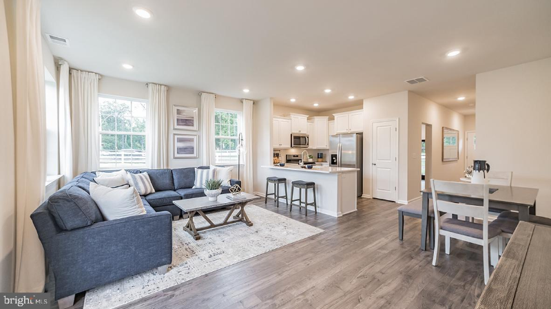
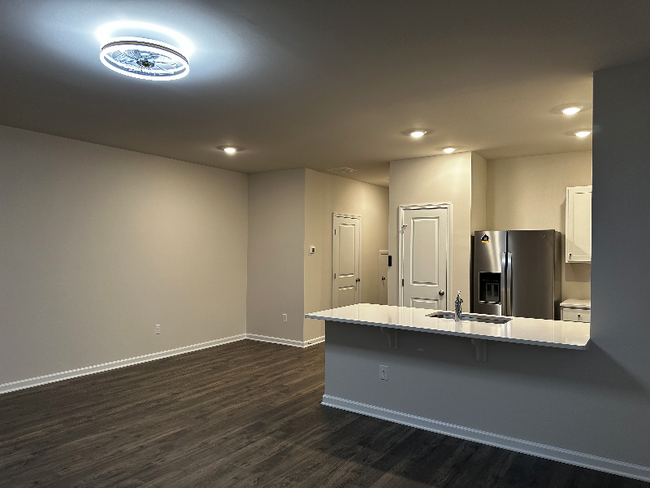
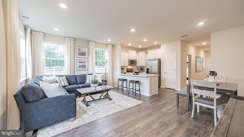
Property Id: 1273388 Brand new 3 BR 2.5 Bath duplex luxury town home for rent in Laurel Run by D.R Horton community at 39 Springside rd, westampton. On first floor you will find Living room, Dining and Kitchen all with HARDWOOD floors and white QUARTZ counter tops, half bath room and garage along with access to back yard. Second floor has Master bedroom with attached bath with dual sink and stand in shower and full walk in closet, additional two bed rooms with laundry facilities completes the second level. Closer to major routes 295 and NJ Tpk. Great westampton schools. Pictures shown are from the model home end unit.**
7 Elliot Ln is a townhome located in Burlington County and the 08060 ZIP Code. This area is served by the Eastampton Township attendance zone.
Townhome Features
Washer/Dryer
Dishwasher
Hardwood Floors
Microwave
- Washer/Dryer
- Cable Ready
- Dishwasher
- Microwave
- Oven
- Refrigerator
- Hardwood Floors
- Spa
- Lawn
Fees and Policies
The fees below are based on community-supplied data and may exclude additional fees and utilities.
- Dogs Allowed
-
Fees not specified
- Cats Allowed
-
Fees not specified
- Parking
-
Garage--
Details
Utilities Included
-
Trash Removal
 This Property
 Available Property
- Washer/Dryer
- Cable Ready
- Dishwasher
- Microwave
- Oven
- Refrigerator
- Hardwood Floors
- Lawn
- Spa
| Colleges & Universities | Distance | ||
|---|---|---|---|
| Colleges & Universities | Distance | ||
| Drive: | 15 min | 7.2 mi | |
| Drive: | 15 min | 8.6 mi | |
| Drive: | 31 min | 17.1 mi | |
| Drive: | 34 min | 18.8 mi |
Transportation options available in Westampton Township include Burlington Towne Center, located 8.0 miles from 7 Elliot Ln. 7 Elliot Ln is near Trenton Mercer, located 24.9 miles or 38 minutes away, and Philadelphia International, located 31.9 miles or 50 minutes away.
| Transit / Subway | Distance | ||
|---|---|---|---|
| Transit / Subway | Distance | ||
|
|
Drive: | 13 min | 8.0 mi |
|
|
Drive: | 15 min | 8.8 mi |
|
|
Drive: | 19 min | 11.0 mi |
|
|
Drive: | 19 min | 11.0 mi |
|
|
Drive: | 19 min | 11.8 mi |
| Commuter Rail | Distance | ||
|---|---|---|---|
| Commuter Rail | Distance | ||
|
|
Drive: | 21 min | 11.4 mi |
|
|
Drive: | 22 min | 11.9 mi |
|
|
Drive: | 25 min | 13.7 mi |
|
|
Drive: | 26 min | 14.3 mi |
|
|
Drive: | 27 min | 14.8 mi |
| Airports | Distance | ||
|---|---|---|---|
| Airports | Distance | ||
|
Trenton Mercer
|
Drive: | 38 min | 24.9 mi |
|
Philadelphia International
|
Drive: | 50 min | 31.9 mi |
Time and distance from 7 Elliot Ln.
| Shopping Centers | Distance | ||
|---|---|---|---|
| Shopping Centers | Distance | ||
| Drive: | 6 min | 2.7 mi | |
| Drive: | 7 min | 2.9 mi | |
| Drive: | 6 min | 3.2 mi |
| Parks and Recreation | Distance | ||
|---|---|---|---|
| Parks and Recreation | Distance | ||
|
Historic Smithville Park
|
Drive: | 3 min | 1.4 mi |
|
Rancocas Nature Center
|
Drive: | 8 min | 3.9 mi |
|
Rancocas State Park
|
Drive: | 12 min | 5.3 mi |
|
Paws Farm Nature Center
|
Drive: | 12 min | 7.7 mi |
|
Johnson's Corner Farm
|
Drive: | 15 min | 9.3 mi |
| Hospitals | Distance | ||
|---|---|---|---|
| Hospitals | Distance | ||
| Drive: | 5 min | 2.8 mi | |
| Drive: | 17 min | 8.3 mi | |
| Drive: | 18 min | 10.4 mi |
| Military Bases | Distance | ||
|---|---|---|---|
| Military Bases | Distance | ||
| Drive: | 20 min | 10.6 mi | |
| Drive: | 28 min | 13.7 mi | |
| Drive: | 57 min | 18.8 mi |
You May Also Like
What Are Walk Score®, Transit Score®, and Bike Score® Ratings?
Walk Score® measures the walkability of any address. Transit Score® measures access to public transit. Bike Score® measures the bikeability of any address.
What is a Sound Score Rating?
A Sound Score Rating aggregates noise caused by vehicle traffic, airplane traffic and local sources


