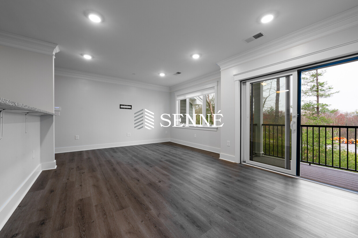
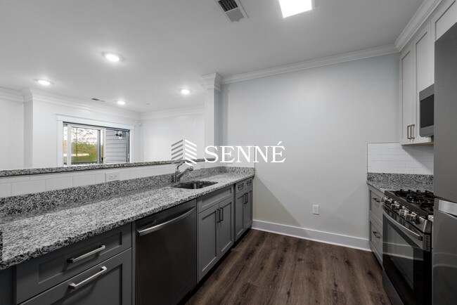
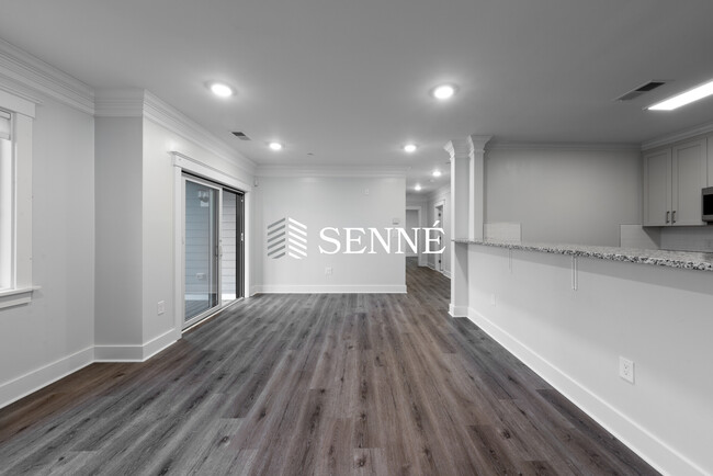

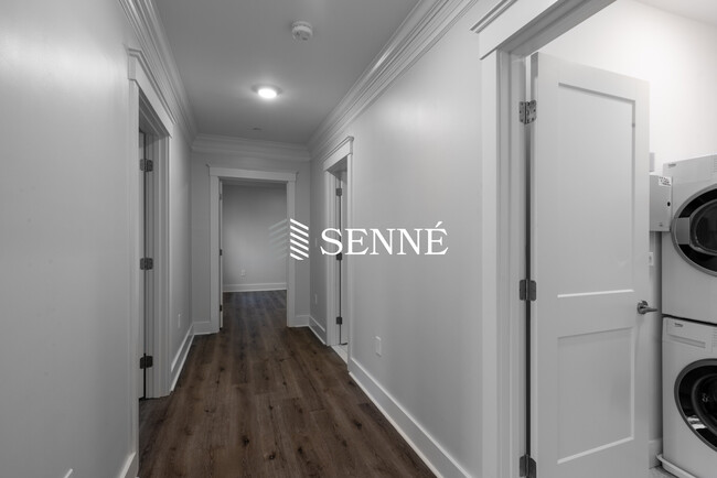
16 Hennery Way Unit F
Medfield, MA 02052
-
Bedrooms
2
-
Bathrooms
1
-
Square Feet
1,050 sq ft
-
Available
Available Now
Highlight
- Pets Allowed

16 Hennery Way is an apartment community located in Norfolk County and the 02052 ZIP Code. This area is served by the Medfield attendance zone.
Apartment Features
- Washer/Dryer
- Air Conditioning
- Dishwasher
Fees and Policies
The fees below are based on community-supplied data and may exclude additional fees and utilities.
- Dogs Allowed
-
Fees not specified
- Cats Allowed
-
Fees not specified
- Parking
-
Surface Lot--
Details
Utilities Included
-
Trash Removal
Contact
- Phone Number
- Contact
495-South is a large area surrounding Interstate 495 about 20 miles south of Boston. This suburban town features peaceful neighborhoods nestled in forested areas paired with commercial developments. Renters have the choice of moderately priced to luxury apartments, condos, and single-family homes. An abundance of shopping and dining choices are scattered along the town’s major thoroughfares. Ponds, creeks, and large natural areas like Franklin State Forest and DelCarte Conservation Area provide relaxing outdoor activities. Residents have access to big-city amenities by driving a bit north into Boston, and the eclectic downtown districts of Worcester and Framingham are situated outside of the western and eastern corners of town.
Learn more about living in 495-South| Colleges & Universities | Distance | ||
|---|---|---|---|
| Colleges & Universities | Distance | ||
| Drive: | 21 min | 9.7 mi | |
| Drive: | 21 min | 10.9 mi | |
| Drive: | 23 min | 11.4 mi | |
| Drive: | 27 min | 13.5 mi |


View GreatSchools Rating Methodology
Transportation options available in Medfield include Waban Station, located 12.3 miles from 16 Hennery Way Unit F. 16 Hennery Way Unit F is near General Edward Lawrence Logan International, located 24.3 miles or 46 minutes away, and Worcester Regional, located 35.5 miles or 63 minutes away.
| Transit / Subway | Distance | ||
|---|---|---|---|
| Transit / Subway | Distance | ||
|
|
Drive: | 26 min | 12.3 mi |
|
|
Drive: | 27 min | 12.5 mi |
|
|
Drive: | 26 min | 12.9 mi |
|
|
Drive: | 26 min | 14.8 mi |
|
|
Drive: | 28 min | 14.9 mi |
| Commuter Rail | Distance | ||
|---|---|---|---|
| Commuter Rail | Distance | ||
|
|
Drive: | 9 min | 4.8 mi |
|
|
Drive: | 12 min | 6.2 mi |
|
|
Drive: | 15 min | 7.5 mi |
|
|
Drive: | 17 min | 7.7 mi |
|
|
Drive: | 17 min | 7.7 mi |
| Airports | Distance | ||
|---|---|---|---|
| Airports | Distance | ||
|
General Edward Lawrence Logan International
|
Drive: | 46 min | 24.3 mi |
|
Worcester Regional
|
Drive: | 63 min | 35.5 mi |
Time and distance from 16 Hennery Way Unit F.
| Shopping Centers | Distance | ||
|---|---|---|---|
| Shopping Centers | Distance | ||
| Drive: | 4 min | 1.7 mi | |
| Drive: | 6 min | 3.2 mi | |
| Drive: | 9 min | 4.9 mi |
| Parks and Recreation | Distance | ||
|---|---|---|---|
| Parks and Recreation | Distance | ||
|
Mass Audubon's Stony Brook Wildlife Sanctuary
|
Drive: | 12 min | 6.3 mi |
|
Lookout Farm
|
Drive: | 16 min | 7.2 mi |
|
Mass Audubon's Broadmoor Wildlife Sanctuary
|
Drive: | 12 min | 7.2 mi |
|
Natick Community Organic Farm
|
Drive: | 14 min | 8.4 mi |
|
Weezie's Garden for Children
|
Drive: | 20 min | 9.9 mi |
| Hospitals | Distance | ||
|---|---|---|---|
| Hospitals | Distance | ||
| Drive: | 11 min | 5.4 mi | |
| Drive: | 16 min | 7.3 mi | |
| Drive: | 19 min | 9.1 mi |
| Military Bases | Distance | ||
|---|---|---|---|
| Military Bases | Distance | ||
| Drive: | 17 min | 9.1 mi |
- Washer/Dryer
- Air Conditioning
- Dishwasher
16 Hennery Way Unit F Photos
What Are Walk Score®, Transit Score®, and Bike Score® Ratings?
Walk Score® measures the walkability of any address. Transit Score® measures access to public transit. Bike Score® measures the bikeability of any address.
What is a Sound Score Rating?
A Sound Score Rating aggregates noise caused by vehicle traffic, airplane traffic and local sources

16 Hennery Way
Medfield, MA 02052