
$2,700 / Month
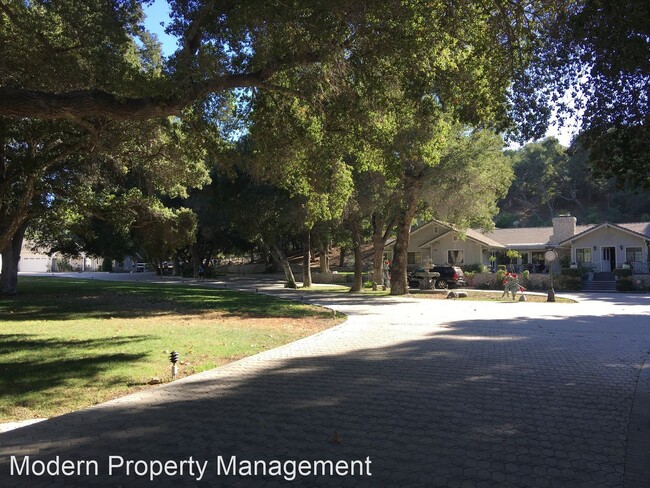
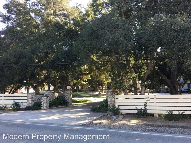
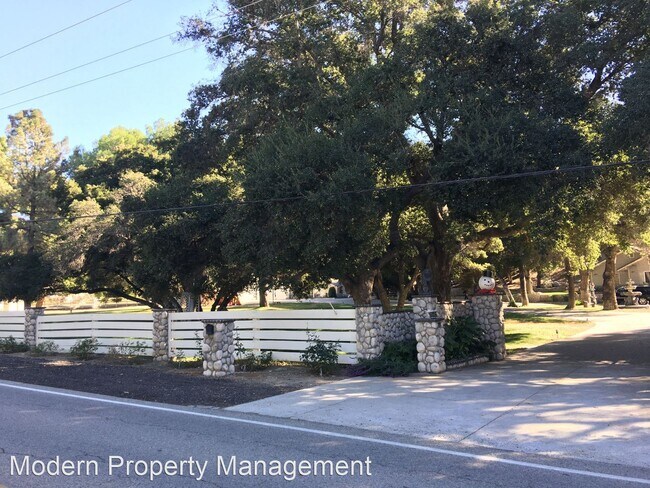
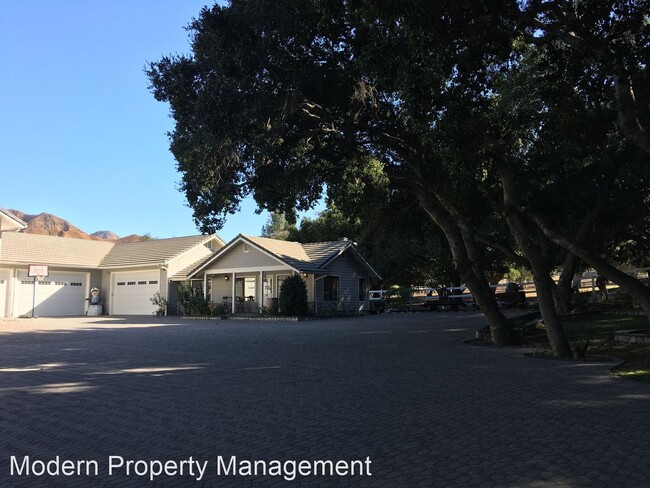
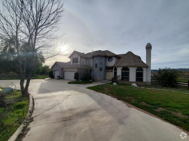
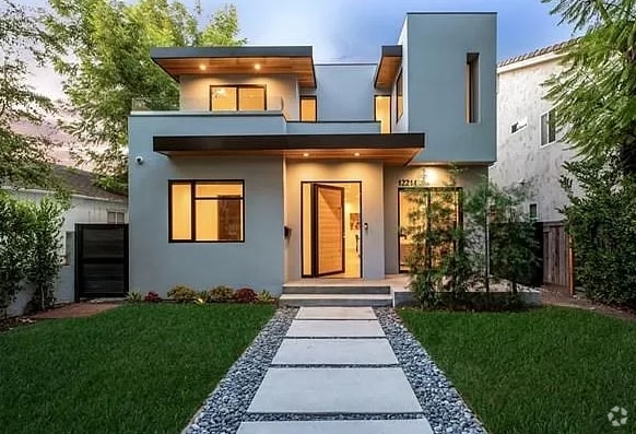
16056 Placerita Canyon Rd
Santa Clarita, CA 91387
2 Weeks Ago
Favorites
16056 Placerita Canyon Rd

Favorites
Check Back Soon for Upcoming Availability
| Beds | Baths | Average SF |
|---|---|---|
| 1 Bedroom 1 Bedroom 1 Br | 1 Bath 1 Bath 1 Ba | 900 SF |
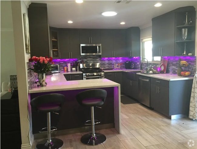
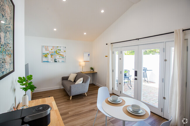
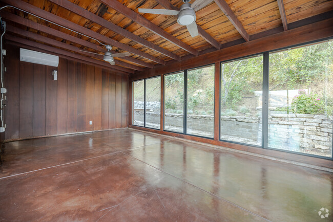
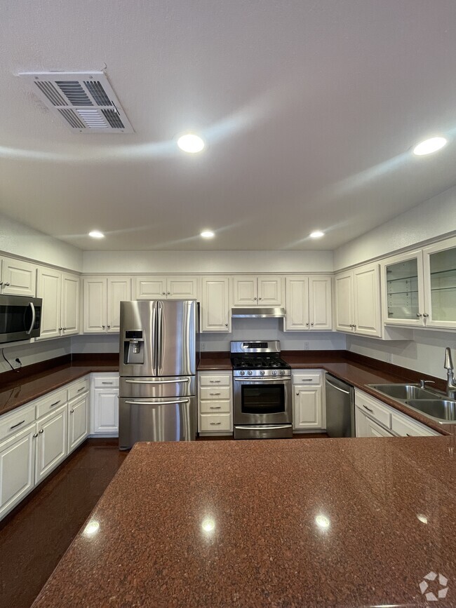
About This Property
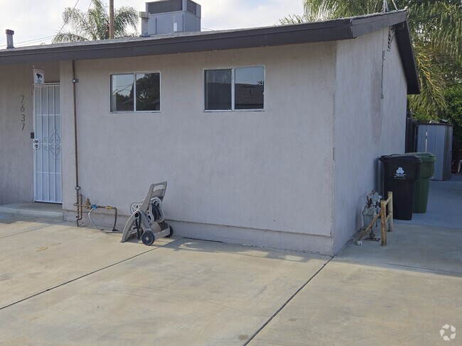
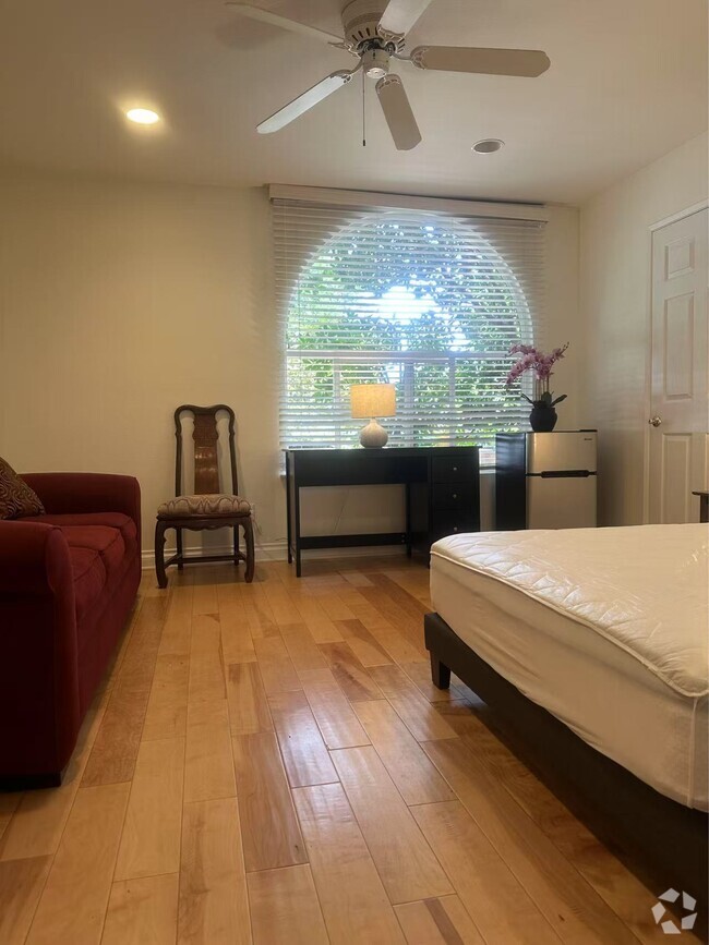
(818) 287-6668 - Peace & Serenity Await @ The Enchanting Oaks - 1 bedroom 1 full bath large farmhouse guest cottage in the beautiful Sand Canyon Estates on park-like grounds is now available for lease. Furnished or unfurnished. Includes utilities and 2 uncovered parking spaces. No Pets Allowed (RLNE4295791) Pet policies: No Dogs Allowed, No Cats Allowed.
16056 Placerita Canyon Rd is a house located in Los Angeles County and the 91387 ZIP Code. This area is served by the William S. Hart Union High attendance zone.
Unique Features
- No Dogs Allowed, No Cats Allowed
Fees and Policies
The fees below are based on community-supplied data and may exclude additional fees and utilities.
Location
Get Directions
The Antelope Valley region sits in the northernmost stretches of Los Angeles County. Antelope Valley also constitutes the western portion of the Mojave Desert, located between the Tehachapi, Sierra Pelona, and San Gabriel Mountains, which all lend stunning mountain vistas to the rentals in the region.
Antelope Valley’s largest cities include Lancaster and Palmdale, in addition to a slew of smaller cities and towns that each boast their own unique identity and sense of character. The region’s more affordable cost of living draws plenty of Los Angeles area commuters who don’t mind a longer commute time.
The rental options are just as diverse as the region itself, with an array of apartments, condos, townhomes, and houses available for rent throughout Antelope Valley. Popular spots for outdoor recreation include Angeles National Forest and Castaic Lake State Recreation Area, as well as Greater Los Angeles’ renowned beaches, which are about a two-hour drive away.
Learn more about living in Antelope ValleyBelow are rent ranges for similar nearby apartments
| Beds | Average Size | Lowest | Typical | Premium |
|---|---|---|---|---|
| Studio Studio Studio | 470-473 Sq Ft | $1,295 | $1,964 | $3,794 |
| 1 Bed 1 Bed 1 Bed | 733-736 Sq Ft | $1,000 | $2,595 | $6,115 |
| 2 Beds 2 Beds 2 Beds | 1058-1059 Sq Ft | $2,000 | $3,345 | $8,162 |
| 3 Beds 3 Beds 3 Beds | 1552 Sq Ft | $2,800 | $5,001 | $25,000 |
| 4 Beds 4 Beds 4 Beds | 2727 Sq Ft | $2,163 | $10,490 | $42,000 |
Amenities
- No Dogs Allowed, No Cats Allowed
Education
| Colleges & Universities | Distance | ||
|---|---|---|---|
| Colleges & Universities | Distance | ||
| Drive: | 24 min | 12.6 mi | |
| Drive: | 21 min | 14.8 mi | |
| Drive: | 28 min | 16.1 mi | |
| Drive: | 30 min | 22.2 mi |
16056 Placerita Canyon Rd is within 21 minutes or 14.8 miles from Mission College. It is also near College of the Canyons and Cal State Northridge.
Schools


Charter Elementary, Middle & High School
Grades K-12
2,877 Students
Nearby
Public Elementary School
Grades K-6
595 Students
Attendance Zone
Public Middle School
Grades 7-8
991 Students
Attendance Zone
Public High School
Grades 9-12
1,946 Students
Attendance Zone
Private Elementary School
Grades PK-1
Nearby
Private Elementary, Middle & High School
Grades K-12
424 Students
Nearby
School data provided by
 The GreatSchools Rating helps parents compare schools within a state based on a variety of school quality indicators and provides a helpful picture of how effectively each school serves all of its students. Ratings are on a scale of 1 (below average) to 10 (above average) and can include test scores, college readiness, academic progress, advanced courses, equity, discipline and attendance data. We also advise parents to visit schools, consider other information on school performance and programs, and consider family needs as part of the school selection process.
View GreatSchools Rating Methodology
View GreatSchools Rating Methodology
Transportation options available in Santa Clarita include North Hollywood Station, located 22.7 miles from 16056 Placerita Canyon Rd. 16056 Placerita Canyon Rd is near Bob Hope, located 21.8 miles or 30 minutes away, and Los Angeles International, located 38.9 miles or 51 minutes away.
| Transit / Subway | Distance | ||
|---|---|---|---|
| Transit / Subway | Distance | ||
|
|
Drive: | 30 min | 22.7 mi |
|
|
Drive: | 33 min | 25.0 mi |
|
|
Drive: | 37 min | 27.9 mi |
|
|
Drive: | 37 min | 28.2 mi |
|
|
Drive: | 38 min | 29.0 mi |
| Commuter Rail | Distance | ||
|---|---|---|---|
| Commuter Rail | Distance | ||
|
|
Drive: | 12 min | 7.1 mi |
|
|
Drive: | 14 min | 7.9 mi |
|
|
Drive: | 17 min | 9.9 mi |
|
|
Drive: | 21 min | 13.9 mi |
|
|
Drive: | 26 min | 19.9 mi |
| Airports | Distance | ||
|---|---|---|---|
| Airports | Distance | ||
|
Bob Hope
|
Drive: | 30 min | 21.8 mi |
|
Los Angeles International
|
Drive: | 51 min | 38.9 mi |
Time and distance from 16056 Placerita Canyon Rd.
| Shopping Centers | Distance | ||
|---|---|---|---|
| Shopping Centers | Distance | ||
| Drive: | 7 min | 3.5 mi | |
| Drive: | 8 min | 4.5 mi | |
| Drive: | 12 min | 6.9 mi |
16056 Placerita Canyon Rd has 3 shopping centers within 6.9 miles, which is about a 12-minute drive. The miles and minutes will be for the farthest away property.
| Parks and Recreation | Distance | ||
|---|---|---|---|
| Parks and Recreation | Distance | ||
|
Placerita Canyon State Park
|
Drive: | 3 min | 1.9 mi |
|
Placerita Canyon Nature Center
|
Drive: | 5 min | 3.3 mi |
|
Wildlife Waystation
|
Drive: | 19 min | 9.6 mi |
|
El Cariso Regional Park
|
Drive: | 21 min | 15.0 mi |
|
Veterans Memorial Park
|
Drive: | 26 min | 15.5 mi |
16056 Placerita Canyon Rd has 5 parks within 15.5 miles, including Placerita Canyon State Park, Placerita Canyon Nature Center, and Veterans Memorial Park.
| Hospitals | Distance | ||
|---|---|---|---|
| Hospitals | Distance | ||
| Drive: | 17 min | 9.7 mi | |
| Drive: | 20 min | 13.1 mi | |
| Drive: | 19 min | 13.5 mi |
16056 Placerita Canyon Rd has 3 hospitals within 13.5 miles, the nearest is Henry Mayo Newhall Hospital which is 9.7 miles away and a 17 minute drive.
| Military Bases | Distance | ||
|---|---|---|---|
| Military Bases | Distance | ||
| Drive: | 52 min | 41.4 mi | |
| Drive: | 84 min | 51.6 mi |
16056 Placerita Canyon Rd is 41.4 miles from Los Angeles Air Force Base, and is convenient to other military bases, including Edwards Air Force Base North Antelope Valley.
You May Also Like
Similar Rentals Nearby
What Are Walk Score®, Transit Score®, and Bike Score® Ratings?
Walk Score® measures the walkability of any address. Transit Score® measures access to public transit. Bike Score® measures the bikeability of any address.
What is a Sound Score Rating?
A Sound Score Rating aggregates noise caused by vehicle traffic, airplane traffic and local sources

16056 Placerita Canyon Rd
Santa Clarita, CA 91387