
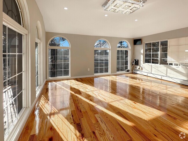
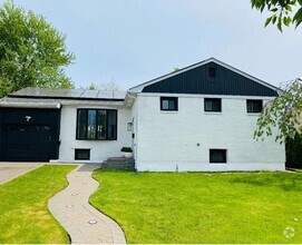
$3,600 / Month
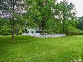
161-24 Normal Rd
Queens, NY 11432
2 Weeks Ago
Favorites
161-24 Normal Rd

Favorites
Check Back Soon for Upcoming Availability
| Beds | Baths | Average SF |
|---|---|---|
| 3 Bedrooms 3 Bedrooms 3 Br | 1 Bath 1 Bath 1 Ba | 1,400 SF |
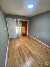
About This Property
Very good and big 1st floor apartment and close to all transportation. Based on information submitted to the MLS GRID as of [see last changed date above]. All data is obtained from various sources and may not have been verified by broker or MLS GRID. Supplied Open House Information is subject to change without notice. All information should be independently reviewed and verified for accuracy. Properties may or may not be listed by the office/agent presenting the information. Some IDX listings have been excluded from this website. Prices displayed on all Sold listings are the Last Known Listing Price and may not be the actual selling price.
161-24 Normal Rd is a house located in Queens County and the 11432 ZIP Code. This area is served by the New York City Geographic District #28 attendance zone.
Location
Get Directions
Jamaica Hills is a vibrant neighborhood situated in the center of Queens. Along with housing several good schools, Jamaica Hills is located just south of Saint John's University and is less than a mile from York College. You’ll find locals enjoying Captain Tilly Park or walking to one of Jamaica Hills diverse eateries serving everything from Caribbean classics to vegetarian fare. Jamaica Hills has houses, apartments, and condos available for rent. Like many New York City neighborhoods, rentals here are typically expensive. There are several bus stops and subway stations in Jamaica Hill so you can travel throughout the city with ease. For out-of-state trips, John F. Kennedy International Airport is just over five miles away.
Learn more about living in Jamaica HillsBelow are rent ranges for similar nearby apartments
Education
| Colleges & Universities | Distance | ||
|---|---|---|---|
| Colleges & Universities | Distance | ||
| Drive: | 4 min | 1.3 mi | |
| Drive: | 4 min | 1.5 mi | |
| Drive: | 8 min | 3.4 mi | |
| Drive: | 10 min | 5.1 mi |
161-24 Normal Rd is within 4 minutes or 1.3 miles from York College. It is also near St. John's University and Queens College.
Schools


Public Elementary School
Grades PK-5
634 Students
Attendance Zone
Public Middle School
Grades 6-8
1,348 Students
Attendance Zone
Public High School
Grades 9-12
2,381 Students
Attendance Zone
Private Elementary, Middle & High School
Grades K-12
Nearby
Private Elementary & Middle School
Grades PK-8
337 Students
Nearby
School data provided by
 The GreatSchools Rating helps parents compare schools within a state based on a variety of school quality indicators and provides a helpful picture of how effectively each school serves all of its students. Ratings are on a scale of 1 (below average) to 10 (above average) and can include test scores, college readiness, academic progress, advanced courses, equity, discipline and attendance data. We also advise parents to visit schools, consider other information on school performance and programs, and consider family needs as part of the school selection process.
View GreatSchools Rating Methodology
View GreatSchools Rating Methodology
Transportation options available in Queens include Parsons Boulevard, located 0.4 mile from 161-24 Normal Rd. 161-24 Normal Rd is near Laguardia, located 7.1 miles or 14 minutes away, and John F Kennedy International, located 7.2 miles or 11 minutes away.
| Transit / Subway | Distance | ||
|---|---|---|---|
| Transit / Subway | Distance | ||
|
|
Walk: | 6 min | 0.4 mi |
|
|
Walk: | 13 min | 0.7 mi |
|
|
Walk: | 14 min | 0.8 mi |
|
|
Walk: | 15 min | 0.8 mi |
|
|
Drive: | 4 min | 1.4 mi |
| Commuter Rail | Distance | ||
|---|---|---|---|
| Commuter Rail | Distance | ||
|
|
Drive: | 4 min | 1.5 mi |
|
|
Drive: | 6 min | 2.1 mi |
|
|
Drive: | 5 min | 2.2 mi |
|
|
Drive: | 7 min | 2.7 mi |
|
|
Drive: | 8 min | 3.1 mi |
| Airports | Distance | ||
|---|---|---|---|
| Airports | Distance | ||
|
Laguardia
|
Drive: | 14 min | 7.1 mi |
|
John F Kennedy International
|
Drive: | 11 min | 7.2 mi |
Time and distance from 161-24 Normal Rd.
| Shopping Centers | Distance | ||
|---|---|---|---|
| Shopping Centers | Distance | ||
| Walk: | 13 min | 0.7 mi | |
| Walk: | 14 min | 0.8 mi | |
| Drive: | 3 min | 1.5 mi |
161-24 Normal Rd has 3 shopping centers within 1.5 miles, which is about a 3-minute walk. The miles and minutes will be for the farthest away property.
| Parks and Recreation | Distance | ||
|---|---|---|---|
| Parks and Recreation | Distance | ||
|
Rufus King Park
|
Drive: | 3 min | 1.1 mi |
|
Detective Keith L. Williams Park
|
Drive: | 6 min | 1.9 mi |
|
Kissena Park
|
Drive: | 9 min | 3.0 mi |
|
Cunningham Park
|
Drive: | 7 min | 3.3 mi |
|
Roy Wilkins Recreation Center
|
Drive: | 9 min | 3.4 mi |
161-24 Normal Rd has 5 parks within 3.4 miles, including Rufus King Park, Detective Keith L. Williams Park, and Kissena Park.
| Hospitals | Distance | ||
|---|---|---|---|
| Hospitals | Distance | ||
| Walk: | 8 min | 0.4 mi | |
| Drive: | 4 min | 1.7 mi | |
| Drive: | 9 min | 3.7 mi |
161-24 Normal Rd has 3 hospitals within 3.7 miles, the nearest is Queens Hospital Center which is 0.4 mile away and a 8 minute walk.
| Military Bases | Distance | ||
|---|---|---|---|
| Military Bases | Distance | ||
| Drive: | 14 min | 8.0 mi | |
| Drive: | 33 min | 16.0 mi |
161-24 Normal Rd is 8.0 miles from Fort Totten US Govt Reservation, and is convenient to other military bases, including US Coast Guard Heliport.
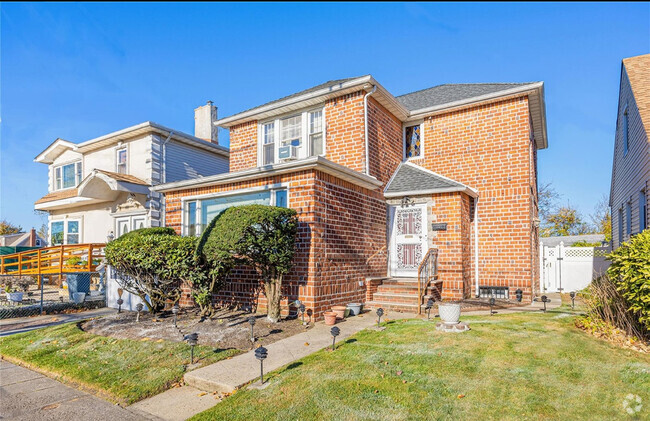
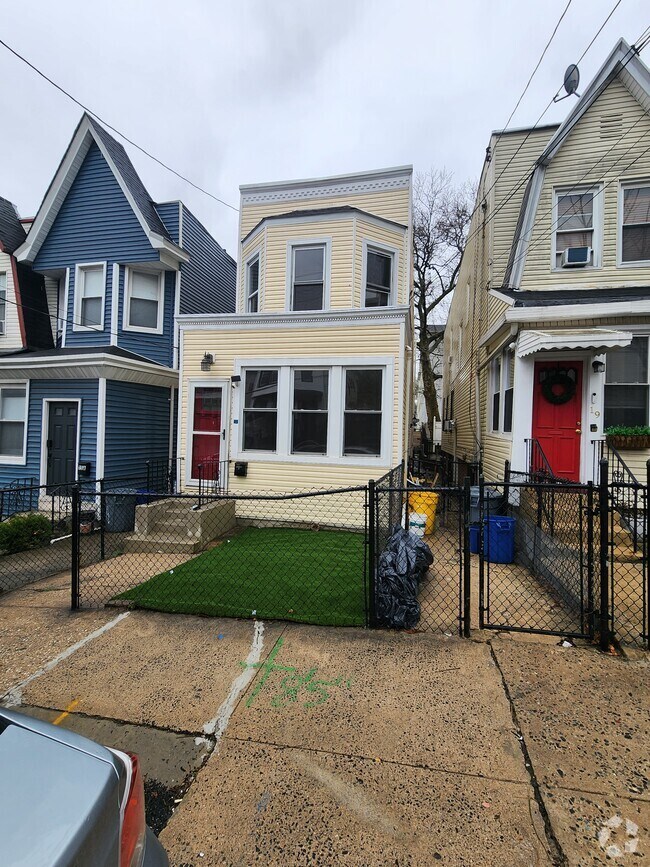
You May Also Like
Similar Rentals Nearby
What Are Walk Score®, Transit Score®, and Bike Score® Ratings?
Walk Score® measures the walkability of any address. Transit Score® measures access to public transit. Bike Score® measures the bikeability of any address.
What is a Sound Score Rating?
A Sound Score Rating aggregates noise caused by vehicle traffic, airplane traffic and local sources
161-24 Normal Rd
Queens, NY 11432