
$2,900 / Month
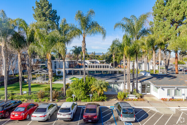
162 Waverly St
Sunnyvale, CA 94086
2 Weeks Ago
Favorites
162 Waverly St

Favorites
Check Back Soon for Upcoming Availability
| Beds | Baths | Average SF |
|---|---|---|
| 2 Bedrooms 2 Bedrooms 2 Br | 1 Bath 1 Bath 1 Ba | 800 SF |
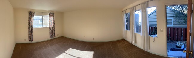
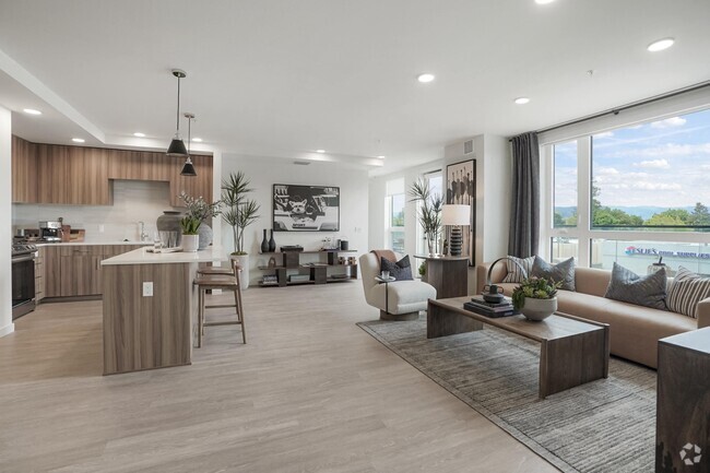
About This Property
162 Waverly St is an apartment community located in Santa Clara County and the 94086 ZIP Code.
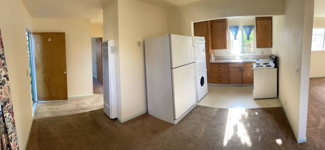
Apartment Features
Washer/Dryer
High Speed Internet Access
Refrigerator
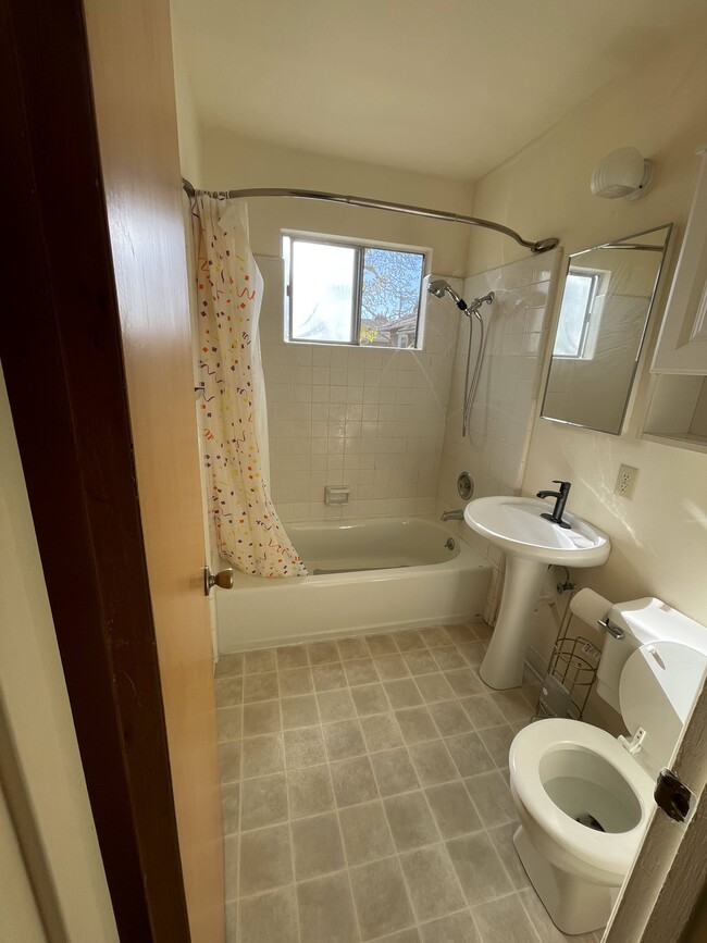
Tub/Shower
- High Speed Internet Access
- Washer/Dryer
- Heating
- Smoke Free
- Cable Ready
- Tub/Shower
- Disposal
- Eat-in Kitchen
- Oven
- Range
- Refrigerator
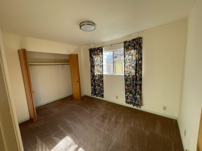
- Carpet
Fees and Policies
The fees below are based on community-supplied data and may exclude additional fees and utilities.
- Parking
-
Street--
Property Address:
162 Waverly St,
Sunnyvale,
CA
94086
Sunnyvale West is a sprawling community that makes up a large portion of the city. Surrounded by big businesses and job opportunities in Silicon Valley, Sunnyvale West is a residential haven. Known for its family-friendly atmosphere and walkable, bike-friendly streets, Sunnyvale West is a highly sought-after place to call home. Neighborhood parks are commonplace in this district, including Serra Park, Mango Park, Las Palmas Park, and Washington Park. Residents enjoy living near the heart of the city along El Camino Real, where you’ll find a variety of restaurants, grocers, car dealerships, department stores, service-based shops, and more. For more big-city amenities, locals travel roughly 40 miles north into San Francisco or 15 miles east into San Jose. There are abundant apartments, houses, condos, and townhomes available for rent in Sunnyvale West that range from mid-range to upscale.
Learn more about living in Sunnyvale WestBelow are rent ranges for similar nearby apartments
Amenities
- High Speed Internet Access
- Washer/Dryer
- Heating
- Smoke Free
- Cable Ready
- Tub/Shower
- Disposal
- Eat-in Kitchen
- Oven
- Range
- Refrigerator
- Carpet
Education
| Colleges & Universities | Distance | ||
|---|---|---|---|
| Colleges & Universities | Distance | ||
| Drive: | 13 min | 5.4 mi | |
| Drive: | 12 min | 5.9 mi | |
| Drive: | 16 min | 6.4 mi | |
| Drive: | 12 min | 7.4 mi |
162 Waverly St is within 13 minutes or 5.4 miles from De Anza College. It is also near Foothill College, Middlefield and Foothill Coll., Los Altos.
Transportation options available in Sunnyvale include Middlefield Station, located 1.8 miles from 162 Waverly St. 162 Waverly St is near Norman Y Mineta San Jose International, located 7.1 miles or 13 minutes away, and San Francisco International, located 27.8 miles or 37 minutes away.
| Transit / Subway | Distance | ||
|---|---|---|---|
| Transit / Subway | Distance | ||
|
|
Drive: | 4 min | 1.8 mi |
|
|
Drive: | 5 min | 2.4 mi |
|
|
Drive: | 5 min | 2.6 mi |
|
|
Drive: | 6 min | 2.7 mi |
|
|
Drive: | 5 min | 2.7 mi |
| Commuter Rail | Distance | ||
|---|---|---|---|
| Commuter Rail | Distance | ||
| Walk: | 8 min | 0.5 mi | |
| Drive: | 6 min | 2.5 mi | |
| Drive: | 7 min | 2.7 mi | |
| Drive: | 10 min | 5.5 mi | |
| Drive: | 10 min | 6.1 mi |
| Airports | Distance | ||
|---|---|---|---|
| Airports | Distance | ||
|
Norman Y Mineta San Jose International
|
Drive: | 13 min | 7.1 mi |
|
San Francisco International
|
Drive: | 37 min | 27.8 mi |
Time and distance from 162 Waverly St.
| Shopping Centers | Distance | ||
|---|---|---|---|
| Shopping Centers | Distance | ||
| Walk: | 12 min | 0.6 mi | |
| Walk: | 12 min | 0.6 mi |
162 Waverly St has 2 shopping centers within 0.6 mile, which is about a 12-minute walk. The miles and minutes will be for the farthest away property.
| Parks and Recreation | Distance | ||
|---|---|---|---|
| Parks and Recreation | Distance | ||
|
Sunnyvale Baylands Park
|
Drive: | 10 min | 4.5 mi |
|
Fujitsu Planetarium
|
Drive: | 13 min | 5.4 mi |
|
Stevens Creek Shoreline Nature Study Area
|
Drive: | 13 min | 5.6 mi |
|
Deer Hollow Farm
|
Drive: | 14 min | 6.9 mi |
|
Rancho San Antonio County Park
|
Drive: | 15 min | 7.0 mi |
162 Waverly St has 5 parks within 7.0 miles, including Sunnyvale Baylands Park, Fujitsu Planetarium, and Stevens Creek Shoreline Nature Study Area.
| Hospitals | Distance | ||
|---|---|---|---|
| Hospitals | Distance | ||
| Drive: | 7 min | 3.4 mi | |
| Drive: | 9 min | 4.3 mi | |
| Drive: | 9 min | 4.6 mi |
162 Waverly St has 3 hospitals within 4.6 miles, the nearest is El Camino Hospital which is 3.4 miles away and a 7 minute drive.
| Military Bases | Distance | ||
|---|---|---|---|
| Military Bases | Distance | ||
| Drive: | 11 min | 5.4 mi |
162 Waverly St is 5.4 miles and a 11 minute drive from Ames Research Center.
You May Also Like
Similar Rentals Nearby


What Are Walk Score®, Transit Score®, and Bike Score® Ratings?
Walk Score® measures the walkability of any address. Transit Score® measures access to public transit. Bike Score® measures the bikeability of any address.
What is a Sound Score Rating?
A Sound Score Rating aggregates noise caused by vehicle traffic, airplane traffic and local sources

162 Waverly St
Sunnyvale, CA 94086