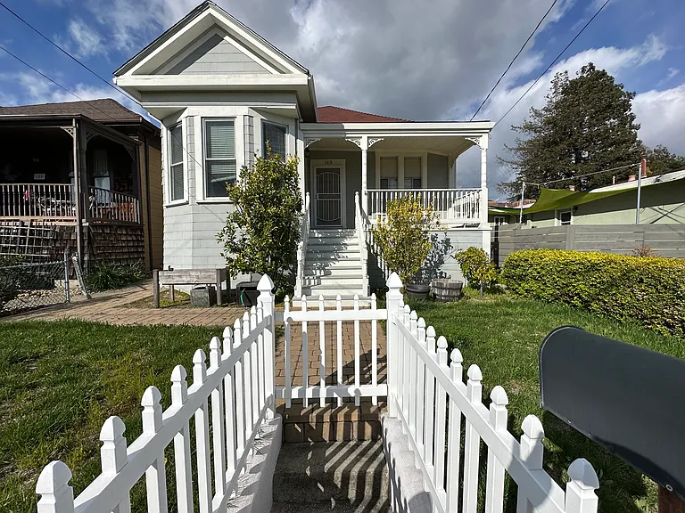
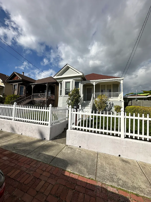
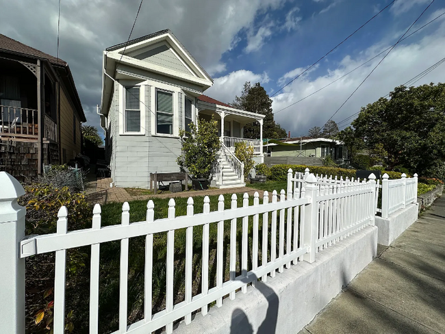
163 E I St
Benicia, CA 94510
-
Bedrooms
3
-
Bathrooms
2
-
Square Feet
1,350 sq ft
-
Available
Available Mar 1
Highlights
- Pets Allowed
- Hardwood Floors
- Fireplace
- Fenced Lot
- Security System
About This Home
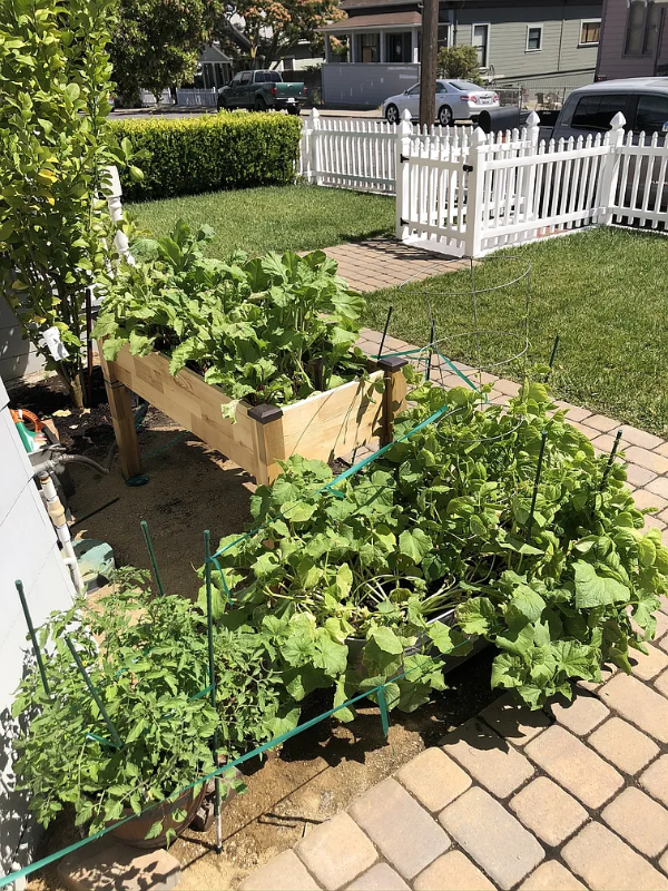
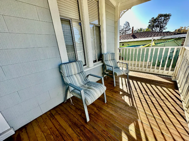
Property Id: 1758082 Welcome to this beautifully updated Queen Anne-style home just half a block from First Street! Enjoy the convenience of being within walking distance to restaurants, parks, baseball fields, schools, shopping, and Downtown Benicia events. Home Features: 3 Bedrooms | 2 Bathrooms Updated kitchen and great room Newer flooring throughout Primary suite with remodeled bathroom Fenced in backyard with spacious deck for enjoyment with large shade tree based on season. Central heat & A/C for year-round comfort Professionally maintained front & backyards (included in lease) Assigned off-street parking + additional street parking available Please Note: An in-law unit off the alley is a separate rental and utilities are shared in accordance with lease. Ask landlord for more information. - Minimum 1 year lease - Security deposit required (one month's rent) - One off street parking spot, street parking - Small pets allowed with pet deposit
163 E I St is a house located in Solano County and the 94510 ZIP Code. This area is served by the Benicia Unified attendance zone.
House Features
Washer/Dryer
Dishwasher
Hardwood Floors
Microwave
- Washer/Dryer
- Cable Ready
- Security System
- Fireplace
- Dishwasher
- Disposal
- Microwave
- Refrigerator
- Hardwood Floors
- Fenced Lot
- Lawn
Contact
- Listed by John Warring
- Phone Number (707) 716-5175
- Contact
-
Source

- Washer/Dryer
- Cable Ready
- Security System
- Fireplace
- Dishwasher
- Disposal
- Microwave
- Refrigerator
- Hardwood Floors
- Fenced Lot
- Lawn
Situated along the Carquinez Strait in the San Francisco Bay Area, Benicia is a scenic waterfront city rich in history, cultural amenities, and sweeping vistas. Benicia boasts an irresistible historic charm, especially in its quaint downtown area, which is brimming with one-of-a-kind shops, delectable eateries, and vibrant artists’ studios.
Founded in 1847, Benicia once served as California’s state capital for 13 months, and now touts the only state capitol building outside of Sacramento. Residents and visitors alike can uncover much of Benicia’s past at the Benicia Historical Museum.
Nearly 500 acres of parkland provides ample green space and tranquil trails for all kinds of outdoor recreation. Benicia’s thriving arts community creates a broad range of art, from glass art and sculptures to theatrical plays and music. Benicia’s friendly community comes together for a variety of events, like the Downtown Farmers Market, Opening Day on the Strait, and artist studio open houses.
Learn more about living in Benicia| Colleges & Universities | Distance | ||
|---|---|---|---|
| Colleges & Universities | Distance | ||
| Drive: | 19 min | 10.3 mi | |
| Drive: | 17 min | 10.9 mi | |
| Drive: | 23 min | 16.6 mi | |
| Drive: | 24 min | 17.3 mi |
Transportation options available in Benicia include North Concord Martinez Station, located 11.9 miles from 163 E I St. 163 E I St is near Metro Oakland International, located 38.7 miles or 50 minutes away, and San Francisco International, located 46.3 miles or 63 minutes away.
| Transit / Subway | Distance | ||
|---|---|---|---|
| Transit / Subway | Distance | ||
|
|
Drive: | 18 min | 11.9 mi |
|
|
Drive: | 19 min | 12.4 mi |
|
|
Drive: | 19 min | 13.8 mi |
|
|
Drive: | 20 min | 15.0 mi |
|
|
Drive: | 23 min | 18.3 mi |
| Commuter Rail | Distance | ||
|---|---|---|---|
| Commuter Rail | Distance | ||
|
|
Drive: | 11 min | 6.9 mi |
|
|
Drive: | 27 min | 21.3 mi |
|
|
Drive: | 31 min | 24.3 mi |
|
|
Drive: | 34 min | 26.1 mi |
|
|
Drive: | 36 min | 27.1 mi |
| Airports | Distance | ||
|---|---|---|---|
| Airports | Distance | ||
|
Metro Oakland International
|
Drive: | 50 min | 38.7 mi |
|
San Francisco International
|
Drive: | 63 min | 46.3 mi |
Time and distance from 163 E I St.
| Shopping Centers | Distance | ||
|---|---|---|---|
| Shopping Centers | Distance | ||
| Walk: | 10 min | 0.5 mi | |
| Drive: | 4 min | 1.6 mi | |
| Drive: | 4 min | 1.8 mi |
| Parks and Recreation | Distance | ||
|---|---|---|---|
| Parks and Recreation | Distance | ||
|
Benicia Capitol State Historic Park
|
Drive: | 4 min | 1.9 mi |
|
Benicia State Recreation Area
|
Drive: | 8 min | 3.5 mi |
|
Martinez Regional Shoreline
|
Drive: | 13 min | 6.3 mi |
|
Crockett Hills Regional Park
|
Drive: | 12 min | 8.4 mi |
|
Carquinez Strait Regional Shoreline
|
Drive: | 18 min | 10.6 mi |
| Hospitals | Distance | ||
|---|---|---|---|
| Hospitals | Distance | ||
| Drive: | 11 min | 7.2 mi | |
| Drive: | 12 min | 7.6 mi | |
| Drive: | 13 min | 8.3 mi |
| Military Bases | Distance | ||
|---|---|---|---|
| Military Bases | Distance | ||
| Drive: | 7 min | 3.6 mi | |
| Drive: | 17 min | 9.7 mi |
You May Also Like
What Are Walk Score®, Transit Score®, and Bike Score® Ratings?
Walk Score® measures the walkability of any address. Transit Score® measures access to public transit. Bike Score® measures the bikeability of any address.
What is a Sound Score Rating?
A Sound Score Rating aggregates noise caused by vehicle traffic, airplane traffic and local sources

163 E I St
Benicia, CA 94510