$4,800 / Month
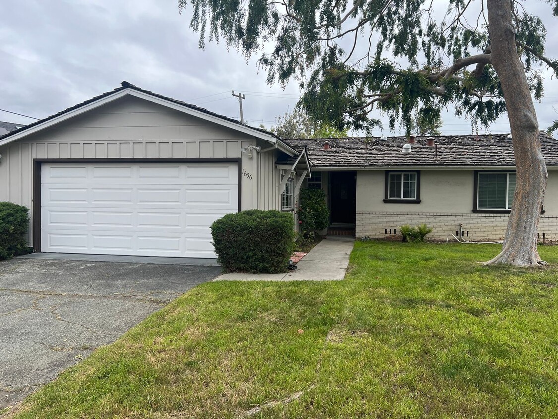
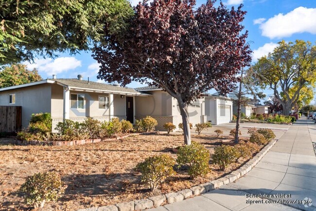
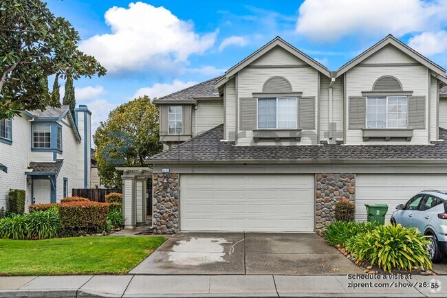
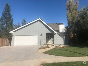
1656 Kennard Way
Sunnyvale, CA 94087
Today
Favorites
408-720-0920
-
Bedrooms
3
-
Bathrooms
2
-
Square Feet
1,250 sq ft
-
Available
Available May 5
1656 Kennard Way

Favorites
About This Home
$4,700 deposit,
Available May 5
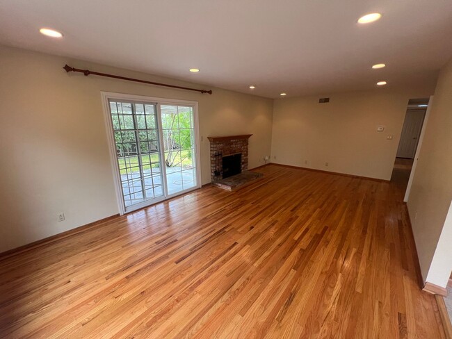
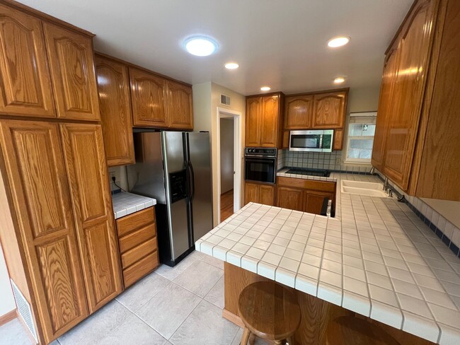
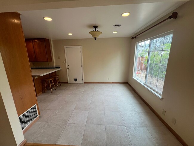
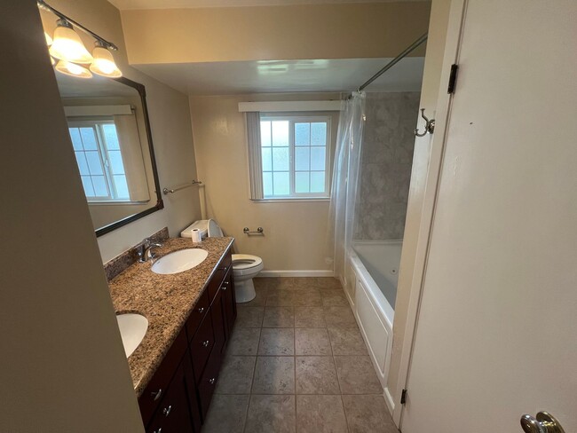
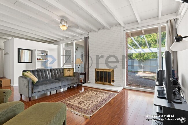
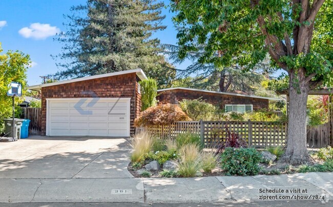
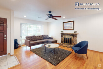
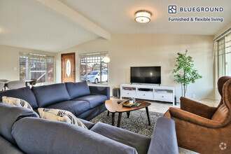
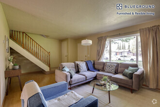
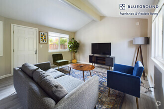
This beautiful home offers great natural light. Hardwood flooring throughout. Kitchen feature stainless steel appliances and lots of storage. Recessed lighting in living room and bedrooms. Large backyard ideal for outdoor dining and entertaining as well as ample space for additional gardening. This home is in proximity to/close to: 1 mile to Cupertino Village (Ranch 99, restaurants) and 2.5 miles Cupertino Main Street (Philz, Wanpo, restaurants). 2 miles to Kaiser hospital. Panama park and Ortega park. Apple Campus Cupertino Close to 85 and 280 This is a must-see! Parking 2 Car Garage Driveway Pets None Laundry W/D Inlcuded HVAC Central heating/AC Utilities: Tenant Pays All Utilities Schools(*Tenant to Verify*) Laurelwood Elementary Marian A. Peterson Middle School Adrian Wilcox High If this doesn’t quite meet your needs feel free to view our other available rentals at or give us a call at .
1656 Kennard Way is a house located in Santa Clara County and the 94087 ZIP Code.
* Price shown is base rent and may not include non-optional fees and utilities.
Price, availability, fees, and any applicable rent special are subject to change without notice.
* Square footage definitions vary. Displayed square footage is approximate.
Contact
- Listed by Altos Realty Advisors, Inc. | Altos Realty Advisors, Inc.
- Phone Number
- Contact
Location
Get Directions
Birdland Neighbors is a predominantly residential neighborhood in the southeast corner of Sunnyvale. Commonly referred to as Birdland, this neighborhood offers high-end rentals in a variety of styles, from quaint single-family houses to lavish apartments. Birdland has several excellent daycares and schools, a dinosaur themed-park, and a hospital nearby, so it’s an extremely family-friendly community.
Very few restaurants or commercial retailers exist in the neighborhood, but locals enjoy the peaceful retreat the neighborhood provides them and don’t have to travel far for more options. Located in Silicon Valley, this tree-lined suburban community is also an excellent choice for industry professionals seeking an easier commute to work. Birdland is only a 15-minute walk to Apple Park, the corporate headquarters of the famed tech company. Adding allure, Birdland Neighbors is also convenient to Downtown Sunnyvale and Downtown San Jose, which are both less than 15 minutes away.
Learn more about living in Birdland Neighbors
Education
| Colleges & Universities | Distance | ||
|---|---|---|---|
| Colleges & Universities | Distance | ||
| Drive: | 9 min | 3.7 mi | |
| Drive: | 12 min | 5.1 mi | |
| Drive: | 12 min | 6.3 mi | |
| Drive: | 15 min | 7.3 mi |
1656 Kennard Way is within 9 minutes or 3.7 miles from De Anza College. It is also near Santa Clara University and San Jose City College.
Transportation options available in Sunnyvale include Vienna Station, located 5.4 miles from 1656 Kennard Way. 1656 Kennard Way is near Norman Y Mineta San Jose International, located 5.6 miles or 12 minutes away, and San Francisco International, located 32.7 miles or 42 minutes away.
| Transit / Subway | Distance | ||
|---|---|---|---|
| Transit / Subway | Distance | ||
|
|
Drive: | 10 min | 5.4 mi |
|
|
Drive: | 12 min | 5.6 mi |
|
|
Drive: | 12 min | 5.7 mi |
|
|
Drive: | 11 min | 6.0 mi |
|
|
Drive: | 13 min | 6.2 mi |
| Commuter Rail | Distance | ||
|---|---|---|---|
| Commuter Rail | Distance | ||
| Drive: | 7 min | 3.5 mi | |
| Drive: | 8 min | 3.5 mi | |
| Drive: | 11 min | 4.9 mi | |
| Drive: | 12 min | 7.7 mi | |
| Drive: | 15 min | 8.0 mi |
| Airports | Distance | ||
|---|---|---|---|
| Airports | Distance | ||
|
Norman Y Mineta San Jose International
|
Drive: | 12 min | 5.6 mi |
|
San Francisco International
|
Drive: | 42 min | 32.7 mi |
Time and distance from 1656 Kennard Way.
| Shopping Centers | Distance | ||
|---|---|---|---|
| Shopping Centers | Distance | ||
| Walk: | 9 min | 0.5 mi | |
| Walk: | 15 min | 0.8 mi | |
| Drive: | 3 min | 1.1 mi |
1656 Kennard Way has 3 shopping centers within 1.1 miles, which is about a 3-minute walk. The miles and minutes will be for the farthest away property.
| Parks and Recreation | Distance | ||
|---|---|---|---|
| Parks and Recreation | Distance | ||
|
Fujitsu Planetarium
|
Drive: | 9 min | 3.7 mi |
|
Deer Hollow Farm
|
Drive: | 11 min | 5.4 mi |
|
Rancho San Antonio County Park
|
Drive: | 11 min | 5.5 mi |
|
McClellan Ranch Park
|
Drive: | 11 min | 5.8 mi |
|
Fremont Older Open Space Preserve
|
Drive: | 15 min | 6.7 mi |
1656 Kennard Way has 5 parks within 6.7 miles, including Fujitsu Planetarium, McClellan Ranch Park, and Deer Hollow Farm.
| Hospitals | Distance | ||
|---|---|---|---|
| Hospitals | Distance | ||
| Walk: | 14 min | 0.8 mi | |
| Drive: | 3 min | 1.3 mi | |
| Drive: | 12 min | 7.7 mi |
1656 Kennard Way has 3 hospitals within 7.7 miles, the nearest is Kaiser Permanente Psychiatric Health Facility - Santa Clara which is 0.8 mile away and a 14 minute walk.
| Military Bases | Distance | ||
|---|---|---|---|
| Military Bases | Distance | ||
| Drive: | 17 min | 9.7 mi |
1656 Kennard Way is 9.7 miles and a 17 minute drive from Ames Research Center.
You May Also Like
Similar Rentals Nearby
What Are Walk Score®, Transit Score®, and Bike Score® Ratings?
Walk Score® measures the walkability of any address. Transit Score® measures access to public transit. Bike Score® measures the bikeability of any address.
What is a Sound Score Rating?
A Sound Score Rating aggregates noise caused by vehicle traffic, airplane traffic and local sources

1656 Kennard Way
Sunnyvale, CA 94087