
$3,000 / Month
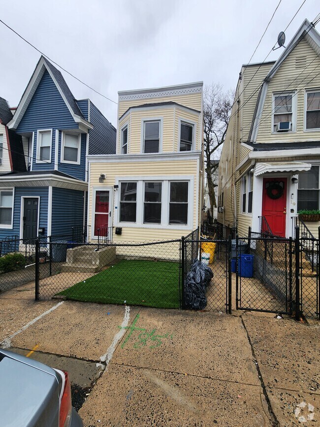
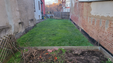
166 Starmond Ave
Clifton, NJ 07013
2 Weeks Ago
Favorites
166 Starmond Ave

Favorites
Check Back Soon for Upcoming Availability
| Beds | Baths | Average SF |
|---|---|---|
| 3 Bedrooms 3 Bedrooms 3 Br | 2.5 Baths 2.5 Baths 2.5 Ba | — |
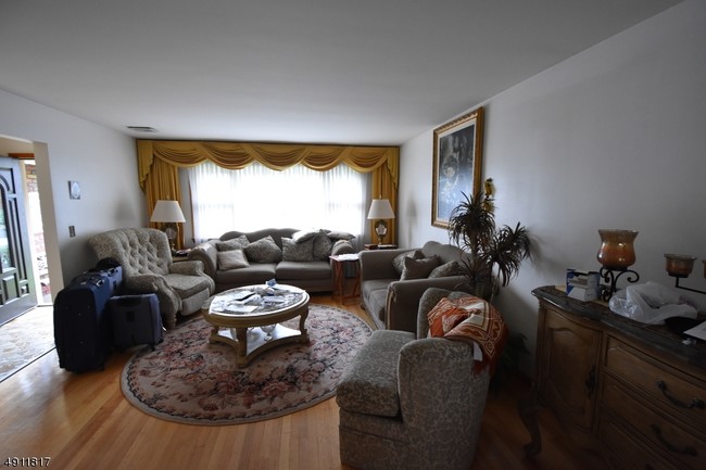
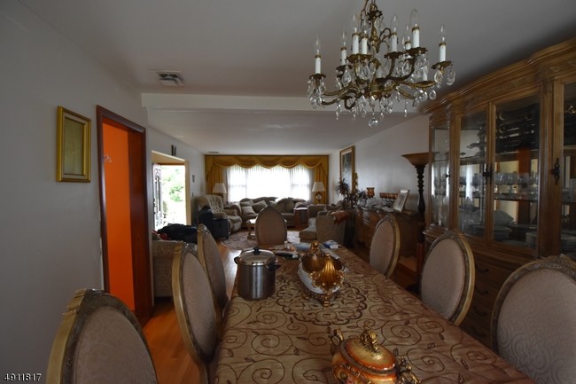
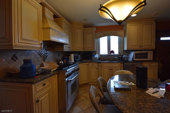
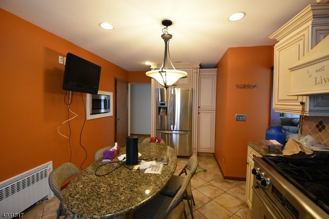
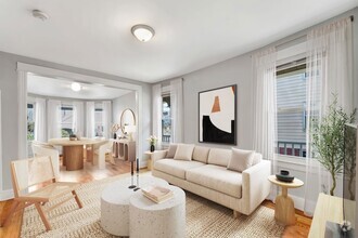
About This Property
PEACEFUL WHOLE HOME WITH LOTS OF LIGHT AND LOTS OF SPACE, INCLUDING A LARGE FINISHED BASEMENT WITH OPPORTUNITY FOR ADDL LIVING ARRANGEMENTS; STAINLESS APPLIANCES INCL. WASHER/DRYER AND MODERN TOUCHES
166 Starmond Ave is a house located in Passaic County and the 07013 ZIP Code. This area is served by the Clifton Public attendance zone.
House Features
- Air Conditioning
Fees and Policies
The fees below are based on community-supplied data and may exclude additional fees and utilities.
- Parking
-
Garage--
Location
Get Directions
Richfield is a charming neighborhood in the heart of Clifton. Residents enjoy a wide variety of apartments and houses available for rent in this tranquil locale. Montclair State University is just a short drive west of the neighborhood, making Richfield an attractive option for many students, faculty, and staff seeking a rental close to campus. The Garden State Parkway forms the neighborhood’s western border, connecting the community to countless amenities and employment opportunities in the area.
Learn more about living in RichfieldBelow are rent ranges for similar nearby apartments
Amenities
- Air Conditioning
Education
| Colleges & Universities | Distance | ||
|---|---|---|---|
| Colleges & Universities | Distance | ||
| Drive: | 6 min | 3.2 mi | |
| Drive: | 7 min | 3.4 mi | |
| Drive: | 10 min | 4.2 mi | |
| Drive: | 11 min | 5.0 mi |
166 Starmond Ave is within 7 minutes or 3.4 miles from Montclair State University. It is also near Passaic County C.C., Passaic and Berkeley College.
Schools


Public Elementary & Middle School
Grades K-8
446 Students
Nearby
Public Elementary School
Grades PK-5
401 Students
Nearby
Public Middle School
Grades 6-8
1,189 Students
Nearby
Public High School
Grades 9-12
3,059 Students
Attendance Zone
Private Elementary School
Grades K
145 Students
Nearby
Private Elementary & Middle School
Grades PK-8
134 Students
Nearby
School data provided by
 The GreatSchools Rating helps parents compare schools within a state based on a variety of school quality indicators and provides a helpful picture of how effectively each school serves all of its students. Ratings are on a scale of 1 (below average) to 10 (above average) and can include test scores, college readiness, academic progress, advanced courses, equity, discipline and attendance data. We also advise parents to visit schools, consider other information on school performance and programs, and consider family needs as part of the school selection process.
View GreatSchools Rating Methodology
View GreatSchools Rating Methodology
Transportation options available in Clifton include Grove Street, located 7.3 miles from 166 Starmond Ave. 166 Starmond Ave is near Newark Liberty International, located 16.7 miles or 21 minutes away, and Laguardia, located 26.9 miles or 40 minutes away.
| Transit / Subway | Distance | ||
|---|---|---|---|
| Transit / Subway | Distance | ||
|
|
Drive: | 12 min | 7.3 mi |
|
|
Drive: | 13 min | 7.6 mi |
|
|
Drive: | 13 min | 7.7 mi |
|
|
Drive: | 14 min | 8.1 mi |
|
|
Drive: | 13 min | 8.2 mi |
| Commuter Rail | Distance | ||
|---|---|---|---|
| Commuter Rail | Distance | ||
|
|
Walk: | 19 min | 1.0 mi |
|
|
Drive: | 5 min | 2.4 mi |
|
|
Drive: | 6 min | 3.1 mi |
|
|
Drive: | 7 min | 3.4 mi |
|
|
Drive: | 7 min | 3.8 mi |
| Airports | Distance | ||
|---|---|---|---|
| Airports | Distance | ||
|
Newark Liberty International
|
Drive: | 21 min | 16.7 mi |
|
Laguardia
|
Drive: | 40 min | 26.9 mi |
Time and distance from 166 Starmond Ave.
| Shopping Centers | Distance | ||
|---|---|---|---|
| Shopping Centers | Distance | ||
| Walk: | 14 min | 0.8 mi | |
| Walk: | 20 min | 1.1 mi | |
| Drive: | 4 min | 1.5 mi |
166 Starmond Ave has 3 shopping centers within 1.5 miles, which is about a 4-minute walk. The miles and minutes will be for the farthest away property.
| Parks and Recreation | Distance | ||
|---|---|---|---|
| Parks and Recreation | Distance | ||
|
Presby Memorial Iris Gardens
|
Drive: | 7 min | 3.5 mi |
|
Van Vleck House & Gardens
|
Drive: | 11 min | 5.5 mi |
|
Meadowlands Environment Center
|
Drive: | 18 min | 8.0 mi |
|
McDowell Observatory
|
Drive: | 18 min | 8.0 mi |
|
Richard W. DeKorte Park
|
Drive: | 18 min | 9.7 mi |
166 Starmond Ave has 5 parks within 9.7 miles, including Presby Memorial Iris Gardens, Van Vleck House & Gardens, and Meadowlands Environment Center.
| Hospitals | Distance | ||
|---|---|---|---|
| Hospitals | Distance | ||
| Drive: | 5 min | 2.5 mi | |
| Drive: | 6 min | 3.2 mi | |
| Drive: | 12 min | 7.5 mi |
166 Starmond Ave has 3 hospitals within 7.5 miles, the nearest is St. Mary's General Hospital which is 2.5 miles away and a 5 minute drive.
| Military Bases | Distance | ||
|---|---|---|---|
| Military Bases | Distance | ||
| Drive: | 30 min | 18.9 mi | |
| Drive: | 29 min | 21.2 mi |
166 Starmond Ave is 18.9 miles from Governors Island Support Center, and is convenient to other military bases, including Military Ocean Terminal.
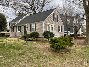
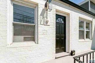
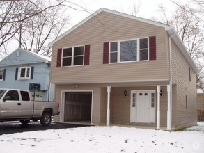
You May Also Like
Similar Rentals Nearby

What Are Walk Score®, Transit Score®, and Bike Score® Ratings?
Walk Score® measures the walkability of any address. Transit Score® measures access to public transit. Bike Score® measures the bikeability of any address.
What is a Sound Score Rating?
A Sound Score Rating aggregates noise caused by vehicle traffic, airplane traffic and local sources
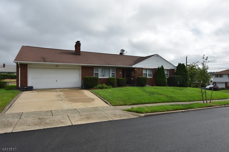
166 Starmond Ave
Clifton, NJ 07013