

$2,250 / Month
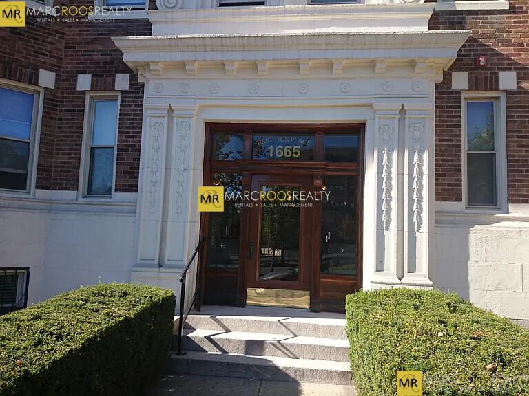
1665 Commonwealth Ave
Boston, MA 02135
Today
Favorites
617-236-8550
-
Bedrooms
1
-
Bathrooms
1
-
Square Feet
--
-
Available
Available Sep 1
Highlight
- Pets Allowed
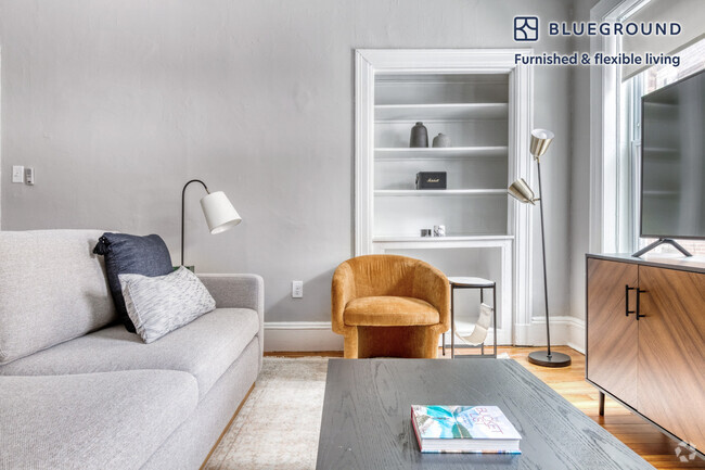
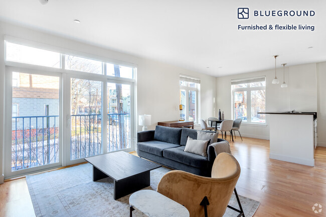
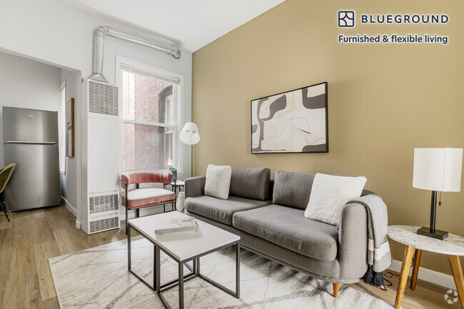
1665 Commonwealth Ave Unit 4

Favorites
About This Home
12 Month Lease
,
Available Sep 1
Located in the heart of sought after Brighton just minutes from shopping, dining, bars, nightlife, and much more! Awesome commuting location very close to Green Line B train to BC and Government Center! Convenient to the Green Line C & D trains, as well as many major MBTA bus routes. Very close to Boston College campus! Easy access by bus, bike, train, or foot to attractions such as St. Elizabeth's Medical Center, Chestnut Hill, Boston University, Cleveland Circle, Newton Center, Longwood Medical, Oak Square, Packard's Corner, Washington Square, Coolidge Corner, and more! Lovely area with public parks, country clubs, golf courses, reservoirs, ponds, and conservation areas close by! A great location to call home in beautiful Brighton!
1665 Commonwealth Ave is a condo located in Suffolk County and the 02135 ZIP Code.
* Price shown is base rent and may not include non-optional fees and utilities.
Price, availability, fees, and any applicable rent special are subject to change without notice.
* Square footage definitions vary. Displayed square footage is approximate.
Fees and Policies
The fees below are based on community-supplied data and may exclude additional fees and utilities.
- Dogs Allowed
-
Fees not specified
- Cats Allowed
-
Fees not specified
Details
Utilities Included
-
Heat
Lease Options
-
12 Months
Contact
- Listed by Marc Roos
- Phone Number (617) 236-8550
- Contact
Location
Get Directions
Expenses
Utilities Included
Heat
Included
Saint Elizabeth’s is a Brighton neighborhood situated about 10 miles away from Boston. Thanks to Saint Elizabeth’s top border sitting on Highway 20, commuting in and out of Brighton is easy. Some residents travel by car, but buses and railways make commuting via public transportation a breeze.
The neighborhood’s best amenities are two world-renowned hospitals, Saint Elizabeth’s Medical Center and Franciscan Children’s, that sit on the edge of town. Other great amenities of Saint Elizabeth’s include many local parks like Ringer Playground and Chestnut Hill Reservoir, which has great trails and greenspace. This neighborhood is also equipped with cozy coffee shops, restaurants serving international and American classics, and shopping plazas with grocers and convenience stores.
Saint Elizabeth’s has several rental options ranging from apartments to single-family homes.
Learn more about living in St Elizabeth's
Education
| Colleges & Universities | Distance | ||
|---|---|---|---|
| Colleges & Universities | Distance | ||
| Drive: | 4 min | 1.4 mi | |
| Drive: | 3 min | 1.5 mi | |
| Drive: | 5 min | 2.5 mi | |
| Drive: | 7 min | 3.0 mi |
1665 Commonwealth Ave Unit 4 is within 4 minutes or 1.4 miles from Boston College, Brighton. It is also near Boston College and Boston University.
Transportation options available in Boston include Sutherland Street Station, located 0.2 mile from 1665 Commonwealth Ave Unit 4. 1665 Commonwealth Ave Unit 4 is near General Edward Lawrence Logan International, located 9.6 miles or 17 minutes away.
| Transit / Subway | Distance | ||
|---|---|---|---|
| Transit / Subway | Distance | ||
|
|
Walk: | 3 min | 0.2 mi |
|
|
Walk: | 4 min | 0.2 mi |
|
|
Walk: | 8 min | 0.4 mi |
|
|
Walk: | 11 min | 0.6 mi |
|
|
Walk: | 12 min | 0.7 mi |
| Commuter Rail | Distance | ||
|---|---|---|---|
| Commuter Rail | Distance | ||
|
|
Drive: | 7 min | 3.7 mi |
|
|
Drive: | 8 min | 3.8 mi |
|
|
Drive: | 8 min | 3.8 mi |
| Drive: | 9 min | 4.6 mi | |
|
|
Drive: | 10 min | 5.2 mi |
| Airports | Distance | ||
|---|---|---|---|
| Airports | Distance | ||
|
General Edward Lawrence Logan International
|
Drive: | 17 min | 9.6 mi |
Time and distance from 1665 Commonwealth Ave Unit 4.
| Shopping Centers | Distance | ||
|---|---|---|---|
| Shopping Centers | Distance | ||
| Walk: | 6 min | 0.3 mi | |
| Walk: | 13 min | 0.7 mi | |
| Drive: | 5 min | 1.6 mi |
1665 Commonwealth Ave Unit 4 has 3 shopping centers within 1.6 miles, which is about a 5-minute drive. The miles and minutes will be for the farthest away property.
| Parks and Recreation | Distance | ||
|---|---|---|---|
| Parks and Recreation | Distance | ||
|
Chestnut Hill Reservation
|
Walk: | 13 min | 0.7 mi |
|
John Fitzgerald Kennedy National Historic Site
|
Drive: | 4 min | 1.9 mi |
|
Frederick Law Olmsted National Historic Site
|
Drive: | 5 min | 2.3 mi |
|
Hammond Pond Reservation
|
Drive: | 5 min | 2.6 mi |
|
Coit Observatory
|
Drive: | 6 min | 2.9 mi |
1665 Commonwealth Ave Unit 4 has 5 parks within 2.9 miles, including Chestnut Hill Reservation, John Fitzgerald Kennedy National Historic Site, and Frederick Law Olmsted National Historic Site.
| Hospitals | Distance | ||
|---|---|---|---|
| Hospitals | Distance | ||
| Walk: | 13 min | 0.7 mi | |
| Walk: | 15 min | 0.8 mi | |
| Drive: | 3 min | 1.9 mi |
1665 Commonwealth Ave Unit 4 has 3 hospitals within 1.9 miles, the nearest is Franciscan Children's Hospital & Rehab Center which is 0.7 mile away and a 13 minutes drive.
| Military Bases | Distance | ||
|---|---|---|---|
| Military Bases | Distance | ||
| Drive: | 28 min | 12.9 mi | |
| Drive: | 23 min | 13.3 mi |
1665 Commonwealth Ave Unit 4 is 12.9 miles from Hanscom Air Force Base, and is convenient to other military bases, including US Military Reservation.
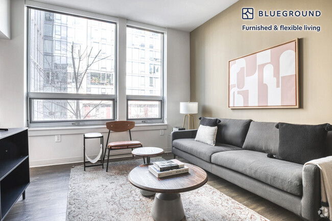
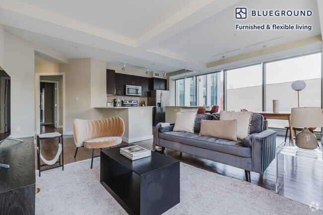
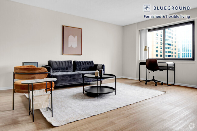
You May Also Like
Similar Rentals Nearby
What Are Walk Score®, Transit Score®, and Bike Score® Ratings?
Walk Score® measures the walkability of any address. Transit Score® measures access to public transit. Bike Score® measures the bikeability of any address.
What is a Sound Score Rating?
A Sound Score Rating aggregates noise caused by vehicle traffic, airplane traffic and local sources
1665 Commonwealth Ave
Boston, MA 02135