$3,520 / Month
1670 El Camino Real
Menlo Park, CA 94025
2 Weeks Ago
Favorites
1670 El Camino Real

Favorites
Check Back Soon for Upcoming Availability
| Beds | Baths | Average SF |
|---|---|---|
| 1 Bedroom 1 Bedroom 1 Br | 1 Bath 1 Bath 1 Ba | — |
About This Property
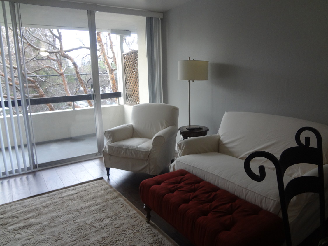
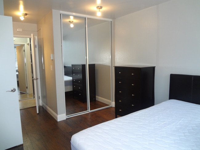
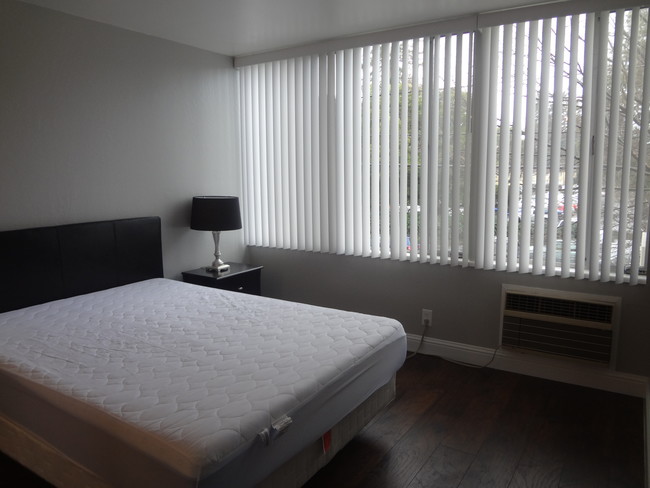
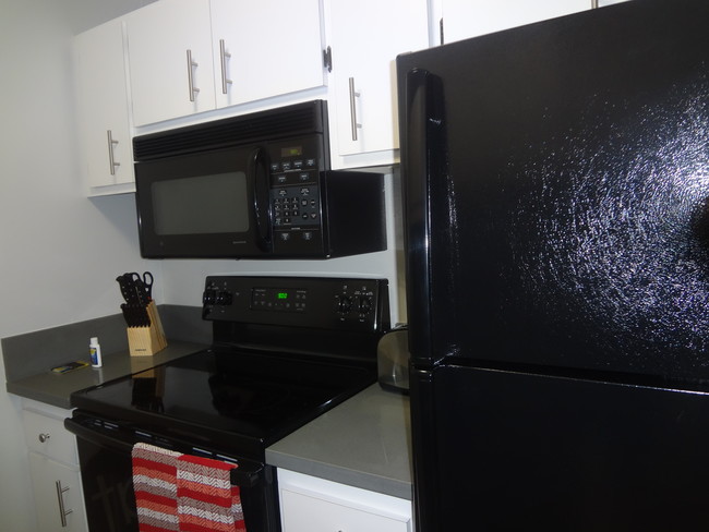
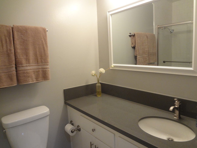
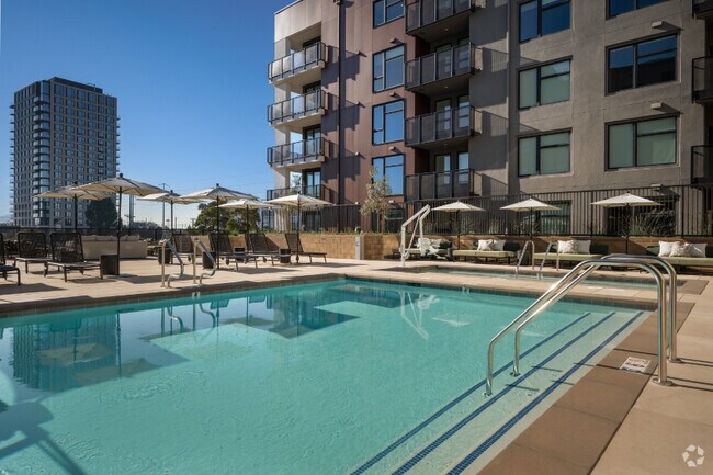
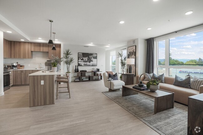
Ref: 378755 HomeSuite is a furnished housing provider where on-demand housing meets concierge level service. Contact us today to book your dream rental. Toll free: (800) 953-0586 Email: sales_support@yourhomesuite.com All HomeSuite properties come fully-furnished and have at least a 30 day minimum lease term (see below for minimum lease term of this specific unit) Prices subject to change for different lengths of stay or times of the year. Please inquire with more details to get a quote. Additional Property Information Below: Move In Date: 2017-05-22 Utilities: 0 Tenant Pays Utilities: No Minimum Lease: 0 months Maximum Lease: 12 months Deposit: 1000 Cable: No Internet: Yes Electricity/Gas: No Heat: Yes Parking: Parking Type Furniture Alteration: Maximum Occupants: 3 Laundry: Laundry Type Pets: Cat Friendly, Dog Friendly, Pets Considered You'll love to call this apartment home. Located 3 blocks from the Menlo Park Cal Train station, and a short stroll from downtown Menlo Park and Stanford University, this location simply cannot be beat. The apartment itself is well apportioned with everything you need to live comfortably, including all linens and housewares. The apartment also features air conditioning and a private balcony. Our apartment community features a gym, sprawling swimming pool, and gated/secured access, as well as several laundry facilities on-site. We have full time on-site management & maintenance personnel.
1670 El Camino Real is an apartment community located in San Mateo County and the 94025 ZIP Code.
Location
Get Directions
Minutes north of the Stanford University campus and just a couple blocks from the 101, Lindenwood is a charming suburban community offering something for all walks of life. The local division of the Palo Alto VA Hospital sits just a few blocks east of the neighborhood, making it a highly convenient location for healthcare professional.
Trees and greenery surround you everywhere in the neighborhood, particularly in public recreation areas like Flood Park and Holbrook-Palmer Park, which feature networks of trails that are perfect for jogging or just a leisurely stroll through the foliage. Numerous public and private schools can be found throughout the community and just beyond, giving students the option to walk to class easily.
In addition to the local bus system, rail service from Menlo Park Station makes it easy to get to work without a personal vehicle – be sure to grab a cup of coffee at Café Borrone before you catch your train.
Learn more about living in LindenwoodBelow are rent ranges for similar nearby apartments
Education
| Colleges & Universities | Distance | ||
|---|---|---|---|
| Colleges & Universities | Distance | ||
| Walk: | 4 min | 0.3 mi | |
| Drive: | 10 min | 3.9 mi | |
| Drive: | 14 min | 6.3 mi | |
| Drive: | 16 min | 9.1 mi |
1670 El Camino Real is within 4 minutes or 0.3 mile from Menlo College. It is also near Stanford University and Canada College.
Transportation options available in Menlo Park include Bayshore/Nasa Station, located 11.5 miles from 1670 El Camino Real. 1670 El Camino Real is near San Francisco International, located 18.5 miles or 26 minutes away, and Norman Y Mineta San Jose International, located 19.0 miles or 26 minutes away.
| Transit / Subway | Distance | ||
|---|---|---|---|
| Transit / Subway | Distance | ||
|
|
Drive: | 17 min | 11.5 mi |
|
|
Drive: | 17 min | 11.8 mi |
|
|
Drive: | 18 min | 12.0 mi |
|
|
Drive: | 18 min | 12.1 mi |
|
|
Drive: | 18 min | 12.4 mi |
| Commuter Rail | Distance | ||
|---|---|---|---|
| Commuter Rail | Distance | ||
| Walk: | 13 min | 0.7 mi | |
| Drive: | 5 min | 2.0 mi | |
| Drive: | 7 min | 3.0 mi | |
| Drive: | 9 min | 3.8 mi | |
| Drive: | 12 min | 5.1 mi |
| Airports | Distance | ||
|---|---|---|---|
| Airports | Distance | ||
|
San Francisco International
|
Drive: | 26 min | 18.5 mi |
|
Norman Y Mineta San Jose International
|
Drive: | 26 min | 19.0 mi |
Time and distance from 1670 El Camino Real.
| Shopping Centers | Distance | ||
|---|---|---|---|
| Shopping Centers | Distance | ||
| Walk: | 13 min | 0.7 mi | |
| Walk: | 16 min | 0.9 mi | |
| Walk: | 17 min | 0.9 mi |
1670 El Camino Real has 3 shopping centers within 0.9 mile, which is about a 17-minute walk. The miles and minutes will be for the farthest away property.
| Parks and Recreation | Distance | ||
|---|---|---|---|
| Parks and Recreation | Distance | ||
|
Holbrook-Palmer Park
|
Walk: | 12 min | 0.6 mi |
|
Fremont Park
|
Drive: | 3 min | 1.2 mi |
|
Jack W. Lyle Park
|
Drive: | 4 min | 1.7 mi |
|
Burgess Park
|
Drive: | 5 min | 1.7 mi |
|
El Palo Alto Park
|
Drive: | 6 min | 2.0 mi |
1670 El Camino Real has 5 parks within 2.0 miles, including Holbrook-Palmer Park, Fremont Park, and Burgess Park.
| Hospitals | Distance | ||
|---|---|---|---|
| Hospitals | Distance | ||
| Drive: | 7 min | 2.6 mi | |
| Drive: | 7 min | 3.0 mi | |
| Drive: | 7 min | 3.1 mi |
1670 El Camino Real has 3 hospitals within 3.1 miles, the nearest is Lucile Salter Packard Children's Hospital at Stanford which is 2.6 miles away and a 7 minute drive.
| Military Bases | Distance | ||
|---|---|---|---|
| Military Bases | Distance | ||
| Drive: | 20 min | 11.9 mi |
1670 El Camino Real is 11.9 miles and a 20 minute drive from Ames Research Center.
You May Also Like
Similar Rentals Nearby


What Are Walk Score®, Transit Score®, and Bike Score® Ratings?
Walk Score® measures the walkability of any address. Transit Score® measures access to public transit. Bike Score® measures the bikeability of any address.
What is a Sound Score Rating?
A Sound Score Rating aggregates noise caused by vehicle traffic, airplane traffic and local sources

1670 El Camino Real
Menlo Park, CA 94025