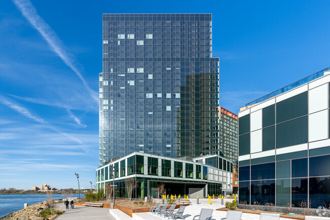
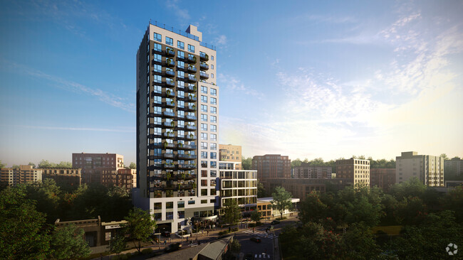
171 Meserole St
171 Meserole St,
Brooklyn,
NY
11206
2 Weeks Ago
Favorites
171 Meserole St

Favorites
Check Back Soon for Upcoming Availability
About 171 Meserole St Brooklyn, NY 11206
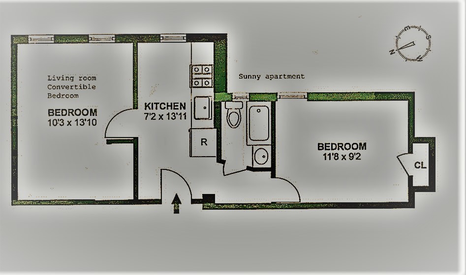
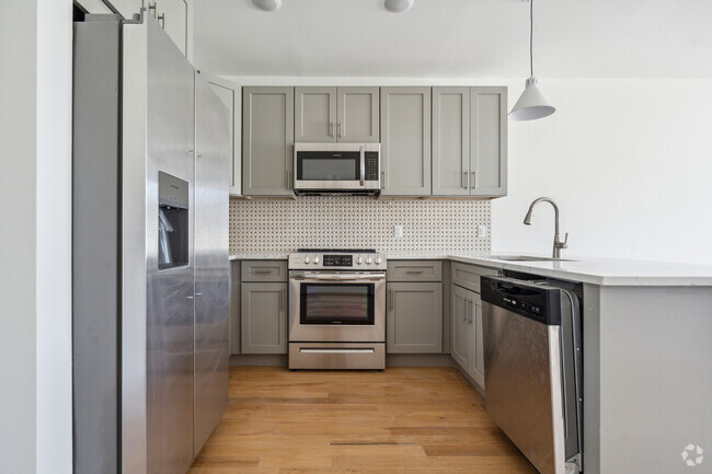
Converted 2 bedroom apt has a clever floor plan & high ceilings.Separate windowed eat-in kitchen. Windows in every room,lots of sunlight-including bathroom.EASY 1 block walk to L train.(Montrose Ave station)Live-in super.Easy Application-Contact Jason to Schedule A Viewing & Info.
171 Meserole St is an apartment community located in Kings County and the 11206 ZIP Code.
Apartment Features
- Eat-in Kitchen
- Kitchen
- Laundry Facilities
- Gated
Fees and Policies
The fees below are based on community-supplied data and may exclude additional fees and utilities.
- Dogs Allowed
-
Fees not specified
- Cats Allowed
-
Fees not specified
- Parking
-
Street--
Details
Lease Options
-
12 Months
Location
Get Directions
Nestled on the banks of the East River, Williamsburg’s nightlife scene glows just as bright as its art culture. Artists first moved to the area in the 1970s because of its affordability compared to surrounding areas, such as Manhattan. The neighborhood also offers larger homes, and direct access to transportation. In addition, the art community is alive and thriving, with local gallery favorites such as Front Room Gallery and Greenpoint.
To discover whether you should move to Williamsburg, find out what the neighborhood is all about. This area’s energy is unmatched, especially since the neighborhood has become a mecca for the creatives throughout the city. The luxury apartments in Williamsburg are surrounded by exceptional restaurants from authentic takeout to tapas to Michelin-rated fine dining. Longstanding spots like the Brooklyn Brewery have been providing residents with chilled pints since 1988.
Learn more about living in WilliamsburgBelow are rent ranges for similar nearby apartments
Amenities
- Eat-in Kitchen
- Kitchen
- Laundry Facilities
- Gated
Education
| Colleges & Universities | Distance | ||
|---|---|---|---|
| Colleges & Universities | Distance | ||
| Drive: | 7 min | 2.1 mi | |
| Drive: | 7 min | 2.3 mi | |
| Drive: | 8 min | 3.0 mi | |
| Drive: | 9 min | 3.0 mi |
171 Meserole St is within 7 minutes or 2.1 miles from Pratt Institute. It is also near Saint Joseph's Coll, Brooklyn and City Tech - CUNY.
Transportation options available in Brooklyn include Montrose Avenue, located 0.2 mile from 171 Meserole St. 171 Meserole St is near Laguardia, located 7.4 miles or 15 minutes away, and John F Kennedy International, located 12.9 miles or 23 minutes away.
| Transit / Subway | Distance | ||
|---|---|---|---|
| Transit / Subway | Distance | ||
|
|
Walk: | 3 min | 0.2 mi |
|
|
Walk: | 6 min | 0.4 mi |
|
|
Walk: | 9 min | 0.5 mi |
|
|
Walk: | 11 min | 0.6 mi |
|
|
Walk: | 11 min | 0.6 mi |
| Commuter Rail | Distance | ||
|---|---|---|---|
| Commuter Rail | Distance | ||
|
|
Drive: | 8 min | 2.6 mi |
|
|
Drive: | 9 min | 2.8 mi |
|
|
Drive: | 10 min | 3.1 mi |
|
|
Drive: | 10 min | 3.5 mi |
|
|
Drive: | 9 min | 3.6 mi |
| Airports | Distance | ||
|---|---|---|---|
| Airports | Distance | ||
|
Laguardia
|
Drive: | 15 min | 7.4 mi |
|
John F Kennedy International
|
Drive: | 23 min | 12.9 mi |
Time and distance from 171 Meserole St.
| Shopping Centers | Distance | ||
|---|---|---|---|
| Shopping Centers | Distance | ||
| Drive: | 4 min | 1.4 mi | |
| Drive: | 6 min | 2.6 mi | |
| Drive: | 6 min | 2.6 mi |
171 Meserole St has 3 shopping centers within 2.6 miles, which is about a 6-minute drive. The miles and minutes will be for the farthest away property.
| Parks and Recreation | Distance | ||
|---|---|---|---|
| Parks and Recreation | Distance | ||
|
Martinez Playground
|
Walk: | 3 min | 0.2 mi |
|
Sternberg Park
|
Walk: | 6 min | 0.3 mi |
|
McCarren Park
|
Drive: | 4 min | 1.4 mi |
|
Maria Hernandez Park
|
Drive: | 5 min | 1.5 mi |
|
Hattie Carthan Garden
|
Drive: | 6 min | 1.9 mi |
171 Meserole St has 5 parks within 1.9 miles, including Martinez Playground, Sternberg Park, and Maria Hernandez Park.
| Hospitals | Distance | ||
|---|---|---|---|
| Hospitals | Distance | ||
| Walk: | 11 min | 0.6 mi | |
| Drive: | 6 min | 2.2 mi | |
| Drive: | 9 min | 2.8 mi |
171 Meserole St has 3 hospitals within 2.8 miles, the nearest is Woodhull Medical & Mental Health Center which is 0.6 mile away and a 11 minute walk.
| Military Bases | Distance | ||
|---|---|---|---|
| Military Bases | Distance | ||
| Drive: | 17 min | 6.6 mi | |
| Drive: | 26 min | 12.8 mi |
171 Meserole St is 6.6 miles from Governors Island Support Center, and is convenient to other military bases, including Military Ocean Terminal.
You May Also Like
Similar Rentals Nearby


What Are Walk Score®, Transit Score®, and Bike Score® Ratings?
Walk Score® measures the walkability of any address. Transit Score® measures access to public transit. Bike Score® measures the bikeability of any address.
What is a Sound Score Rating?
A Sound Score Rating aggregates noise caused by vehicle traffic, airplane traffic and local sources