

$1,800 / Month
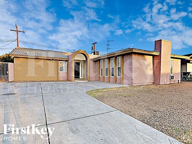
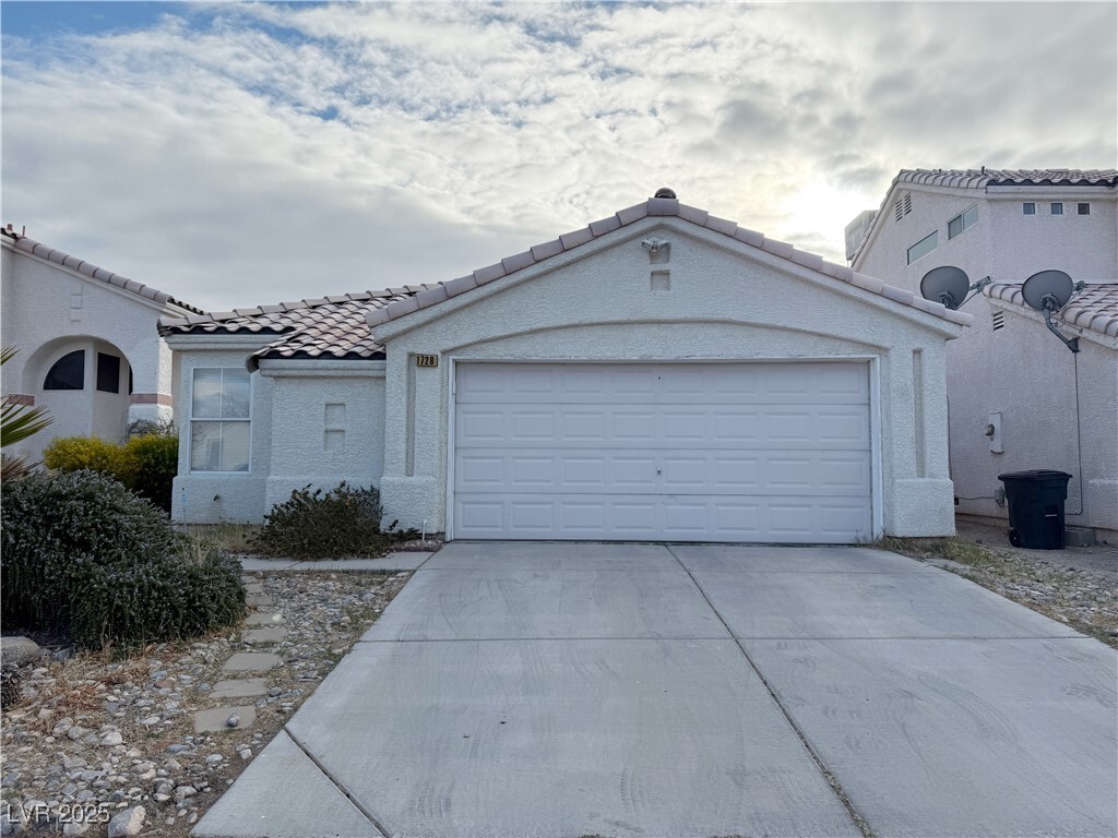
1728 Leaning Pine Way
Las Vegas, NV 89128
Today
Favorites
702-683-0888
-
Bedrooms
2
-
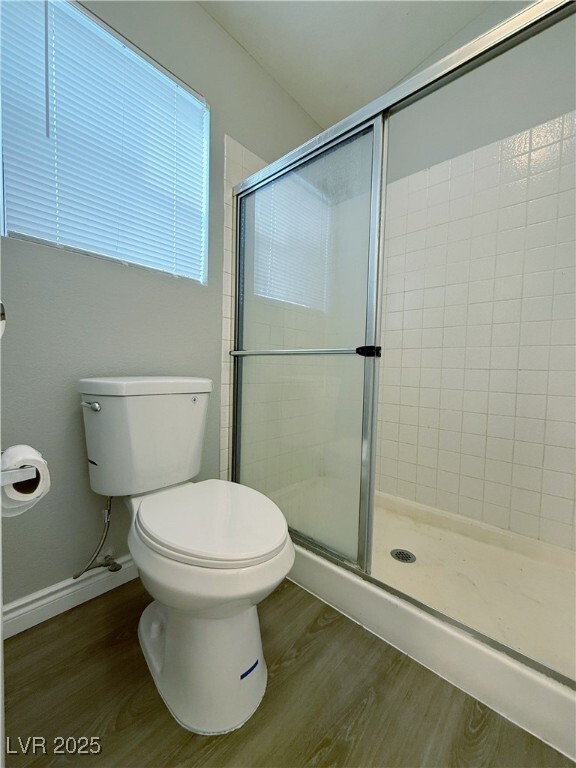
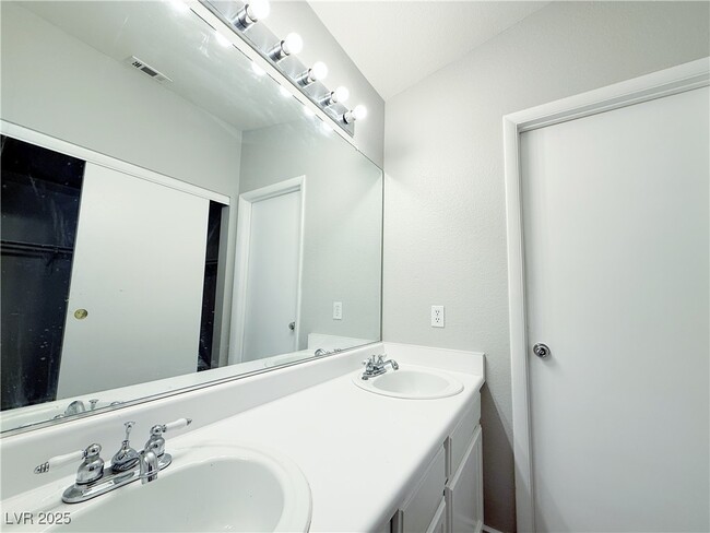
Bathrooms
2
-
Square Feet
1,322 sq ft
-
Available
Available Now
Highlights
- Community Basketball Court
- 2 Car Attached Garage
- Refrigerated Cooling System
- Ceramic Tile Flooring
- Central Heating and Cooling System
- Ceiling Fan
1728 Leaning Pine Way

Favorites
About This Home
Available Now
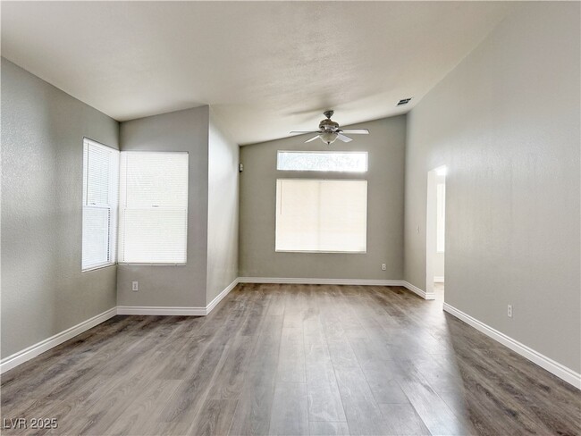
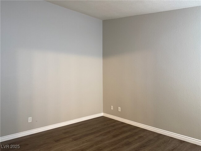
Charming single-story bungalow in the Northwest featuring vaulted ceilings throughout, offering a spacious and airy feel. This home includes 2 bedrooms, plus a den that could easily be converted into a 3rd bedroom. The eat-in kitchen and dining/living room combination provide great space for casual and formal occasions. All appliances are included, making it move-in ready. Enjoy easy access to US 95, nearby schools, shopping, and a variety of restaurants. The front yard is low-maintenance, and the backyard is a blank canvas waiting for your personal touch to create your dream garden. This home offers comfortable living in a convenient location—come see it today!
1728 Leaning Pine Way is a house located in Clark County and the 89128 ZIP Code. This area is served by the Clark County attendance zone.
* Price shown is base rent and may not include non-optional fees and utilities.
Price, availability, fees, and any applicable rent special are subject to change without notice.
* Square footage definitions vary. Displayed square footage is approximate.
Home Details
Home Type
Single Family Detached Home
Year Built
Built in 1991
Bedrooms and Bathrooms
2 Full Bathrooms
2 Bedrooms
Flooring
Linoleum
Ceramic Tile
Laminate
Vinyl
Home Design
Pitched Roof
Tile Roof
Stucco
Frame Construction
Interior Spaces
Ceiling Fan
1,322 Sq Ft Home
1-Story Property
Blinds
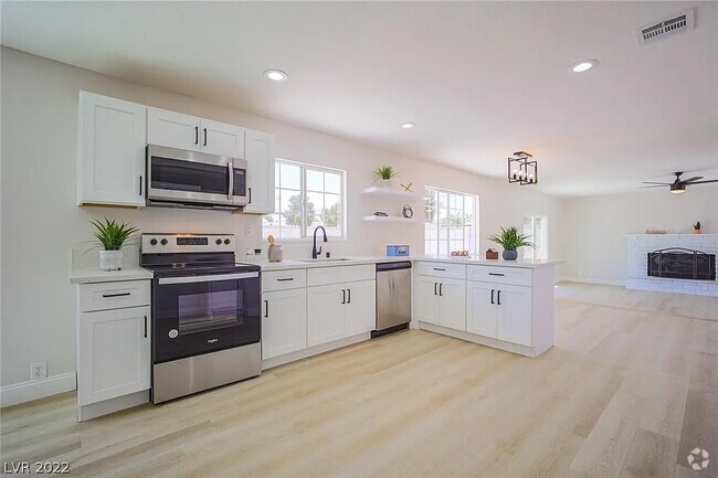
Kitchen
Gas Range
Microwave
Dishwasher
Disposal
Laundry
Washer and Dryer
Laundry on main level
Listing and Financial Details
Security Deposit $1,700
Property Available on 3/13/25
12 Month Lease Term
Tenant pays for cable TV, electricity, gas, grounds care, sewer, trash collection, water
The owner pays for association fees
Lot Details
3,920 Sq Ft Lot
West Facing Home
Back Yard Fenced
Block Wall Fence
Parking
2 Car Attached Garage
Schools
Mcmillian Elementary School
Becker Middle School
Cimarron-Memorial High School
Utilities
Refrigerated Cooling System
Central Heating and Cooling System
Heating System Uses Gas
Cable TV Available
Community Details
Overview
No Home Owners Association
Tenaya East #1B By Lewis Homes Subdivision
Pet Policy
Pets allowed on a case-by-case basis
Pet Deposit $500
Recreation
Community Basketball Court
Contact
- Listed by Huong Dam-Nardelli | Coldwell Banker Premier
- Phone Number
- Website View Property Website
- Contact
-
Source
 Greater Las Vegas Association of REALTORS®
©2025 Greater Las Vegas Association of REALTORS®. All rights reserved.
$2,017 / month
$334,900 Listing Price
2 Beds
•2.5 Baths
•
1,114 Sq Ft
$1,905 / month
$330,000 Listing Price
4 Beds
•3 Baths
•
1,768 Sq Ft
$2,040 / month
$339,900 Listing Price
4 Beds
•2.5 Baths
•
1,669 Sq Ft
Location
Get Directions
Amenities
- Washer/Dryer
- Air Conditioning
- Ceiling Fans
- Dishwasher
- Disposal
- Microwave
- Range
- Refrigerator
- Tile Floors
- Vinyl Flooring
Summerlin sits approximately ten miles west of downtown Las Vegas, nestled right where the cityscape begins to give way to the Spring Mountains and the Red Rock Canyon National Reserve. With the close proximity to the city center, gorgeous views of the mountains, and swanky houses filling the landscape, Summerlin has a reputation as one of the most affluent communities in Nevada.
It’s easy to stay active and take advantage of the Nevada sunshine here: in addition to the hiking, biking, and camping offered by the adjacent wilderness, the neighborhood includes dozens of public parks, golf courses, and sports fields within its bounds, including an award-winning trail system.
While mostly a residential neighborhood, several shopping centers and restaurants are scattered throughout Summerlin, giving residents the convenience of being able to walk down the street for groceries or a bite to eat in many cases.
Learn more about living in Summerlin
Education
| Colleges & Universities | Distance | ||
|---|---|---|---|
| Colleges & Universities | Distance | ||
| Drive: | 8 min | 3.6 mi | |
| Drive: | 12 min | 7.1 mi | |
| Drive: | 18 min | 11.7 mi | |
| Drive: | 22 min | 12.0 mi |
1728 Leaning Pine Way is within 8 minutes or 3.6 miles from Southern Nevada, Charleston. It is also near Nev. State Coll., Shadow Lane and Southern Nevada, Cheyenne.
Schools


Public Elementary School
Grades PK-5
526 Students
Attendance Zone
Public Elementary School
Grades PK-5
572 Students
Attendance Zone
Public Middle School
Grades 6-8
1,127 Students
Attendance Zone
Public High School
Grades 9-12
2,503 Students
Attendance Zone
Private Elementary School
Grades PK-2
Nearby
Private Elementary, Middle & High School
Grades K-12
153 Students
Nearby
School data provided by
 The GreatSchools Rating helps parents compare schools within a state based on a variety of school quality indicators and provides a helpful picture of how effectively each school serves all of its students. Ratings are on a scale of 1 (below average) to 10 (above average) and can include test scores, college readiness, academic progress, advanced courses, equity, discipline and attendance data. We also advise parents to visit schools, consider other information on school performance and programs, and consider family needs as part of the school selection process.
View GreatSchools Rating Methodology
View GreatSchools Rating Methodology
Transportation options available in Las Vegas include Sahara Station, located 9.0 miles from 1728 Leaning Pine Way. 1728 Leaning Pine Way is near Harry Reid International, located 13.3 miles or 24 minutes away, and Boulder City Municipal, located 33.2 miles or 43 minutes away.
| Transit / Subway | Distance | ||
|---|---|---|---|
| Transit / Subway | Distance | ||
|
|
Drive: | 15 min | 9.0 mi |
|
|
Drive: | 17 min | 9.4 mi |
|
|
Drive: | 16 min | 9.6 mi |
|
|
Drive: | 18 min | 10.2 mi |
|
|
Drive: | 18 min | 10.8 mi |
| Airports | Distance | ||
|---|---|---|---|
| Airports | Distance | ||
|
Harry Reid International
|
Drive: | 24 min | 13.3 mi |
|
Boulder City Municipal
|
Drive: | 43 min | 33.2 mi |
Time and distance from 1728 Leaning Pine Way.
| Shopping Centers | Distance | ||
|---|---|---|---|
| Shopping Centers | Distance | ||
| Walk: | 7 min | 0.4 mi | |
| Walk: | 8 min | 0.4 mi | |
| Walk: | 9 min | 0.5 mi |
1728 Leaning Pine Way has 3 shopping centers within 0.5 mile, which is about a 9-minute walk. The miles and minutes will be for the farthest away property.
| Parks and Recreation | Distance | ||
|---|---|---|---|
| Parks and Recreation | Distance | ||
|
Springs Preserve
|
Drive: | 9 min | 4.9 mi |
|
Spring Mountains National Recreation Area
|
Drive: | 9 min | 5.2 mi |
|
DISCOVERY Children's Museum
|
Drive: | 12 min | 8.0 mi |
|
Las Vegas Natural History Museum
|
Drive: | 11 min | 8.0 mi |
|
Old Las Vegas Mormon State Historic Park
|
Drive: | 12 min | 8.1 mi |
1728 Leaning Pine Way has 5 parks within 8.1 miles, including Springs Preserve, Spring Mountains National Recreation Area, and Las Vegas Natural History Museum.
| Hospitals | Distance | ||
|---|---|---|---|
| Hospitals | Distance | ||
| Drive: | 5 min | 1.9 mi | |
| Drive: | 7 min | 3.6 mi | |
| Drive: | 8 min | 5.0 mi |
1728 Leaning Pine Way has 3 hospitals within 5.0 miles, the nearest is Mountainview Hospital which is 1.9 miles away and a 5 minute drive.
| Military Bases | Distance | ||
|---|---|---|---|
| Military Bases | Distance | ||
| Drive: | 32 min | 17.2 mi |
1728 Leaning Pine Way is 17.2 miles and a 32 minute drive from Nellis Air Force Base.
You May Also Like
Similar Rentals Nearby


What Are Walk Score®, Transit Score®, and Bike Score® Ratings?
Walk Score® measures the walkability of any address. Transit Score® measures access to public transit. Bike Score® measures the bikeability of any address.
What is a Sound Score Rating?
A Sound Score Rating aggregates noise caused by vehicle traffic, airplane traffic and local sources
1728 Leaning Pine Way
Las Vegas, NV 89128