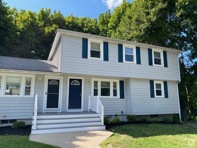
$1,500 / Month
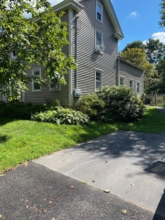
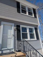
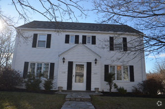
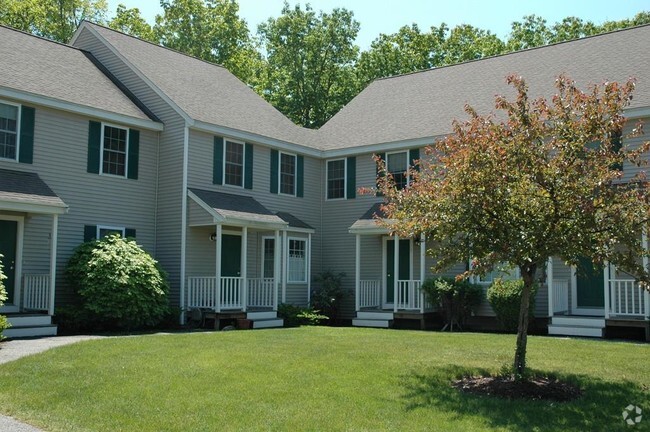
18 West St
Westborough, MA 01581
2 Weeks Ago
Favorites
18 West St

Favorites
Check Back Soon for Upcoming Availability
| Beds | Baths | Average SF |
|---|---|---|
| 1 Bedroom 1 Bedroom 1 Br | 1 Bath 1 Bath 1 Ba | 800 SF |
About This Property
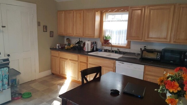
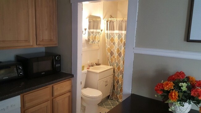
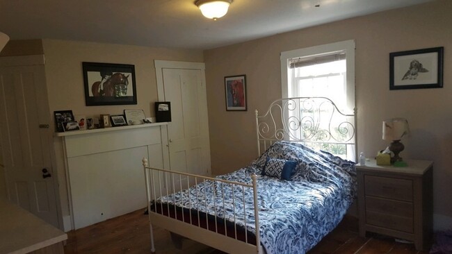
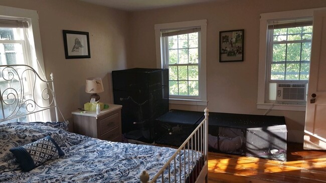
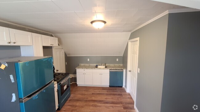
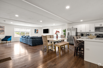
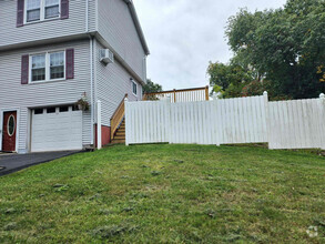
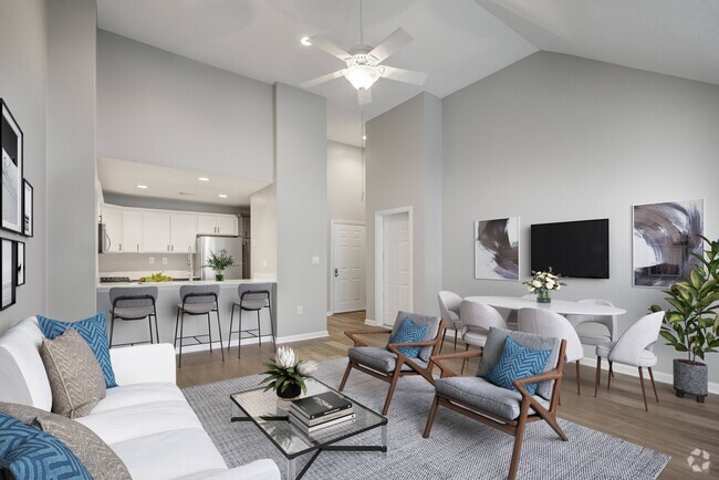
AVAILABLE MAY 1! 1 bedroom apartment in downtown Westborough two family duplex. Close to rte30,easy access to rt9,495& MA Pike and commuter rail. Enjoy many area amenities,including shops,restaurants,public golf course,walking/hiking trails,etc. The front door leads into a welcoming entry way with staircase to 2nd floor. The living room has beautiful wood floors and lots of natural light. Beyond is the large eat-in kitchen,with backdoor access and laundry/storage area. Off the kitchen is the full bathroom. Upstairs is a large,sunny bedroom,connecting to a bonus room - perfect as a home office,den or for extra storage. More storage space behind bonus room and back stairwell. 1 designated parking spot in driveway for tenant. Cats only - up to two cats allowed. No smoking or candles allowed.
18 West St is a townhome located in Worcester County and the 01581 ZIP Code. This area is served by the Westborough attendance zone.
Property Address:
18 West St,
Westborough,
MA
01581
Situated just moments east of Worcester is the Route 9 Corridor, a large neighborhood compiled of several communities including Shrewsbury, Westborough, Northborough, and Southborough. Not only is Worcester at residents’ fingertips, but Downtown Boston is less than 40 miles east. The Route 9 Corridor is a commuter’s dream, offering easy city access and entry onto Interstates 290, 495, and 90.
The suburb is dotted with ponds, reservoirs, brooks, and rivers, providing ample outdoor recreation. Renters craving a beach day can bask on the sunny shores of Lake Chauncy Beach. Route 9 Corridor’s Prospect Park allows locals to take their dog for a stroll while Assabet Park gives children ample space to play on the playground. Those looking for winter recreation won’t want to miss the powdery slopes of Ski Ward Ski Area. No matter the season, renters settling in this diverse community can choose from gorgeous apartments ranging in price and amenities.
Learn more about living in Route 9 CorridorBelow are rent ranges for similar nearby apartments
| Beds | Average Size | Lowest | Typical | Premium |
|---|---|---|---|---|
| Studio Studio Studio | 519 Sq Ft | $1,750 | $2,492 | $4,105 |
| 1 Bed 1 Bed 1 Bed | 805-806 Sq Ft | $1,200 | $2,980 | $6,180 |
| 2 Beds 2 Beds 2 Beds | 1208-1210 Sq Ft | $1,800 | $3,584 | $9,413 |
| 3 Beds 3 Beds 3 Beds | 1406-1407 Sq Ft | $2,517 | $4,038 | $6,604 |
| 4 Beds 4 Beds 4 Beds | 2656 Sq Ft | $2,850 | $5,218 | $8,000 |
Education
| Colleges & Universities | Distance | ||
|---|---|---|---|
| Colleges & Universities | Distance | ||
| Drive: | 9 min | 4.1 mi | |
| Drive: | 15 min | 8.4 mi | |
| Drive: | 18 min | 10.3 mi | |
| Drive: | 19 min | 10.6 mi |
18 West St is within 9 minutes or 4.1 miles from Tufts University, Grafton. It is also near Stillman College and Worcester Polytechnic Inst..
Schools
Public Elementary School
Grades 4-6
865 Students
Nearby
7
Out of 10
Public Elementary School
Grades PK-3
475 Students
Nearby
5
Out of 10
Public Elementary School
Grades K-3
391 Students
Nearby
4
Out of 10
Public Middle School
Grades 7-8
590 Students
Nearby
7
Out of 10
Public High School
Grades 9-12
1,178 Students
Attendance Zone
7
Out of 10
Private Elementary & Middle School
Grades K-9
467 Students
Nearby
Private Elementary & Middle School
Grades PK-8
Nearby
Private Elementary School
Grades PK-K
95 Students
Nearby
Private High School
Grades 9-12
365 Students
Nearby
School data provided by
GreatSchools
The GreatSchools Rating helps parents compare schools within a state based on a variety of school quality indicators and provides a helpful picture of how effectively each school serves all of its students. Ratings are on a scale of 1 (below average) to 10 (above average) and can include test scores, college readiness, academic progress, advanced courses, equity, discipline and attendance data. We also advise parents to visit schools, consider other information on school performance and programs, and consider family needs as part of the school selection process.
Transportation options available in Westborough include Riverside Station, located 22.3 miles from 18 West St. 18 West St is near Worcester Regional, located 15.2 miles or 29 minutes away, and General Edward Lawrence Logan International, located 35.4 miles or 51 minutes away.
| Transit / Subway | Distance | ||
|---|---|---|---|
| Transit / Subway | Distance | ||
|
|
Drive: | 34 min | 22.3 mi |
|
|
Drive: | 34 min | 22.6 mi |
|
|
Drive: | 35 min | 23.3 mi |
|
|
Drive: | 38 min | 24.9 mi |
|
|
Drive: | 38 min | 25.1 mi |
| Commuter Rail | Distance | ||
|---|---|---|---|
| Commuter Rail | Distance | ||
|
|
Drive: | 5 min | 1.9 mi |
|
|
Drive: | 9 min | 4.1 mi |
|
|
Drive: | 14 min | 7.3 mi |
|
|
Drive: | 18 min | 10.0 mi |
|
|
Drive: | 24 min | 10.8 mi |
| Airports | Distance | ||
|---|---|---|---|
| Airports | Distance | ||
|
Worcester Regional
|
Drive: | 29 min | 15.2 mi |
|
General Edward Lawrence Logan International
|
Drive: | 51 min | 35.4 mi |
Time and distance from 18 West St.
| Shopping Centers | Distance | ||
|---|---|---|---|
| Shopping Centers | Distance | ||
| Walk: | 12 min | 0.7 mi | |
| Drive: | 4 min | 1.4 mi | |
| Drive: | 5 min | 1.6 mi |
18 West St has 3 shopping centers within 1.6 miles, which is about a 5-minute drive. The miles and minutes will be for the farthest away property.
| Parks and Recreation | Distance | ||
|---|---|---|---|
| Parks and Recreation | Distance | ||
|
Cedar Hill and Sawink Farm Reservation
|
Drive: | 9 min | 3.5 mi |
|
Walkup And Robinson Memorial Reservation
|
Drive: | 8 min | 3.6 mi |
|
Whitehall State Park
|
Drive: | 13 min | 4.4 mi |
|
Ward Hill Ski Area
|
Drive: | 12 min | 5.2 mi |
|
Upton State Forest
|
Drive: | 12 min | 5.7 mi |
18 West St has 5 parks within 5.7 miles, including Walkup And Robinson Memorial Reservation, Cedar Hill and Sawink Farm Reservation, and Whitehall State Park.
| Hospitals | Distance | ||
|---|---|---|---|
| Hospitals | Distance | ||
| Drive: | 14 min | 8.1 mi | |
| Drive: | 15 min | 8.4 mi | |
| Drive: | 16 min | 9.5 mi |
18 West St has 3 hospitals within 9.5 miles, the nearest is Worcester Recovery Center and Hospital which is 8.1 miles away and a 14 minutes drive.
| Military Bases | Distance | ||
|---|---|---|---|
| Military Bases | Distance | ||
| Drive: | 27 min | 15.3 mi |
18 West St is 15.3 miles and a 27 minutes from US Military Reservation.
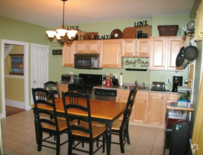
You May Also Like
Similar Rentals Nearby
-
-
 $3,9504 Beds, 2 Baths, 1,700 sq ftTownhome for Rent
 -
-
-
-
-
 $2,6002 Beds, 1.5 Baths, 900 sq ftTownhome for Rent
 -
 $5,8003 Beds, 2.5 Baths, 1,800 sq ftTownhome for Rent
 -
 $2,4002 Beds, 1 Bath, 864 sq ftTownhome for Rent
 -

What Are Walk Score®, Transit Score®, and Bike Score® Ratings?
Walk Score® measures the walkability of any address. Transit Score® measures access to public transit. Bike Score® measures the bikeability of any address.
What is a Sound Score Rating?
A Sound Score Rating aggregates noise caused by vehicle traffic, airplane traffic and local sources

18 West St
Westborough, MA 01581