
$2,395 / Month
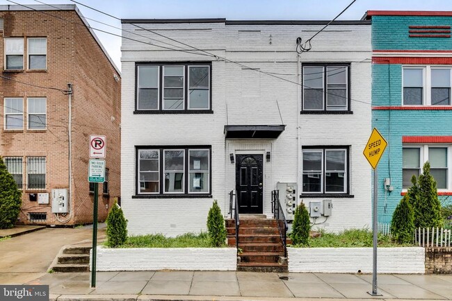
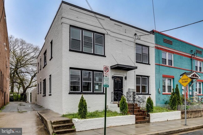
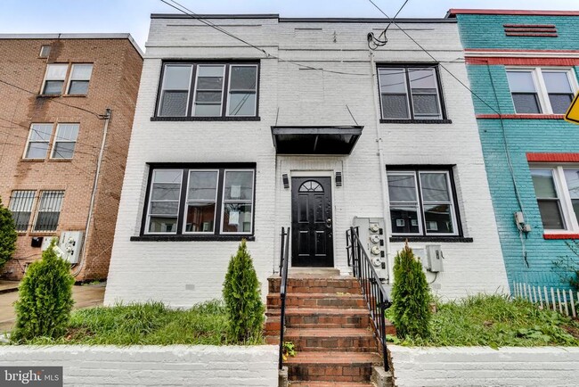
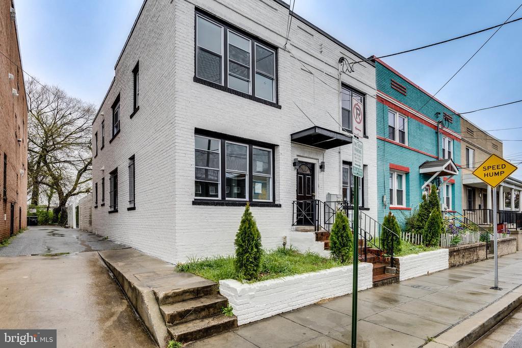
1825 Providence St NE
Washington, DC 20002
Today
Favorites
571-327-7531
-
Bedrooms
2
-
Bathrooms
1
-
Square Feet
2,182 sq ft
-
Available
Available Apr 17
Highlights
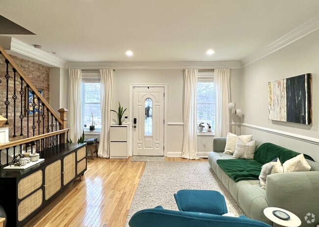
- Midcentury Modern Architecture
- Central Heating and Cooling System
1825 Providence St NE

Favorites
Home Details
Year Built
Built in 1942
Bedrooms and Bathrooms
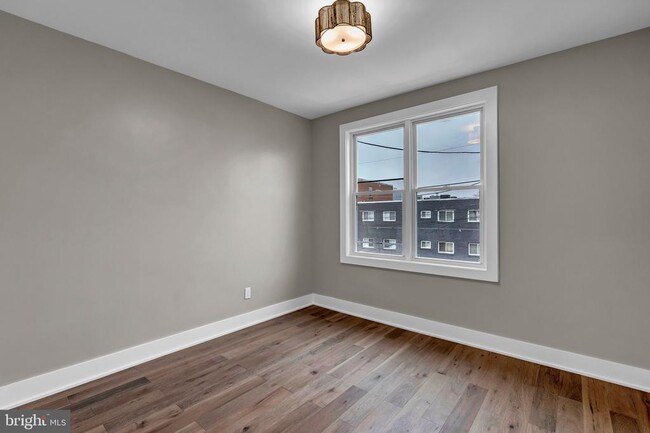
2 Main Level Bedrooms
1 Full Bathroom
Home Design
Midcentury Modern Architecture
Brick Exterior Construction
Interior Spaces
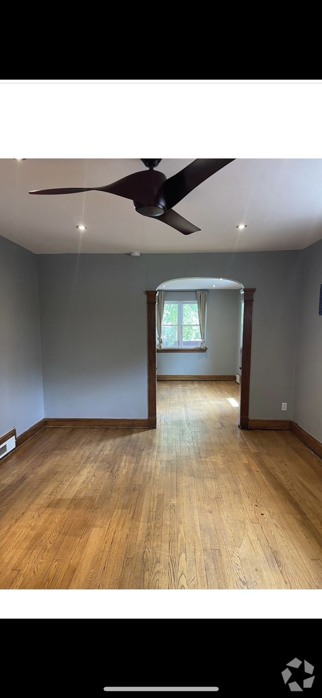
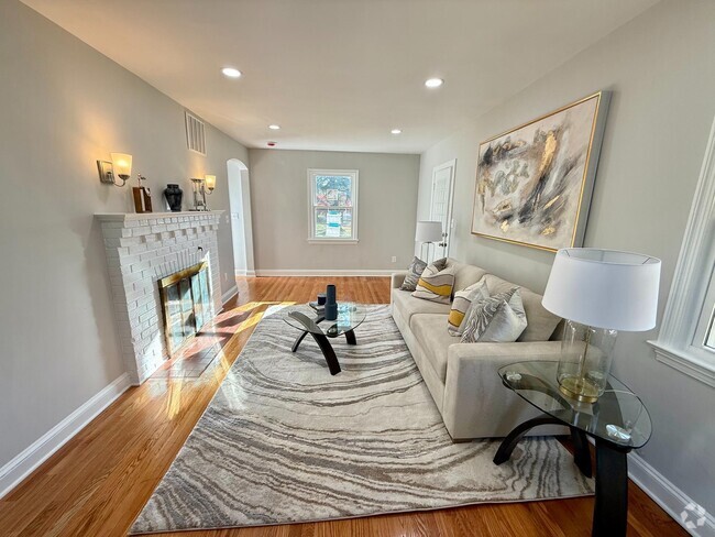
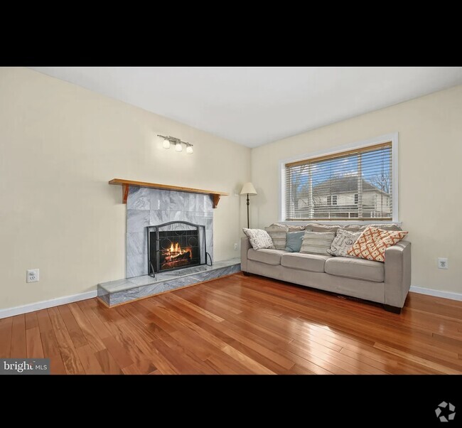
2,182 Sq Ft Home
Property has 2 Levels
Listing and Financial Details
Security Deposit $2,395
12-Month Lease Term
Available 1/1/25
Assessor Parcel Number 4043//0009
Tenant pays for electricity
Rent includes water, sewer
No Smoking Allowed
Residential Lease
Lot Details
3,600 Sq Ft Lot
Property is zoned R4
Parking
On-Street Parking
Off-Street Parking
Unpaved Parking
Utilities
Central Heating and Cooling System
Natural Gas Water Heater
Cooling System Utilizes Natural Gas
Community Details
Overview
No Home Owners Association
Brentwood Subdivision
Pet Policy
No Pets Allowed
Contact
- Listed by zahra isabel moutawakil | Fairfax Realty
- Phone Number
- Contact
-
Source
 Bright MLS, Inc.
Copyright © 2025 Bright MLS, Inc.
Location
Get Directions
There's a secret in Washington, DC: the tiny, trendy neighborhood of Ivy City. If you haven't heard of it, you aren't alone -- this up-and-coming neighborhood was mostly industrial and largely forgotten for decades. But with a history dating back to the 1870s and charming row houses lining the streets, the whispers about Ivy City are growing louder. Luxury apartments in historic warehouses add elegance to the neighborhood, and bars, restaurants, and entertainment venues add a layer of energy and excitement.
Ivy City's unique name (there isn't an abundance of ivy and it isn't a city) dates back to Civil War-era poet Thomas Seaton Donoho. He named his house Ivy Hall and wrote a book of poems called "Ivywall" in 1860. Donoho dubbed the rural area he lived in "Ivy City" and the name stuck. Ivy City is located on the northeast side of Gallaudet University, extending along New York Avenue from Mt. Olivet Road to the intersection of New York Avenue with West Virginia Avenue.
Learn more about living in Ivy City
Education
| Colleges & Universities | Distance | ||
|---|---|---|---|
| Colleges & Universities | Distance | ||
| Walk: | 15 min | 0.8 mi | |
| Drive: | 6 min | 2.5 mi | |
| Drive: | 5 min | 2.7 mi | |
| Drive: | 5 min | 2.7 mi |
1825 Providence St NE is within 15 minutes or 0.8 mile from Gallaudet University. It is also near Georgetown and Georgetown Law.
Schools


Public Elementary & Middle School
Grades PK-8
321 Students
Attendance Zone
Public High School
Grades 9-12
868 Students
Attendance Zone
Private Elementary & Middle School
Grades PK-8
123 Students
Nearby
Private High School
Grades 9-12
Nearby
School data provided by
 The GreatSchools Rating helps parents compare schools within a state based on a variety of school quality indicators and provides a helpful picture of how effectively each school serves all of its students. Ratings are on a scale of 1 (below average) to 10 (above average) and can include test scores, college readiness, academic progress, advanced courses, equity, discipline and attendance data. We also advise parents to visit schools, consider other information on school performance and programs, and consider family needs as part of the school selection process.
View GreatSchools Rating Methodology
View GreatSchools Rating Methodology
Transportation options available in Washington include Noma-Gallaudet U, located 1.7 miles from 1825 Providence St NE. 1825 Providence St NE is near Ronald Reagan Washington Ntl, located 7.8 miles or 14 minutes away, and Baltimore/Washington International Thurgood Marshall, located 29.0 miles or 43 minutes away.
| Transit / Subway | Distance | ||
|---|---|---|---|
| Transit / Subway | Distance | ||
|
|
Drive: | 4 min | 1.7 mi |
|
|
Drive: | 4 min | 1.9 mi |
|
|
Drive: | 4 min | 2.2 mi |
|
|
Drive: | 6 min | 2.5 mi |
|
|
Drive: | 5 min | 2.6 mi |
| Commuter Rail | Distance | ||
|---|---|---|---|
| Commuter Rail | Distance | ||
|
|
Drive: | 5 min | 1.9 mi |
|
|
Drive: | 7 min | 3.7 mi |
|
|
Drive: | 12 min | 5.1 mi |
| Drive: | 15 min | 6.3 mi | |
|
|
Drive: | 11 min | 6.5 mi |
| Airports | Distance | ||
|---|---|---|---|
| Airports | Distance | ||
|
Ronald Reagan Washington Ntl
|
Drive: | 14 min | 7.8 mi |
|
Baltimore/Washington International Thurgood Marshall
|
Drive: | 43 min | 29.0 mi |
Time and distance from 1825 Providence St NE.
| Shopping Centers | Distance | ||
|---|---|---|---|
| Shopping Centers | Distance | ||
| Walk: | 3 min | 0.2 mi | |
| Walk: | 13 min | 0.7 mi | |
| Drive: | 3 min | 1.2 mi |
1825 Providence St NE has 3 shopping centers within 1.2 miles, which is about a 3-minute walk. The miles and minutes will be for the farthest away property.
| Parks and Recreation | Distance | ||
|---|---|---|---|
| Parks and Recreation | Distance | ||
|
Washington Youth Garden
|
Walk: | 17 min | 0.9 mi |
|
National Arboretum
|
Drive: | 6 min | 1.8 mi |
|
Kingman and Heritage Island Park
|
Drive: | 4 min | 2.0 mi |
|
Marian Koshland Science Museum
|
Drive: | 5 min | 2.7 mi |
|
Carter G. Woodson Home National Historic Site
|
Drive: | 5 min | 3.0 mi |
1825 Providence St NE has 5 parks within 3.0 miles, including Washington Youth Garden, National Arboretum, and Kingman and Heritage Island Park.
| Hospitals | Distance | ||
|---|---|---|---|
| Hospitals | Distance | ||
| Drive: | 6 min | 2.5 mi | |
| Drive: | 6 min | 3.0 mi | |
| Drive: | 8 min | 3.4 mi |
1825 Providence St NE has 3 hospitals within 3.4 miles, the nearest is Howard University Hospital which is 2.5 miles away and a 6 minute drive.
| Military Bases | Distance | ||
|---|---|---|---|
| Military Bases | Distance | ||
| Drive: | 7 min | 3.4 mi | |
| Drive: | 7 min | 3.6 mi |
1825 Providence St NE is 3.4 miles from Washington Navy Yard, and is convenient to other military bases, including US Soldiers & Airmens Home.
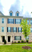
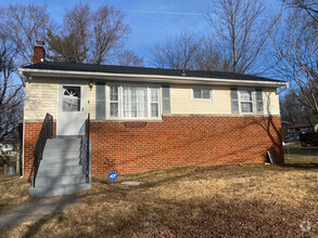
You May Also Like
Similar Rentals Nearby
What Are Walk Score®, Transit Score®, and Bike Score® Ratings?
Walk Score® measures the walkability of any address. Transit Score® measures access to public transit. Bike Score® measures the bikeability of any address.
What is a Sound Score Rating?
A Sound Score Rating aggregates noise caused by vehicle traffic, airplane traffic and local sources
1825 Providence St NE
Washington, DC 20002