
$2,000 / Month
183 N 12th St
Newark, NJ 07107
2 Weeks Ago
Favorites
183 N 12th St

Favorites
Check Back Soon for Upcoming Availability
| Beds | Baths | Average SF |
|---|---|---|
| 2 Bedrooms 2 Bedrooms 2 Br | 1 Bath 1 Bath 1 Ba | — |
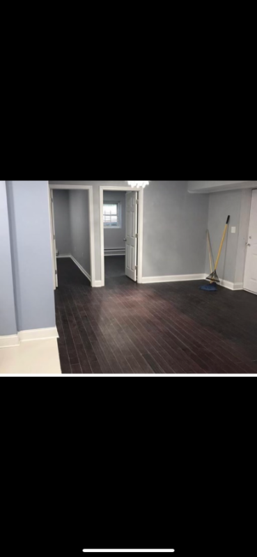
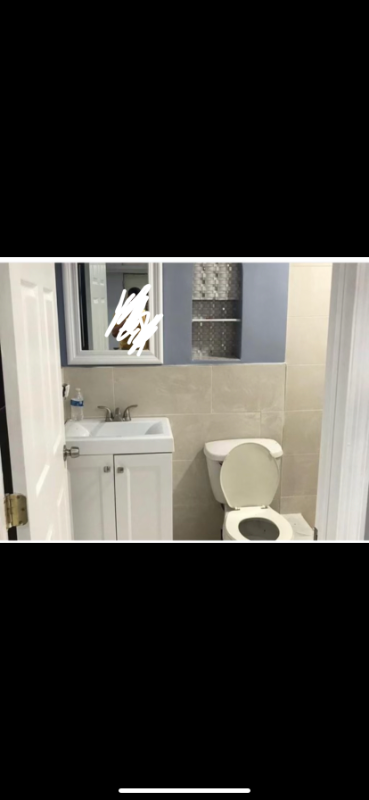
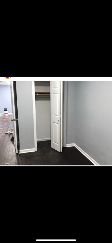
About This Property
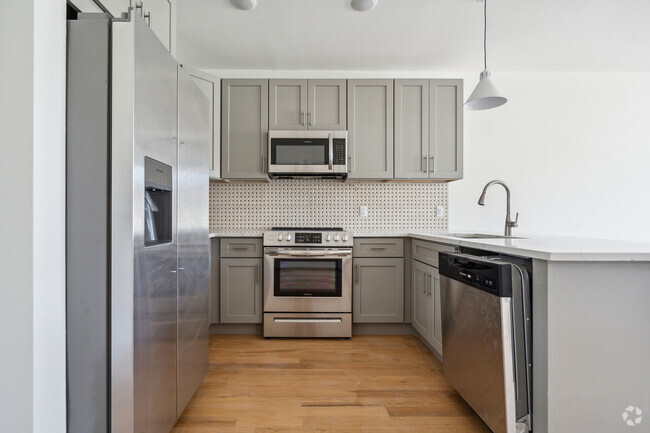
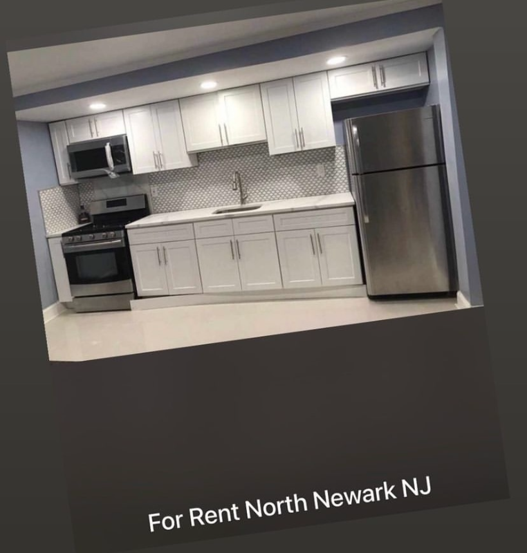
Property Id: 925080 2BR/1bath Available 8/1/22 includes all utilities
183 N 12th St is an apartment community located in Essex County and the 07107 ZIP Code.
Features
- Microwave
- Oven
- Refrigerator
Fees and Policies
The fees below are based on community-supplied data and may exclude additional fees and utilities.
Details
Utilities Included
-
Gas
-
Water
-
Electricity
Location
Get Directions
Lower Roseville is located in northwest Newark, making up the second part of the Roseville neighborhood. The area has a long history going back to Old Newark and is known for its laid-back lifestyle and close-knit community. The neighborhood is mainly residential, but there are a variety of restaurants, cafes, retailers, and parks as well. Lower Roseville sits alongside Branch Brook Park and the Cathedral Basilica. A historic piece of architecture and culture and a scenic, 360-acre park are at the fingertips of Lower Roseville residents.
Learn more about living in Lower RosevilleBelow are rent ranges for similar nearby apartments
Amenities
- Microwave
- Oven
- Refrigerator
Expenses
Utilities Included
Gas, Water, Electricity
Included
Education
| Colleges & Universities | Distance | ||
|---|---|---|---|
| Colleges & Universities | Distance | ||
| Drive: | 5 min | 2.2 mi | |
| Drive: | 4 min | 2.3 mi | |
| Drive: | 5 min | 2.4 mi | |
| Drive: | 6 min | 2.8 mi |
183 N 12th St is within 5 minutes or 2.2 miles from N.J. Inst. of Technology. It is also near Rutgers, Newark Campus and Essex County College.
Transportation options available in Newark include Park Avenue, located 0.6 mile from 183 N 12th St. 183 N 12th St is near Newark Liberty International, located 8.1 miles or 14 minutes away, and Laguardia, located 28.3 miles or 43 minutes away.
| Transit / Subway | Distance | ||
|---|---|---|---|
| Transit / Subway | Distance | ||
|
|
Walk: | 11 min | 0.6 mi |
|
|
Walk: | 17 min | 0.9 mi |
|
|
Drive: | 3 min | 1.2 mi |
|
|
Drive: | 4 min | 1.3 mi |
|
|
Drive: | 4 min | 1.5 mi |
| Commuter Rail | Distance | ||
|---|---|---|---|
| Commuter Rail | Distance | ||
|
|
Drive: | 3 min | 1.7 mi |
|
|
Drive: | 4 min | 1.9 mi |
|
|
Drive: | 4 min | 2.0 mi |
|
|
Drive: | 4 min | 2.2 mi |
|
|
Drive: | 5 min | 2.6 mi |
| Airports | Distance | ||
|---|---|---|---|
| Airports | Distance | ||
|
Newark Liberty International
|
Drive: | 14 min | 8.1 mi |
|
Laguardia
|
Drive: | 43 min | 28.3 mi |
Time and distance from 183 N 12th St.
| Shopping Centers | Distance | ||
|---|---|---|---|
| Shopping Centers | Distance | ||
| Walk: | 16 min | 0.9 mi | |
| Drive: | 3 min | 1.3 mi | |
| Drive: | 4 min | 1.5 mi |
183 N 12th St has 3 shopping centers within 1.5 miles, which is about a 4-minute walk. The miles and minutes will be for the farthest away property.
| Parks and Recreation | Distance | ||
|---|---|---|---|
| Parks and Recreation | Distance | ||
|
Branch Brook Park
|
Drive: | 4 min | 1.8 mi |
|
Newark Museum and Dreyfuss Planetarium
|
Drive: | 5 min | 2.4 mi |
|
Edison National Historic Site
|
Drive: | 7 min | 3.4 mi |
|
Kearny Marsh
|
Drive: | 10 min | 4.9 mi |
|
Richard W. DeKorte Park
|
Drive: | 14 min | 6.5 mi |
183 N 12th St has 5 parks within 6.5 miles, including Branch Brook Park, Newark Museum and Dreyfuss Planetarium, and Edison National Historic Site.
| Hospitals | Distance | ||
|---|---|---|---|
| Hospitals | Distance | ||
| Drive: | 4 min | 1.9 mi | |
| Drive: | 4 min | 2.1 mi | |
| Drive: | 4 min | 2.1 mi |
183 N 12th St has 3 hospitals within 2.1 miles, the nearest is The University Hospital which is 1.9 miles away and a 4 minute drive.
| Military Bases | Distance | ||
|---|---|---|---|
| Military Bases | Distance | ||
| Drive: | 19 min | 12.0 mi | |
| Drive: | 29 min | 14.0 mi | |
| Drive: | 35 min | 20.0 mi |
183 N 12th St has 3 military bases within 20.0 miles, the nearest is Military Ocean Terminal which is 12.0 miles away and a 19 minute drive.
You May Also Like
Similar Rentals Nearby


What Are Walk Score®, Transit Score®, and Bike Score® Ratings?
Walk Score® measures the walkability of any address. Transit Score® measures access to public transit. Bike Score® measures the bikeability of any address.
What is a Sound Score Rating?
A Sound Score Rating aggregates noise caused by vehicle traffic, airplane traffic and local sources
183 N 12th St
Newark, NJ 07107