$2,980 / Month
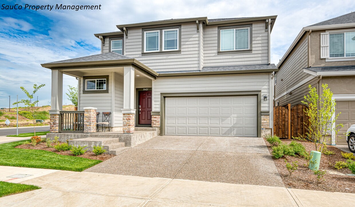
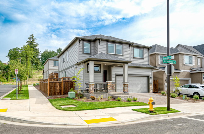
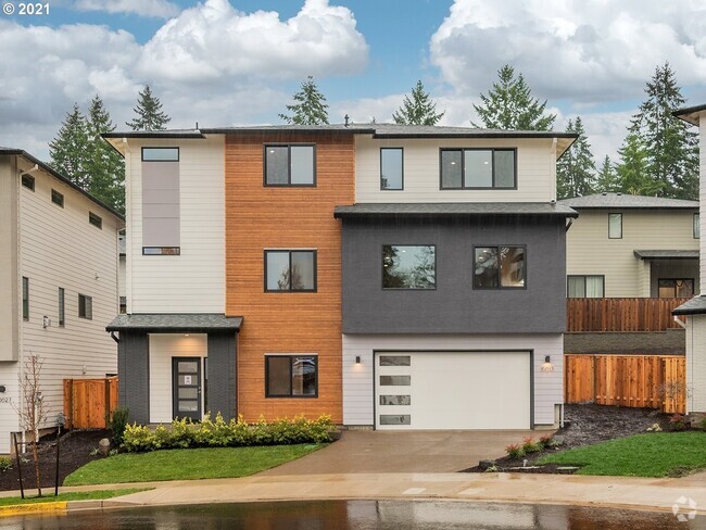
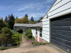
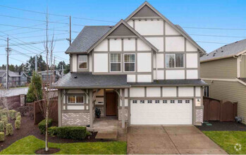
18421 SW Sugarloaf Ln
Beaverton, OR 97007
2 Weeks Ago
Favorites
18421 SW Sugarloaf Ln

Favorites
Check Back Soon for Upcoming Availability
| Beds | Baths | Average SF |
|---|---|---|
| 4 Bedrooms 4 Bedrooms 4 Br | 2.5 Baths 2.5 Baths 2.5 Ba | 2,238 SF |
About This Property
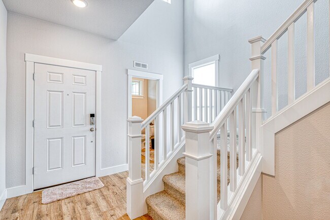
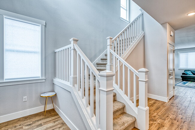
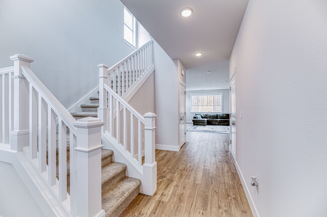
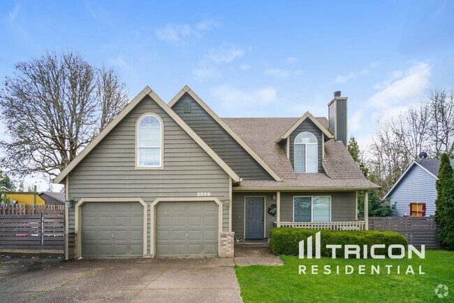
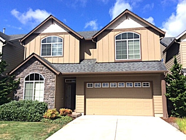
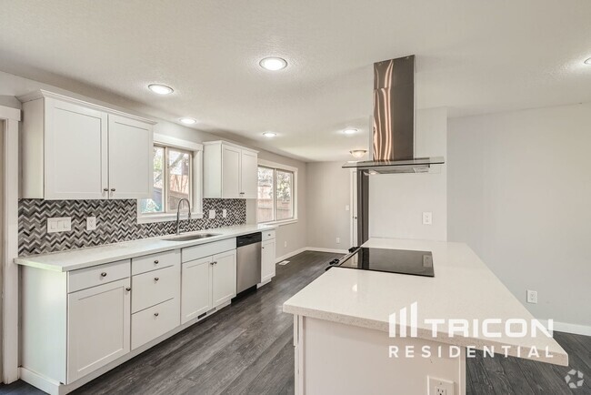
Stunning newer home in Lolich Farms, on a corner lot near Progress Ridge, now available for rent! Built in 2021, this gorgeous property is full of incredible upgrades, including central AC, open concept living, upgraded kitchen, double garage, fenced yard, double garage, stainless appliances, and much more. Perfectly situated within minutes of wineries, Progress Ridge Shopping Center, Mountainside High School, and easy access to Sherwood, Hillsboro, Beaverton and Portland. Appliances included. Pets Allowed: No Smoking/Vaping Allowed: No Renters Insurance Required: Yes HOA Compliance Required: Yes Central AC: Yes All information deemed reliable but should be independently verified.
18421 SW Sugarloaf Ln is a house located in Washington County and the 97007 ZIP Code. This area is served by the Beaverton School District 48j attendance zone.
Location
Get Directions
Residents that live in Cooper Mountain-Aloha South love their rental condos and single-family homes, because of the close proximity to Cooper Mountain. The park has hiking, picnic tables, nature courses at the Cooper Mountain Nature House, as well as natural beauty that draws in locals of all types to this unique part of Oregon.
This neighborhood serves as a suburb for Beaverton and Portland. Beaverton is about four miles northeast and Portland is about ten, and both are easily accessible via the light rail and I-5. Homes here tend to be spacious and have a sense of serenity. When it’s time to mingle with your neighbors, make a date for breakfast at Biscuits Café in Scholls Ferry.
Learn more about living in Cooper Mountain-Aloha SouthBelow are rent ranges for similar nearby apartments
Education
| Colleges & Universities | Distance | ||
|---|---|---|---|
| Colleges & Universities | Distance | ||
| Drive: | 19 min | 8.8 mi | |
| Drive: | 19 min | 9.1 mi | |
| Drive: | 20 min | 10.8 mi | |
| Drive: | 25 min | 12.2 mi |
18421 SW Sugarloaf Ln is within 19 minutes or 8.8 miles from Portland C.C., Sylvania Campus. It is also near Oregon Health & Sci., West and Pacific Univ. Oregon, Hillsb..
Schools


Public Elementary & Middle School
Grades PK-8
887 Students
Nearby
Public Elementary School
Grades K-5
429 Students
Attendance Zone
Public Middle School
Grades 6-8
667 Students
Attendance Zone
Public High School
Grades 9-12
1,758 Students
Attendance Zone
Private Elementary, Middle & High School
Grades PK-12
111 Students
Nearby
Private Elementary, Middle & High School
Grades K-12
Nearby
School data provided by
 The GreatSchools Rating helps parents compare schools within a state based on a variety of school quality indicators and provides a helpful picture of how effectively each school serves all of its students. Ratings are on a scale of 1 (below average) to 10 (above average) and can include test scores, college readiness, academic progress, advanced courses, equity, discipline and attendance data. We also advise parents to visit schools, consider other information on school performance and programs, and consider family needs as part of the school selection process.
View GreatSchools Rating Methodology
View GreatSchools Rating Methodology
Transportation options available in Beaverton include Millikan Way, located 6.8 miles from 18421 SW Sugarloaf Ln. 18421 SW Sugarloaf Ln is near Portland International, located 26.5 miles or 44 minutes away.
| Transit / Subway | Distance | ||
|---|---|---|---|
| Transit / Subway | Distance | ||
|
|
Drive: | 13 min | 6.8 mi |
|
|
Drive: | 14 min | 7.1 mi |
|
|
Drive: | 14 min | 7.2 mi |
|
|
Drive: | 15 min | 7.4 mi |
|
|
Drive: | 15 min | 7.5 mi |
| Commuter Rail | Distance | ||
|---|---|---|---|
| Commuter Rail | Distance | ||
|
|
Drive: | 11 min | 5.3 mi |
|
|
Drive: | 14 min | 5.8 mi |
|
|
Drive: | 15 min | 7.4 mi |
|
|
Drive: | 17 min | 8.9 mi |
|
|
Drive: | 25 min | 12.3 mi |
| Airports | Distance | ||
|---|---|---|---|
| Airports | Distance | ||
|
Portland International
|
Drive: | 44 min | 26.5 mi |
Time and distance from 18421 SW Sugarloaf Ln.
| Shopping Centers | Distance | ||
|---|---|---|---|
| Shopping Centers | Distance | ||
| Drive: | 3 min | 1.4 mi | |
| Drive: | 5 min | 2.1 mi | |
| Drive: | 5 min | 2.2 mi |
18421 SW Sugarloaf Ln has 3 shopping centers within 2.2 miles, which is about a 5-minute drive. The miles and minutes will be for the farthest away property.
| Parks and Recreation | Distance | ||
|---|---|---|---|
| Parks and Recreation | Distance | ||
|
Cooper Mountain Nature Park
|
Drive: | 6 min | 3.5 mi |
|
Jenkins Estate
|
Drive: | 8 min | 3.9 mi |
|
Tualatin Hills Nature Park
|
Drive: | 13 min | 6.5 mi |
|
Tualatin Hills Nature Center
|
Drive: | 14 min | 6.7 mi |
|
Tualatin River National Wildlife Refuge
|
Drive: | 13 min | 6.7 mi |
18421 SW Sugarloaf Ln has 5 parks within 6.7 miles, including Cooper Mountain Nature Park, Jenkins Estate, and Tualatin River National Wildlife Refuge.
| Hospitals | Distance | ||
|---|---|---|---|
| Hospitals | Distance | ||
| Drive: | 17 min | 9.4 mi | |
| Drive: | 19 min | 10.3 mi | |
| Drive: | 19 min | 11.0 mi |
18421 SW Sugarloaf Ln has 3 hospitals within 11.0 miles, the nearest is Cedar Hills Hospital which is 9.4 miles away and a 17 minute drive.
| Military Bases | Distance | ||
|---|---|---|---|
| Military Bases | Distance | ||
| Drive: | 40 min | 23.3 mi | |
| Drive: | 65 min | 38.6 mi |
18421 SW Sugarloaf Ln is 23.3 miles from Portland Airport Air Guard Station, and is convenient to other military bases, including Camp Bonneville Military Reservation.
You May Also Like
Similar Rentals Nearby
What Are Walk Score®, Transit Score®, and Bike Score® Ratings?
Walk Score® measures the walkability of any address. Transit Score® measures access to public transit. Bike Score® measures the bikeability of any address.
What is a Sound Score Rating?
A Sound Score Rating aggregates noise caused by vehicle traffic, airplane traffic and local sources

18421 SW Sugarloaf Ln
Beaverton, OR 97007