-
This Darling Apartment is Centrally Located!

-


-
Monthly Rent
$1,295
-
Bedrooms
2 bd
-
Bathrooms
2 ba
-
Square Feet
1,090 sq ft
Details

About This Property
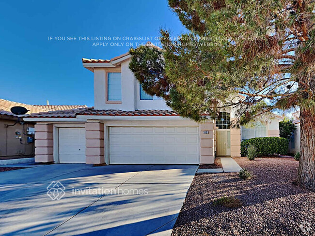
Features: - 2 Bedrooms. - 2 Bathrooms. - 1,090 Sq Ft. - Carpet Flooring in Bedrooms. - Tile in Common Areas. - Easy Access to Freeway. Convenient Locations: Las Vegas Golf Club, College of Southern Nevada Western Center, Meadows Mall, EW Griffith Elementary School, Texas Station, Public Storage, Wells Fargo Bank, Smart & Final,
1852 N Decatur Blvd is a house located in Clark County and the 89108 ZIP Code. This area is served by the Clark County attendance zone.
Discover Homeownership
Renting vs. Buying
-
Housing Cost Per Month: $1,295
-
Rent for 30 YearsRenting doesn't build equity Future EquityRenting isn't tax deductible Mortgage Interest Tax Deduction$0 Net Return
-
Buy Over 30 Years$506K - $900K Future Equity$230K Mortgage Interest Tax Deduction$39K - $434K Gain Net Return
-
 This Property
 Available Property
A peaceful suburb in desert terrain with distant mountain views, Twin Lakes is known for its proximity to the heart of Las Vegas and its overall family-friendly atmosphere. Twin Lakes houses the College of Southern Nevada along with good public schools such as Twin Lakes Elementary. Enjoy city parks such as Ed Fountain Park or Lorenzi Park, boasting baseball diamonds, tennis and basketball courts, playgrounds, and an abundance of paved walking trails.
Twin Lakes houses Meadows Mall, which includes major department stores that you’ll love. And if you’re a golfer, you’ll appreciate the sprawling Las Vegas Golf Club right in town. Twin Lakes is located just four miles west of Downtown Las Vegas, and seven miles north of the Las Vegas Strip. Whether you’re commuting for work or a weekend on the town, Twin Lakes features a central location.
Learn more about living in Twin Lakes| Colleges & Universities | Distance | ||
|---|---|---|---|
| Colleges & Universities | Distance | ||
| Drive: | 9 min | 4.8 mi | |
| Drive: | 10 min | 4.8 mi | |
| Drive: | 14 min | 7.5 mi | |
| Drive: | 19 min | 9.8 mi |
Transportation options available in Las Vegas include Sahara Station, located 6.7 miles from 1852 N Decatur Blvd. 1852 N Decatur Blvd is near Harry Reid International, located 11.0 miles or 21 minutes away, and Boulder City Municipal, located 31.0 miles or 41 minutes away.
| Transit / Subway | Distance | ||
|---|---|---|---|
| Transit / Subway | Distance | ||
|
|
Drive: | 12 min | 6.7 mi |
|
|
Drive: | 14 min | 7.1 mi |
|
|
Drive: | 13 min | 7.3 mi |
|
|
Drive: | 15 min | 8.0 mi |
|
|
Drive: | 15 min | 8.6 mi |
| Airports | Distance | ||
|---|---|---|---|
| Airports | Distance | ||
|
Harry Reid International
|
Drive: | 21 min | 11.0 mi |
|
Boulder City Municipal
|
Drive: | 41 min | 31.0 mi |
Time and distance from 1852 N Decatur Blvd.
| Shopping Centers | Distance | ||
|---|---|---|---|
| Shopping Centers | Distance | ||
| Walk: | 6 min | 0.4 mi | |
| Walk: | 7 min | 0.4 mi | |
| Walk: | 12 min | 0.7 mi |
| Parks and Recreation | Distance | ||
|---|---|---|---|
| Parks and Recreation | Distance | ||
|
Springs Preserve
|
Drive: | 7 min | 2.9 mi |
|
Spring Mountains National Recreation Area
|
Drive: | 8 min | 4.5 mi |
|
DISCOVERY Children's Museum
|
Drive: | 9 min | 5.7 mi |
|
Las Vegas Natural History Museum
|
Drive: | 9 min | 5.7 mi |
|
Old Las Vegas Mormon State Historic Park
|
Drive: | 10 min | 5.9 mi |
| Hospitals | Distance | ||
|---|---|---|---|
| Hospitals | Distance | ||
| Drive: | 8 min | 4.3 mi | |
| Drive: | 8 min | 4.4 mi | |
| Drive: | 9 min | 4.7 mi |
| Military Bases | Distance | ||
|---|---|---|---|
| Military Bases | Distance | ||
| Drive: | 27 min | 14.8 mi |
You May Also Like
Similar Rentals Nearby
-
-
-
-
-
-
-
-
-
Single-Family Homes Discounts
Pets Allowed Fitness Center In Unit Washer & Dryer Business Center Gated Walk-Up
-
1 / 14Single-Family Homes Specials
Pets Allowed Pool In Unit Washer & Dryer Stainless Steel Appliances Gated
What Are Walk Score®, Transit Score®, and Bike Score® Ratings?
Walk Score® measures the walkability of any address. Transit Score® measures access to public transit. Bike Score® measures the bikeability of any address.
What is a Sound Score Rating?
A Sound Score Rating aggregates noise caused by vehicle traffic, airplane traffic and local sources
