
$1,900 / Month
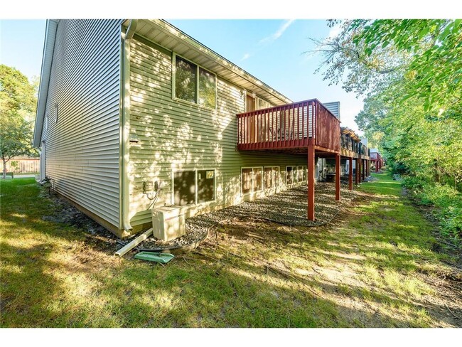
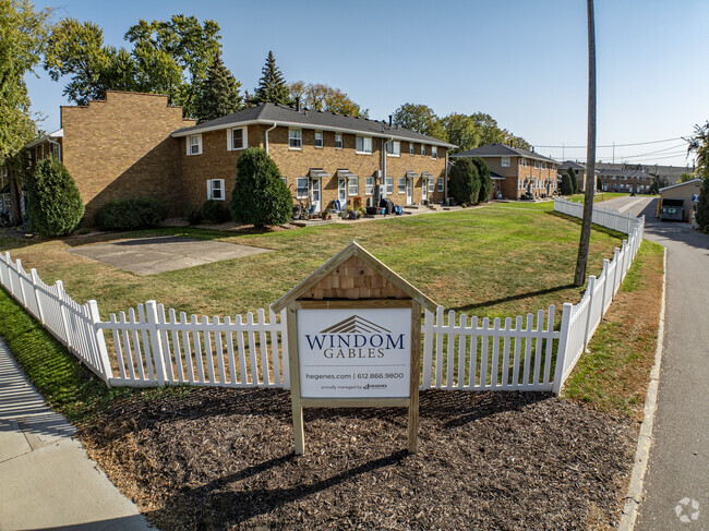
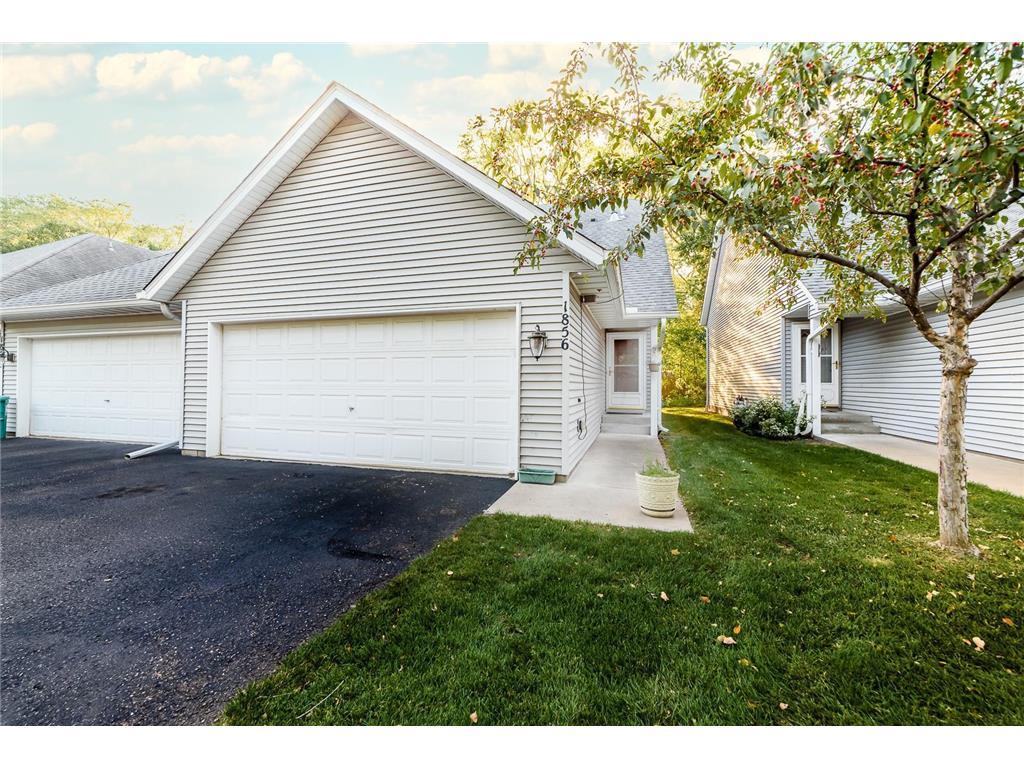
1856 County Hwy 10
Spring Lake Park, MN 55432
2 Weeks Ago
Favorites
1856 County Hwy 10

Favorites
Check Back Soon for Upcoming Availability
| Beds | Baths | Average SF |
|---|---|---|
| 3 Bedrooms 3 Bedrooms 3 Br | 2 Baths 2 Baths 2 Ba | 1,514 SF |
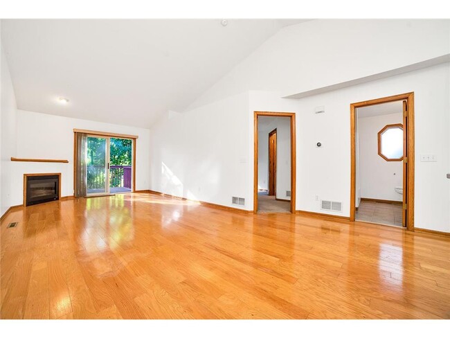
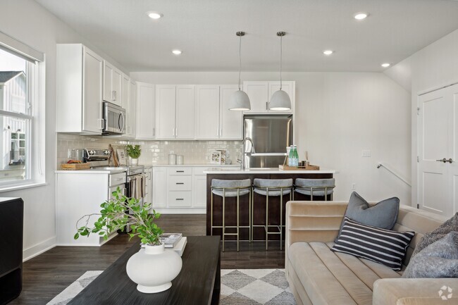
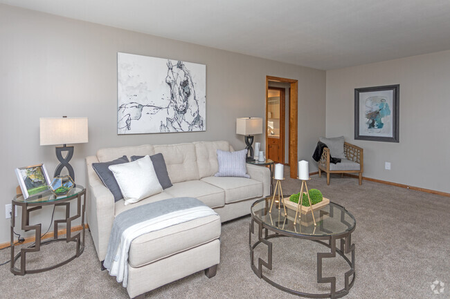
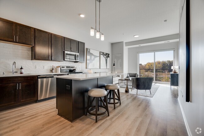
About This Property
Agent and Tenant to verify all Info
1856 County Hwy 10 is a townhome located in Ramsey County and the 55432 ZIP Code. This area is served by the Mounds View Public attendance zone.
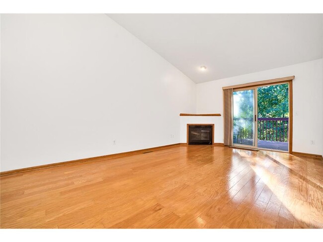
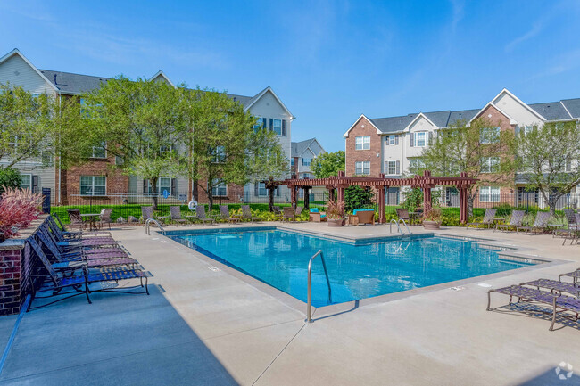
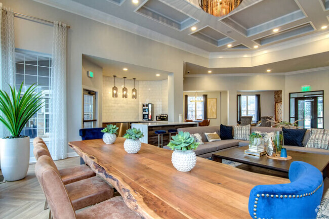
Townhome Features
Dishwasher
Washer/Dryer Hookup
Walk-In Closets
Refrigerator
- Washer/Dryer Hookup
- Ceiling Fans
- Smoke Free
- Fireplace
- Dishwasher
- Range
- Refrigerator
- Skylights
- Walk-In Closets
- Laundry Facilities
Fees and Policies
The fees below are based on community-supplied data and may exclude additional fees and utilities.
- Cats Allowed
-
Fees not specified
-
Weight limit--
-
Pet Limit--
- Parking
-
Garage--
Location
Get Directions
Amenities
- Washer/Dryer Hookup
- Ceiling Fans
- Smoke Free
- Fireplace
- Dishwasher
- Range
- Refrigerator
- Skylights
- Walk-In Closets
- Laundry Facilities
Education
| Colleges & Universities | Distance | ||
|---|---|---|---|
| Colleges & Universities | Distance | ||
| Drive: | 10 min | 5.7 mi | |
| Drive: | 11 min | 7.4 mi | |
| Drive: | 14 min | 8.2 mi | |
| Drive: | 17 min | 11.2 mi |
1856 County Hwy 10 is within 10 minutes or 5.7 miles from Bethel University, Saint Paul. It is also near Northwestern College and Anoka-Ramsey C.C., Coon Rapids.
Schools


Public Elementary, Middle & High School
Grades PK-12
Nearby
Public Elementary School
Grades 1-5
497 Students
Attendance Zone
Public Middle School
Grades 6-8
699 Students
Attendance Zone
Public High School
Grades 9-12
1,706 Students
Attendance Zone
Private Elementary, Middle & High School
Grades PK-12
159 Students
Nearby
Private Elementary & Middle School
Grades K-8
239 Students
Nearby
Private Elementary & Middle School
Grades 3-8
16 Students
Nearby
Private High School
Grades 9-12
239 Students
Nearby
School data provided by
 The GreatSchools Rating helps parents compare schools within a state based on a variety of school quality indicators and provides a helpful picture of how effectively each school serves all of its students. Ratings are on a scale of 1 (below average) to 10 (above average) and can include test scores, college readiness, academic progress, advanced courses, equity, discipline and attendance data. We also advise parents to visit schools, consider other information on school performance and programs, and consider family needs as part of the school selection process.
View GreatSchools Rating Methodology
View GreatSchools Rating Methodology
Transportation options available in Spring Lake Park include Target Field Station Platform 2, located 13.7 miles from 1856 County Hwy 10. 1856 County Hwy 10 is near Minneapolis-St Paul International/Wold-Chamberlain, located 21.2 miles or 34 minutes away.
| Transit / Subway | Distance | ||
|---|---|---|---|
| Transit / Subway | Distance | ||
| Drive: | 21 min | 13.7 mi | |
| Drive: | 20 min | 13.8 mi | |
|
|
Drive: | 21 min | 13.9 mi |
|
|
Drive: | 21 min | 14.0 mi |
|
|
Drive: | 21 min | 14.1 mi |
| Commuter Rail | Distance | ||
|---|---|---|---|
| Commuter Rail | Distance | ||
|
|
Drive: | 11 min | 6.0 mi |
|
|
Drive: | 15 min | 10.0 mi |
|
|
Drive: | 16 min | 11.7 mi |
|
|
Drive: | 22 min | 13.8 mi |
|
|
Drive: | 20 min | 15.0 mi |
| Airports | Distance | ||
|---|---|---|---|
| Airports | Distance | ||
|
Minneapolis-St Paul International/Wold-Chamberlain
|
Drive: | 34 min | 21.2 mi |
Time and distance from 1856 County Hwy 10.
| Shopping Centers | Distance | ||
|---|---|---|---|
| Shopping Centers | Distance | ||
| Walk: | 16 min | 0.9 mi | |
| Walk: | 17 min | 0.9 mi | |
| Drive: | 3 min | 1.4 mi |
1856 County Hwy 10 has 3 shopping centers within 1.4 miles, which is about a 3-minute walk. The miles and minutes will be for the farthest away property.
| Parks and Recreation | Distance | ||
|---|---|---|---|
| Parks and Recreation | Distance | ||
|
Creekview Park
|
Drive: | 3 min | 2.0 mi |
|
Springbrook Nature Center
|
Drive: | 7 min | 3.3 mi |
|
Locke County Park
|
Drive: | 11 min | 4.9 mi |
|
Silverwood Park
|
Drive: | 11 min | 5.1 mi |
|
B. F. Nelson Park
|
Drive: | 10 min | 5.9 mi |
1856 County Hwy 10 has 5 parks within 5.9 miles, including Creekview Park, Springbrook Nature Center, and Locke County Park.
| Hospitals | Distance | ||
|---|---|---|---|
| Hospitals | Distance | ||
| Drive: | 16 min | 9.4 mi | |
| Drive: | 19 min | 12.9 mi | |
| Drive: | 20 min | 14.0 mi |
1856 County Hwy 10 has 3 hospitals within 14.0 miles, the nearest is Mercy Hospital which is 9.4 miles away and a 16 minute drive.
| Military Bases | Distance | ||
|---|---|---|---|
| Military Bases | Distance | ||
| Drive: | 30 min | 19.5 mi |
1856 County Hwy 10 is 19.5 miles and a 30 minute drive from Fort Snelling Military Reservation.
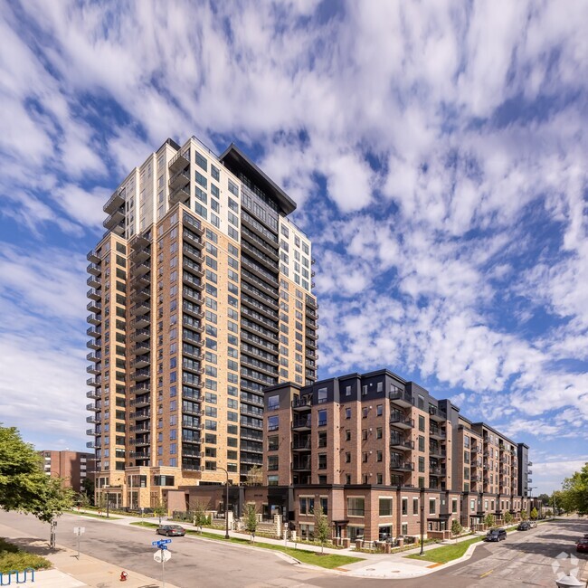
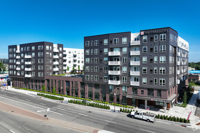
You May Also Like
-
The Preserve Apartments & Townhomes
13600 Commerce Blvd
Rogers, MN 55374
3 Br $2,150-$4,546 16.8 mi
-
Lake Place Luxury Apartments & Townhomes
11445-11447 Anderson Lakes Pky
Eden Prairie, MN 55344
3 Br $2,100-$2,700 21.0 mi
-
Acclaim of Woodbury Rental Home Community
10108 Sunbird Cir
Woodbury, MN 55129
3-4 Br $2,750-$3,850 22.7 mi
Similar Rentals Nearby


What Are Walk Score®, Transit Score®, and Bike Score® Ratings?
Walk Score® measures the walkability of any address. Transit Score® measures access to public transit. Bike Score® measures the bikeability of any address.
What is a Sound Score Rating?
A Sound Score Rating aggregates noise caused by vehicle traffic, airplane traffic and local sources
1856 County Hwy 10
Spring Lake Park, MN 55432