

$518 / Month
1875 E Pleasant Hill Rd
Atlanta, GA 30349
2 Weeks Ago
Favorites
1875 E Pleasant Hill Rd

Favorites
Check Back Soon for Upcoming Availability
| Beds | Baths | Average SF |
|---|---|---|
| 1 Bedroom 1 Bedroom 1 Br | 1 Bath 1 Bath 1 Ba | — |
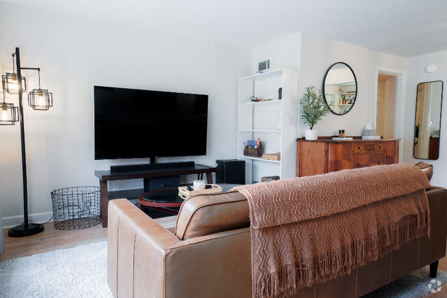
About This Property
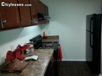
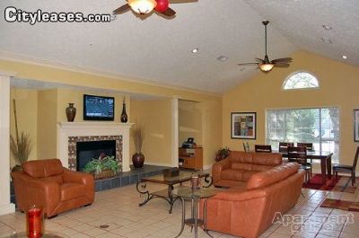
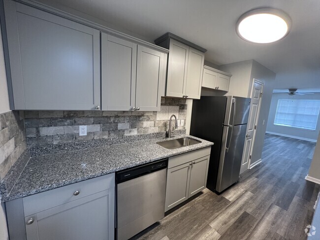
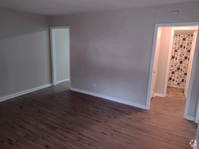
Sublet.com ID 2519665. Poplar Pointe Apartment homes combine luxury living with convenience unlike other apartments. Conveniently located to I-285, I-85, Hartsfield Jackson Airport, and I-75, our apartments are convenient to everything while being tucked away from it all. Residents enter our gated community to be welcomed by lush landscaping, tree lined picnic areas with garden trellis and amenities for any lifestyle. Enjoy apartment features including garden tubs, wood burning fireplaces, screened patios, full size w/d connections and so much more. Come experience why Poplar Pointe Apartments is the place to call home. For more details and images visit sublet.com/rhp.asp and enter ID 2519665
1875 E Pleasant Hill Rd is a condo located in Fulton County and the 30349 ZIP Code. This area is served by the Clayton County attendance zone.
Location
Get Directions
Atlanta, Georgia is one of the most well-known cities in the country, recognized for its Southern charm and modern sophistication. This city is full of surprises – from towering skyscrapers to historic, brick-lined sidewalks, Atlanta has it all. Atlanta’s economy is remarkably diverse. It’s a major transportation hub and is home to the world’s busiest airport, Hartsfield-Jackson Atlanta International. This booming metropolis is the third most popular filming destination with several major movie studios, and is a communications hub with CNN, Cox Enterprises, the Weather Channel, and Turner Broadcasting.
The city of Atlanta is one of the fastest-growing tech hubs in the nation as well. Fortune 500 companies thrive here, with headquarters including Delta Airlines, UPS, Coca-Cola, and Home Depot. Universities that call Atlanta home include Georgia State University, Georgia Tech, Clark Atlanta University, and Emory University.
Learn more about living in Atlanta
Education
| Colleges & Universities | Distance | ||
|---|---|---|---|
| Colleges & Universities | Distance | ||
| Drive: | 17 min | 10.2 mi | |
| Drive: | 21 min | 10.9 mi | |
| Drive: | 19 min | 10.9 mi | |
| Drive: | 23 min | 12.8 mi |
1875 E Pleasant Hill Rd is within 17 minutes or 10.2 miles from Atlanta Metropolitan State. It is also near Clayton State University and Atlanta Technical College.
Schools


Public Elementary School
Grades PK-5
693 Students
Attendance Zone
Public Middle School
Grades 6-8
767 Students
Attendance Zone
Public High School
Grades 9-12
1,206 Students
Attendance Zone
Private Elementary, Middle & High School
Grades PK-12
139 Students
Nearby
Private Elementary, Middle & High School
Grades PK-12
58 Students
Nearby
Private Elementary School
Grades PK-2 & 4
Nearby
School data provided by
 The GreatSchools Rating helps parents compare schools within a state based on a variety of school quality indicators and provides a helpful picture of how effectively each school serves all of its students. Ratings are on a scale of 1 (below average) to 10 (above average) and can include test scores, college readiness, academic progress, advanced courses, equity, discipline and attendance data. We also advise parents to visit schools, consider other information on school performance and programs, and consider family needs as part of the school selection process.
View GreatSchools Rating Methodology
View GreatSchools Rating Methodology
Transportation options available in Atlanta include Airport, located 4.4 miles from 1875 E Pleasant Hill Rd. 1875 E Pleasant Hill Rd is near Hartsfield - Jackson Atlanta International, located 6.0 miles or 13 minutes away.
| Transit / Subway | Distance | ||
|---|---|---|---|
| Transit / Subway | Distance | ||
|
|
Drive: | 10 min | 4.4 mi |
|
|
Drive: | 12 min | 5.7 mi |
|
|
Drive: | 15 min | 7.6 mi |
|
|
Drive: | 18 min | 9.4 mi |
|
|
Drive: | 18 min | 10.2 mi |
| Commuter Rail | Distance | ||
|---|---|---|---|
| Commuter Rail | Distance | ||
|
|
Drive: | 27 min | 17.7 mi |
| Airports | Distance | ||
|---|---|---|---|
| Airports | Distance | ||
|
Hartsfield - Jackson Atlanta International
|
Drive: | 13 min | 6.0 mi |
Time and distance from 1875 E Pleasant Hill Rd.
| Shopping Centers | Distance | ||
|---|---|---|---|
| Shopping Centers | Distance | ||
| Walk: | 17 min | 0.9 mi | |
| Drive: | 4 min | 1.5 mi | |
| Drive: | 4 min | 1.6 mi |
1875 E Pleasant Hill Rd has 3 shopping centers within 1.6 miles, which is about a 4-minute walk. The miles and minutes will be for the farthest away property.
| Parks and Recreation | Distance | ||
|---|---|---|---|
| Parks and Recreation | Distance | ||
|
West Atlanta Watershed Alliance (WAWA)
|
Drive: | 24 min | 12.4 mi |
|
Cascade Springs Nature Preserve
|
Drive: | 20 min | 13.8 mi |
|
Atlanta BeltLine Southwest Connector Spur Trail
|
Drive: | 25 min | 16.1 mi |
1875 E Pleasant Hill Rd has 3 parks within 16.1 miles, including Cascade Springs Nature Preserve, West Atlanta Watershed Alliance (WAWA), and Atlanta BeltLine Southwest Connector Spur Trail.
| Hospitals | Distance | ||
|---|---|---|---|
| Hospitals | Distance | ||
| Drive: | 7 min | 2.1 mi | |
| Drive: | 13 min | 5.2 mi | |
| Drive: | 11 min | 5.4 mi |
1875 E Pleasant Hill Rd has 3 hospitals within 5.4 miles, the nearest is Southern Crescent Behavioral Health System - Anchor Hospital Campus which is 2.1 miles away and a 7 minute drive.
| Military Bases | Distance | ||
|---|---|---|---|
| Military Bases | Distance | ||
| Drive: | 19 min | 10.1 mi | |
| Drive: | 22 min | 12.2 mi |
1875 E Pleasant Hill Rd is 10.1 miles from Fort McPherson, and is convenient to other military bases, including Fort Gillem.
You May Also Like
Similar Rentals Nearby


What Are Walk Score®, Transit Score®, and Bike Score® Ratings?
Walk Score® measures the walkability of any address. Transit Score® measures access to public transit. Bike Score® measures the bikeability of any address.
What is a Sound Score Rating?
A Sound Score Rating aggregates noise caused by vehicle traffic, airplane traffic and local sources

1875 E Pleasant Hill Rd
Atlanta, GA 30349