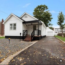
Apartments for Rent in Central Islip NY
338 Rentals Available
-
-
-
-
-
-
-
-
-
-
-

Central Islip Market Snapshot
Average 1-Bedroom Rent is $2,414/mo
Unchanged From Last Year
View More Central Islip Rent Insights -
-
-
-
-
-
-
-
-
-
-
-
-
-
-
-
-
-
-
-
-
-
-
-
-
-
-
-
-
-
-
-
-
-
Showing 40 of 62 Results - Page 1 of 2
Explore Rent Prices Near Central Islip, NY
Central Islip, NY’s average rent price is $2,469 per month. Compare rent prices and available listings in nearby cities to find better value or more options that fit your budget.
| Average Rent | |
|---|---|
| Islip Terrace | $2,464 |
| Brentwood | $1,833 |
| Hauppauge | $2,674 |
| East Islip | $2,417 |
| Bohemia | $2,474 |
Average Monthly Rent is calculated using the average rent of active one-bedroom apartment listings.
Central Islip, NY Apartments for Rent
Located in the middle of the town of Islip, Central Islip is a metro area with a large population of about 35,000 residents. One of its most appealing aspects is the array of transportation options. Residents have connections to neighboring villages and far destinations from their apartments via the Long Island Expressway. The village has some of the most bus routes in Suffolk County that pass through the village and Central Islip has its own train station.
Central Islip also has a solid set of local businesses, restaurants and stores mostly clustered along easy-to-reach streets. Central Islip residents have outstanding opportunities for outdoor recreation and attractions within and around the busy neighborhood.
Central Islip, NY Rental Insights
-
The average rent in Central Islip, NY is $2,414 per month. By comparison, renters across the U.S. pay an average of $1,632, which means housing in Central Islip, NY is slightly more expensive than much of the country.
-
You can find flexible rentals in Central Islip, NY by exploring short-term rentals for temporary stays or browsing furnished apartments for move-in ready options that save time and hassle.
-
Tour apartments from your couch with Matterport 3D Tours. We have 338 Central Islip apartments with virtual tours available. Walk through the apartment, view room layouts and get a feel for the space before an in-person tour.
-
Central Islip, NY has very few transit options. Residents typically rely on driving for daily needs.
-
Students renting in Central Islip, NY have access to Touro University, SUNY Suffolk Co., Grant Campus, SUNY Suffolk Co., Ammerman, and St Joseph's Coll., Long Island.
