
19 Braemore Rd Unit 1
Boston, MA 02135

-
Monthly Rent
$3,500
-
Bedrooms
3 bd
-
Bathrooms
2 ba
-
Square Feet
Details
About This Property
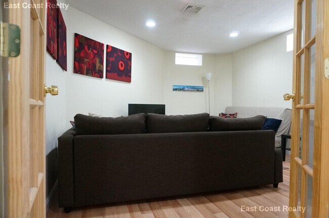
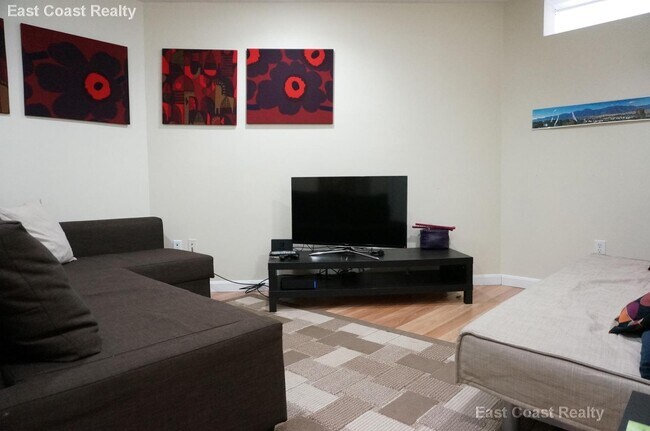
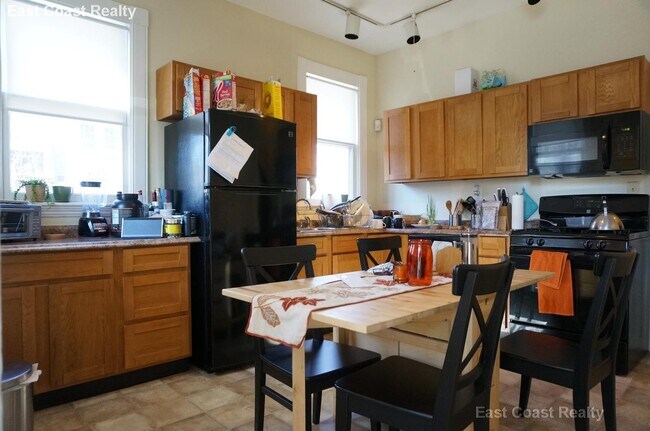
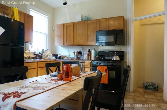
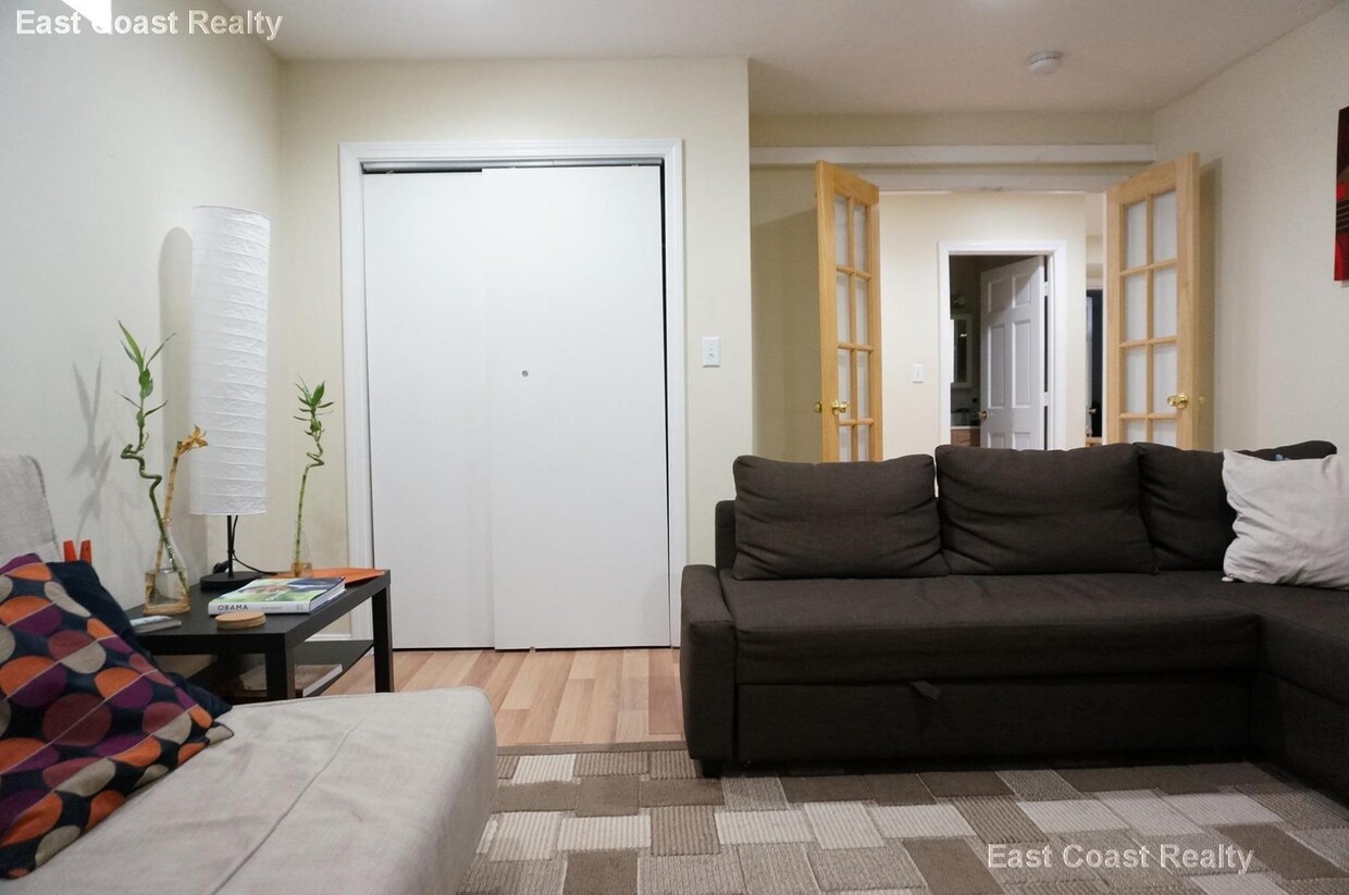
SEPT 2025- 3 Bed 2 Bath, W/D in Unit, NO BROKER FEE, Easy MBTA Incredible 3 bed 2 bath Duplex! Conveniently located within walking distance of 3 Green line Trains---The D, C and B, this location is great for anyone who needs access to downtown. Cleveland Circle is a vibrant area with a number of shops, restaurants, and bars in addition to close proximity to many fields, tennis courts, and even a public swimming area.
19 Braemore Rd is an apartment community located in Suffolk County and the 02135 ZIP Code.
Fees and Policies
The fees below are based on community-supplied data and may exclude additional fees and utilities.
- Cats Allowed
-
Fees not specified
-
Weight limit--
-
Pet Limit--
Details
Lease Options
-
12 Months
 This Property
 Available Property
Situated about five miles west of Downtown Boston, Commonwealth boasts a vibrant atmosphere with charming brick buildings, local shops, delectable restaurants, numerous entertainment options, lush parks and playgrounds, and a diverse population. Commonwealth is convenient to several renowned attractions, including the John Fitzgerald Kennedy National Historic Site, Coolidge Corner Theatre, Brookline Booksmith, and Brighton Music Hall.
Commonwealth residents also enjoy quick access to Boston College, making the area especially popular among the institution’s students, faculty, and staff. A host of T stops strewn along Commonwealth Avenue provide easy commutes and travels to Greater Boston as well as convenience to an array of metropolitan amenities.
Learn more about living in Commonwealth| Colleges & Universities | Distance | ||
|---|---|---|---|
| Colleges & Universities | Distance | ||
| Drive: | 4 min | 1.3 mi | |
| Drive: | 3 min | 1.4 mi | |
| Drive: | 6 min | 2.8 mi | |
| Drive: | 7 min | 3.1 mi |
Transportation options available in Boston include Chestnut Hill Avenue Station, located 0.2 mile from 19 Braemore Rd Unit 1. 19 Braemore Rd Unit 1 is near General Edward Lawrence Logan International, located 9.9 miles or 18 minutes away.
| Transit / Subway | Distance | ||
|---|---|---|---|
| Transit / Subway | Distance | ||
|
|
Walk: | 3 min | 0.2 mi |
|
|
Walk: | 5 min | 0.3 mi |
|
|
Walk: | 7 min | 0.4 mi |
|
|
Walk: | 8 min | 0.4 mi |
|
|
Walk: | 9 min | 0.5 mi |
| Commuter Rail | Distance | ||
|---|---|---|---|
| Commuter Rail | Distance | ||
|
|
Drive: | 9 min | 3.9 mi |
|
|
Drive: | 8 min | 3.9 mi |
|
|
Drive: | 8 min | 4.1 mi |
| Drive: | 10 min | 4.8 mi | |
|
|
Drive: | 10 min | 5.0 mi |
| Airports | Distance | ||
|---|---|---|---|
| Airports | Distance | ||
|
General Edward Lawrence Logan International
|
Drive: | 18 min | 9.9 mi |
Time and distance from 19 Braemore Rd Unit 1.
| Shopping Centers | Distance | ||
|---|---|---|---|
| Shopping Centers | Distance | ||
| Walk: | 15 min | 0.8 mi | |
| Walk: | 18 min | 0.9 mi | |
| Drive: | 5 min | 1.9 mi |
| Parks and Recreation | Distance | ||
|---|---|---|---|
| Parks and Recreation | Distance | ||
|
Chestnut Hill Reservation
|
Walk: | 5 min | 0.3 mi |
|
Frederick Law Olmsted National Historic Site
|
Drive: | 5 min | 2.1 mi |
|
John Fitzgerald Kennedy National Historic Site
|
Drive: | 4 min | 2.2 mi |
|
Hammond Pond Reservation
|
Drive: | 5 min | 2.6 mi |
|
Coit Observatory
|
Drive: | 7 min | 3.3 mi |
| Hospitals | Distance | ||
|---|---|---|---|
| Hospitals | Distance | ||
| Drive: | 3 min | 1.4 mi | |
| Drive: | 3 min | 1.6 mi | |
| Drive: | 6 min | 3.1 mi |
| Military Bases | Distance | ||
|---|---|---|---|
| Military Bases | Distance | ||
| Drive: | 22 min | 13.2 mi | |
| Drive: | 28 min | 15.8 mi |
You May Also Like
What Are Walk Score®, Transit Score®, and Bike Score® Ratings?
Walk Score® measures the walkability of any address. Transit Score® measures access to public transit. Bike Score® measures the bikeability of any address.
What is a Sound Score Rating?
A Sound Score Rating aggregates noise caused by vehicle traffic, airplane traffic and local sources
19 Braemore Rd
Boston, MA 02135