$1,700 / Month
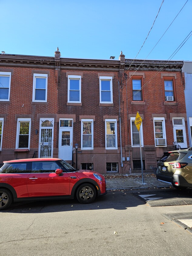
1930 N Howard St
Philadelphia, PA 19122
Today
Favorites
856-644-6249
-
Bedrooms
3
-
Bathrooms
1
-
Square Feet
1,160 sq ft
-
Available
Available Now
1930 N Howard St

Favorites
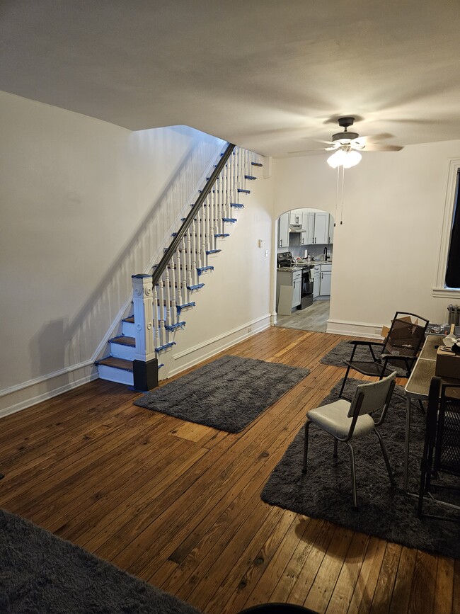
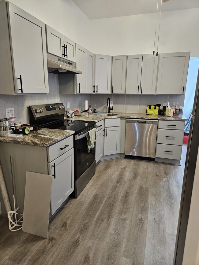
About This Home
12 Month Lease,
$5,100 deposit,
Available Now
Great location, convenient to Berks St Septa El Stop, residential block, convenient to Temple University/Fishtown/Northern Liberties, newly remodeled
1930 N Howard St is a house located in Philadelphia County and the 19122 ZIP Code. This area is served by the The School District of Philadelphia attendance zone.
* Price shown is base rent and may not include non-optional fees and utilities.
Price, availability, fees, and any applicable rent special are subject to change without notice.
* Square footage definitions vary. Displayed square footage is approximate.
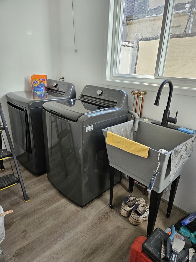
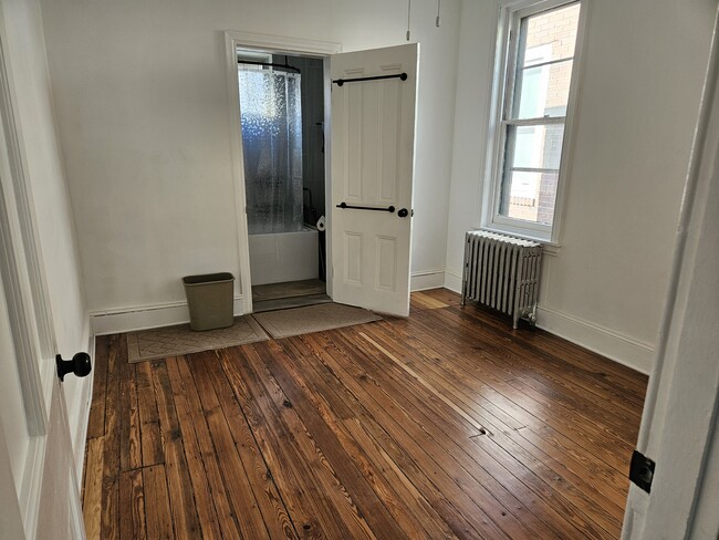
House Features
- Washer/Dryer
Fees and Policies
The fees below are based on community-supplied data and may exclude additional fees and utilities.
- Parking
-
Street--
Details
Property Information
-
Built in 1925
Contact
- Phone Number
- Contact
$1,400 / month
$250,000 Listing Price
3 Beds
•1 Baths
•
852 Sq Ft
$1,003 / month
$155,000 Listing Price
4 Beds
•1 Baths
•
1,902 Sq Ft
$1,322 / month
$225,000 Listing Price
3 Beds
•2.5 Baths
•
1,892 Sq Ft
Location
Get Directions
Not to be confused with Northeast Philadelphia, North Philadelphia East encompasses the smaller subsets of Ludlow, Yorktown, West Kensington, Poplar, and Callowhill. This composite area runs from the Vine Street Expressway, stretching north to Erie Avenue. Broad Street acts as its eastern border, and the western edge runs a jagged line separating North Philadelphia East from the nearby Kensington, Port Richmond, and Fishtown neighborhoods. With such a long stretch of city, the neighborhood offers a diverse blend of important city landmarks, such as renowned musical venues the Electric Factory and Union Transfer, and Temple University, North Philadelphia's premiere site of higher learning.
Learn more about living in North Philadelphia East
Education
| Colleges & Universities | Distance | ||
|---|---|---|---|
| Colleges & Universities | Distance | ||
| Drive: | 5 min | 1.7 mi | |
| Drive: | 7 min | 2.6 mi | |
| Drive: | 7 min | 3.1 mi | |
| Drive: | 9 min | 3.2 mi |
1930 N Howard St is within 5 minutes or 1.7 miles from Temple University, Main Campus. It is also near Temple Univ., Health Center and C.C. of Philadelphia.
Schools


Public Elementary School
Grades K-5
250 Students
Attendance Zone
Public Elementary School
Grades PK-5
411 Students
Nearby
Public Middle & High School
Grades 6-12
468 Students
Attendance Zone
Private Elementary & Middle School
Grades PK-8
Nearby
Private Elementary, Middle & High School
Grades PK-12
88 Students
Nearby
School data provided by
 The GreatSchools Rating helps parents compare schools within a state based on a variety of school quality indicators and provides a helpful picture of how effectively each school serves all of its students. Ratings are on a scale of 1 (below average) to 10 (above average) and can include test scores, college readiness, academic progress, advanced courses, equity, discipline and attendance data. We also advise parents to visit schools, consider other information on school performance and programs, and consider family needs as part of the school selection process.
View GreatSchools Rating Methodology
View GreatSchools Rating Methodology
Transportation options available in Philadelphia include Berks, located 0.1 mile from 1930 N Howard St. 1930 N Howard St is near Philadelphia International, located 13.5 miles or 25 minutes away, and Trenton Mercer, located 32.0 miles or 49 minutes away.
| Transit / Subway | Distance | ||
|---|---|---|---|
| Transit / Subway | Distance | ||
|
|
Walk: | 2 min | 0.1 mi |
|
|
Walk: | 8 min | 0.4 mi |
| Drive: | 4 min | 1.1 mi | |
| Drive: | 4 min | 1.1 mi | |
| Drive: | 4 min | 1.3 mi |
| Commuter Rail | Distance | ||
|---|---|---|---|
| Commuter Rail | Distance | ||
|
|
Walk: | 17 min | 0.9 mi |
|
|
Drive: | 5 min | 1.8 mi |
|
|
Drive: | 5 min | 2.1 mi |
|
|
Drive: | 7 min | 2.5 mi |
|
|
Drive: | 8 min | 3.1 mi |
| Airports | Distance | ||
|---|---|---|---|
| Airports | Distance | ||
|
Philadelphia International
|
Drive: | 25 min | 13.5 mi |
|
Trenton Mercer
|
Drive: | 49 min | 32.0 mi |
Time and distance from 1930 N Howard St.
| Shopping Centers | Distance | ||
|---|---|---|---|
| Shopping Centers | Distance | ||
| Walk: | 19 min | 1.0 mi | |
| Drive: | 5 min | 1.5 mi | |
| Drive: | 5 min | 1.7 mi |
1930 N Howard St has 3 shopping centers within 1.7 miles, which is about a 5-minute walk. The miles and minutes will be for the farthest away property.
| Parks and Recreation | Distance | ||
|---|---|---|---|
| Parks and Recreation | Distance | ||
|
Wagner Free Institute of Science
|
Drive: | 6 min | 2.0 mi |
|
Edgar Allan Poe Nat'l Historic Site
|
Drive: | 6 min | 2.2 mi |
|
Great Egg Harbor River
|
Drive: | 7 min | 2.5 mi |
|
Lower Delaware National Wild and Scenic River
|
Drive: | 7 min | 2.5 mi |
|
Independence National Historical Park
|
Drive: | 7 min | 2.7 mi |
1930 N Howard St has 5 parks within 2.7 miles, including Wagner Free Institute of Science, Edgar Allan Poe Nat'l Historic Site, and Great Egg Harbor River.
| Hospitals | Distance | ||
|---|---|---|---|
| Hospitals | Distance | ||
| Drive: | 6 min | 2.1 mi | |
| Drive: | 7 min | 2.7 mi | |
| Drive: | 7 min | 2.9 mi |
1930 N Howard St has 3 hospitals within 2.9 miles, the nearest is St. Christopher's Hospital for Children which is 2.1 miles away and a 6 minute drive.
| Military Bases | Distance | ||
|---|---|---|---|
| Military Bases | Distance | ||
| Drive: | 16 min | 7.9 mi |
1930 N Howard St is 7.9 miles and a 16 minute drive from Philadelphia Naval Busi Center.
Amenities
- Washer/Dryer
1930 N Howard St Photos
What Are Walk Score®, Transit Score®, and Bike Score® Ratings?
Walk Score® measures the walkability of any address. Transit Score® measures access to public transit. Bike Score® measures the bikeability of any address.
What is a Sound Score Rating?
A Sound Score Rating aggregates noise caused by vehicle traffic, airplane traffic and local sources

1930 N Howard St
Philadelphia, PA 19122