$1,645 / Month
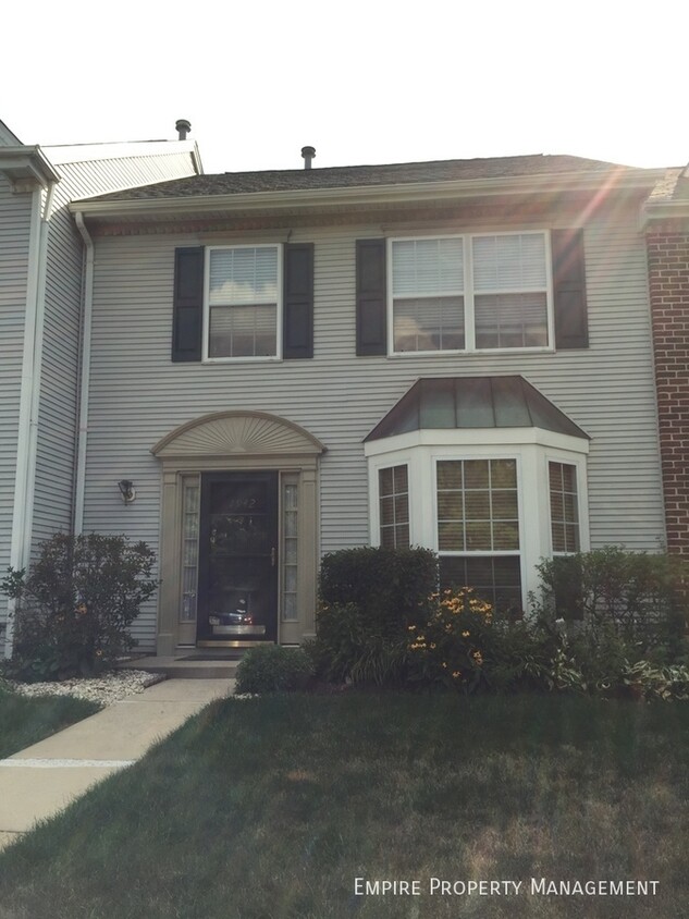
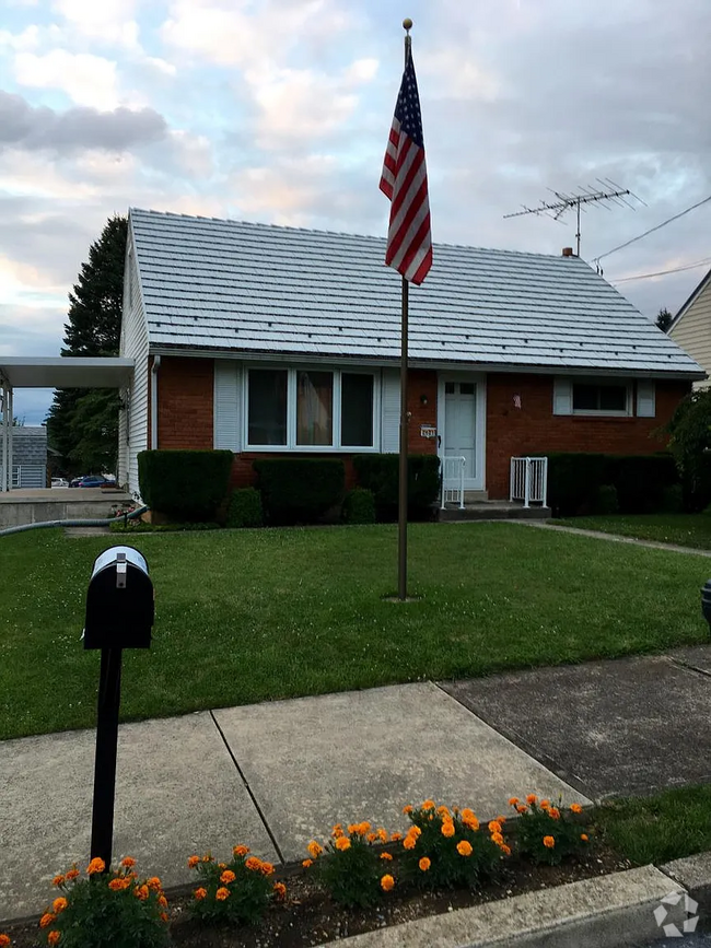
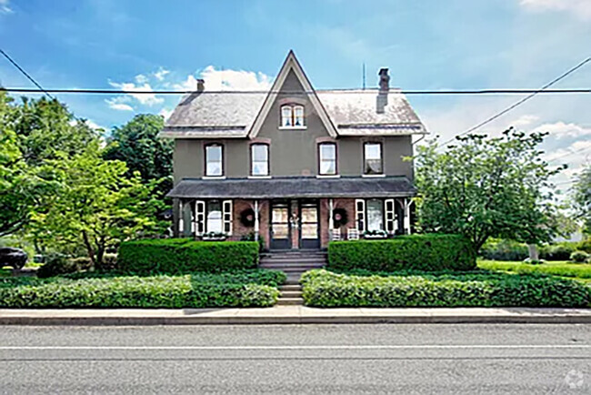
1942 Pine Ct
Hellertown, PA 18055
Today
Favorites
610-347-5337
-
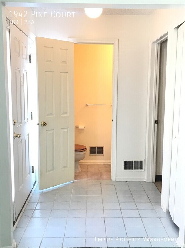
Bedrooms
3
-
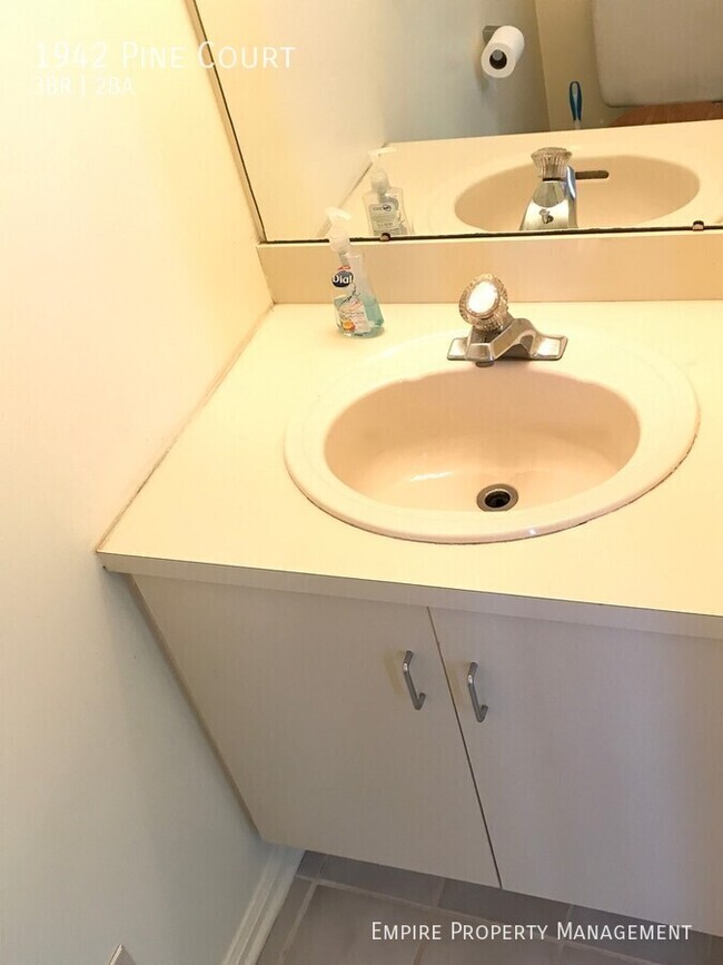
Bathrooms
1.5
-
Square Feet
1,376 sq ft
-
Available
Available May 14
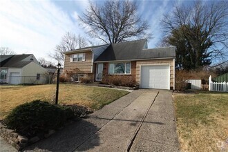
1942 Pine Ct

Favorites
About This Home
Available May 14
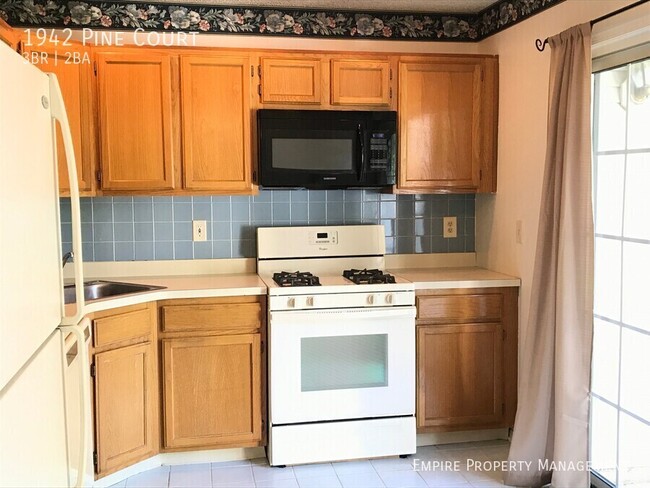
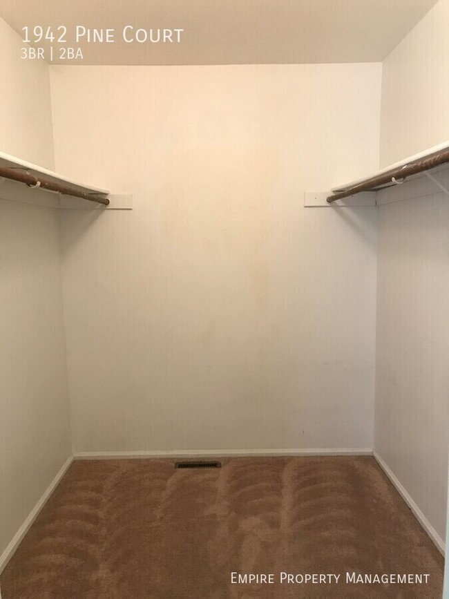
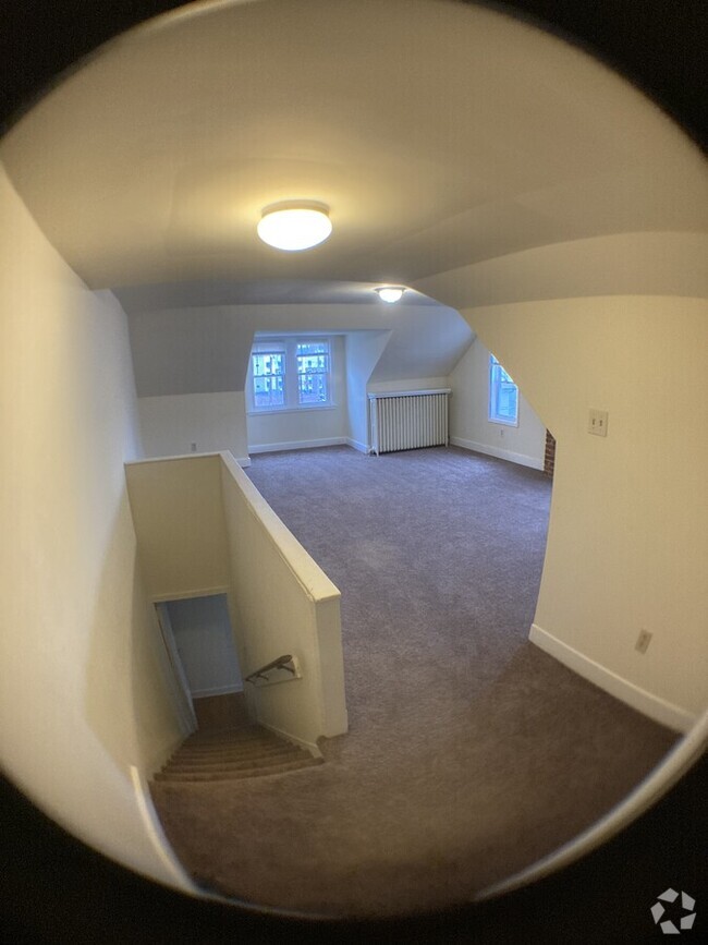
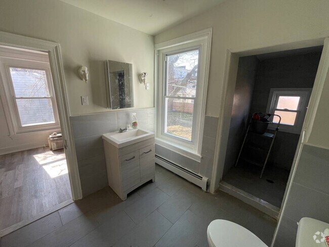
---- SCHEDULE A SHOWING ONLINE AT: ---- THERE WILL BE NO SHOWINGS RIGHT NOW. YOU CAN STILL APPLY AND IF APPROVED TENANTS WILL ALLOW YOU IN TO LOOK BEFORE YOU SIGN A LEASE Great 3 bedroom 1.5 bathroom townhouse in the Society Hill development with air conditioning! Tenant has access to club house with amenities including the swimming pool, tennis ball court, and playground. Landlord pays for Trash. Tenants pays for Electric, Gas, Water and Sewer. Gas Stove and Gas Heat. Pets are considered on a case to case basis with an additional fee. Available Sept 15th! APPLY at
1942 Pine Ct is a house located in Northampton County and the 18055 ZIP Code. This area is served by the Saucon Valley attendance zone.
* Price shown is base rent and may not include non-optional fees and utilities.
Price, availability, fees, and any applicable rent special are subject to change without notice.
* Square footage definitions vary. Displayed square footage is approximate.
Contact
- Listed by Jayda Benscoter
- Phone Number
- Contact
Location
Get Directions
Situated approximately 80 miles north of Philadelphia and the same distance west of New York City, the sprawling area of Hellertown-Saucon Valley provides convenience to those wanting to live in proximity to big cities without having to deal with urban headaches. Much of the area encompasses low-lying apartments and more pastoral countryside, making it easy to find an affordable rental in a beautiful landscape.
Several historic and visitor-friendly Main Streets fall within Hellertown-Saucon Valley, as do historic sites, museums, and kid-friendly venues, granting residents of the area access to innumerable activities for every lifestyle. Interstates 78 and 476 serve as the main thoroughfares into Philly, New York, or the number of cities that surround the area.
Learn more about living in Hellertown-Saucon Valley
Education
| Colleges & Universities | Distance | ||
|---|---|---|---|
| Colleges & Universities | Distance | ||
| Drive: | 5 min | 1.7 mi | |
| Drive: | 8 min | 4.0 mi | |
| Drive: | 10 min | 4.5 mi | |
| Drive: | 12 min | 5.7 mi |
1942 Pine Ct is within 5 minutes or 1.7 miles from Lehigh Univ., Goodman. It is also near Lehigh University and Northampton CC, Fowler Center.
Schools


Public Elementary School
Grades PK-5
449 Students
Nearby
Public Elementary & Middle School
Grades 5-8
635 Students
Attendance Zone
Public Elementary School
Grades K-4
670 Students
Attendance Zone
Public High School
Grades 9-12
648 Students
Attendance Zone
Private Elementary & Middle School
Grades PK-8
116 Students
Nearby
Private Middle & High School
Grades 7-12
7 Students
Nearby
School data provided by
 The GreatSchools Rating helps parents compare schools within a state based on a variety of school quality indicators and provides a helpful picture of how effectively each school serves all of its students. Ratings are on a scale of 1 (below average) to 10 (above average) and can include test scores, college readiness, academic progress, advanced courses, equity, discipline and attendance data. We also advise parents to visit schools, consider other information on school performance and programs, and consider family needs as part of the school selection process.
View GreatSchools Rating Methodology
View GreatSchools Rating Methodology
Transportation options available in Hellertown include Norristown Transportation Center (100 Line), located 43.8 miles from 1942 Pine Ct. 1942 Pine Ct is near Lehigh Valley International, located 9.9 miles or 21 minutes away, and Trenton Mercer, located 42.7 miles or 73 minutes away.
| Transit / Subway | Distance | ||
|---|---|---|---|
| Transit / Subway | Distance | ||
|
|
Drive: | 64 min | 43.8 mi |
|
|
Drive: | 67 min | 44.7 mi |
|
|
Drive: | 67 min | 44.7 mi |
|
|
Drive: | 63 min | 45.2 mi |
|
|
Drive: | 65 min | 45.9 mi |
| Commuter Rail | Distance | ||
|---|---|---|---|
| Commuter Rail | Distance | ||
|
|
Drive: | 43 min | 25.9 mi |
|
|
Drive: | 43 min | 26.0 mi |
|
|
Drive: | 48 min | 27.7 mi |
|
|
Drive: | 45 min | 28.7 mi |
|
|
Drive: | 47 min | 30.0 mi |
| Airports | Distance | ||
|---|---|---|---|
| Airports | Distance | ||
|
Lehigh Valley International
|
Drive: | 21 min | 9.9 mi |
|
Trenton Mercer
|
Drive: | 73 min | 42.7 mi |
Time and distance from 1942 Pine Ct.
| Shopping Centers | Distance | ||
|---|---|---|---|
| Shopping Centers | Distance | ||
| Drive: | 4 min | 1.5 mi | |
| Drive: | 5 min | 1.9 mi | |
| Drive: | 6 min | 2.9 mi |
1942 Pine Ct has 3 shopping centers within 2.9 miles, which is about a 6-minute drive. The miles and minutes will be for the farthest away property.
| Parks and Recreation | Distance | ||
|---|---|---|---|
| Parks and Recreation | Distance | ||
|
Lost River Caverns
|
Drive: | 3 min | 1.2 mi |
|
Flint Hill Farm Educational Center
|
Drive: | 12 min | 5.0 mi |
|
Delaware & Lehigh National Heritage Corridor
|
Drive: | 20 min | 12.1 mi |
|
Pool Wildlife Sanctuary
|
Drive: | 25 min | 12.4 mi |
|
Mariton Wildlife Sanctuary
|
Drive: | 25 min | 12.5 mi |
1942 Pine Ct has 5 parks within 12.5 miles, including Lost River Caverns, Flint Hill Farm Educational Center, and Mariton Wildlife Sanctuary.
| Hospitals | Distance | ||
|---|---|---|---|
| Hospitals | Distance | ||
| Drive: | 9 min | 4.0 mi | |
| Drive: | 16 min | 8.0 mi | |
| Drive: | 15 min | 8.6 mi |
1942 Pine Ct has 3 hospitals within 8.6 miles, the nearest is St. Luke's Hospital Bethlehem which is 4.0 miles away and a 9 minute drive.
| Military Bases | Distance | ||
|---|---|---|---|
| Military Bases | Distance | ||
| Drive: | 57 min | 35.5 mi | |
| Drive: | 59 min | 36.7 mi |
1942 Pine Ct is 35.5 miles from Willow Grove Naval Air Station, and is convenient to other military bases, including Naval Air Development Center.
You May Also Like
Similar Rentals Nearby


What Are Walk Score®, Transit Score®, and Bike Score® Ratings?
Walk Score® measures the walkability of any address. Transit Score® measures access to public transit. Bike Score® measures the bikeability of any address.
What is a Sound Score Rating?
A Sound Score Rating aggregates noise caused by vehicle traffic, airplane traffic and local sources

1942 Pine Ct
Hellertown, PA 18055