$2,350 / Month
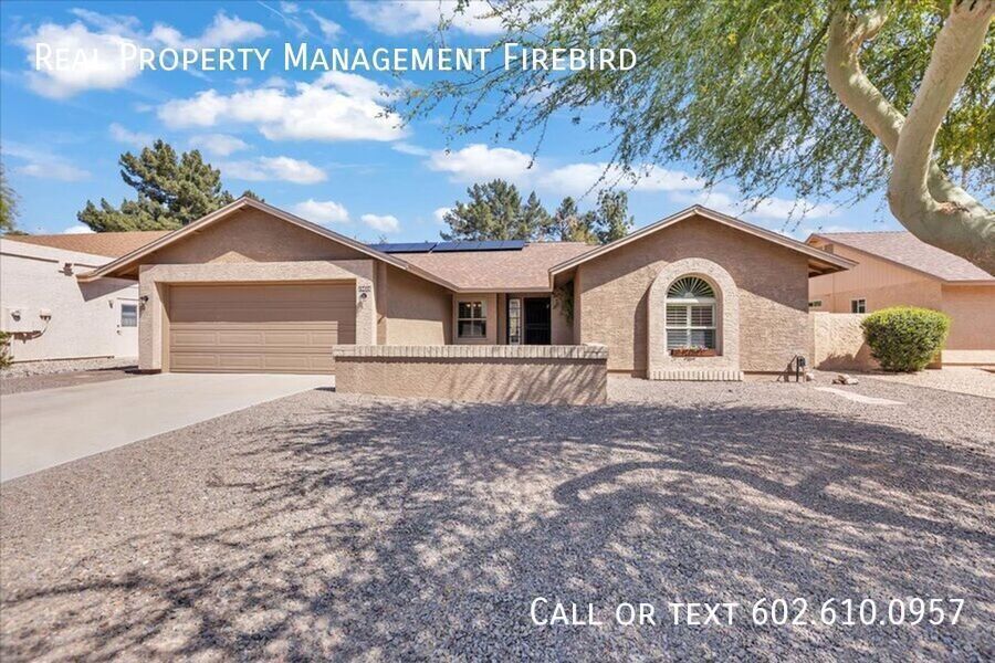
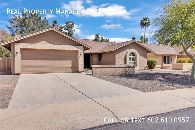
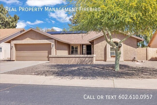
19421 N 98th Ave
Peoria, AZ 85382
Today
Favorites
602-610-0957
-
Bedrooms
2
-
Bathrooms
2
-
Square Feet
1,712 sq ft
-
Available
Available Now
19421 N 98th Ave

Favorites
About This Home
Available Now
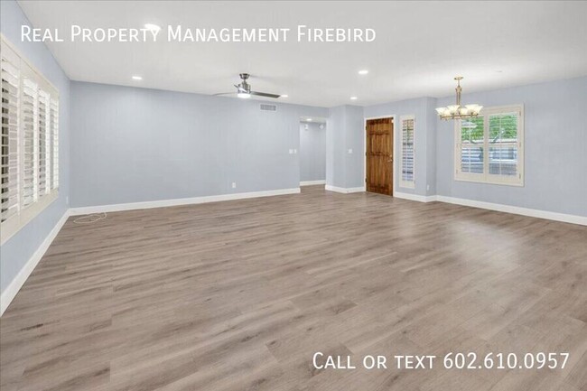
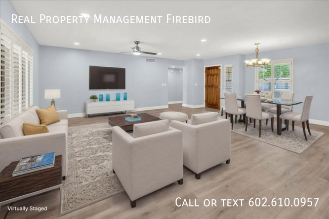
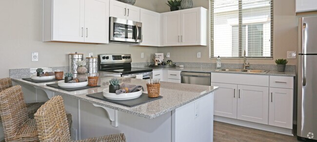
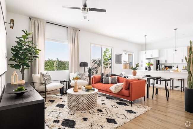
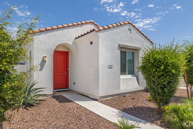
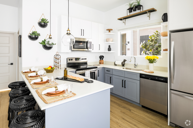
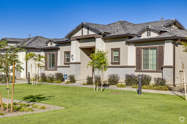
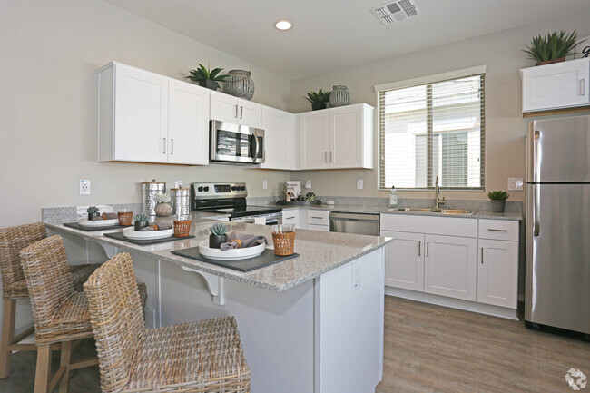
---- SCHEDULE A SHOWING ONLINE AT: ---- $500 off your first month's rent – schedule your tour today! This is a 55+ community which requires at least one resident to be aged 55 years or older and all other residents must be at least 40 years or older. This beautiful home is nestled in the heart of Westbrook Village one of Peoria's most sought-after active communities! This beautifully maintained 2-bedroom, 2-bathroom home offers comfortable desert living with thoughtful upgrades throughout. Step inside to a bright and airy layout featuring an enclosed Arizona room perfect for morning coffee, hobbies, or hosting guests year-round. With mini-split systems in both bedrooms and the Arizona room, you'll enjoy energy-efficient, customized comfort even during the hottest summer days. Other highlights include: - Spacious 2-car garage - Low-maintenance desert landscaping - Huge kitchen with ample cabinetry - Move-in ready and lovingly cared for As a tenant in Westbrook Village, you'll enjoy resort-style amenities, including: - Two 18-hole golf courses - Two pro shops and on-site restaurants - Driving ranges and putting greens - Two full-service recreation centers with pools, fitness, crafts, clubs, and so much more! Whether you're looking to relax, stay active, or be part of a vibrant community, this home offers it all. Don't miss out on the Westbrook lifestyle – schedule your tour today!
19421 N 98th Ave is a house located in Maricopa County and the 85382 ZIP Code. This area is served by the Peoria Unified attendance zone.
* Price shown is base rent and may not include non-optional fees and utilities.
Price, availability, fees, and any applicable rent special are subject to change without notice.
* Square footage definitions vary. Displayed square footage is approximate.
Fees and Policies
The fees below are based on community-supplied data and may exclude additional fees and utilities.
- Dogs Allowed
-
Fees not specified
- Cats Allowed
-
Fees not specified
Contact
- Listed by Jason Petzke
- Phone Number
- Contact
Location
Get Directions
On the north side of Peoria sits the hiking town of North Peoria. A large residential community, North Peoria is located near everything from shopping to restaurants and big-city attractions. The Lake Pleasant Towne Center hosts a variety of food and retail stores, including Panera Bread, El Pollo Loco, Kohl’s, and Tuesday Morning.
Avid hikers love North Peoria for its hiking trails! The Sunrise Mountain Trail, located on the Sunrise Mountain Preserve, is a moderate four-mile loop with scenic views of the neighborhood. For even more trails, residents can venture out to the Peoria Regional Preserve. The nearness to Phoenix attractions and the convenience to Interstate 17 attracts renters.
Learn more about living in North Peoria
Education
| Colleges & Universities | Distance | ||
|---|---|---|---|
| Colleges & Universities | Distance | ||
| Drive: | 14 min | 6.6 mi | |
| Drive: | 17 min | 7.7 mi | |
| Drive: | 18 min | 8.6 mi | |
| Drive: | 21 min | 9.8 mi |
19421 N 98th Ave is within 14 minutes or 6.6 miles from Midwestern University. It is also near Thunderbird, West Campus and Glendale C.C., North Campus.
Schools


Public Elementary & Middle School
Grades PK-8
732 Students
Attendance Zone
Public Middle & High School
Grades 7-12
2,018 Students
Attendance Zone
Private Elementary School
Grades PK-6
Nearby
Private Elementary, Middle & High School
Grades PK-10
Nearby
Private Elementary, Middle & High School
Grades PK-12
Nearby
Private High School
Grades 9-12
31 Students
Nearby
School data provided by
 The GreatSchools Rating helps parents compare schools within a state based on a variety of school quality indicators and provides a helpful picture of how effectively each school serves all of its students. Ratings are on a scale of 1 (below average) to 10 (above average) and can include test scores, college readiness, academic progress, advanced courses, equity, discipline and attendance data. We also advise parents to visit schools, consider other information on school performance and programs, and consider family needs as part of the school selection process.
View GreatSchools Rating Methodology
View GreatSchools Rating Methodology
Transportation options available in Peoria include 19Th Ave/Dunlap, located 18.3 miles from 19421 N 98th Ave. 19421 N 98th Ave is near Phoenix Sky Harbor International, located 33.7 miles or 46 minutes away.
| Transit / Subway | Distance | ||
|---|---|---|---|
| Transit / Subway | Distance | ||
|
|
Drive: | 27 min | 18.3 mi |
|
|
Drive: | 28 min | 19.4 mi |
|
|
Drive: | 29 min | 20.0 mi |
|
|
Drive: | 30 min | 21.1 mi |
|
|
Drive: | 33 min | 22.4 mi |
| Airports | Distance | ||
|---|---|---|---|
| Airports | Distance | ||
|
Phoenix Sky Harbor International
|
Drive: | 46 min | 33.7 mi |
Time and distance from 19421 N 98th Ave.
| Shopping Centers | Distance | ||
|---|---|---|---|
| Shopping Centers | Distance | ||
| Drive: | 4 min | 1.2 mi | |
| Drive: | 3 min | 1.5 mi | |
| Drive: | 4 min | 1.6 mi |
19421 N 98th Ave has 3 shopping centers within 1.6 miles, which is about a 4-minute drive. The miles and minutes will be for the farthest away property.
| Parks and Recreation | Distance | ||
|---|---|---|---|
| Parks and Recreation | Distance | ||
|
Challenger Space Center
|
Drive: | 7 min | 3.4 mi |
|
Deem Hills Recreation Area
|
Drive: | 17 min | 8.6 mi |
|
Adobe Dam Regional Park
|
Drive: | 18 min | 10.0 mi |
|
Acoma Park
|
Drive: | 20 min | 10.3 mi |
|
Adobe Mountain Park
|
Drive: | 18 min | 10.7 mi |
19421 N 98th Ave has 5 parks within 10.7 miles, including Challenger Space Center, Deem Hills Recreation Area, and Adobe Dam Regional Park.
| Hospitals | Distance | ||
|---|---|---|---|
| Hospitals | Distance | ||
| Drive: | 10 min | 4.5 mi | |
| Drive: | 12 min | 5.3 mi | |
| Drive: | 17 min | 8.6 mi |
19421 N 98th Ave has 3 hospitals within 8.6 miles, the nearest is Arrowhead Hospital which is 4.5 miles away and a 10 minute drive.
| Military Bases | Distance | ||
|---|---|---|---|
| Military Bases | Distance | ||
| Drive: | 24 min | 15.5 mi | |
| Drive: | 46 min | 33.5 mi | |
| Drive: | 105 min | 78.5 mi |
19421 N 98th Ave has 3 military bases within 78.5 miles, the nearest is Luke Air Force Base which is 15.5 miles away and a 24 minute drive.
You May Also Like
Similar Rentals Nearby


What Are Walk Score®, Transit Score®, and Bike Score® Ratings?
Walk Score® measures the walkability of any address. Transit Score® measures access to public transit. Bike Score® measures the bikeability of any address.
What is a Sound Score Rating?
A Sound Score Rating aggregates noise caused by vehicle traffic, airplane traffic and local sources

19421 N 98th Ave
Peoria, AZ 85382