$825 / Month
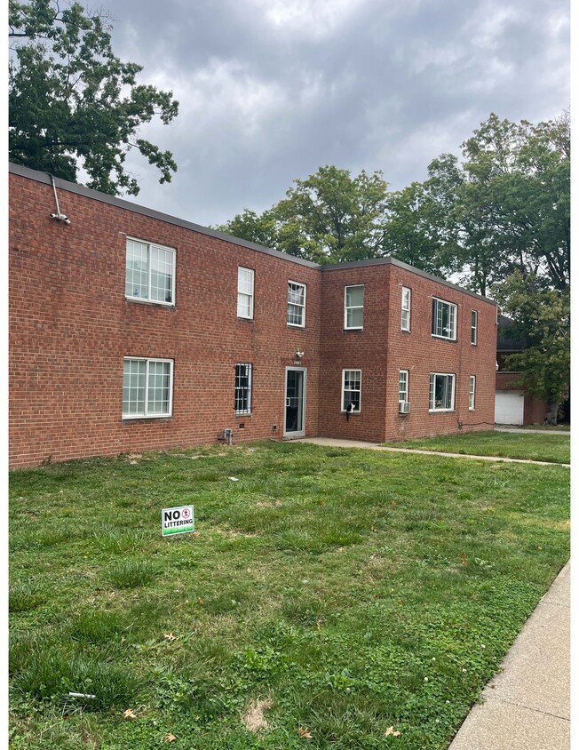
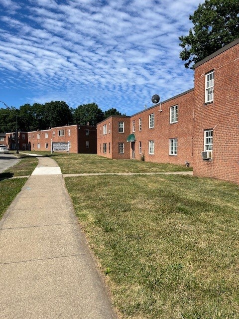
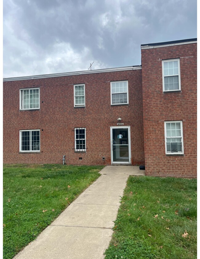
1950 Nelawood Rd
East Cleveland, OH 44112
Today
Favorites
862-285-5826
-
Bedrooms
2
-
Bathrooms
1
-
Square Feet
800 sq ft
-
Available
Available Now
Highlight
- Pets Allowed
1950 Nelawood Rd Unit 59-105

Favorites
About This Home
12 Month Lease,
$825 deposit,
Available Now
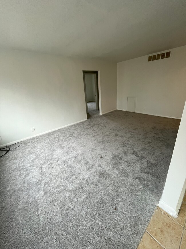
Apartments are located in Cleveland Heights Ohio. Freshly painted. New carpeting. New appliances. Garden style apartments. Conveniently located near RTA red bus lines 41 and 28. One block from Noble Rd. Apex Academy nearby. Shaw HS. Apartment is located on Nelacrest Road. Onsite laundry facilities. Pet fee $35/month Application fee $25
1950 Nelawood Rd is an apartment community located in Cuyahoga County and the 44112 ZIP Code. This area is served by the East Cleveland City attendance zone.
* Price shown is base rent and may not include non-optional fees and utilities.
Price, availability, fees, and any applicable rent special are subject to change without notice.
* Square footage definitions vary. Displayed square footage is approximate.
Apartment Features
- Range
- Refrigerator
- Laundry Facilities
Fees and Policies
The fees below are based on community-supplied data and may exclude additional fees and utilities.
- Dogs Allowed
-
Fees not specified
- Cats Allowed
-
Fees not specified
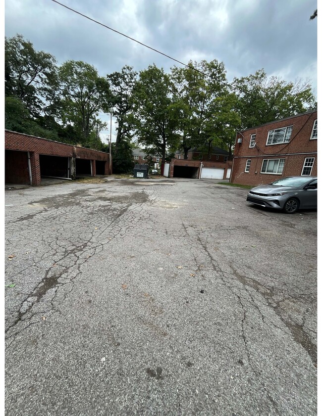
- Parking
-
Surface Lot--
Details
Utilities Included
-
Water
-
Heat
-
Sewer
Contact
- Phone Number (862) 285-5826
- Contact
Location
Get Directions
Historic landmarks are part of what make East Cleveland so unique. Nela Park and Forest Hill Park are both in the National Register of Historic Places, and their influence on East Cleveland is irreplaceable. Nela Park, the headquarters of GE Lighting, was the first industrial park in the world, and is renowned for its beautiful, university-like architecture. Every year, Nela Park features a popular Christmas light display that's beloved by residents and visitors alike.
Join the community in the great outdoors at Forest Hill Park, a historic urban park that was part of John D. Rockefeller’s estate. Enjoy this majestic hilltop setting overlooking Cleveland, and catch a glimpse of Lake Erie in the distance. On this 235-acre blend of meadow and forest, you’ll find an array of tennis courts, ball fields, and park equipment.
Learn more about living in East Cleveland
Education
| Colleges & Universities | Distance | ||
|---|---|---|---|
| Colleges & Universities | Distance | ||
| Drive: | 8 min | 3.5 mi | |
| Drive: | 8 min | 3.6 mi | |
| Drive: | 9 min | 3.9 mi | |
| Drive: | 11 min | 4.0 mi |
1950 Nelawood Rd Unit 59-105 is within 8 minutes or 3.5 miles from Cleveland Institute of Art. It is also near Case Western Reserve and Cleveland Institute of Music.
Schools
Public Elementary School
Grades K-2
246 Students
Attendance Zone
Public Elementary School
Grades 3-5
198 Students
Attendance Zone
3
Out of 10
Public Elementary & Middle School
Grades PK-8
172 Students
Nearby
5
Out of 10
Public Middle School
Grades 6-8
291 Students
Attendance Zone
3
Out of 10
Public High School
Grades 9-12
541 Students
Attendance Zone
2
Out of 10
Private Elementary & Middle School
Grades 1-8
147 Students
Nearby
Private Elementary, Middle & High School
Grades PK-12
19 Students
Nearby
Private High School
Grades 9-12
336 Students
Nearby
School data provided by
GreatSchools
The GreatSchools Rating helps parents compare schools within a state based on a variety of school quality indicators and provides a helpful picture of how effectively each school serves all of its students. Ratings are on a scale of 1 (below average) to 10 (above average) and can include test scores, college readiness, academic progress, advanced courses, equity, discipline and attendance data. We also advise parents to visit schools, consider other information on school performance and programs, and consider family needs as part of the school selection process.
Transportation options available in East Cleveland include Louis Stokes Station At Windermere, located 1.9 miles from 1950 Nelawood Rd Unit 59-105. 1950 Nelawood Rd Unit 59-105 is near Cleveland-Hopkins International, located 22.7 miles or 38 minutes away.
| Transit / Subway | Distance | ||
|---|---|---|---|
| Transit / Subway | Distance | ||
|
|
Drive: | 5 min | 1.9 mi |
|
|
Drive: | 5 min | 2.4 mi |
| Drive: | 8 min | 3.5 mi | |
|
|
Drive: | 10 min | 4.5 mi |
|
|
Drive: | 14 min | 5.7 mi |
| Commuter Rail | Distance | ||
|---|---|---|---|
| Commuter Rail | Distance | ||
|
|
Drive: | 19 min | 9.1 mi |
| Drive: | 30 min | 14.9 mi | |
| Drive: | 32 min | 16.6 mi | |
| Drive: | 40 min | 22.5 mi | |
| Drive: | 45 min | 25.0 mi |
| Airports | Distance | ||
|---|---|---|---|
| Airports | Distance | ||
|
Cleveland-Hopkins International
|
Drive: | 38 min | 22.7 mi |
Time and distance from 1950 Nelawood Rd Unit 59-105.
| Shopping Centers | Distance | ||
|---|---|---|---|
| Shopping Centers | Distance | ||
| Drive: | 4 min | 1.4 mi | |
| Drive: | 4 min | 1.7 mi | |
| Drive: | 5 min | 1.8 mi |
1950 Nelawood Rd Unit 59-105 has 3 shopping centers within 1.8 miles, which is about a 5-minute drive. The miles and minutes will be for the farthest away property.
| Parks and Recreation | Distance | ||
|---|---|---|---|
| Parks and Recreation | Distance | ||
|
Euclid Creek Reservation
|
Drive: | 8 min | 3.3 mi |
|
Cleveland Botanical Garden
|
Drive: | 9 min | 3.8 mi |
|
Children's Museum of Cleveland
|
Drive: | 10 min | 4.1 mi |
|
Cleveland Museum of Natural History
|
Drive: | 10 min | 4.2 mi |
|
Nature Center at Shaker Lakes
|
Drive: | 13 min | 5.4 mi |
1950 Nelawood Rd Unit 59-105 has 5 parks within 5.4 miles, including Euclid Creek Reservation, Cleveland Botanical Garden, and Children's Museum of Cleveland.
| Hospitals | Distance | ||
|---|---|---|---|
| Hospitals | Distance | ||
| Drive: | 8 min | 3.7 mi | |
| Drive: | 8 min | 3.7 mi | |
| Drive: | 11 min | 4.7 mi |
1950 Nelawood Rd Unit 59-105 has 3 hospitals within 4.7 miles, the nearest is Rainbow Babies and Childrens Hospital which is 3.7 miles away and a 8 minutes drive.
| Military Bases | Distance | ||
|---|---|---|---|
| Military Bases | Distance | ||
| Drive: | 112 min | 91.5 mi |
1950 Nelawood Rd Unit 59-105 is 91.5 miles and a 112 minutes from Mansfield Lahm Airport Air Guard Station.
Amenities
- Range
- Refrigerator
- Laundry Facilities
1950 Nelawood Rd Unit 59-105 Photos
What Are Walk Score®, Transit Score®, and Bike Score® Ratings?
Walk Score® measures the walkability of any address. Transit Score® measures access to public transit. Bike Score® measures the bikeability of any address.
What is a Sound Score Rating?
A Sound Score Rating aggregates noise caused by vehicle traffic, airplane traffic and local sources

1950 Nelawood Rd
East Cleveland, OH 44112