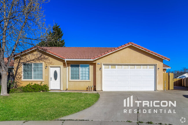
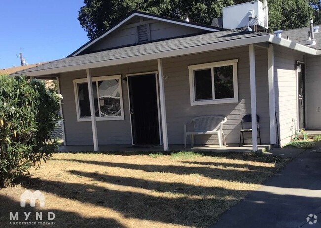
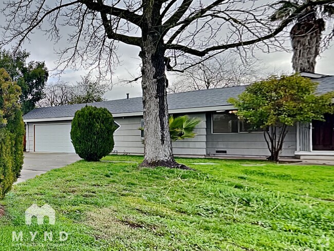
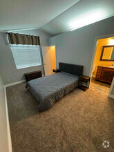
1956 Hershey Dr
1956 Hershey Dr
Woodland, CA 95776

Check Back Soon for Upcoming Availability
Located several miles west of the Sacramento International Airport, Woodland is a beautiful suburb great for renters of all ages. Nicknamed the City of Trees, Woodland is primarily an agricultural region and is the largest crop producer in California, which plays a major role in the town’s economy. There's a lot to love about the City of Trees: skinny palm trees stretching into the sky, a historic downtown district with shady sidewalks and jaunty awnings, tidy neighborhoods with green lawns, and fantastic parks. But there's more to Woodland than just an attractive setting.
Woodland is home to the University of California-Davis campus, which makes Woodland feel like a small college town at times. There are also plenty of activities that residents of any age will enjoy.
Learn more about living in Woodland| Colleges & Universities | Distance | ||
|---|---|---|---|
| Colleges & Universities | Distance | ||
| Drive: | 18 min | 11.7 mi | |
| Drive: | 29 min | 22.0 mi | |
| Drive: | 32 min | 22.1 mi | |
| Drive: | 34 min | 24.6 mi |
Transportation options available in Woodland include Township 9 Station (Wb), located 16.8 miles from 1956 Hershey Dr. 1956 Hershey Dr is near Sacramento International, located 9.9 miles or 15 minutes away.
| Transit / Subway | Distance | ||
|---|---|---|---|
| Transit / Subway | Distance | ||
| Drive: | 21 min | 16.8 mi | |
|
|
Drive: | 22 min | 17.5 mi |
|
|
Drive: | 22 min | 17.6 mi |
|
|
Drive: | 23 min | 17.7 mi |
|
|
Drive: | 23 min | 17.8 mi |
| Commuter Rail | Distance | ||
|---|---|---|---|
| Commuter Rail | Distance | ||
|
|
Drive: | 19 min | 9.6 mi |
|
|
Drive: | 42 min | 30.1 mi |
|
|
Drive: | 44 min | 33.4 mi |
|
|
Drive: | 45 min | 35.4 mi |
|
|
Drive: | 50 min | 39.4 mi |
| Airports | Distance | ||
|---|---|---|---|
| Airports | Distance | ||
|
Sacramento International
|
Drive: | 15 min | 9.9 mi |
Time and distance from 1956 Hershey Dr.
| Shopping Centers | Distance | ||
|---|---|---|---|
| Shopping Centers | Distance | ||
| Walk: | 14 min | 0.8 mi | |
| Drive: | 3 min | 1.4 mi | |
| Drive: | 4 min | 1.5 mi |
| Parks and Recreation | Distance | ||
|---|---|---|---|
| Parks and Recreation | Distance | ||
|
Sacramento RiverTrain
|
Drive: | 4 min | 1.6 mi |
|
Woodland Opera House State Historic Park
|
Drive: | 7 min | 2.6 mi |
|
Explorit
|
Drive: | 18 min | 9.4 mi |
|
California Raptor Center
|
Drive: | 19 min | 11.5 mi |
|
Central Park
|
Drive: | 18 min | 11.5 mi |
| Hospitals | Distance | ||
|---|---|---|---|
| Hospitals | Distance | ||
| Drive: | 9 min | 4.0 mi | |
| Drive: | 14 min | 9.3 mi |
| Military Bases | Distance | ||
|---|---|---|---|
| Military Bases | Distance | ||
| Drive: | 36 min | 21.3 mi |
You May Also Like
Similar Rentals Nearby
-
-
-
-
-
$2,9504 Beds, 2.5 Baths, 1,811 sq ftHouse for Rent
-
-
$2,5953 Beds, 2 Baths, 1,314 sq ftHouse for Rent
-
-
$2,3752 Beds, 2 Baths, 1,000 sq ftHouse for Rent
-
What Are Walk Score®, Transit Score®, and Bike Score® Ratings?
Walk Score® measures the walkability of any address. Transit Score® measures access to public transit. Bike Score® measures the bikeability of any address.
What is a Sound Score Rating?
A Sound Score Rating aggregates noise caused by vehicle traffic, airplane traffic and local sources


