$3,000 / Month
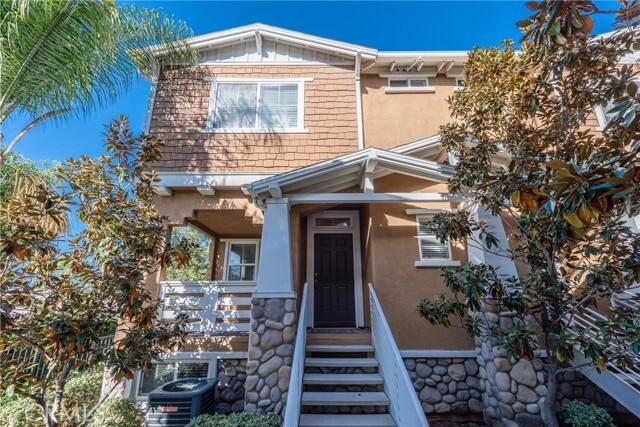
1957 Annandale Way
Pomona, CA 91767
Today
Favorites
626-927-6900
-
Bedrooms
3
-
Bathrooms
3
-
Square Feet
1,618 sq ft
-
Available
Available Apr 29
1957 Annandale Way

Favorites
About This Home
12 Month Lease,
$3,000 deposit,
Available Apr 29
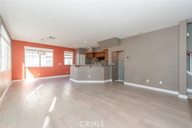
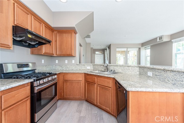
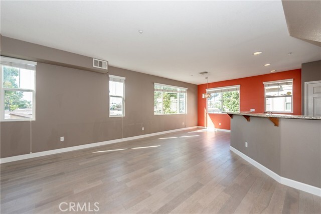
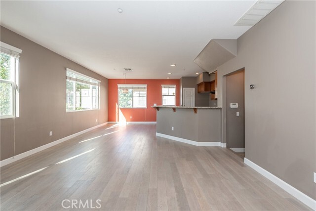
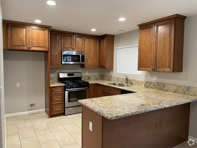
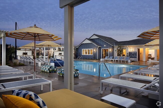
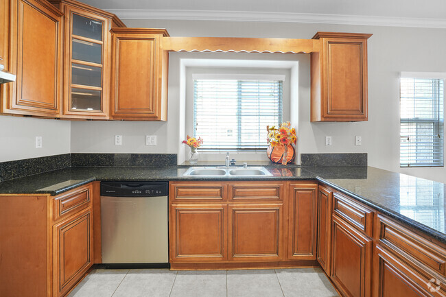
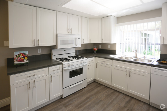
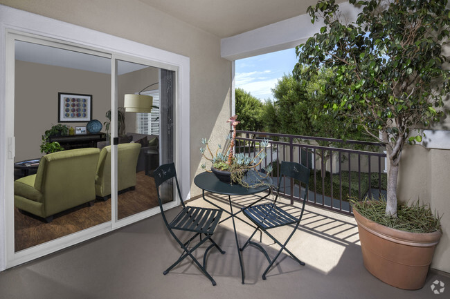
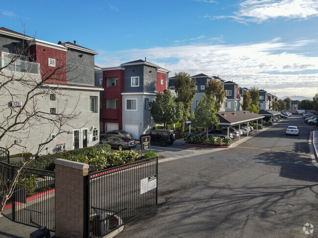
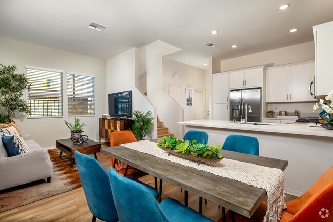
Highly desirable Cobblestone community with new renovated salted Pool, Jacuzzi and multiple play areas. Three floor end unit townhouse built in 2009 with high efficient Air Conditioning and Heating system. Gated community with security camera monitoring 24/7. The first floor offers direct access to a 2 car attached garage and a large bonus room that can be used as a home office or 4th bedroom. The second floor is bright and airy, has an open concept kitchen with countertop, living room and dining area, and a half bath. It also provides access to a covered patio which is perfect for entertaining, having your morning coffee and grilling. The third floor has a huge primary bedroom, two more bedrooms, one full hallway bath, and laundry room. One of the best locations in the community, away from any street noise. Conveniently located close to Claremont Colleges, La Verne University, and Western University. Just off 10 FWY, Indian Hill exit. Community borders city of Claremont. Walking distance to shopping center, Super King supermarket, Starbucks, In-N-Out and all kinds of restaurants. 5 minutes drive to Claremont Colleges, downtown Claremont, Costco, Target, Montclair Shopping Mall. Security deposit is one month. No pets preferred. Tenants pays on utilities including water, electricity, gas, and internet. Trash is included in rent. Renter's insurance is required. Bring your own washer/dryer/refrigerator. Ready to move in today.
1957 Annandale Way is a townhome located in Los Angeles County and the 91767 ZIP Code.
* Price shown is base rent and may not include non-optional fees and utilities.
Price, availability, fees, and any applicable rent special are subject to change without notice.
* Square footage definitions vary. Displayed square footage is approximate.
Townhome Features
- Air Conditioning
- Heating
Fees and Policies
The fees below are based on community-supplied data and may exclude additional fees and utilities.
- Parking
-
Other--
Details
Lease Options
-
12 Months
Contact
- Listed by Kai Tu | Ricky&Jessie Realty
- Phone Number
- Contact
-
Source
 California Regional Multiple Listing Service
Copyright 2025 © California Regional MLS. All rights reserved.
Location
Get Directions
Amenities
- Air Conditioning
- Heating
Tucked in the Pomona Valley, Pomona is known for gorgeous mountainous views—especially those of Mount Baldy, the highest peak in the San Gabriel Mountains. Formerly a fruitful agricultural town, Pomona is now a busy city and a college town, home to California State Polytechnic University-Pomona, Western University of Health Sciences, and Western University College of Veterinary Medicine. Two additional college campuses, Claremont Colleges and Mount San Antonio College, are located just outside of the city. Pomona pays homage to its past be preserving historic buildings like the Fox Theater Pomona. The fully restored theater is surrounded by restaurants, pubs, shops, and art galleries in Downtown Pomona's Arts Colony.
Renters in Pomona are about 30 miles west of Downtown Los Angeles. If you prefer mass transit, take the train from Pomona Station or travel by car along Interstate 10.
Learn more about living in Pomona
Education
| Colleges & Universities | Distance | ||
|---|---|---|---|
| Colleges & Universities | Distance | ||
| Drive: | 5 min | 2.0 mi | |
| Drive: | 5 min | 2.2 mi | |
| Drive: | 6 min | 3.2 mi | |
| Drive: | 7 min | 4.0 mi |
1957 Annandale Way is within 5 minutes or 2.0 miles from Pomona College. It is also near Claremont Graduate University and Western Health Scis., Pomono.
Transportation options available in Pomona include Apu / Citrus College Station, located 14.9 miles from 1957 Annandale Way. 1957 Annandale Way is near Ontario International, located 8.3 miles or 12 minutes away, and John Wayne/Orange County, located 36.5 miles or 45 minutes away.
| Transit / Subway | Distance | ||
|---|---|---|---|
| Transit / Subway | Distance | ||
| Drive: | 21 min | 14.9 mi | |
| Drive: | 20 min | 15.4 mi | |
| Drive: | 22 min | 16.6 mi | |
| Drive: | 24 min | 19.1 mi | |
| Drive: | 26 min | 20.6 mi |
| Commuter Rail | Distance | ||
|---|---|---|---|
| Commuter Rail | Distance | ||
|
|
Drive: | 3 min | 1.5 mi |
|
|
Drive: | 5 min | 2.6 mi |
|
|
Drive: | 6 min | 3.2 mi |
|
|
Drive: | 7 min | 3.3 mi |
|
|
Drive: | 9 min | 5.3 mi |
| Airports | Distance | ||
|---|---|---|---|
| Airports | Distance | ||
|
Ontario International
|
Drive: | 12 min | 8.3 mi |
|
John Wayne/Orange County
|
Drive: | 45 min | 36.5 mi |
Time and distance from 1957 Annandale Way.
| Shopping Centers | Distance | ||
|---|---|---|---|
| Shopping Centers | Distance | ||
| Walk: | 14 min | 0.7 mi | |
| Walk: | 14 min | 0.7 mi | |
| Walk: | 26 min | 1.3 mi |
1957 Annandale Way has 3 shopping centers within 1.3 miles, which is about a 26-minute walk. The miles and minutes will be for the farthest away property.
| Parks and Recreation | Distance | ||
|---|---|---|---|
| Parks and Recreation | Distance | ||
|
Millikan Planetarium
|
Drive: | 4 min | 1.9 mi |
|
Rancho Santa Ana Botanic Garden
|
Drive: | 6 min | 2.6 mi |
|
Pitzer College Arboretum
|
Drive: | 6 min | 3.0 mi |
|
Alf Museum of Paleontology
|
Drive: | 10 min | 4.7 mi |
|
Frank G. Bonelli Regional Park
|
Drive: | 11 min | 5.8 mi |
1957 Annandale Way has 5 parks within 5.8 miles, including Millikan Planetarium, Rancho Santa Ana Botanic Garden, and Pitzer College Arboretum.
| Hospitals | Distance | ||
|---|---|---|---|
| Hospitals | Distance | ||
| Drive: | 3 min | 1.7 mi | |
| Drive: | 4 min | 2.5 mi | |
| Drive: | 5 min | 3.1 mi |
1957 Annandale Way has 3 hospitals within 3.1 miles, the nearest is Montclair Hospital Medical Center which is 1.7 miles away and a 3 minute drive.
| Military Bases | Distance | ||
|---|---|---|---|
| Military Bases | Distance | ||
| Drive: | 49 min | 36.4 mi |
1957 Annandale Way is 36.4 miles and a 49 minute drive from Los Alamitos Army Airfield.
You May Also Like
Similar Rentals Nearby


What Are Walk Score®, Transit Score®, and Bike Score® Ratings?
Walk Score® measures the walkability of any address. Transit Score® measures access to public transit. Bike Score® measures the bikeability of any address.
What is a Sound Score Rating?
A Sound Score Rating aggregates noise caused by vehicle traffic, airplane traffic and local sources

1957 Annandale Way
Pomona, CA 91767