$1,495 / Month
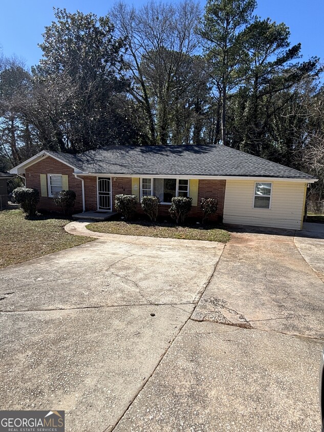
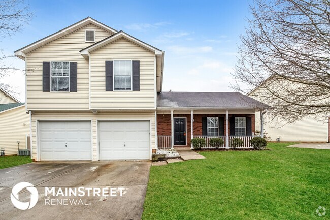
1979 Columbia Dr
Decatur, GA 30032
Today
Favorites
770-679-1770
-
Bedrooms
3
-
Bathrooms
2
-
Square Feet
--
-
Available
Available Now
Highlights
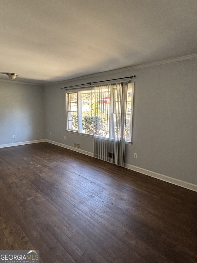
- Bonus Room
- Laundry closet
- 1-Story Property
- Forced Air Heating and Cooling System
- Ceiling Fan
- Carpet
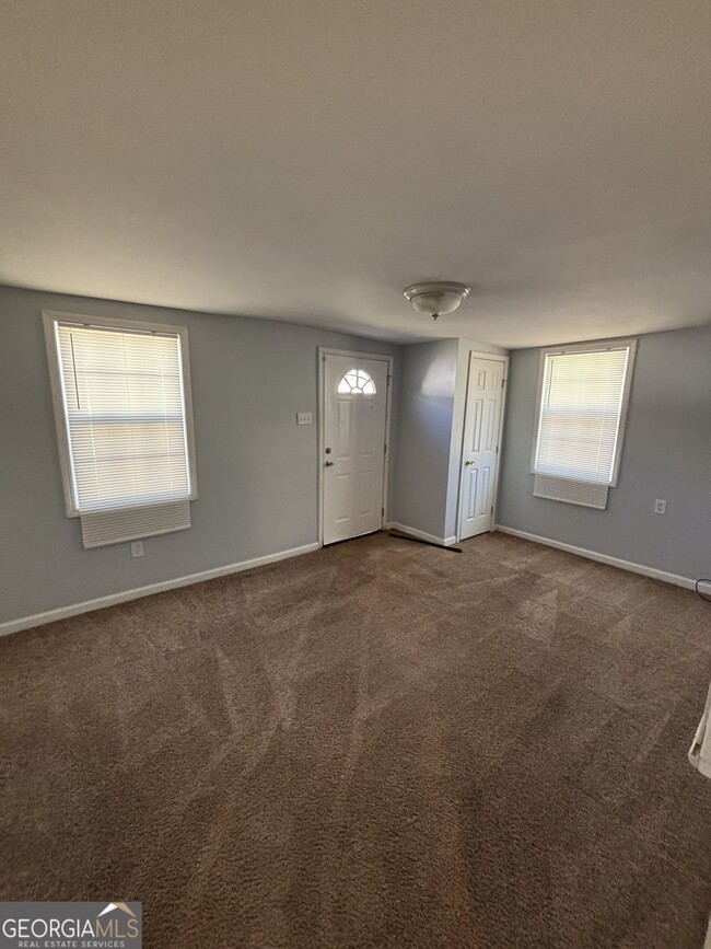
1979 Columbia Dr

Favorites
About This Home
$1,795 deposit,
Available Now
3 bed 2 bath plus bonus room near shopping, stores, I-285 and on the bus route. For more information call or text . Reduced price for 1st 6 months
1979 Columbia Dr is a house located in DeKalb County and the 30032 ZIP Code. This area is served by the DeKalb County attendance zone.
* Price shown is base rent and may not include non-optional fees and utilities.
Price, availability, fees, and any applicable rent special are subject to change without notice.
* Square footage definitions vary. Displayed square footage is approximate.
Home Details
Home Type
Single Family Detached Home
Year Built
Built in 1954 | Remodeled
Basement
Crawl Space
Bedrooms and Bathrooms
3 Main Level Bedrooms
2 Full Bathrooms
Home Design
Brick Exterior Construction
Composition Roof
Interior Spaces
Bonus Room
1-Story Property
Ceiling Fan
Carpet
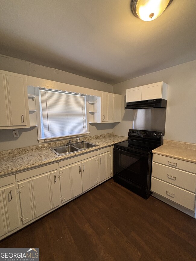
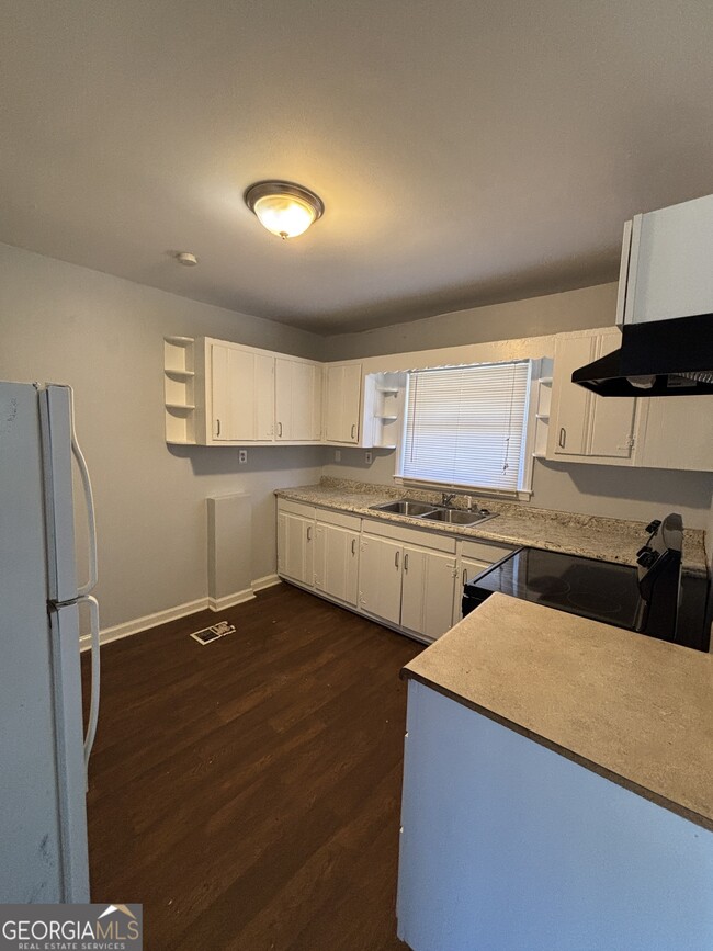
Kitchen
Oven or Range
Dishwasher
Laundry
Laundry closet
Listing and Financial Details
Security Deposit $1,795
12-Month Minimum Lease Term
$100 Application Fee
Lot Details
0.3 Acre Lot
Sloped Lot
Parking
Off-Street Parking
Schools
Snapfinger Elementary School
Columbia Middle School
Columbia High School
Utilities
Forced Air Heating and Cooling System
Heating System Uses Natural Gas
Community Details
Overview
No Home Owners Association
Contact
- Listed by Pat A. Astrin | Astrin Real Estate
- Phone Number (770) 679-1770
- Contact
-
Source
 Georgia Multiple Listing Service
Copyright © 2025 Georgia Multiple Listing Service. All rights reserved. All information provided by the listing agent / broker is deemed reliable but is not guaranteed and should be independently verified.
Location
Get Directions
Amenities
- Dishwasher
- Range
- Refrigerator
Southeast DeKalb refers to a sprawling region in the southeastern portion of DeKalb County. Among the many communities in this area are the communities of Clarkston, Stone Mountain, Lithonia, Panthersville, Gresham Park, and Sheffield Woods.
Each community in this region has its own distinct character. Southeast DeKalb offers ample opportunities for outdoor recreation at destinations such as Stone Mountain Park, Panola Mountain State Park, and Arabia Mountain National Heritage Area. Southeast DeKalb sits within easy driving distance of all that Greater Atlanta has to offer, with close proximity to major thoroughfares like I-285, I-20, and U.S. 278.
Learn more about living in Southeast DeKalb
Education
| Colleges & Universities | Distance | ||
|---|---|---|---|
| Colleges & Universities | Distance | ||
| Drive: | 10 min | 4.4 mi | |
| Drive: | 9 min | 4.6 mi | |
| Drive: | 12 min | 5.2 mi | |
| Drive: | 13 min | 6.3 mi |
1979 Columbia Dr is within 9 minutes or 4.6 miles from Agnes Scott College. It is also near Georgia Perim. Coll., Decatur and Georgia Perim., Clarkston.
Schools
Public Elementary School
Grades PK-5
501 Students
Attendance Zone
2
Out of 10
Public Middle School
Grades 6-8
604 Students
Attendance Zone
4
Out of 10
Public High School
Grades 9-12
898 Students
Attendance Zone
2
Out of 10
Private Elementary, Middle & High School
Grades PK-12
133 Students
Nearby
Private Elementary School
Grades PK-1
Nearby
Private Elementary, Middle & High School
Grades 3-12
Nearby
School data provided by
GreatSchools
The GreatSchools Rating helps parents compare schools within a state based on a variety of school quality indicators and provides a helpful picture of how effectively each school serves all of its students. Ratings are on a scale of 1 (below average) to 10 (above average) and can include test scores, college readiness, academic progress, advanced courses, equity, discipline and attendance data. We also advise parents to visit schools, consider other information on school performance and programs, and consider family needs as part of the school selection process.
Transportation options available in Decatur include Kensington, located 3.1 miles from 1979 Columbia Dr. 1979 Columbia Dr is near Hartsfield - Jackson Atlanta International, located 14.9 miles or 25 minutes away.
| Transit / Subway | Distance | ||
|---|---|---|---|
| Transit / Subway | Distance | ||
|
|
Drive: | 7 min | 3.1 mi |
|
|
Drive: | 7 min | 4.0 mi |
|
|
Drive: | 9 min | 4.1 mi |
|
|
Drive: | 9 min | 4.3 mi |
|
|
Drive: | 11 min | 5.2 mi |
| Commuter Rail | Distance | ||
|---|---|---|---|
| Commuter Rail | Distance | ||
|
|
Drive: | 21 min | 12.7 mi |
| Airports | Distance | ||
|---|---|---|---|
| Airports | Distance | ||
|
Hartsfield - Jackson Atlanta International
|
Drive: | 25 min | 14.9 mi |
Time and distance from 1979 Columbia Dr.
| Shopping Centers | Distance | ||
|---|---|---|---|
| Shopping Centers | Distance | ||
| Walk: | 9 min | 0.5 mi | |
| Walk: | 10 min | 0.5 mi | |
| Walk: | 12 min | 0.7 mi |
1979 Columbia Dr has 3 shopping centers within 0.7 mile, which is about a 12-minute walk. The miles and minutes will be for the farthest away property.
| Parks and Recreation | Distance | ||
|---|---|---|---|
| Parks and Recreation | Distance | ||
|
Bradley Observatory
|
Drive: | 8 min | 4.1 mi |
|
Ferns of the World Garden
|
Drive: | 9 min | 4.1 mi |
|
Wylde Center and Oakhurst Community Garden
|
Drive: | 8 min | 4.4 mi |
|
Glenn Creek Nature Preserve
|
Drive: | 11 min | 4.5 mi |
|
South River Watershed Alliance
|
Drive: | 10 min | 4.8 mi |
1979 Columbia Dr has 5 parks within 4.8 miles, including Wylde Center and Oakhurst Community Garden, Bradley Observatory, and Ferns of the World Garden.
| Hospitals | Distance | ||
|---|---|---|---|
| Hospitals | Distance | ||
| Drive: | 8 min | 3.7 mi | |
| Drive: | 11 min | 5.5 mi | |
| Drive: | 14 min | 6.7 mi |
1979 Columbia Dr has 3 hospitals within 6.7 miles, the nearest is Georgia Regional Hospital Atlanta which is 3.7 miles away and a 8 minute drive.
| Military Bases | Distance | ||
|---|---|---|---|
| Military Bases | Distance | ||
| Drive: | 22 min | 12.6 mi | |
| Drive: | 22 min | 13.1 mi |
1979 Columbia Dr is 12.6 miles from Fort Gillem, and is convenient to other military bases, including Fort McPherson.
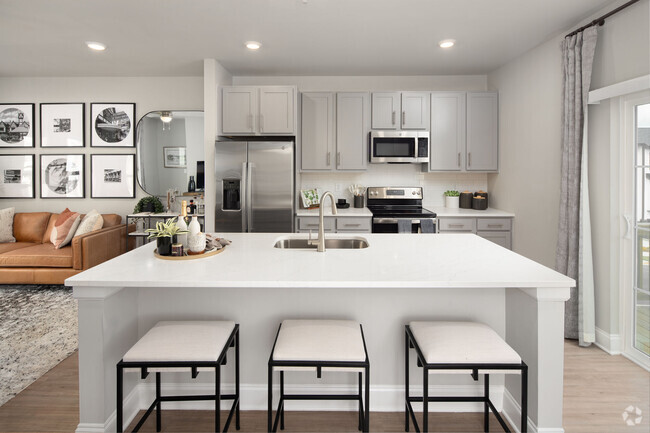
You May Also Like
Similar Rentals Nearby
-
-
Single-Family Homes Specials
Pets Allowed Fitness Center Pool In Unit Washer & Dryer Clubhouse Balcony Tub / Shower
-
1 / 33
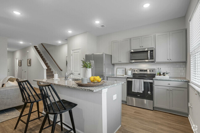
-
Single-Family Homes 1 Month Free
Pets Allowed Pool Clubhouse Stainless Steel Appliances Granite Countertops Washer & Dryer Hookups
-
Townhomes 2 Months Free
Pets Allowed Fitness Center Pool Dishwasher Refrigerator Kitchen
-
-
-
-
1 / 38
-


What Are Walk Score®, Transit Score®, and Bike Score® Ratings?
Walk Score® measures the walkability of any address. Transit Score® measures access to public transit. Bike Score® measures the bikeability of any address.
What is a Sound Score Rating?
A Sound Score Rating aggregates noise caused by vehicle traffic, airplane traffic and local sources

1979 Columbia Dr
Decatur, GA 30032