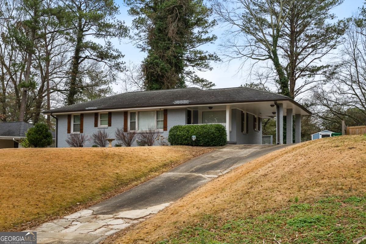
1988 Mark Trail
Decatur, GA 30032
-
Bedrooms
3
-
Bathrooms
2.5
-
Square Feet
--
-
Available
Available Now
Highlights
- Deck
- Private Lot
- Wood Flooring
- Breakfast Bar
- Laundry Room
- Shed

About This Home
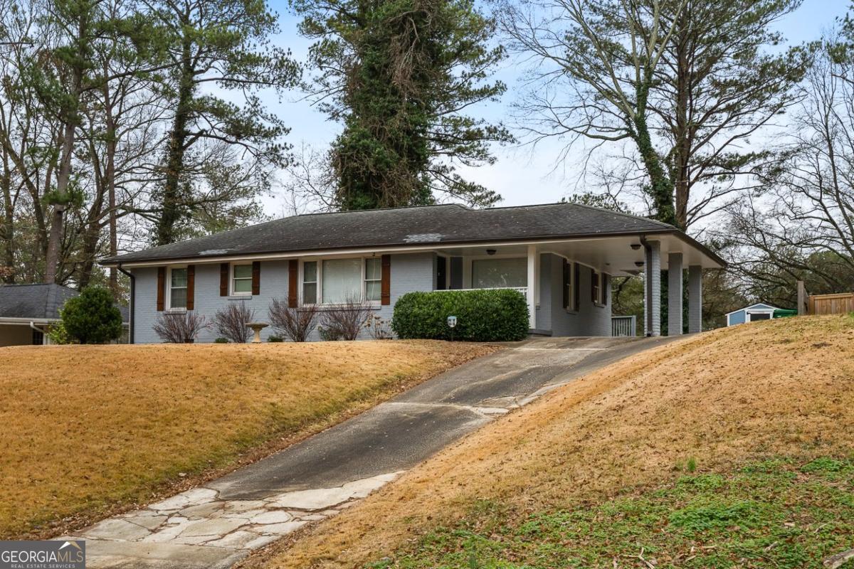
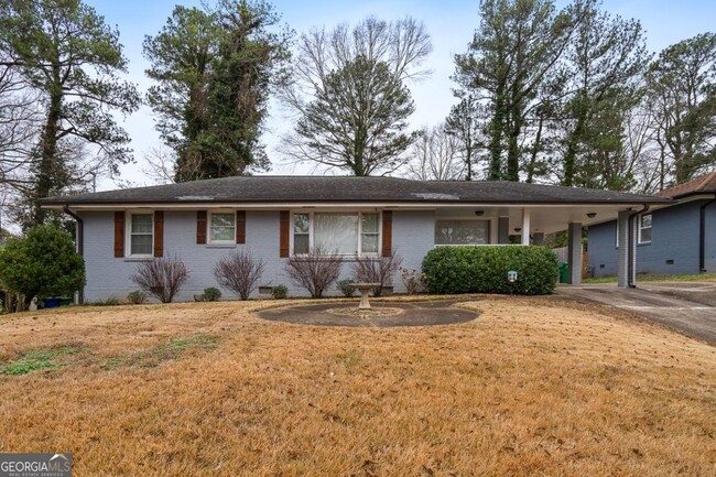
Charming 3-bedroom, 2.5-bathroom home in a sleepy Decatur neighborhood. Recently renovated kitchen and bathrooms with a spacious master suite at the back of the home. Front and back bedrooms feature en-suite bathrooms. Enjoy a wide driveway with parking for multiple vehicles and a convenient tough shed for added storage in the spacious backyard. Located just 3 minutes from I-20, with easy 15-20 minute access to Midtown and 20-30 minutes to Buckhead. Friendly neighborhood with friendly neighbors, plenty of space and modern updates make this the perfect home for comfortable living.
1988 Mark Trail is a house located in DeKalb County and the 30032 ZIP Code. This area is served by the DeKalb County attendance zone.
Home Details
Home Type
Year Built
Basement
Bedrooms and Bathrooms
Flooring
Home Design
Home Security
Interior Spaces
Kitchen
Laundry
Listing and Financial Details
Lot Details
Outdoor Features
Parking
Schools
Utilities
Community Details
Overview
Pet Policy
Contact
- Listed by Alex Worrell | Keller Williams Chattahoochee
- Phone Number (404) 630-5900
- Contact
-
Source
 Georgia Multiple Listing Service
- Dishwasher
- Disposal
- Pantry
- Microwave
Situated between East Atlanta Village and I-285, Candler-McAfee is a laidback suburban community with a small-town feel. Residents enjoy access to a broad range of shops and restaurants stretched along Candler Road, the community’s main commercial thoroughfare.
Candler-McAfee is mostly residential, offering an overall peaceful atmosphere in addition to numerous apartments and houses available for rent along tree-lined streets. While the whole community touts a park-like environment, Candler-McAfee is home to several scenic parks like Glendale Park, NH Scott Park, and Misty Waters Park. Quick access to both I-20 and I-285 affords many Candler-McAfee residents short commute times to countless area employers and attractions.
Learn more about living in Candler-McAfee| Colleges & Universities | Distance | ||
|---|---|---|---|
| Colleges & Universities | Distance | ||
| Drive: | 10 min | 4.2 mi | |
| Drive: | 12 min | 4.4 mi | |
| Drive: | 15 min | 6.8 mi | |
| Drive: | 17 min | 7.2 mi |
Transportation options available in Decatur include East Lake, located 3.5 miles from 1988 Mark Trail. 1988 Mark Trail is near Hartsfield - Jackson Atlanta International, located 12.6 miles or 25 minutes away.
| Transit / Subway | Distance | ||
|---|---|---|---|
| Transit / Subway | Distance | ||
|
|
Drive: | 10 min | 3.5 mi |
|
|
Drive: | 11 min | 5.0 mi |
|
|
Drive: | 12 min | 5.1 mi |
|
|
Drive: | 12 min | 5.4 mi |
|
|
Drive: | 12 min | 5.4 mi |
| Commuter Rail | Distance | ||
|---|---|---|---|
| Commuter Rail | Distance | ||
|
|
Drive: | 19 min | 10.6 mi |
| Airports | Distance | ||
|---|---|---|---|
| Airports | Distance | ||
|
Hartsfield - Jackson Atlanta International
|
Drive: | 25 min | 12.6 mi |
Time and distance from 1988 Mark Trail.
| Shopping Centers | Distance | ||
|---|---|---|---|
| Shopping Centers | Distance | ||
| Drive: | 4 min | 1.5 mi | |
| Drive: | 5 min | 1.6 mi | |
| Drive: | 5 min | 1.6 mi |
| Parks and Recreation | Distance | ||
|---|---|---|---|
| Parks and Recreation | Distance | ||
|
Wylde Center and Oakhurst Community Garden
|
Drive: | 9 min | 3.9 mi |
|
Ferns of the World Garden
|
Drive: | 10 min | 4.4 mi |
|
Bradley Observatory
|
Drive: | 10 min | 4.5 mi |
|
Fernbank Museum of Natural History
|
Drive: | 12 min | 4.6 mi |
|
South River Watershed Alliance
|
Drive: | 12 min | 5.2 mi |
| Hospitals | Distance | ||
|---|---|---|---|
| Hospitals | Distance | ||
| Drive: | 9 min | 4.0 mi | |
| Drive: | 13 min | 6.2 mi | |
| Drive: | 16 min | 7.2 mi |
| Military Bases | Distance | ||
|---|---|---|---|
| Military Bases | Distance | ||
| Drive: | 22 min | 10.3 mi | |
| Drive: | 20 min | 10.9 mi |
You May Also Like
Similar Rentals Nearby
-
-
Single-Family Homes Specials
Pets Allowed Fitness Center Pool In Unit Washer & Dryer Clubhouse Balcony Tub / Shower
-
Single-Family Homes 1 Month Free
Pets Allowed Pool Clubhouse Stainless Steel Appliances Granite Countertops Washer & Dryer Hookups
-
1 / 33
-
-
1 / 38
-
-
-
-
What Are Walk Score®, Transit Score®, and Bike Score® Ratings?
Walk Score® measures the walkability of any address. Transit Score® measures access to public transit. Bike Score® measures the bikeability of any address.
What is a Sound Score Rating?
A Sound Score Rating aggregates noise caused by vehicle traffic, airplane traffic and local sources
