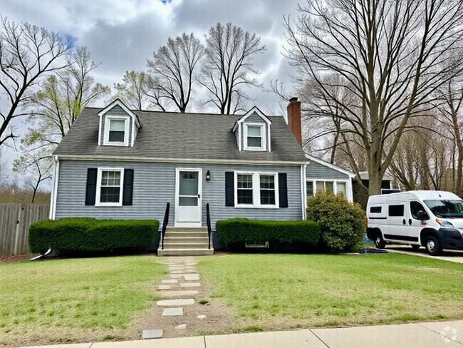
$2,150 / Month
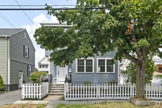
2 Adams St
Charlestown, MA 02129
2 Weeks Ago
Favorites
2 Adams St

Favorites
Check Back Soon for Upcoming Availability
| Beds | Baths | Average SF |
|---|---|---|
| 1 Bedroom 1 Bedroom 1 Br | 1 Bath 1 Bath 1 Ba | 688 SF |
About This Property
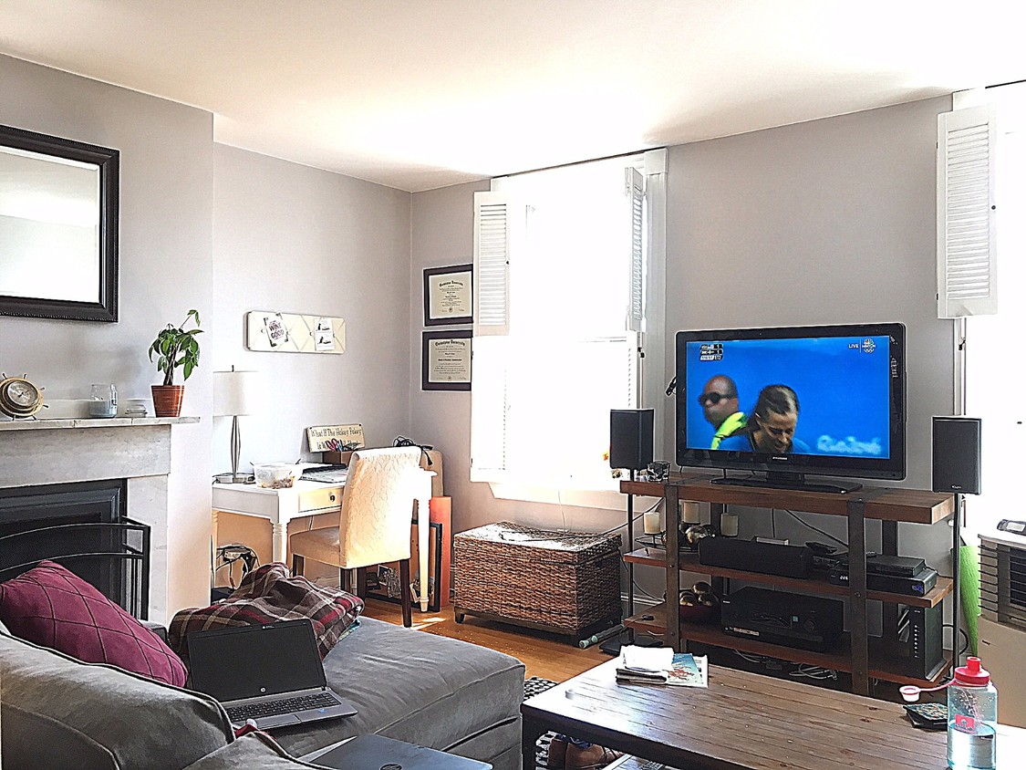
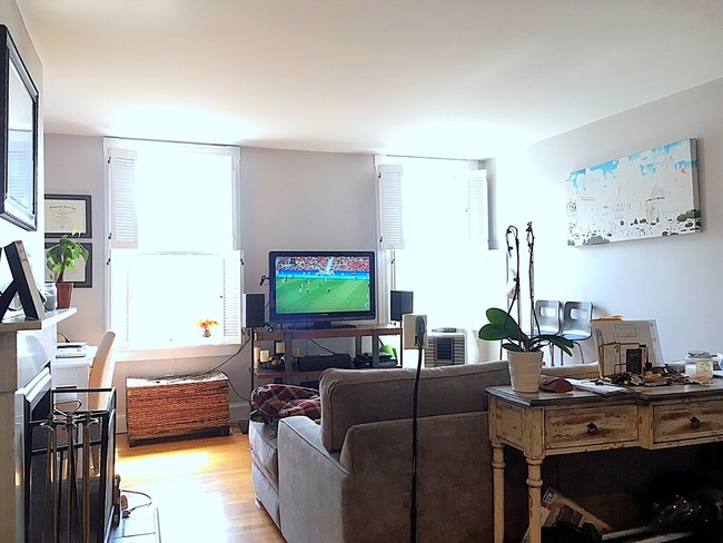
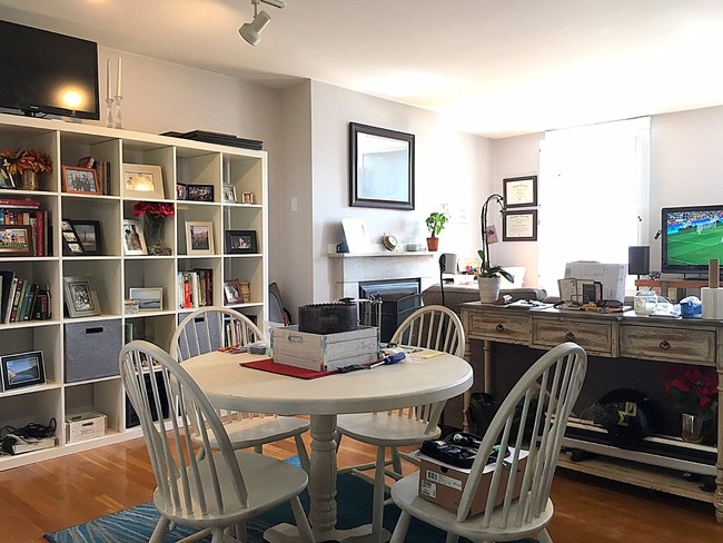
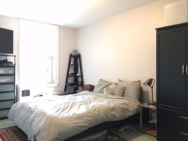
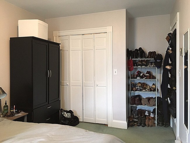
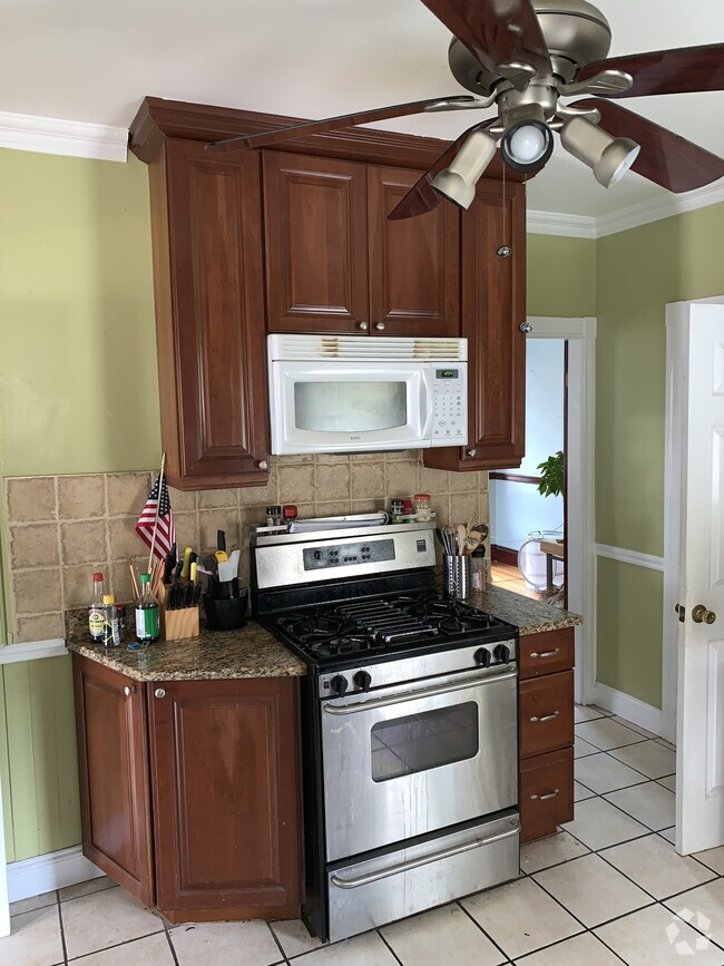
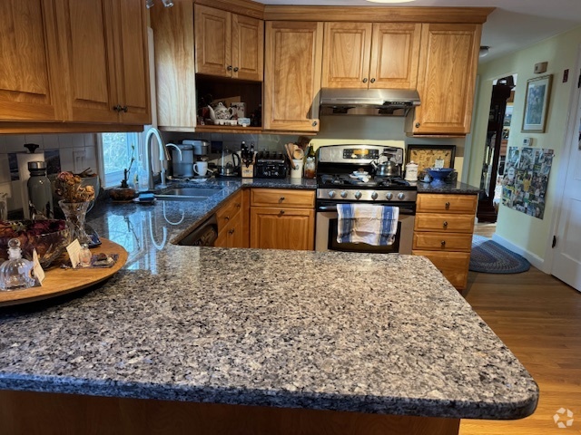
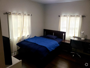
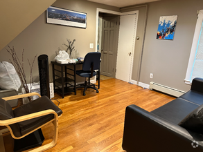
Training Field! Perfect One Bedroom with Amazing Sunlight & Views! Huge Open Concept Livingroom/Diningroom! Enormous Bedroom! Private Back Deck! Laundry in Unit! The Ultimate Location for Easy Living! Minutes from Downtown Boston, Public Transportation, Whole Foods & Waterfront! Hardwood Floors, Pretty Fireplace Mantel! Great Space! Available now or 10/1.
2 Adams St is a house located in Suffolk County and the 02129 ZIP Code. This area is served by the Boston Public Schools attendance zone.
Location
Get Directions
Charlestown’s history is one of its most defining characteristics—several stops along the Freedom Trail can be found here, and landmarks such as the Bunker Hill Memorial and the USS Constitution dominate the landscape.
What is it like to live in Charlestown? Well, for a small neighborhood, Charlestown is packed with public parks and playgrounds, providing welcome green spaces to break up the urban environment. Ferry service from the Navy Yard connects Charlestown to Long Wharf and the North End. One benefit of Charlestown’s dense layout is that much of the area is highly walkable, whether you’re headed from your apartment to work, the grocery store, or just out for a cup of coffee.
Learn more about living in Charlestown
Education
| Colleges & Universities | Distance | ||
|---|---|---|---|
| Colleges & Universities | Distance | ||
| Drive: | 5 min | 1.5 mi | |
| Drive: | 4 min | 1.9 mi | |
| Drive: | 6 min | 2.0 mi | |
| Drive: | 6 min | 3.2 mi |
2 Adams St is within 4 minutes or 1.9 miles from Bunker Hill Community College. It is also near Suffolk University and Emerson College.
Schools


Public Elementary & Middle School
Grades PK-8
523 Students
Nearby
Public Elementary School
Grades PK-6
342 Students
Nearby
Public Middle & High School
Grades 7-12
792 Students
Nearby
Private Elementary & Middle School
Grades PK-8
279 Students
Nearby
Private Elementary School
Grades PK-3
Nearby
Private Middle & High School
Grades 8-12
31 Students
Nearby
School data provided by
 The GreatSchools Rating helps parents compare schools within a state based on a variety of school quality indicators and provides a helpful picture of how effectively each school serves all of its students. Ratings are on a scale of 1 (below average) to 10 (above average) and can include test scores, college readiness, academic progress, advanced courses, equity, discipline and attendance data. We also advise parents to visit schools, consider other information on school performance and programs, and consider family needs as part of the school selection process.
View GreatSchools Rating Methodology
View GreatSchools Rating Methodology
Transportation options available in Charlestown include North Station, located 0.8 mile from 2 Adams St. 2 Adams St is near General Edward Lawrence Logan International, located 3.9 miles or 9 minutes away.
| Transit / Subway | Distance | ||
|---|---|---|---|
| Transit / Subway | Distance | ||
|
|
Walk: | 16 min | 0.8 mi |
|
|
Walk: | 17 min | 0.9 mi |
|
|
Drive: | 3 min | 1.2 mi |
|
|
Drive: | 3 min | 1.6 mi |
|
|
Drive: | 5 min | 2.0 mi |
| Commuter Rail | Distance | ||
|---|---|---|---|
| Commuter Rail | Distance | ||
|
|
Walk: | 18 min | 0.9 mi |
|
|
Drive: | 5 min | 2.8 mi |
|
|
Drive: | 10 min | 3.0 mi |
| Drive: | 7 min | 3.2 mi | |
|
|
Drive: | 12 min | 6.2 mi |
| Airports | Distance | ||
|---|---|---|---|
| Airports | Distance | ||
|
General Edward Lawrence Logan International
|
Drive: | 9 min | 3.9 mi |
Time and distance from 2 Adams St.
| Shopping Centers | Distance | ||
|---|---|---|---|
| Shopping Centers | Distance | ||
| Walk: | 10 min | 0.6 mi | |
| Walk: | 16 min | 0.9 mi | |
| Drive: | 2 min | 1.1 mi |
2 Adams St has 3 shopping centers within 1.1 miles, which is about a 2-minute walk. The miles and minutes will be for the farthest away property.
| Parks and Recreation | Distance | ||
|---|---|---|---|
| Parks and Recreation | Distance | ||
|
Museum of Science
|
Drive: | 4 min | 1.2 mi |
|
Boston National Historical Park
|
Drive: | 5 min | 1.5 mi |
|
New England Aquarium
|
Drive: | 5 min | 1.6 mi |
|
Boston African American National Historic Site
|
Drive: | 5 min | 1.7 mi |
|
Boston Harbor Islands National Recreation Area
|
Drive: | 4 min | 2.5 mi |
2 Adams St has 5 parks within 2.5 miles, including Museum of Science, Boston National Historical Park, and Boston African American National Historic Site.
| Hospitals | Distance | ||
|---|---|---|---|
| Hospitals | Distance | ||
| Drive: | 4 min | 1.5 mi | |
| Drive: | 5 min | 1.6 mi | |
| Drive: | 5 min | 1.9 mi |
2 Adams St has 3 hospitals within 1.9 miles, the nearest is Shriners Hospital for Children - Boston which is 1.5 miles away and a 4 minute drive.
| Military Bases | Distance | ||
|---|---|---|---|
| Military Bases | Distance | ||
| Drive: | 28 min | 15.5 mi | |
| Drive: | 29 min | 17.9 mi |
2 Adams St is 15.5 miles from Hanscom Air Force Base, and is convenient to other military bases, including Fort Miller.
You May Also Like
Similar Rentals Nearby
What Are Walk Score®, Transit Score®, and Bike Score® Ratings?
Walk Score® measures the walkability of any address. Transit Score® measures access to public transit. Bike Score® measures the bikeability of any address.
What is a Sound Score Rating?
A Sound Score Rating aggregates noise caused by vehicle traffic, airplane traffic and local sources

2 Adams St
Charlestown, MA 02129