
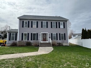
$1,895 / Month
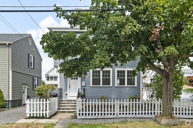
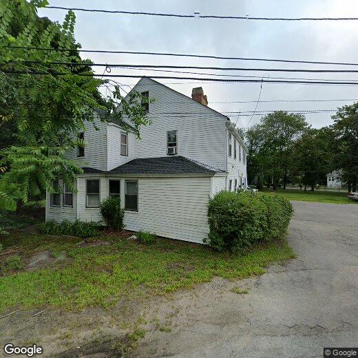
2 Main St
Wilmington, MA 01887
2 Weeks Ago
Favorites
2 Main St

Favorites
Check Back Soon for Upcoming Availability
| Beds | Baths | Average SF |
|---|---|---|
| 2 Bedrooms 2 Bedrooms 2 Br | 1 Bath 1 Bath 1 Ba | 650 SF |
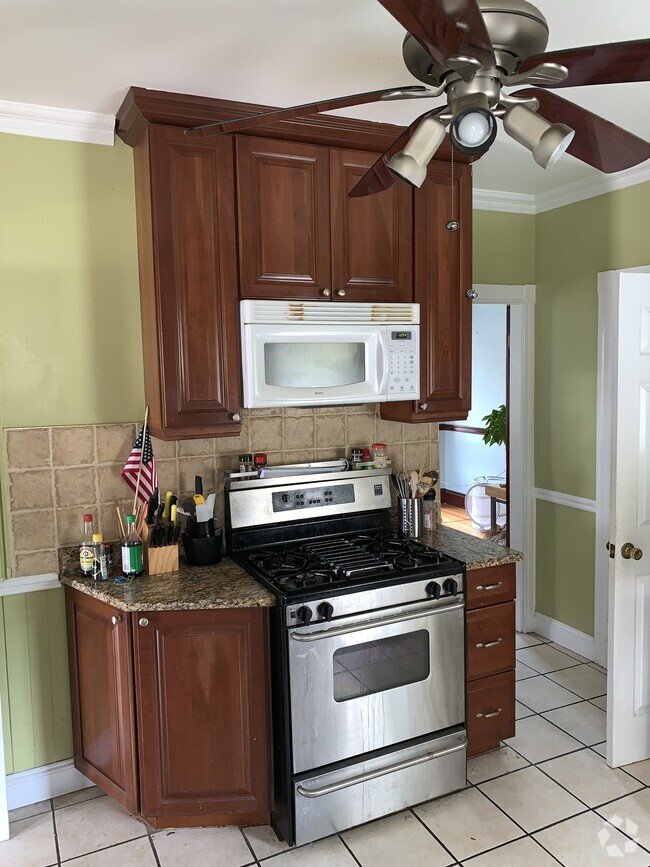
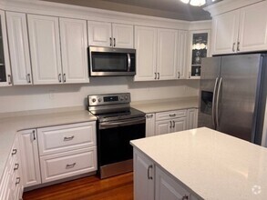
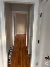
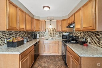
About This Property
Wilmington 2 bedroom first floor only$1,895 per month Includes all utilities. Big yard, plenty of, off street parking. Call now Dick
2 Main St is a house located in Middlesex County and the 01887 ZIP Code. This area is served by the Wilmington attendance zone.
House Features
- Washer/Dryer
- Washer/Dryer Hookup
Fees and Policies
Location
Get Directions
Settled in 1665, Wilmington played a crucial role in the early colonies. The Middlesex Canal, a 27-mile canal connecting the port of Boston and the Merrimack River, passed through Wilmington. As one of the young nation's first engineering projects, the Middlesex Canal's aqueducts and other remnants are listed on the National Register of Historic Places.
Today, Wilmington is a wooded suburban community with some beautiful features, such as Silver Lake and Cranberry Bog. The Town Museum is a fascinating destination, housed in the Col. Joshua Harnden Tavern, built in 1770 and listed on the National Register of Historic Places. Harnden, the man who built the house, achieved the rank of colonel during the American Revolution.
In addition to being a beautiful town with a rich history, Wilmington is ideally located for commuters, roughly 15 miles northwest of Boston. Commuters can take I-93 or, for a car-free commute, hop on the MBTA Lowell Line and arrive downtown in about 20 minutes.
Learn more about living in WilmingtonBelow are rent ranges for similar nearby apartments
Amenities
- Washer/Dryer
- Washer/Dryer Hookup
Education
| Colleges & Universities | Distance | ||
|---|---|---|---|
| Colleges & Universities | Distance | ||
| Drive: | 17 min | 8.4 mi | |
| Drive: | 17 min | 9.0 mi | |
| Drive: | 18 min | 9.4 mi | |
| Drive: | 20 min | 9.4 mi |
2 Main St is within 20 minutes or 9.4 miles from Middlesex C.C., Bedford Campus. It is also near Middlesex C.C., Lowell Campus and Merrimack College.
Schools


Public Elementary School
Grades PK-5
323 Students
Nearby
Public Elementary School
Grades K-2
332 Students
Nearby
Public Elementary School
Grades PK-K & 4-5
292 Students
Nearby
Public Elementary School
Grades PK-3
387 Students
Nearby
Public Elementary School
Grades 3-4
216 Students
Nearby
Public Middle School
Grades 6-8
631 Students
Attendance Zone
Public High School
Grades 9-12
656 Students
Attendance Zone
Private Elementary & Middle School
Grades K-8
81 Students
Nearby
Private Middle & High School
Grades 6-12
758 Students
Nearby
School data provided by
 The GreatSchools Rating helps parents compare schools within a state based on a variety of school quality indicators and provides a helpful picture of how effectively each school serves all of its students. Ratings are on a scale of 1 (below average) to 10 (above average) and can include test scores, college readiness, academic progress, advanced courses, equity, discipline and attendance data. We also advise parents to visit schools, consider other information on school performance and programs, and consider family needs as part of the school selection process.
View GreatSchools Rating Methodology
View GreatSchools Rating Methodology
Transportation options available in Wilmington include Oak Grove Station, located 12.3 miles from 2 Main St. 2 Main St is near General Edward Lawrence Logan International, located 20.2 miles or 30 minutes away, and Manchester Boston Regional, located 35.3 miles or 52 minutes away.
| Transit / Subway | Distance | ||
|---|---|---|---|
| Transit / Subway | Distance | ||
|
|
Drive: | 20 min | 12.3 mi |
|
|
Drive: | 20 min | 13.7 mi |
| Drive: | 20 min | 13.8 mi | |
| Drive: | 21 min | 14.3 mi | |
|
|
Drive: | 26 min | 16.8 mi |
| Commuter Rail | Distance | ||
|---|---|---|---|
| Commuter Rail | Distance | ||
|
|
Drive: | 3 min | 1.8 mi |
|
|
Drive: | 5 min | 2.5 mi |
|
|
Drive: | 11 min | 5.4 mi |
|
|
Drive: | 11 min | 6.0 mi |
|
|
Drive: | 14 min | 7.5 mi |
| Airports | Distance | ||
|---|---|---|---|
| Airports | Distance | ||
|
General Edward Lawrence Logan International
|
Drive: | 30 min | 20.2 mi |
|
Manchester Boston Regional
|
Drive: | 52 min | 35.3 mi |
Time and distance from 2 Main St.
| Shopping Centers | Distance | ||
|---|---|---|---|
| Shopping Centers | Distance | ||
| Drive: | 2 min | 1.2 mi | |
| Drive: | 3 min | 1.3 mi | |
| Drive: | 3 min | 1.6 mi |
2 Main St has 3 shopping centers within 1.6 miles, which is about a 3-minute drive. The miles and minutes will be for the farthest away property.
| Parks and Recreation | Distance | ||
|---|---|---|---|
| Parks and Recreation | Distance | ||
|
Ralph Hill Conservation Area
|
Drive: | 18 min | 8.4 mi |
|
Lowell National Historical Park
|
Drive: | 18 min | 8.9 mi |
|
Stevens-Coolidge Place
|
Drive: | 18 min | 9.7 mi |
|
Harold Parker State Forest
|
Drive: | 23 min | 10.2 mi |
|
Great Brook Farm State Park
|
Drive: | 24 min | 12.3 mi |
2 Main St has 5 parks within 12.3 miles, including Ralph Hill Conservation Area, Lowell National Historical Park, and Harold Parker State Forest.
| Hospitals | Distance | ||
|---|---|---|---|
| Hospitals | Distance | ||
| Drive: | 14 min | 8.1 mi | |
| Drive: | 16 min | 9.7 mi | |
| Drive: | 20 min | 10.4 mi |
2 Main St has 3 hospitals within 10.4 miles, the nearest is Lahey Hospital & Medical Center, Burlington which is 8.1 miles away and a 14 minute drive.
| Military Bases | Distance | ||
|---|---|---|---|
| Military Bases | Distance | ||
| Drive: | 22 min | 12.7 mi | |
| Drive: | 36 min | 19.6 mi |
2 Main St is 12.7 miles from Hanscom Air Force Base, and is convenient to other military bases, including Fort Pickering.
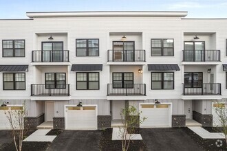
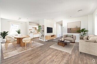
You May Also Like
Similar Rentals Nearby
What Are Walk Score®, Transit Score®, and Bike Score® Ratings?
Walk Score® measures the walkability of any address. Transit Score® measures access to public transit. Bike Score® measures the bikeability of any address.
What is a Sound Score Rating?
A Sound Score Rating aggregates noise caused by vehicle traffic, airplane traffic and local sources
2 Main St
Wilmington, MA 01887