20-22 High St Unit 4
Waltham, MA 02453

-
Monthly Rent
$2,450
-
Bedrooms
2 bd
-
Bathrooms
1 ba
-
Square Feet
900 sq ft
Details

About This Property
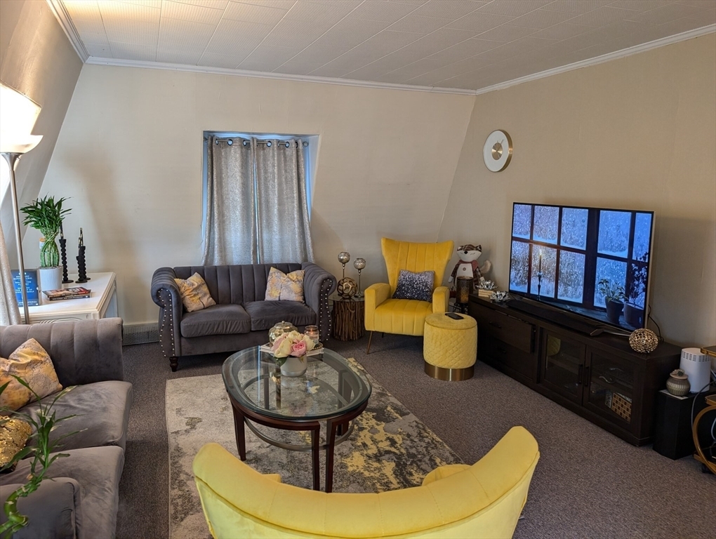
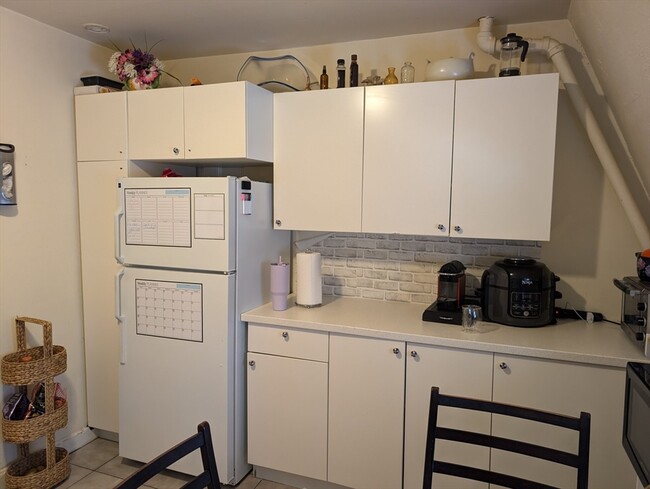
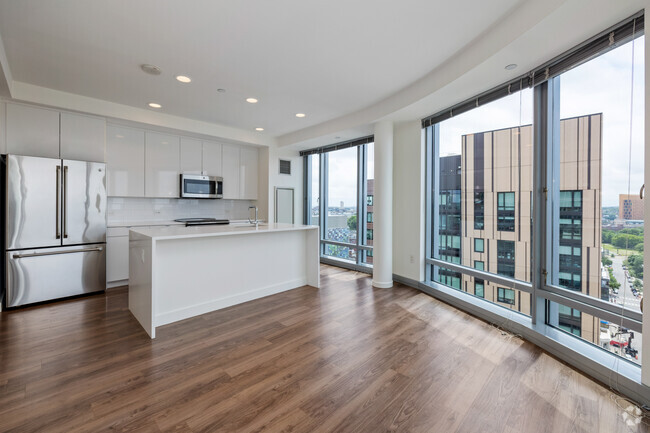
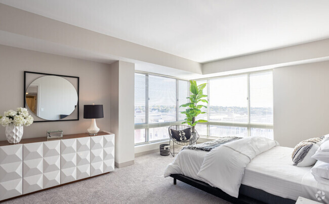
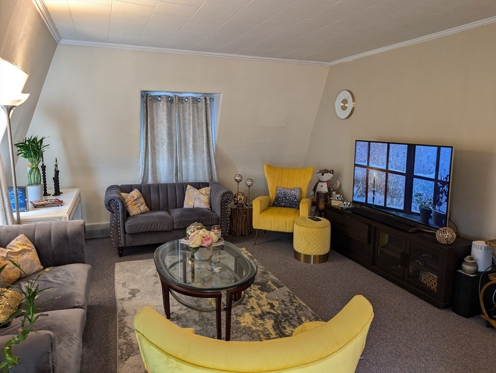
Property is located moments from Moody St. **ALL UTILITIES ARE INCLUDED AND PARKING FOR ONE** Unit has kitchen,living room and Two very spacious bedroom. No Laundry in building however there is a Laundromat moments away. Cats are negotiable and there will be a $50 pet fee added to the monthly rent!
20-22 High St is an apartment community located in Middlesex County and the 02453 ZIP Code.
Contact
 This Property
 Available Property
Nestled along Charles River, the South Side of Waltham, Massachusetts is a bustling neighborhood filled with historic homes, various businesses, local restaurants, and convenient amenities. Wine and dine someone special at Bistro781, or grab some brunch at In a Pickle, the best brunch spot in the city.
Directly south of Downtown Waltham, the South Side is a great place for families or those interested in cozy houses and upscale, modern apartment rentals with quick access to neighboring areas. Riverfront views are a major perk of this neighborhood, so be sure to gaze along the Charles River when you get a chance.
Situated just 10 miles west of Boston, Waltham isn’t your only option for urban conveniences.
Learn more about living in South Side| Colleges & Universities | Distance | ||
|---|---|---|---|
| Colleges & Universities | Distance | ||
| Drive: | 5 min | 1.7 mi | |
| Drive: | 5 min | 2.3 mi | |
| Drive: | 13 min | 5.1 mi | |
| Drive: | 11 min | 5.5 mi |
Transportation options available in Waltham include Riverside Station, located 2.4 miles from 20-22 High St Unit 4. 20-22 High St Unit 4 is near General Edward Lawrence Logan International, located 13.5 miles or 23 minutes away, and Worcester Regional, located 40.2 miles or 58 minutes away.
| Transit / Subway | Distance | ||
|---|---|---|---|
| Transit / Subway | Distance | ||
|
|
Drive: | 6 min | 2.4 mi |
|
|
Drive: | 6 min | 3.0 mi |
|
|
Drive: | 8 min | 3.6 mi |
|
|
Drive: | 9 min | 4.2 mi |
|
|
Drive: | 9 min | 4.4 mi |
| Commuter Rail | Distance | ||
|---|---|---|---|
| Commuter Rail | Distance | ||
| Walk: | 11 min | 0.6 mi | |
|
|
Walk: | 11 min | 0.6 mi |
|
|
Drive: | 3 min | 1.7 mi |
|
|
Drive: | 10 min | 5.7 mi |
|
|
Drive: | 11 min | 6.5 mi |
| Airports | Distance | ||
|---|---|---|---|
| Airports | Distance | ||
|
General Edward Lawrence Logan International
|
Drive: | 23 min | 13.5 mi |
|
Worcester Regional
|
Drive: | 58 min | 40.2 mi |
Time and distance from 20-22 High St Unit 4.
| Shopping Centers | Distance | ||
|---|---|---|---|
| Shopping Centers | Distance | ||
| Walk: | 19 min | 1.0 mi | |
| Drive: | 3 min | 1.3 mi | |
| Drive: | 3 min | 1.3 mi |
| Parks and Recreation | Distance | ||
|---|---|---|---|
| Parks and Recreation | Distance | ||
|
Beaver Brook Reservation
|
Drive: | 5 min | 2.9 mi |
|
Land's Sake Farm
|
Drive: | 8 min | 4.1 mi |
|
Mass Audubon's Habitat Education Center and Wildlife Sanctuary
|
Drive: | 10 min | 4.7 mi |
|
Hemlock Gorge Reservation
|
Drive: | 11 min | 5.0 mi |
|
Hammond Pond Reservation
|
Drive: | 10 min | 5.1 mi |
| Hospitals | Distance | ||
|---|---|---|---|
| Hospitals | Distance | ||
| Drive: | 6 min | 3.1 mi | |
| Drive: | 11 min | 5.5 mi | |
| Drive: | 12 min | 5.9 mi |
| Military Bases | Distance | ||
|---|---|---|---|
| Military Bases | Distance | ||
| Drive: | 17 min | 8.2 mi | |
| Drive: | 19 min | 10.7 mi |
You May Also Like
Similar Rentals Nearby
What Are Walk Score®, Transit Score®, and Bike Score® Ratings?
Walk Score® measures the walkability of any address. Transit Score® measures access to public transit. Bike Score® measures the bikeability of any address.
What is a Sound Score Rating?
A Sound Score Rating aggregates noise caused by vehicle traffic, airplane traffic and local sources
