
$1,900 / Month
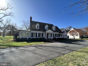
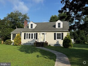
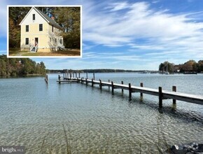
2000 Bennett Point Rd
Queenstown, MD 21658
2 Weeks Ago
Favorites
2000 Bennett Point Rd

Favorites
Check Back Soon for Upcoming Availability
| Beds | Baths | Average SF |
|---|---|---|
| 3 Bedrooms 3 Bedrooms 3 Br | 2 Baths 2 Baths 2 Ba | — |
About This Property
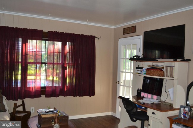
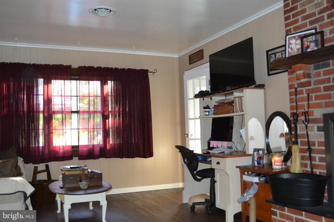
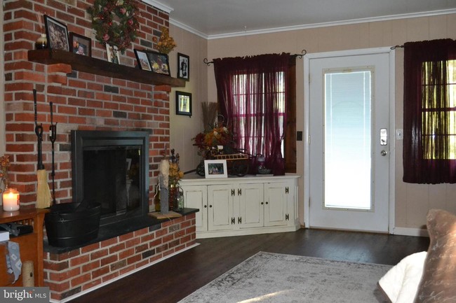
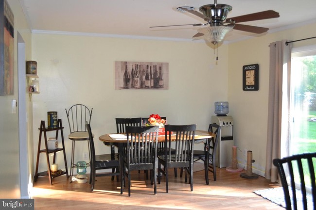
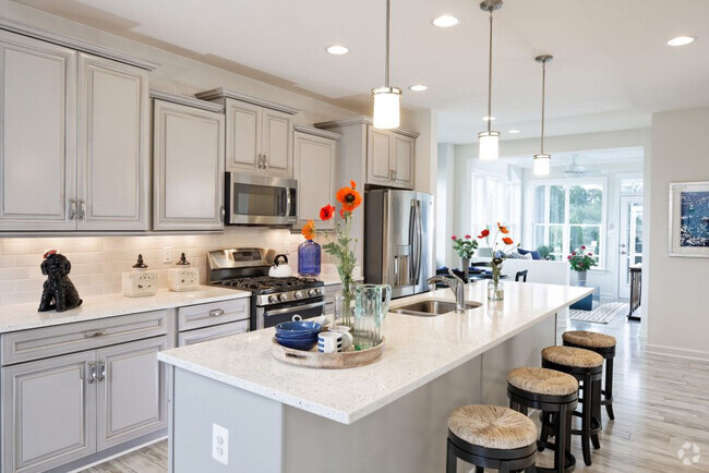
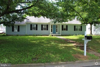
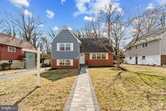
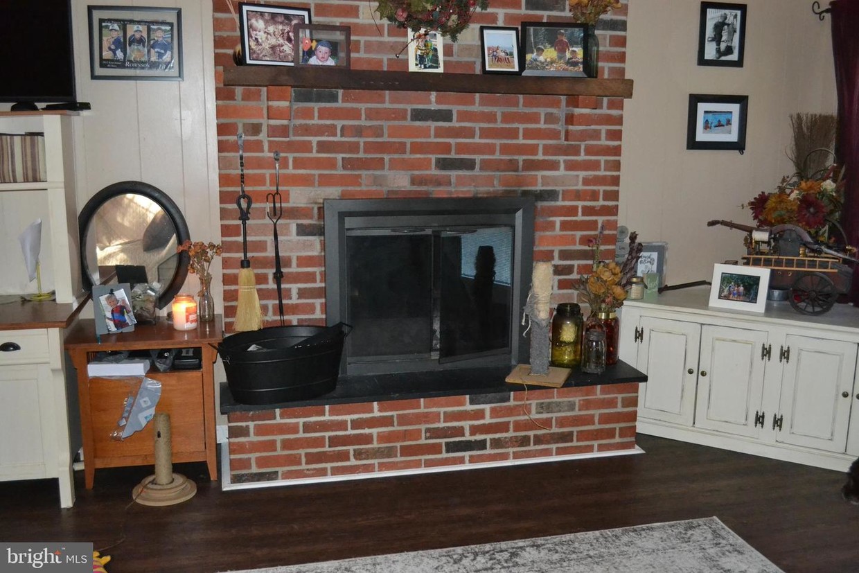
Almost impossible to find, but here is your chance to rent a single family home in the Bennett Point Road area of Queenstown! This lovely home features 3 bedrooms and 2 full baths. There is a large eat-in kitchen, family room and den/living room with brick fireplace and even a separate laundry room. The bathrooms are recently remodeled. Outside you will find a covered front porch, huge and fantastic yard and an inground pool! Available September 1st.
2000 Bennett Point Rd is a house located in Queen Annes County and the 21658 ZIP Code. This area is served by the Queen Anne's County Public Schools attendance zone.
House Features
- Fireplace
Fees and Policies
Location
Get Directions
Amenities
- Fireplace
Education
| Colleges & Universities | Distance | ||
|---|---|---|---|
| Colleges & Universities | Distance | ||
| Drive: | 42 min | 25.3 mi | |
| Drive: | 44 min | 26.2 mi | |
| Drive: | 50 min | 29.9 mi | |
| Drive: | 76 min | 44.6 mi |
2000 Bennett Point Rd is within 42 minutes or 25.3 miles from Anne Arundel Community College. It is also near United States Naval Academy and Washington College.
Schools


Public Elementary School
Grades PK-5
454 Students
Attendance Zone
Public Middle School
Grades 6-8
496 Students
Attendance Zone
Public High School
Grades 9-12
1,164 Students
Attendance Zone
Private Elementary, Middle & High School
Grades PK-12
156 Students
Nearby
Private Elementary & Middle School
Grades PK-8
83 Students
Nearby
School data provided by
 The GreatSchools Rating helps parents compare schools within a state based on a variety of school quality indicators and provides a helpful picture of how effectively each school serves all of its students. Ratings are on a scale of 1 (below average) to 10 (above average) and can include test scores, college readiness, academic progress, advanced courses, equity, discipline and attendance data. We also advise parents to visit schools, consider other information on school performance and programs, and consider family needs as part of the school selection process.
View GreatSchools Rating Methodology
View GreatSchools Rating Methodology
Transportation options available in Queenstown include Cromwell Station/Glen Burnie, located 36.2 miles from 2000 Bennett Point Rd. 2000 Bennett Point Rd is near Baltimore/Washington International Thurgood Marshall, located 42.2 miles or 68 minutes away.
| Transit / Subway | Distance | ||
|---|---|---|---|
| Transit / Subway | Distance | ||
|
|
Drive: | 59 min | 36.2 mi |
|
|
Drive: | 61 min | 38.9 mi |
|
|
Drive: | 66 min | 40.4 mi |
|
|
Drive: | 66 min | 41.0 mi |
|
|
Drive: | 69 min | 42.5 mi |
| Commuter Rail | Distance | ||
|---|---|---|---|
| Commuter Rail | Distance | ||
|
|
Drive: | 60 min | 39.4 mi |
|
|
Drive: | 68 min | 42.3 mi |
| Drive: | 65 min | 42.9 mi | |
|
|
Drive: | 73 min | 46.9 mi |
|
|
Drive: | 90 min | 56.1 mi |
| Airports | Distance | ||
|---|---|---|---|
| Airports | Distance | ||
|
Baltimore/Washington International Thurgood Marshall
|
Drive: | 68 min | 42.2 mi |
Time and distance from 2000 Bennett Point Rd.
| Shopping Centers | Distance | ||
|---|---|---|---|
| Shopping Centers | Distance | ||
| Drive: | 14 min | 5.6 mi | |
| Drive: | 13 min | 5.7 mi | |
| Drive: | 18 min | 9.1 mi |
2000 Bennett Point Rd has 3 shopping centers within 9.1 miles, which is about a 18-minute drive. The miles and minutes will be for the farthest away property.
| Parks and Recreation | Distance | ||
|---|---|---|---|
| Parks and Recreation | Distance | ||
|
Wye Oak State Park
|
Drive: | 21 min | 10.6 mi |
|
Pickering Creek Audubon Center
|
Drive: | 44 min | 21.8 mi |
|
Wye Island Natural Resource Management Area
|
Drive: | 51 min | 23.8 mi |
|
Chesapeake Bay Maritime Museum
|
Drive: | 54 min | 33.0 mi |
|
Eastern Neck National Wildlife Refuge
|
Drive: | 91 min | 50.4 mi |
2000 Bennett Point Rd has 5 parks within 50.4 miles, including Wye Oak State Park, Pickering Creek Audubon Center, and Wye Island Natural Resource Management Area.
| Military Bases | Distance | ||
|---|---|---|---|
| Military Bases | Distance | ||
| Drive: | 65 min | 43.0 mi |
2000 Bennett Point Rd is 43.0 miles and a 65 minute drive from Fort George Meade.
You May Also Like
Similar Rentals Nearby

What Are Walk Score®, Transit Score®, and Bike Score® Ratings?
Walk Score® measures the walkability of any address. Transit Score® measures access to public transit. Bike Score® measures the bikeability of any address.
What is a Sound Score Rating?
A Sound Score Rating aggregates noise caused by vehicle traffic, airplane traffic and local sources
2000 Bennett Point Rd
Queenstown, MD 21658